
|
Before I get into the discussion, a few thoughts on the severe storms for Thursday. It saddens me to hear of the loss of the 9-year-old girl from my former hometown of Poland, who was in a car that was crushed by a tree in Standish. Members of the National Weather Service Gray office conducted a storm survey of the site and issued a report about the destruction in the area. I spent some time quietly and contemplating about it. Forecasting weather is a tough job for many reasons. In the 10½ years I've been doing this, I will say the worst feeling in the world is seeing the train of destruction coming, finding out about loss of life, and then wondering if the communication could have been better to prevent it. That is a natural reaction for anyone who has a conscience and a heart in the weather forecasting business. My first job is to note impacts that could cause injury or loss of life. The forecast comes second. Whether or not the outcome matches up with the impacts and the forecast is on the low end of my expectations. My job is to disseminate data and to relay messages to help you folks prepare for what could happen but be practical and not jump on the hype train and cause a stir for nothing. Seeing the outcome of storm reports across much of New England indicates the forecast threat lived up to expectation. Many weather-related deaths are preventable, and that is why when it happens, it stings. Onward... Triple H weather continues through the weekend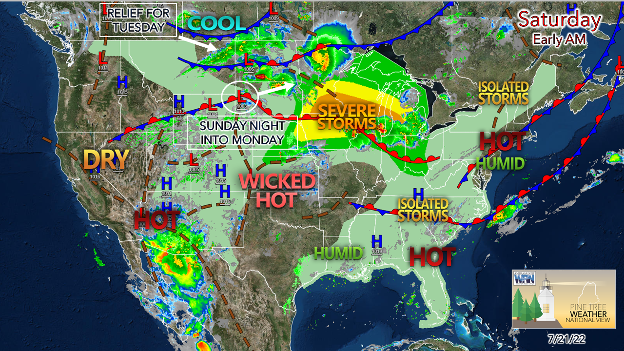 For those tired of this heatwave, I would like to point to Saskatchewan as that is where the relief is. It will take three days to get to Maine, but it is coming. While we deal with the steaminess, folks in the Great Lakes region are going to get hammered with severe storms for the day. A potentially ugly situation there. 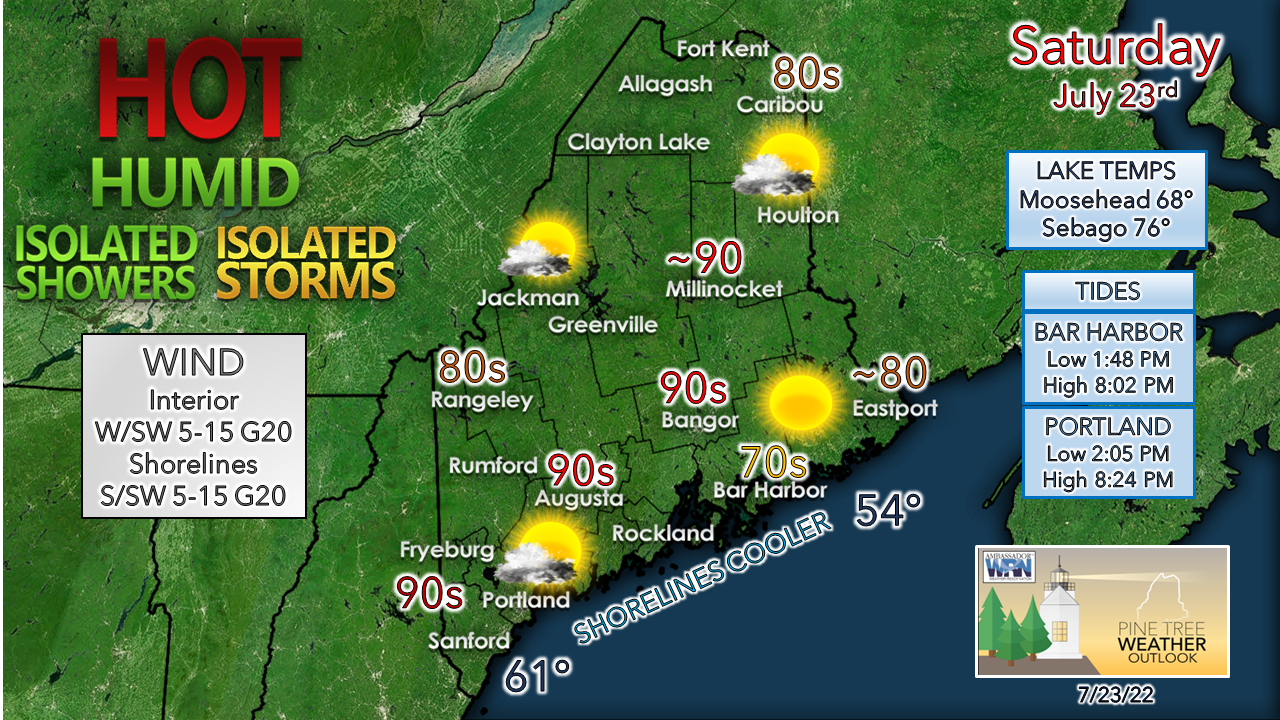 Do what you can to stay cool. The ocean beaches are likely to be jammed, and the good news is with the timing of the tides there will be plenty of room on the sand. You may have to hike to get to it as many folks seek relief. Be on alert for a potential pop-up shower or storm this afternoon over the mountains and along the sea breeze front along the coast. A heat advisory is in effect for Sunday over much of the southwest interior. It will be the hottest day of the stretch. Isolated showers and storms are also possible. Stay aware. Showers and storms on the way Monday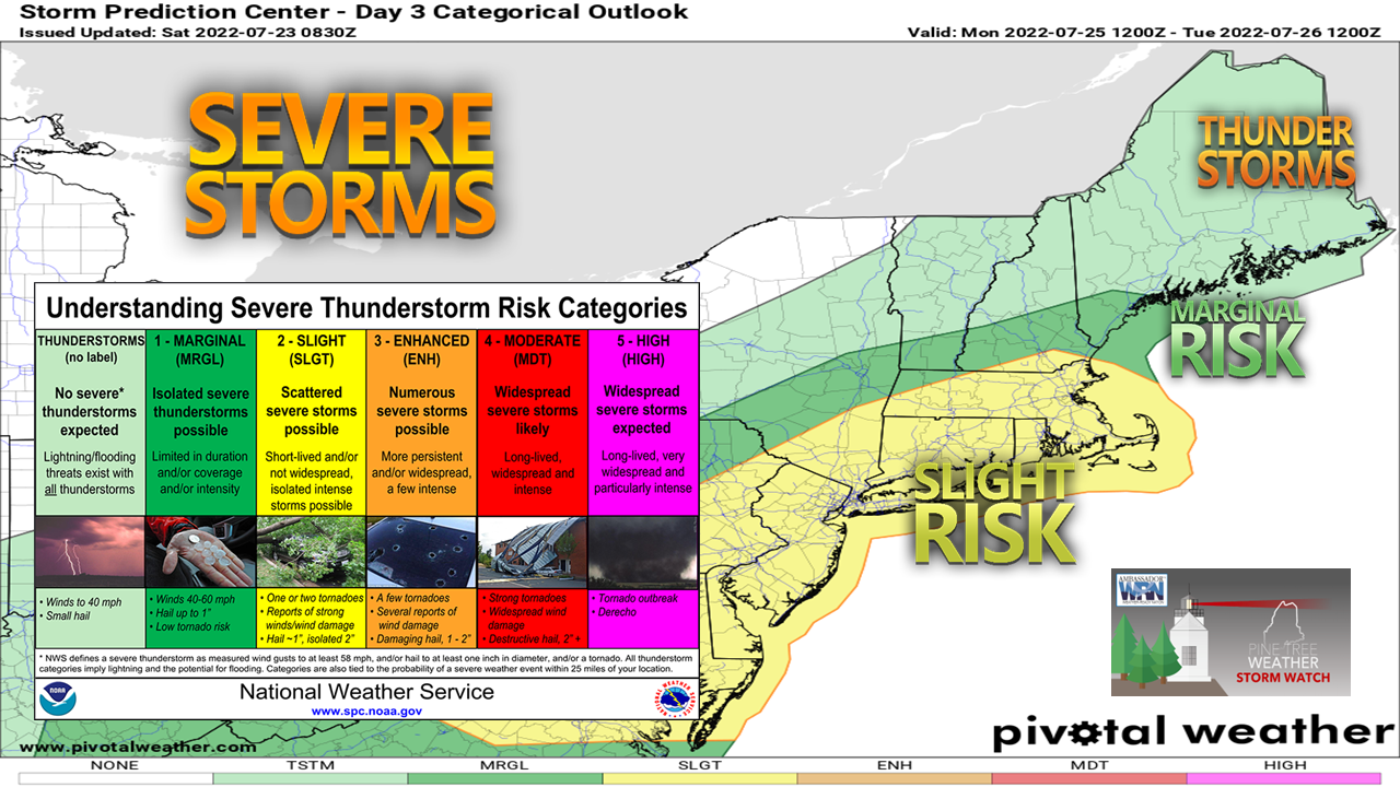 This Day 3 outlook from Storm Prediction Center gives an idea of severe storm potential for Monday, which is subject to change. I will say that at any time there is heat and dew point temperatures in the low 70s with a sharp cold front coming through, it's a potential atmospheric powder keg as the region recently witnessed. 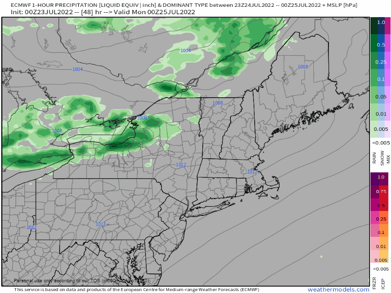 Sunday 8 PM to Monday 10 PM - As of the time of this post Saturday morning, the short-term models had not yet entered the window of the forecast period to better analyze potential. The Weather Prediction Center has mentioned the chance for localized flash flooding from roughly Jackman to Bangor south and west. At this point some morning shower activity on Monday and cloud debris created from it will dictate the severe storm threat in the afternoon. Given the amount of humidity around, a window of sun sets the stage for nasty storms. Stay tuned for more on this. Temperature outlook through ThursdayDryer air works its way into the region on Tuesday. The next chance for showers and storms after Monday appears to come on Thursday. 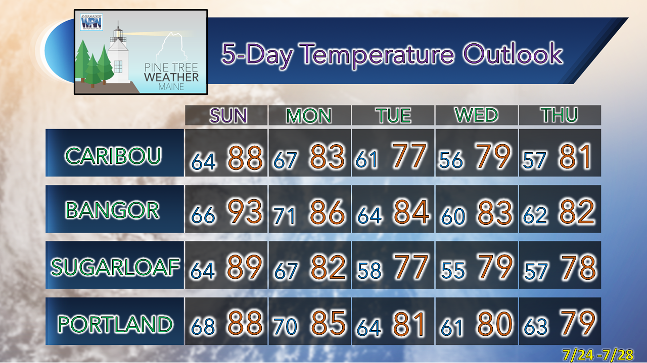 Thank you for supporting this community-based weather information source which operates by financial contributions from people like you. Stay updated, stay on alert, and stay safe! NEXT UPDATE: SUNDAY - Mike NOTE: The forecast information depicted on this platform is for general information purposes only for the public and is not designed or intended for commercial use. For those seeking pinpoint weather information for business operations, you should use a private sector source. For information about where to find commercial forecasters to assist your business, please message me and I will be happy to help you. |

Mike Haggett
|


