
The next upper-low moves into the region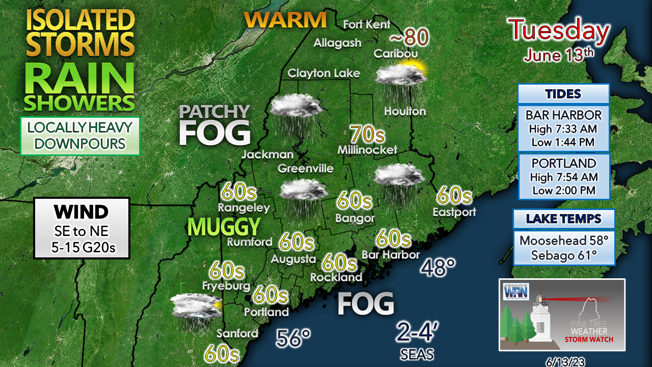 A dense fog advisory has been posted for MidCoast and DownEast areas to start the day. While the fog may dissipate, it's not going very far. It could be stubborn in spots. The best chance for an isolated storm appears to be in the afternoon for the southwest interior. Northern areas enjoy the most sun and warmer temperatures to start off before clouds fill in and showers arrive Tuesday evening. In areas where rain falls may see patchy fog form with dew points in the upper-50s to low 60s. The wind is likely to be noticed along the shorelines and shift from southeast to northeast as a meso-low forms in the Gulf of Maine in the afternoon. 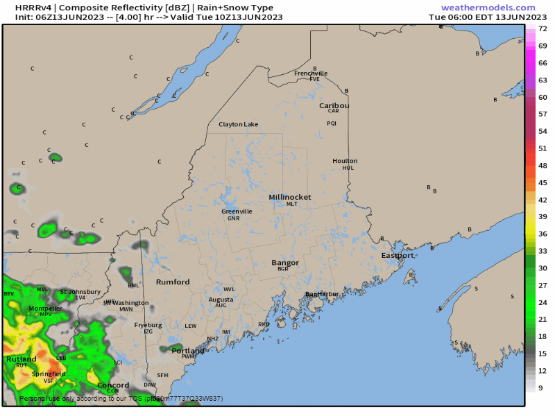 Tuesday 6 AM to Wednesday 6 AM - The day won't be a total washout, but rain could be locally heavy in spots. As the warm front advances northeast, showers taper off over the southwest heading into Wednesday morning. Expect areas of patchy fog to form, and reduced visibility in areas of heavy rain and isolated thunderstorms. The severe storm chance is very low. Areas that get a rumble may get a puff of wind with the downburst of rain. A few showers around Wednesday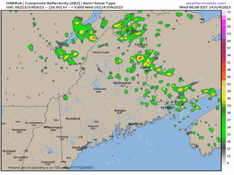 Wednesday 6 AM to Thursday 2 AM - As the warm front continues moving northeast. the region experiences a bit of a lull in shower activity through most of the day, outside of an isolated pop-up. That changes heading into the evening. A surface low is expected to spin up and increase the risk of showers and storms late Wednesday afternoon and continue into the overnight. Once again, expect reduced visibility with heavy rain and fog, and potential for localized flash flooding from run off. Outlook through the weekend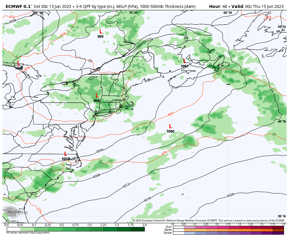 Wednesday 8 PM to Sunday 8 PM - With the surface low stuck in with the upper low, rain and storms remain in the forecast through Saturday. The upper-low departs to the northeast on Sunday but may bring some showers to the region as it heads out through Monday. The next chance for a dry day statewide may be Tuesday. 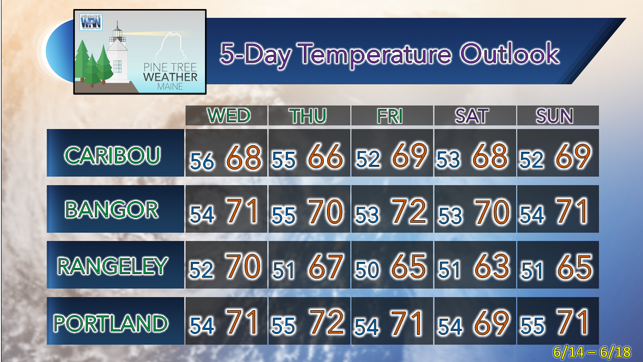 Pine Tree Weather is funded from followers like you. I would appreciate your financial support. Click here for how you can contribute. You may not like the weather, but I hope you like what I do, and support my efforts. Thank you! Stay updated, stay on alert, and stay safe! - Mike NOTE: The forecast information depicted on this platform is for general information purposes only for the public and is not designed or intended for commercial use. For those seeking pinpoint weather information for business operations, you should use a private sector source. For information about where to find commercial forecasters to assist your business, please message me and I will be happy to help you. |

Mike Haggett
|


