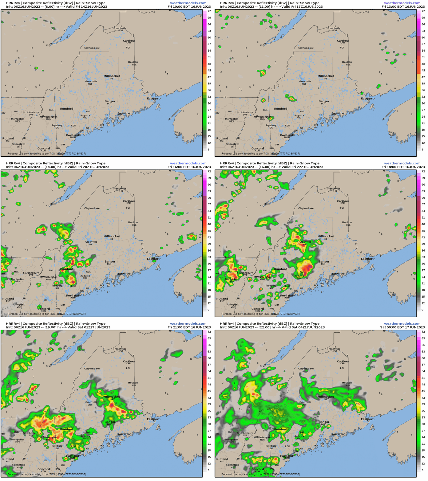
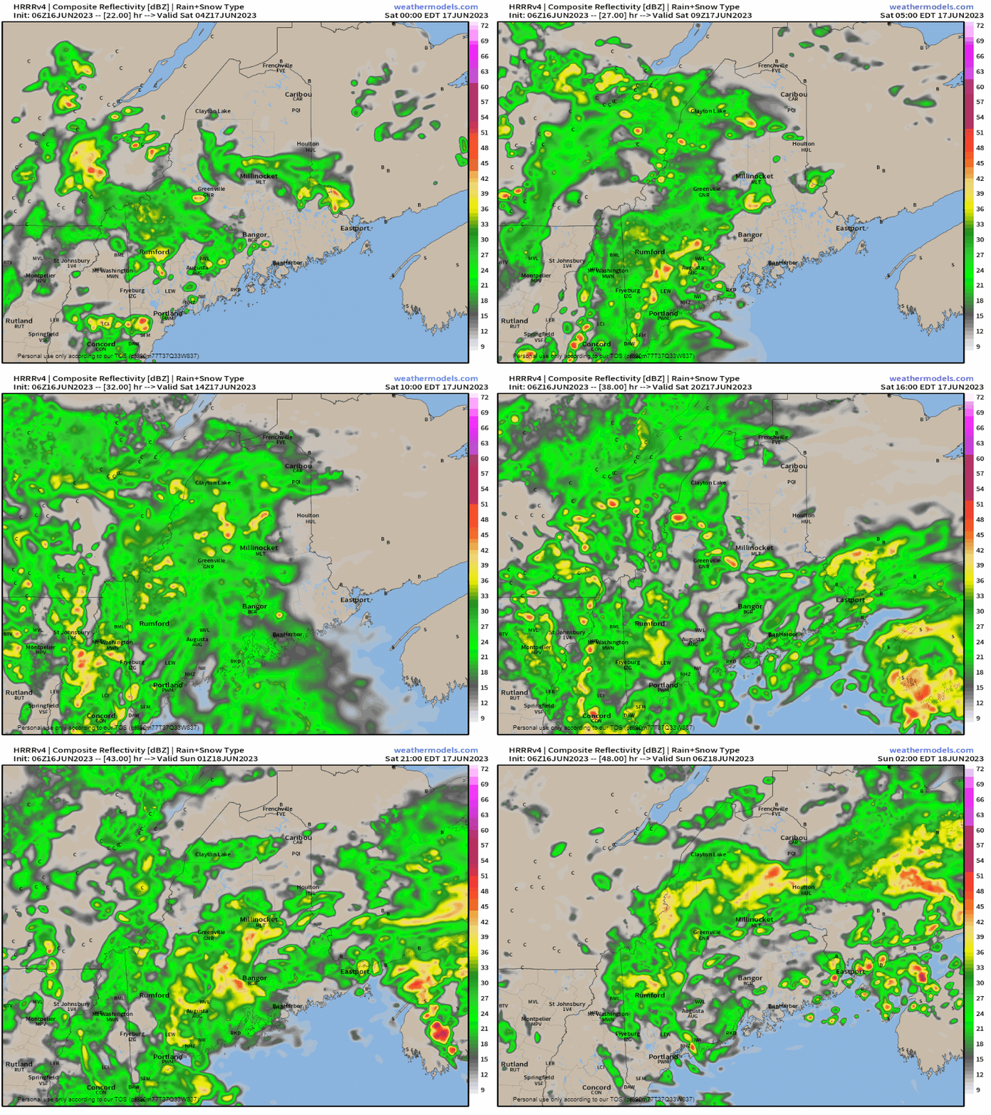
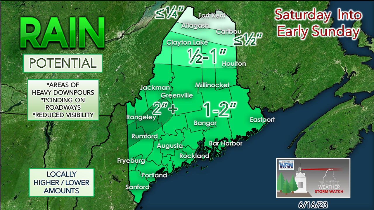
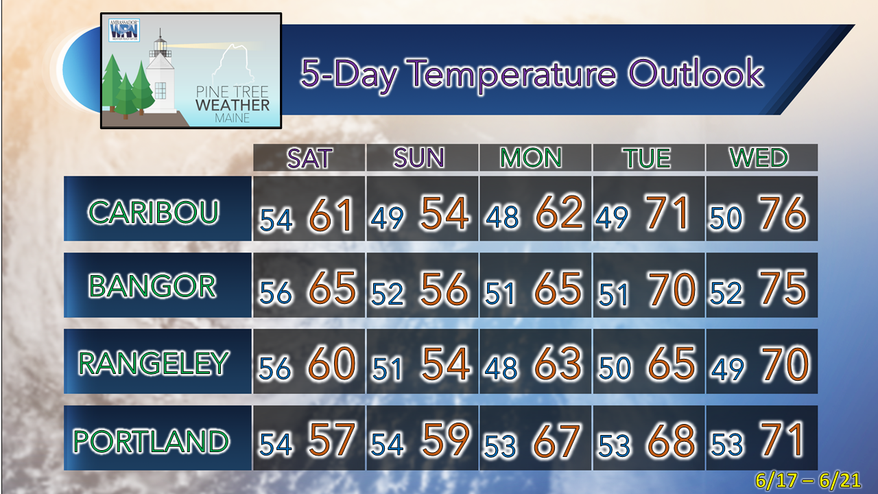
One upper low departs, another moves inThe most recent upper-low has moved over the Gulf of St. Lawrence as of early Friday morning. The region starts the day dry thanks to a weak upper ridge. Another upper-low forming over the Great Lakes moves to the east during the day. A southwest flow brings up the temperatures and raises the humidity levels. Smoke will be noticeable in the sky before the clouds increase heading into the afternoon. Moderate particle pollution is expected by the Maine DEP. Not a major concern for air quality. Friday 10 AM to Saturday Midnight - After a dry morning, the threat of showers and storms increases in the afternoon and into the overnight. The potential for severe is very low. The main concern is for heavy downpours that could reduce visibility and cause ponding on roadways, along with poor drainage flooding. There could be some gusty wind. Expect the chance for nocturnal storms in the overnight, but rest assured that nothing crazy is expected. Expect areas of fog to form in areas that get rain. Saturday is officially a washoutSaturday Midnight to Sunday 2 AM - It will be a great day to do inside projects, cook up a nice meal, binge watch a TV series, or read a book. Low pressure forms along the perimeter of the advancing upper low and spins up low pressure over the Gulf of Maine and brings showers and storms through the day. Other than rain, I am not expecting much in the way of problems with wind. There is the threat of localized flash flooding, especially in the western mountains. Fog will be a thing until this mess clears out. The mountains are likely to get power washed thanks to orographic lift as the low spins gradually through the Gulf of Maine. Stay on alert for rising water levels there. Any rumbles of thunder are a signal that you are about to get dumped on. Far northern areas may not get a whole lot from this. Outlook through midweekRain tapers off during the day on Sunday. After the low departs, a couple short wave frontal boundaries pass through on Monday and Tuesday, which may pop some isolated showers and perhaps a thunderstorm, but no widespread rainfall. Smoke from the wildfires in Quebec may bring hazy conditions. Air quality levels will need to be monitored. Summer arrives on time with temperatures close to normal by midweek. Pine Tree Weather is funded from followers like you. I would appreciate your financial support. Click here for how you can contribute. You may not like the weather, but I hope you like what I do, and support my efforts. Thank you! Stay updated, stay on alert, and stay safe! - Mike NOTE: The forecast information depicted on this platform is for general information purposes only for the public and is not designed or intended for commercial use. For those seeking pinpoint weather information for business operations, you should use a private sector source. For information about where to find commercial forecasters to assist your business, please message me and I will be happy to help you. |
Mike Haggett
|


