
Wildfire smoke around the region through Monday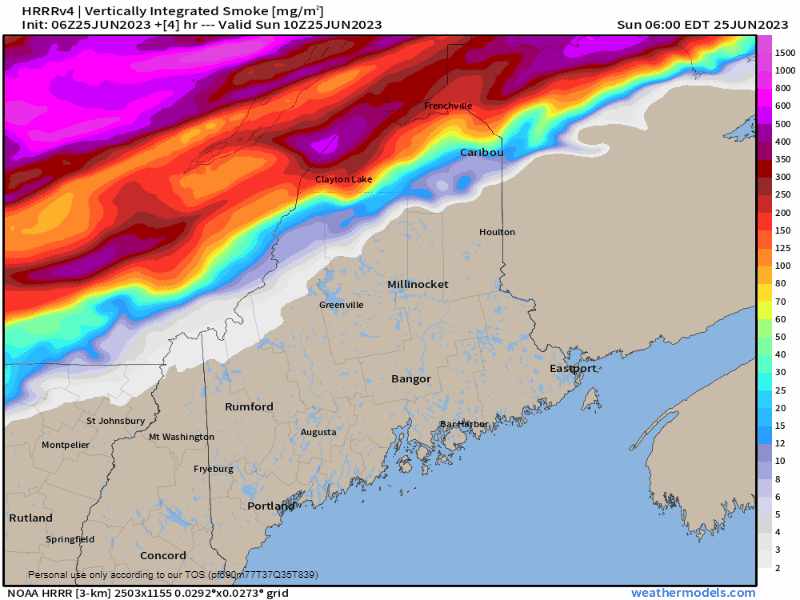 A back door cold front is on track to drop down from Quebec on Sunday and as it does, it drags wildfire smoke from the Abitibi region into the area. With the dew points in the 60s and little in the way of wind, the smell of smoke may be noticeable over the north and higher elevations in the west. An Air Quality Alert is in effect over much of the state for Sunday per order of the Maine Department of Environmental Protection. Folks with respiratory problems are advised to take it easy and to all who are engaging in strenuous activity. Pop-up showers and localized flooders for Sunday Sunday 10 AM to Monday Midnight - As weak shortwave associated with the back door cold front drops into the area, it will give northern areas a pause on the muggy dew points later in the day and into the night. As the boundary descends to the southeast, it will run into a slightly stronger ridge and stall its progress. Slow moving showers with potential for isolated thunderstorms are possible for areas south of Jackman and Danforth. These have the potential of dumping torrential rainfall that could cause localized flash flooding. Expect areas of fog to generate where there is heavy rain and for the coast heading into the evening. Warm front pushes north Monday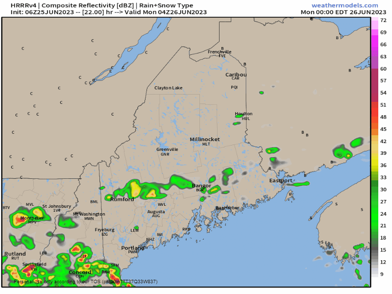 Monday Midnight to Tuesday Midnight - The idea presented here may be over-cooking the shower activity along the coast as stable air from the ocean is expected to bring fog and drizzle into the coastal plain Sunday night and may hang around all day in areas west of Penobscot Bay. Where the sun pops out is where showers and the chance of a thunderstorm is possible. The best chance for that will be for the western foothills and eastern areas northward. Again, localized flash flooding is possible from torrential rain. Monday is expected to be on the cool side with high temperatures in the 60s.  Outlook through Friday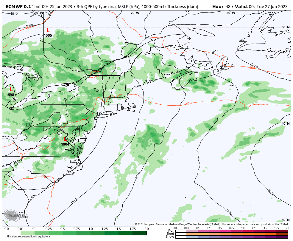 Monday 8 PM to Friday 8 PM - An upper low over the eastern Great Lakes is expected to drop anchor and hang out for much of the week. Tuesday and Wednesday appear to be the wettest period through the week as of now. The upper-low is expected to weaken later in the week, but the chance for showers and storms remains in the forecast through Friday and into the weekend. Temperatures are expected to be mainly in the 70s during the day and 60s at night. Coastal areas can expect fog to be around in the morning and may be stubborn to depart. 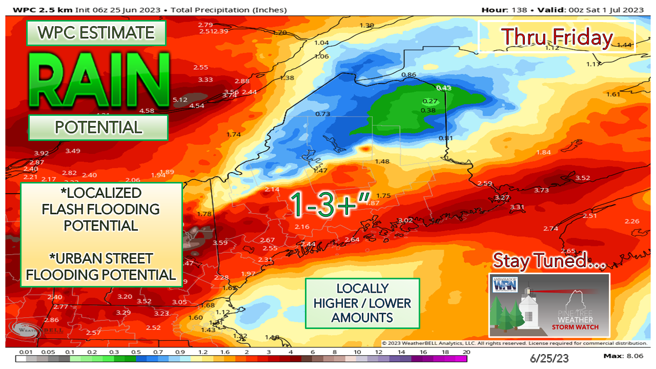 With the upper low parked just to the east, the steady flow of tropical moisture moves in from the south. Areas south of the mountains could see heavy rainfall. While 1-3" is the general idea, localized amounts could go much higher than that. While the first half of the weekend of the Fourth looks muggy and showery, Monday and Tuesday show signs of lower dew points, with a few light showers possible. Stay tuned! Pine Tree Weather is funded from followers like you. I would appreciate your financial support. Click here for how you can contribute. You may not like the weather, but I hope you like what I do, and support my efforts. Thank you! Stay updated, stay on alert, and stay safe! - Mike NOTE: The forecast information depicted on this platform is for general information purposes only for the public and is not designed or intended for commercial use. For those seeking pinpoint weather information for business operations, you should use a private sector source. For information about where to find commercial forecasters to assist your business, please message me and I will be happy to help you. |

Mike Haggett
|


