
Overview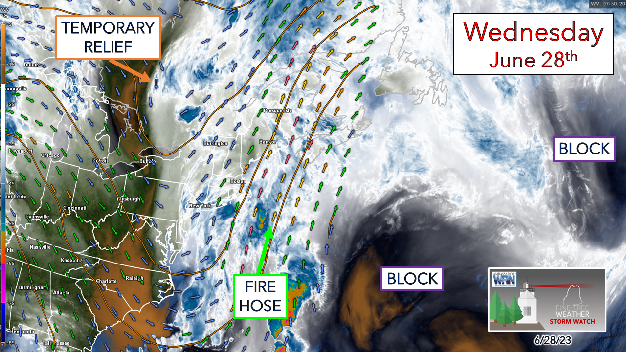 I keep getting asked the same question by people wherever I go as to when this is going to end. That is a question I asked myself when I saw the ideas lining up that we were going to be in for it for a sustained period. I've seen people report that they had received rainfall in 21 of 27 days. Here in Kennebunk, I've recorded rainfall 17 of the previous 27 days. The localized water vapor image from around 4 AM Wednesday morning clearly shows what has gone on for the past several days. The good news is the atmospheric traffic jam that has held the region hostage is about to change, but we have a few more days to get through. Widespread showers with the chance for rumbles Wednesday Wednesday 6 AM to Thursday Midnight - After a quiet start and some areas seeing the sun pop out, the shower activity increases in the afternoon. Unlike the past couple of days, this activity should move along fairly quickly as wind speeds aloft have increased. While the threat for localized flash flooding remains an issue, I don't expect any serious concerns given the speed. Any isolated thunderstorms that develop are likely to be dumpers with potential for some wind, Areas of torrential rainfall are possible, perhaps some minor urban street flooding from that in spots, along with reduced visibility. Expect locally dense fog to develop overnight into Thursday. Stalled front begins to slide east on Thursday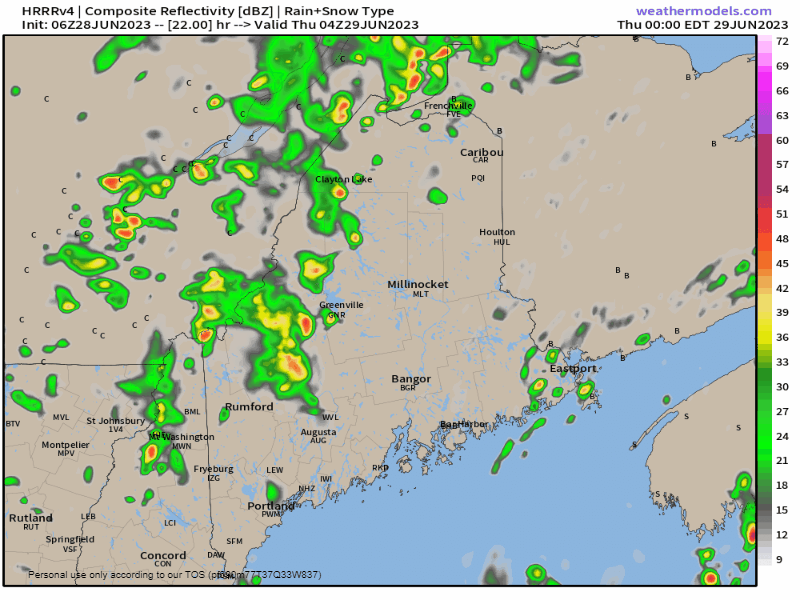 Midnight Thursday to Midnight Friday - Fog is the main concern going into Thursday morning. It's a timing game here as to when the frontal boundary passes through that may dictate when showers and storms flare up. If this model idea holds serve, southern areas may escape with little activity until late in the day, and eastern areas may not see much, if anything, other than fog & drizzle. The power of water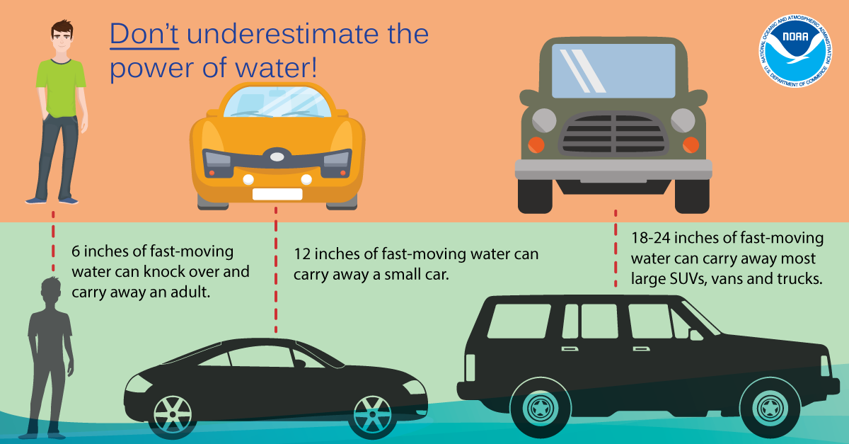 Don’t underestimate the power of water. It only takes 6 inches of fast-moving water to knock over and carry away an adult, and 12 inches to carry away a small car. Turn Around Don’t Drown! weather.gov/safety/flood-turn-around-dont-drown Updated outlook through the Fourth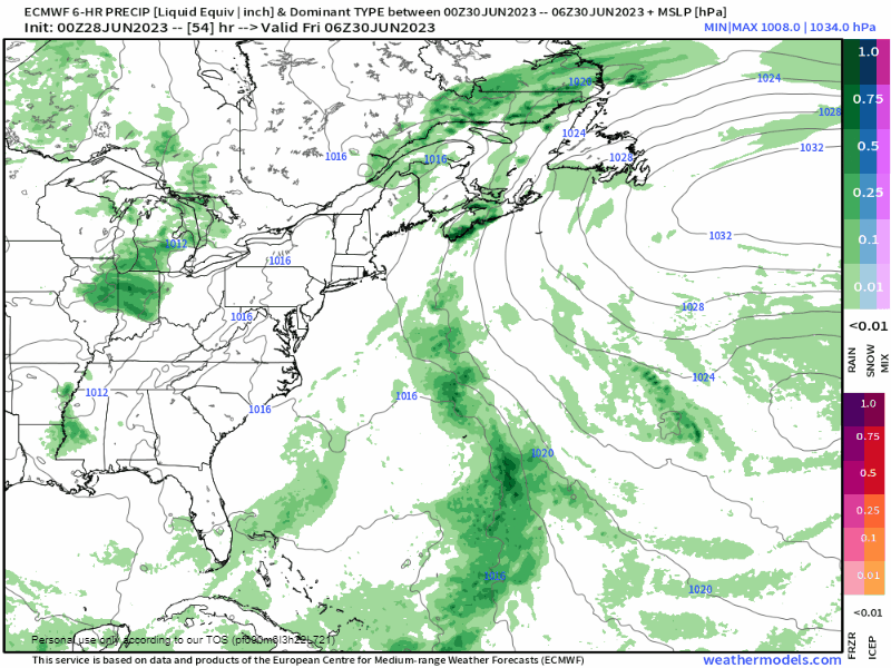 Friday 2 AM to Wednesday 2 AM - The deterministic forecast prog gets busy in the evolution of the shifting pattern. We're headed from a spring like situation to what looks more like summer. Now before everyone jumps for joy, this does not mean we escape chances for showers and storms. While the blocking ridge east of Newfoundland finally breaks down and heads for Europe, a Bermuda high begins to set up shop by the middle part of next week. This pumps in warmer and humid air and keeps the daily risk of showers and storms going. Friday into early Saturday looks better than what we have seen for a while as a ridge from the west noses in and temperatures rise, some sun, with 80s possible. A shower is possible for the north and mountains. The ridge quickly moves east Saturday morning with a frontal boundary approaching from the west that brings the risk of showers and storms Saturday afternoon, pending on timing. A warm front enters the region Sunday attached to low pressure to the west. This will drive the humidity up and bring the risk of locally heavy rainfall, along with storms. The low slides to the east on Monday, but it may be wet to start off. The Fourth appears quiet in the morning, with a risk of showers and thunderstorms in the afternoon. Expect that trend of afternoon showers and storms to continue through next week. Pine Tree Weather is funded from followers like you. I would appreciate your financial support. Click here for how you can contribute. You may not like the weather, but I hope you like what I do, and support my efforts. Thank you! Stay updated, stay on alert, and stay safe! - Mike NOTE: The forecast information depicted on this platform is for general information purposes only for the public and is not designed or intended for commercial use. For those seeking pinpoint weather information for business operations, you should use a private sector source. For information about where to find commercial forecasters to assist your business, please message me and I will be happy to help you. |

Mike Haggett
|


