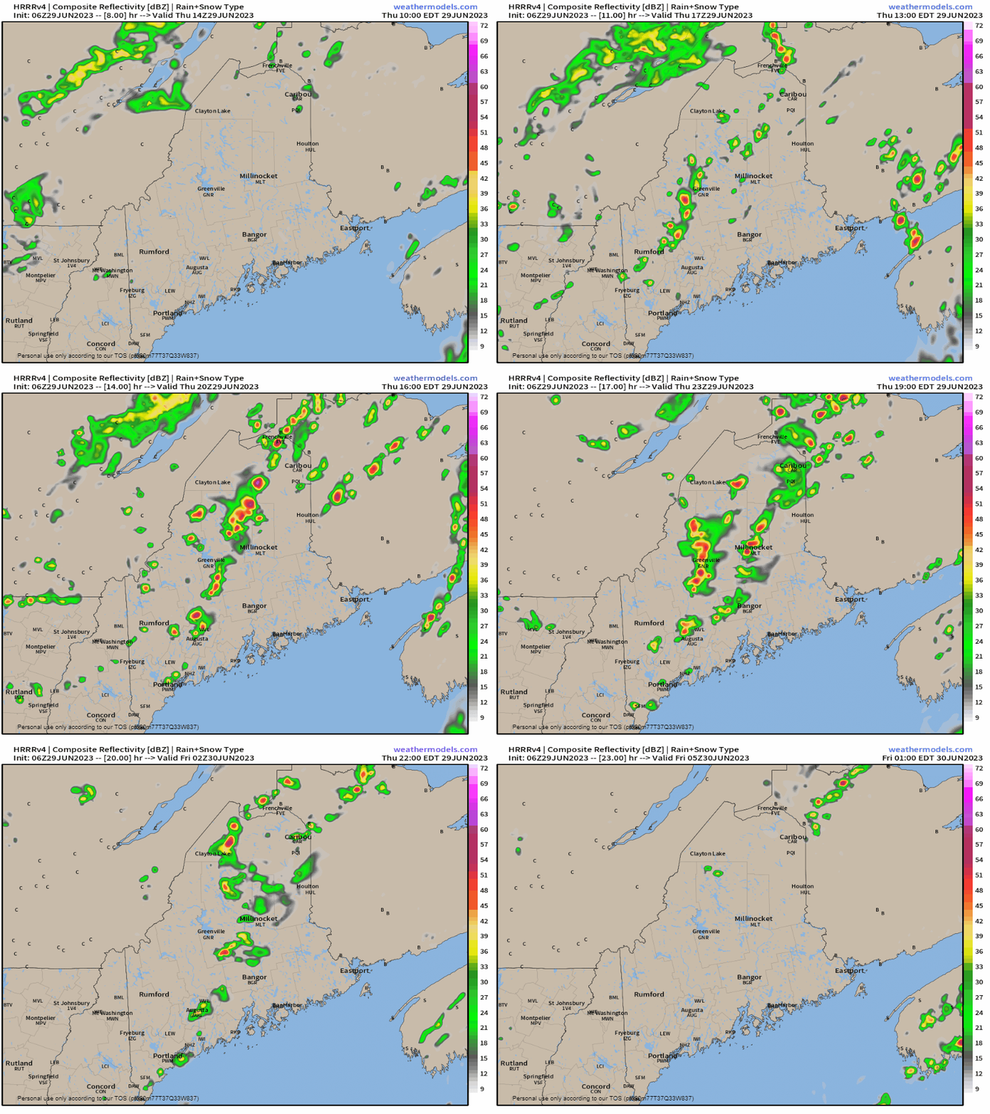
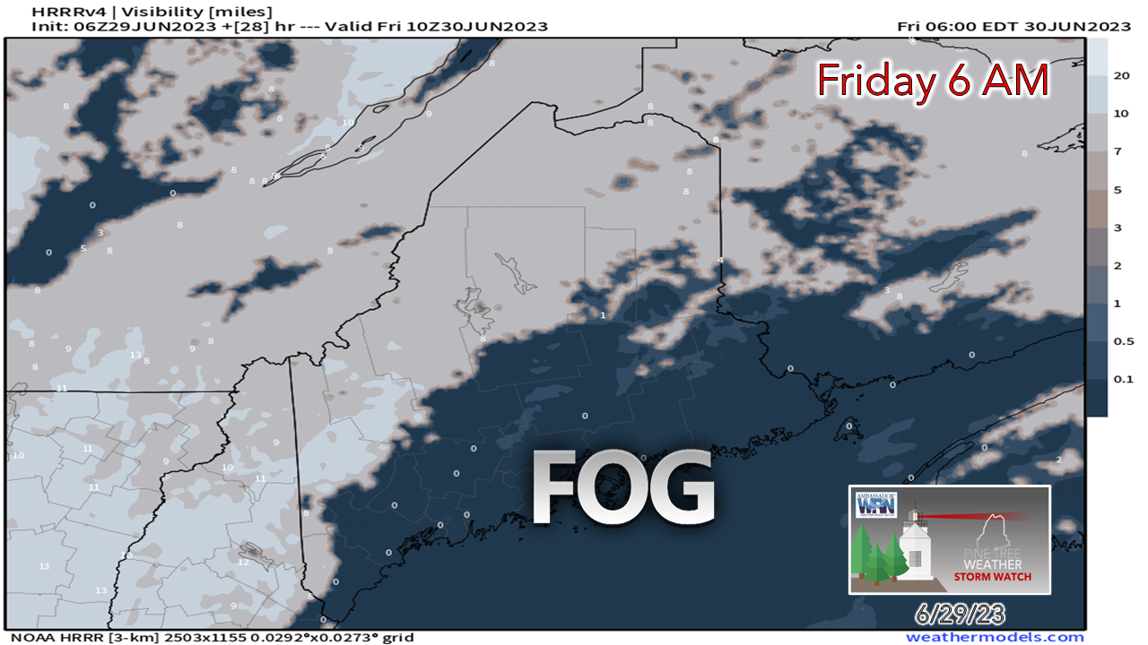
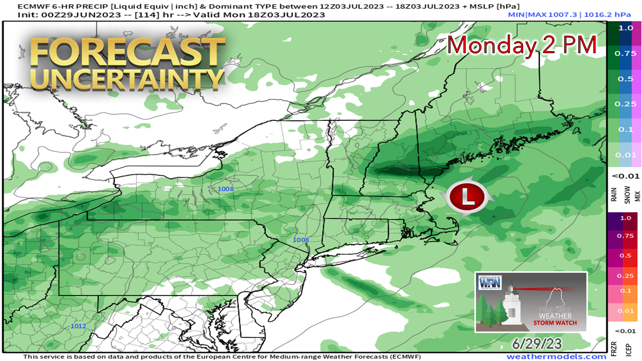
One more day of showers and storms before a breakThe good news is the steering level in the atmosphere is starting to move as blocking begins to break down to the northeast and southeast. The stalled frontal boundary that has been draped over the region is on track to gradually slide to the east. It will pass through leaving us a few parting showers and storms. Expect areas of locally dense fog across much of the coastal plain to start off. Thursday 11 AM to Friday 1 AM - Showers and storms do not appear as widespread as the area experienced on Wednesday, but they will be around. There is concern for training of cells that could bring the risk of localized flash flooding, especially over the west and the north. I expect areas east of Bangor to stay relatively dry but could be stuck in the fog and deal with patchy drizzle through the day. Fog to start on FridayFriday starts off with dense fog over southern and eastern areas that will gradually recede as the morning evolves. It may hang on through the day along the shorelines of the MidCoast and DownEast areas, which may spoil the chance for sun there. The day overall looks dry for most of the state. A weak shortwave passes through the mountains and north in the afternoon and may bring a shower or isolated storm in the afternoon into the early evening. Where there is sun, temperatures may spike up into the 80s. An onshore breeze keeps the coastal communities cooler. Forecast for the weekend improving a bitA question that I have been asked repeatedly this week is if the weekend is going to be a washout. That answer is a firm no. This isn't to say that there won't be showers and storms around, because there will be, especially for the mountains upwards into northwest Aroostook. While that region has the best chance, the rest of the region could be dodging raindrops at times as well. Friday, Saturday, Sunday and the Fourth appear to be reasonably fair overall. Fireworks displays will be weather permitting. Monday is the big question mark at this point. There is enough discrepancy in ideas between the operational models to pause and see what happens with an area of low pressure that is expected to skirt to the south of the region. The European model idea shown above predicts a soaker south of the mountains. In comparison to other ideas, it's the outlier. Time will tell if this idea wins out, or it will be a continuation of the daily shower and storm risk predicted through the rest of the period. Stay tuned! Pine Tree Weather is funded from followers like you. I would appreciate your financial support. Click here for how you can contribute. You may not like the weather, but I hope you like what I do, and support my efforts. Thank you! Stay updated, stay on alert, and stay safe! - Mike NOTE: The forecast information depicted on this platform is for general information purposes only for the public and is not designed or intended for commercial use. For those seeking pinpoint weather information for business operations, you should use a private sector source. For information about where to find commercial forecasters to assist your business, please message me and I will be happy to help you. |
Mike Haggett
|


