|
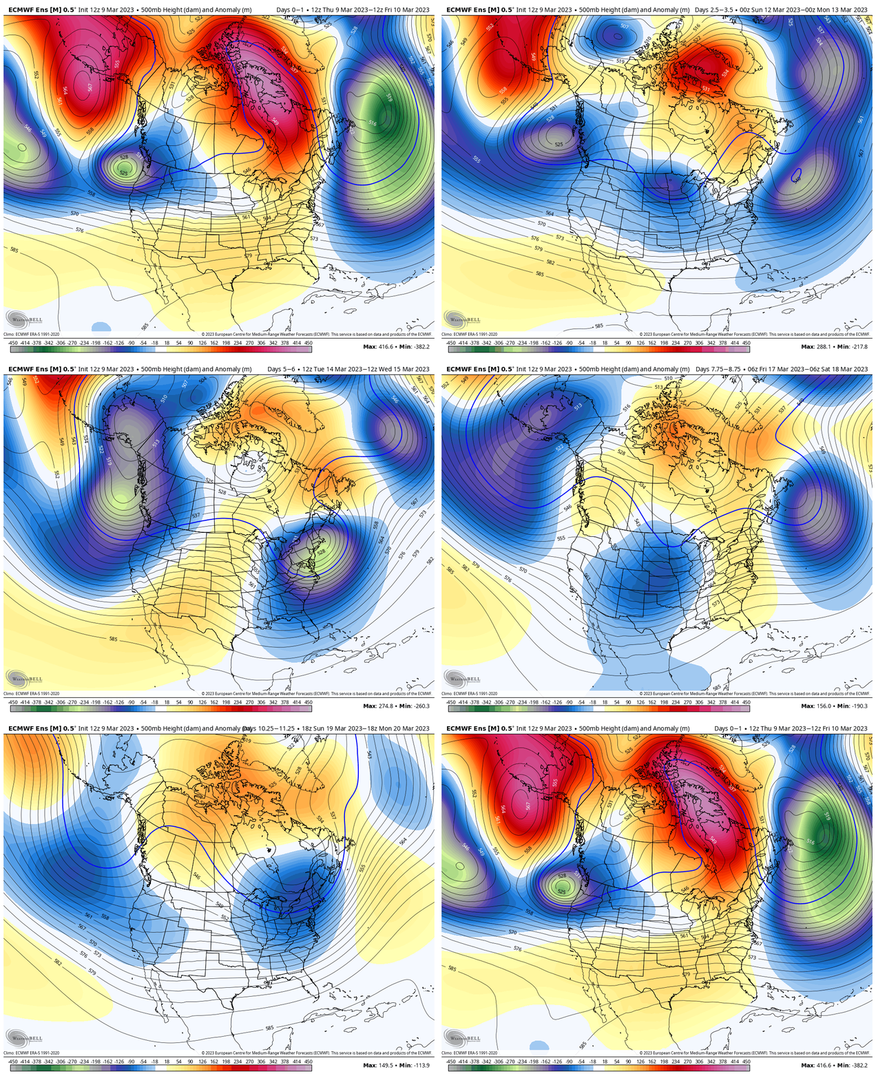
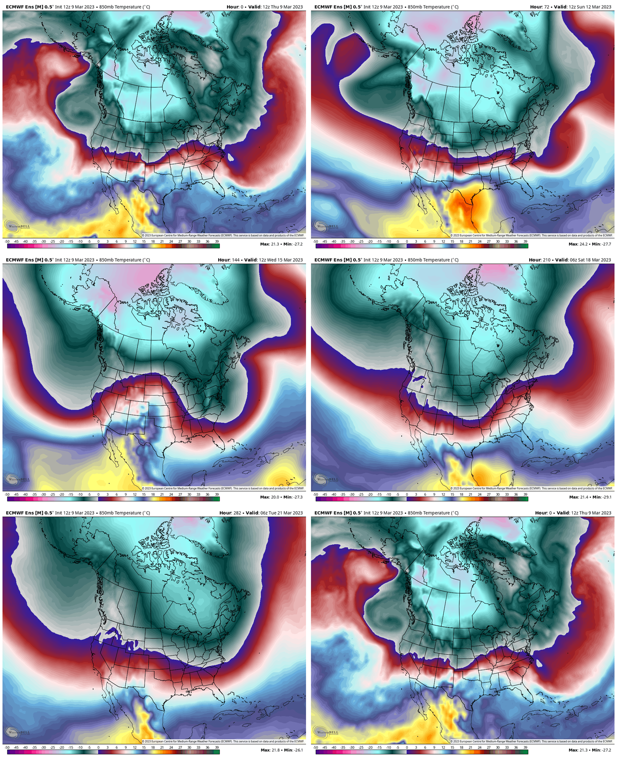
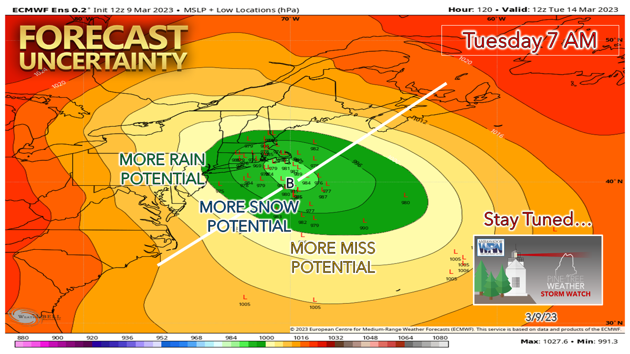
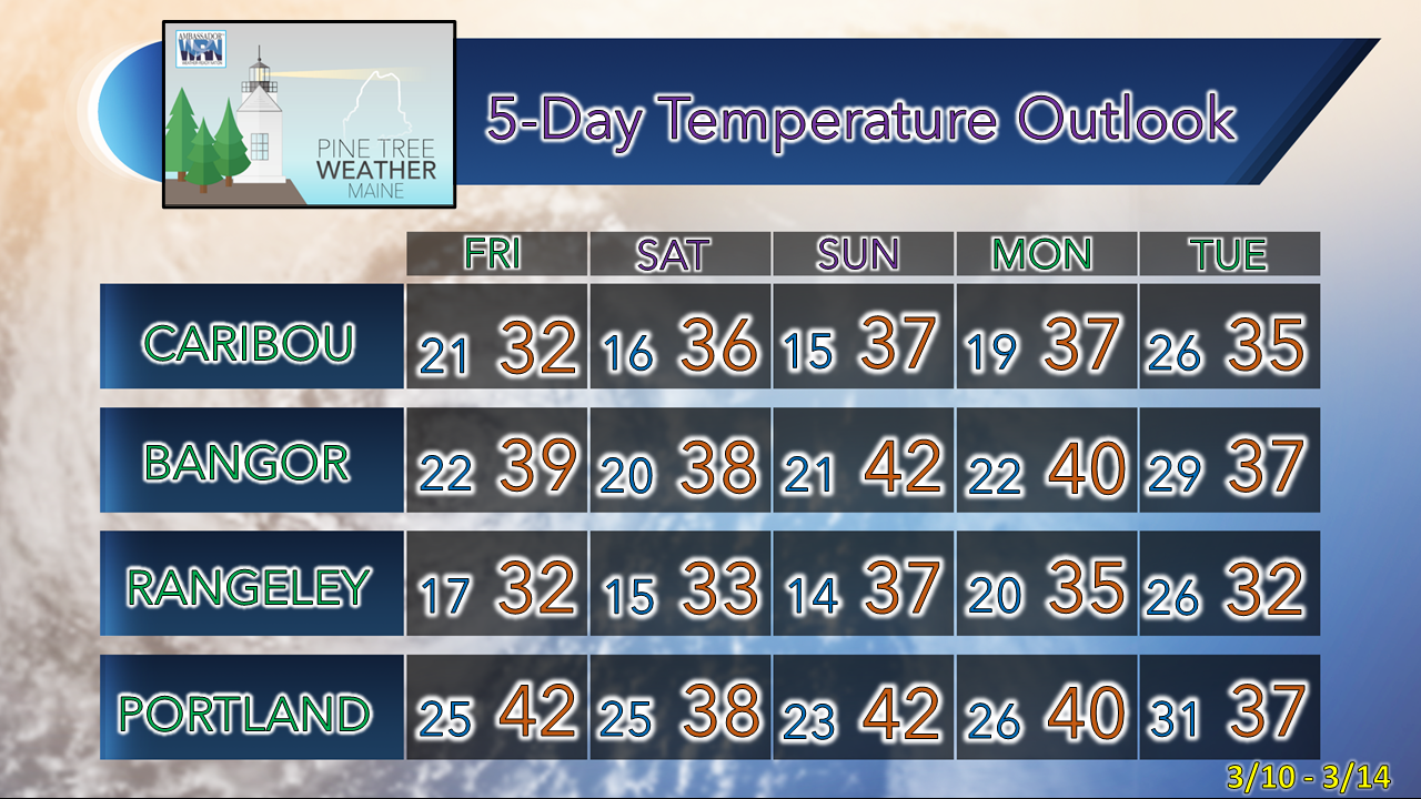
I've been quiet since the previous storm as I have dealt with rheumatoid arthritis in my thumbs, which thanks to the break, is doing better. I would be lying to say that if I wasn't a bit scared by this recent bout, as it was quite painful. As a result, I have taken strong steps to change my lifestyle, by adding more exercise and eliminating gluten and refined sugar from the food I eat. It has taken a couple weeks, but I am now feeling improvement. In the short term, I will take it easy, keep posts brief and on point, and nurse my hands and this website along. I won't be doing too much extra-curricular posting on Twitter, but instead focus my efforts here. I am grateful for the support of my family, friends, and those who follow and financially contribute. Thank you for your understanding. A look at the pattern through mid-monthAs mentioned back in January, La Niña was expected to fade and do so rapidly by March, which that was verified by NOAA Climate. I also mentioned at that point with its retreat to expect a backloaded winter, which that has been initiated with the storm last week, and the storm potential for next week. Looking at the pipeline, there is potential for another spring snow event the weekend after St. Patrick's Day. With the ENSO neutral, spring is likely to be a slow start. I expect mud season to be a messy one. Time will tell what the spring runoff and potential river flooding will look like, but with the cold holding in and snow chances around, that may be something to contend with. Looking at forecast temperatures at the 5,000-foot altimeter level shows a cool month overall for most areas. As long as we stay in the gray area (≤ 0°C) the snow threat will remain in consideration. Tuesday storm one to stay updated onWatching this event unfold over the past few days indicates there is potential for a plowable, impactful storm for Tuesday. Guidance is about as scattered as pepperoni on pizza, as the European ensemble ideas indicate above. Looking at other model ideas, they are jumbled as well, along with being in considerable disagreement. The big question is how sharp the trough comes in, along with where the northern and southern streams come together. It is a safe bet that the cold air will be aloft, so snow over the interior is a distinct possibility, but how far inland is a mystery. There is a chance for strong wind, which with wet snow may bring power outages. Thankfully, the tides won't be astronomically high, but there still may be some shoreline impacts pending on timing and track. I will track and update over the weekend. Temperature outlook through TuesdayThe normal high and low temperatures for Caribou for March 9th are 32° and 13°. For Portland, it is 40° and 24°. Temperatures are expected to be a bit warm on the low end, and around normal on the high end for the foreseeable future. Thank you as always for your support! You may not like the weather, but I hope you like what I do! Please hit the like button on Twitter and Facebook, and share! Stay updated, stay on alert, and stay safe! - Mike NOTE: The forecast information depicted on this platform is for general information purposes only for the public and is not designed or intended for commercial use. For those seeking pinpoint weather information for business operations, you should use a private sector source. For information about where to find commercial forecasters to assist your business, please message me and I will be happy to help you. |
Mike Haggett
|


