
The latest outlook through February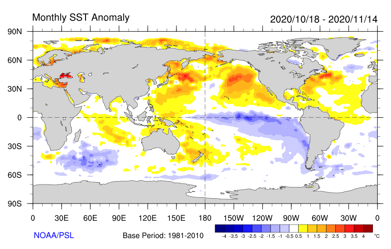 One of the things I have learned in my studies on tropical forecasting this semester is how the impacts of temperatures near the equator can play big role in weather patterns. While El Niño / La Niña are only a theory, the scientific study has made strong inroads over the years. The weather observations and local climatic impacts known of the tiny Galapagos Islands off the coast of Ecuador have been the bellwether of changes in northern hemisphere for many years. Atmospheric science is catching up with it, thus give a better read on what to expect seasonally. In a La Niña pattern, the water is abnormally cooler with the Galapagos Islands, and that anomaly stretches westward along the equator. That is exactly was is being observed as indicated in the sea surface temperature graphic above. 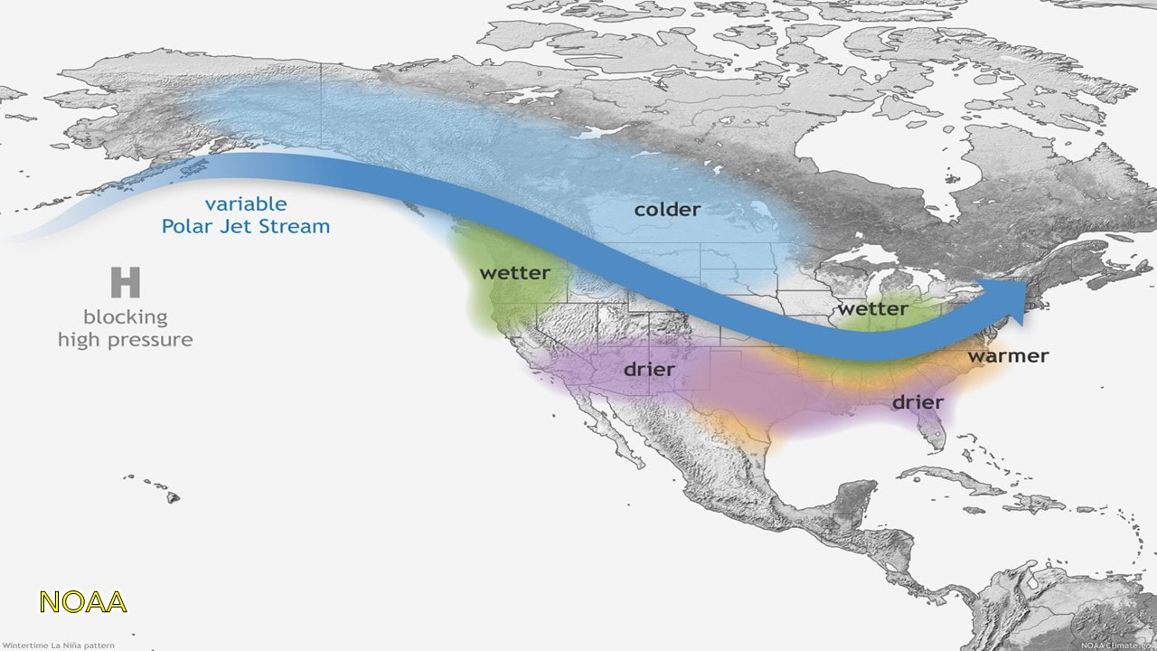 The picture above from NOAA indicates what to expect in a typical winter La Niña pattern. What is notable here: A strong ridge over the eastern Pacific highlighted by the blocking high south of the Aleutians, along with a trough that extends into the Midwest. The polar jet works its way to the northeast. The position of the jet stream has implications on who gets what for precipitation types and amounts, and that will meander back and forth at times as we have already experienced in the past week. I mentioned previously my outlook for winter back in October. Wetter for the coast, mixed precipitation for the western foothills, through central areas over to southern Aroostook / northern Washington County, and snowier for the western mountains on up into The County. That idea has not changed. If anything, it's showing signs of validating. Don't be fooled... everyone will be shovelling at some point. 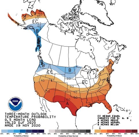 The Climate Prediction Center updated its three month outlook, and the La Niña pattern can be seen with it. Temperatures above normal are certainly possible as the graphic depicts. This isn't exactly anything new. We've dealt with warmer winters for several years now. This season may end up warmer than normal again. While it may not feel that way, the indicator of where our winters are warmer isn't so much the high temperatures, but the low temperatures. Using Caribou as an example, the mean temperatures for December to February average 21.9°F based on 1939-2000 average. Other than in 2018 where the mean average was 20.5°, temperatures have been above normal every year since 2007. 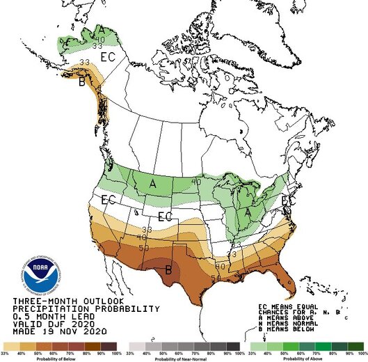 Precipitation amounts appear to be around normal. For the coast, that is 50-70" of snow, if it all comes down in frozen form. For the mountains and north, that ranges from 60-110". One thing appears at this point is that it could be a late start. I am not seeing any indication of any significant snow events anytime soon. That said, the temperatures appear to be low enough at night for the snow guns to build bases on the ski hills. Thoughts on Thanksgiving week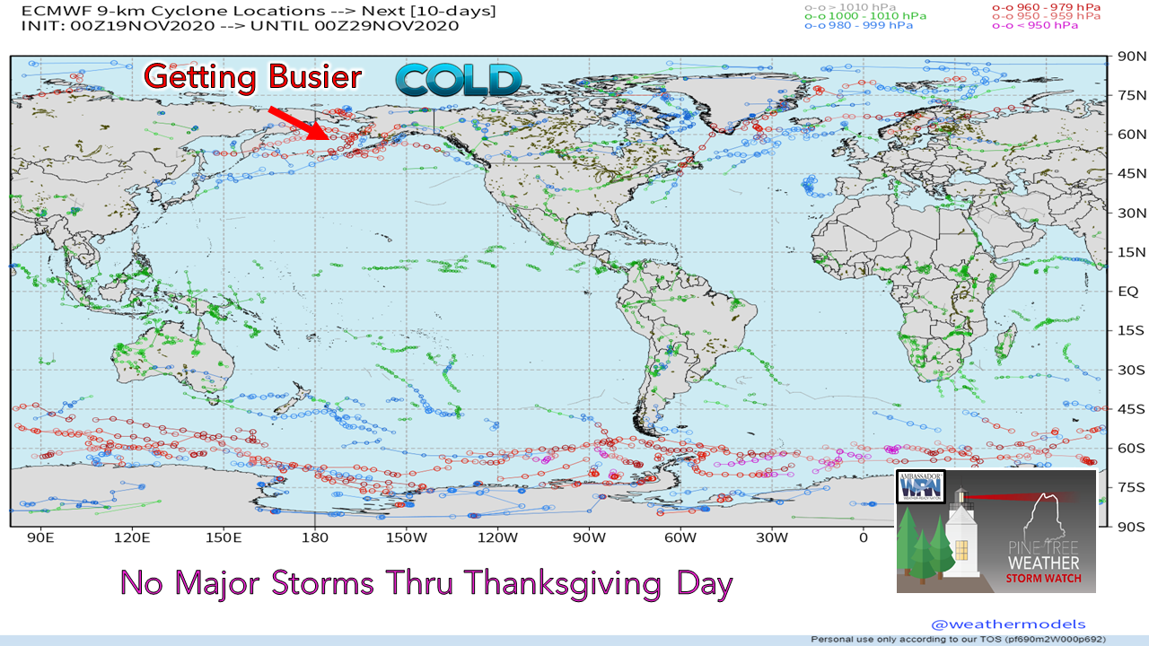 This chart shows potential storm intensity and track over the next 10 days. Looking at the contiguous United States, it doesn't show a whole lot of intense activity. There is a Colorado Low that is worth watching that I will discuss, and potentially a storm around Thanksgiving Day itself, but nothing major. One indication that piques my curiosity is the storm activity around the Aleutian Islands. As that region gets busier, it can indicate potential storm activity a couple weeks out for the northeast. Time will tell if that idea will be true.  Friday / Saturday Outlook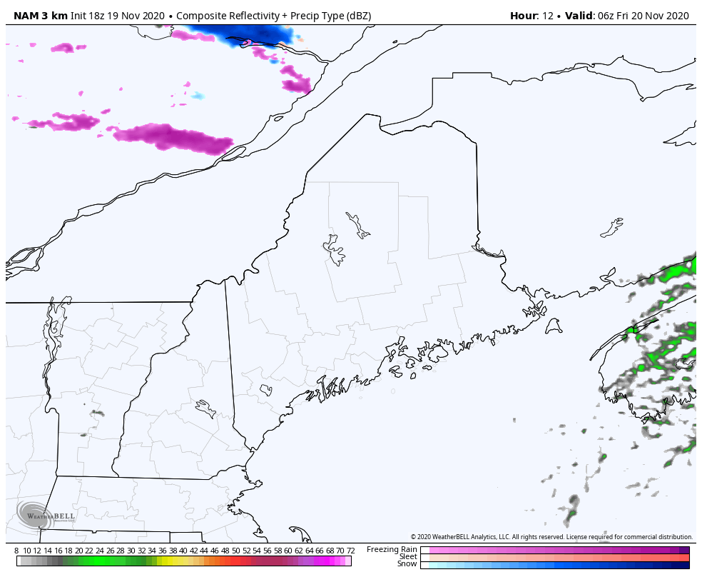 Northern areas may see some mixed precipitation in spots Friday morning as warm air beings to nose in. Anything frozen changes to rain as temperatures rise. An isolated shower / sprinkle is possible over the rest of the state through the evening as a weak cold front approaches from the northwest. 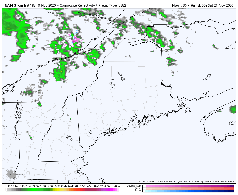 The weak cold front passes through the region overnight into Saturday morning. As high pressure moves into the region, gusty northwest winds in the 20-30 mph range will be out ahead of it until it settles over the region Sunday. The mountains may pick up some snow showers through Saturday afternoon. Outlook through Wednesday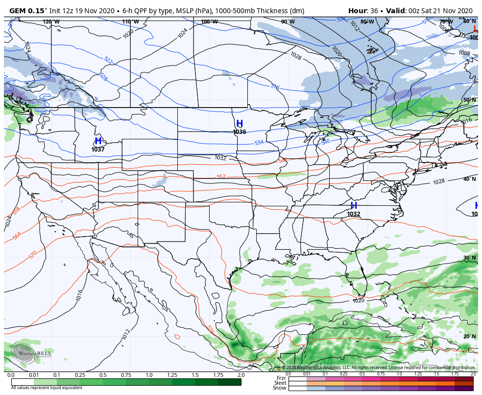 I mentioned the Colorado Low a bit earlier in the post and that is the main weather feature late Sunday night into Monday. For now it appears the coast stays liquid. Precipitation may start off as snow over interior areas. The question there is if that will change to rain. It's a bit early to get into the finer details on this, and I will update on it. If you look closely, you can see the La Niña pattern I discussed on display here. Temperature outlook through WednesdayThe average high is 37° for the north and 24° for the low. For southern areas, the average high is 47° and the low is 30°. Temperatures will ebb a few degrees above and below through the weekend. Headed into Thanksgiving, temperatures appear to be below normal. 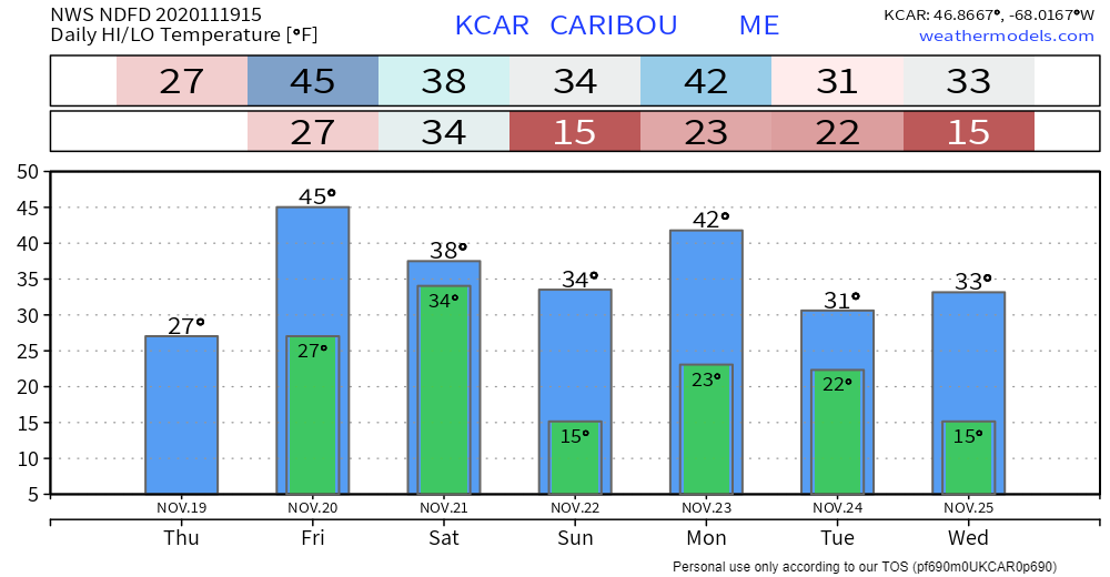 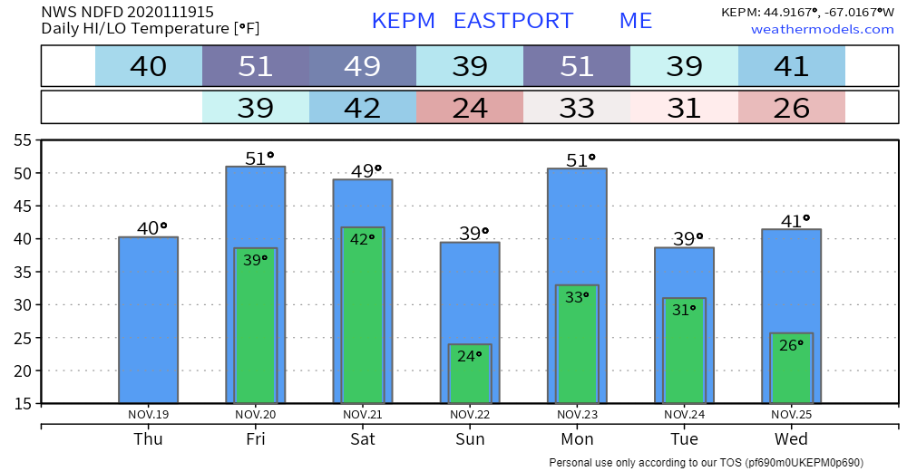 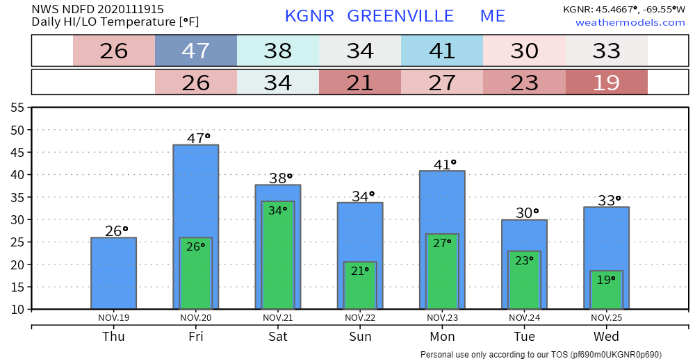 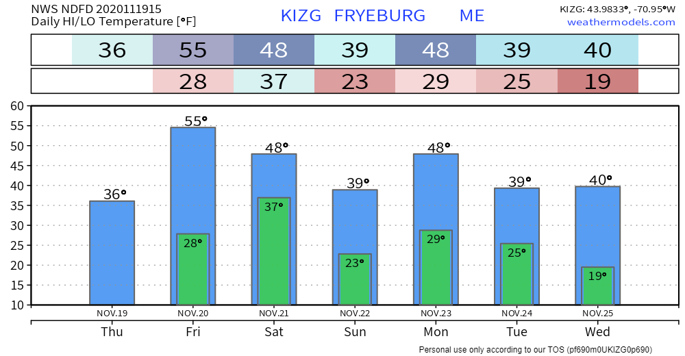 Help fill the gaps!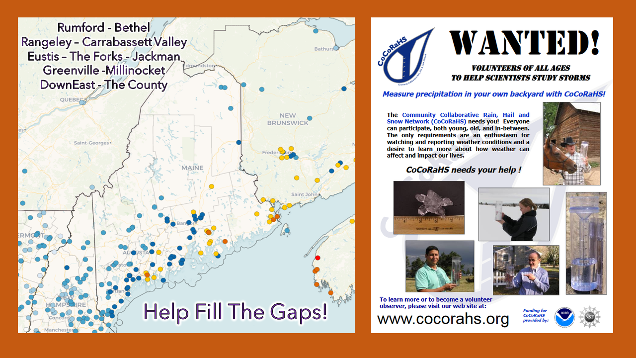 For folks in western, eastern, and northern areas, the Community Collaborative Rain, Hail and Snow Network could use your support! Verification of precipitation is very important to improve forecasts. All ages can participate. Reporting is easy, and it takes very little time to do. For more information, please check the CoCoRaHS Maine website. I would be more than happy to answer any questions you may have about the program! Be prepared to receive alerts and stay updated!
For more information, please follow Pine Tree Weather on Facebook and Twitter.
** FUNDING NEEDED FOR 2021 ** Thank you for supporting this community based weather information source that is funded by your financial contributions. Stay updated, stay on alert, and stay safe! - Mike |

Mike Haggett
|


