Trend through midweek: comfortable The pattern over the next five days is relatively quiet. Upper-level troughs tend to dominate the period, which keeps heat and humidity away from the region. The temperature trend starts cooler and then modifies to slightly warmer than normal levels heading into next week. I have the 5-day outlook for temperatures, along with thoughts on Hurricane Larry that pokes late into the loop on its approach to Bermuda as the post unfolds. A sunny Saturday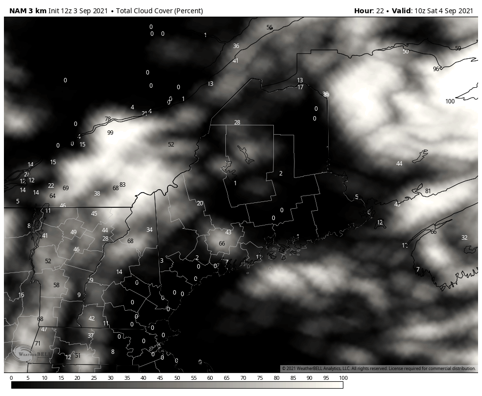 High pressure slides into the region as the remnants of Ida move to the east. It may a be bit breezy as northwesterly winds could range in the 5-15 mph range as the high moves in. A pleasant day overall with highs in the 70s for most areas. Crisp start for northern areas Sunday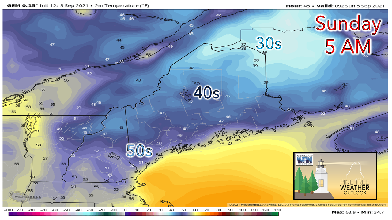 With the high passing through the region Saturday night, northern areas may feel a touch of fall in the air to start off Sunday. Cloud cover will dictate any frost threat in the Allagash and St. John River regions, but right now that threat is low. It would not surprise me if Estcourt Station posts a low number to start the day, potentially around or below freezing, if the sky conditions stay clear. Showers possible Sunday night into Labor Day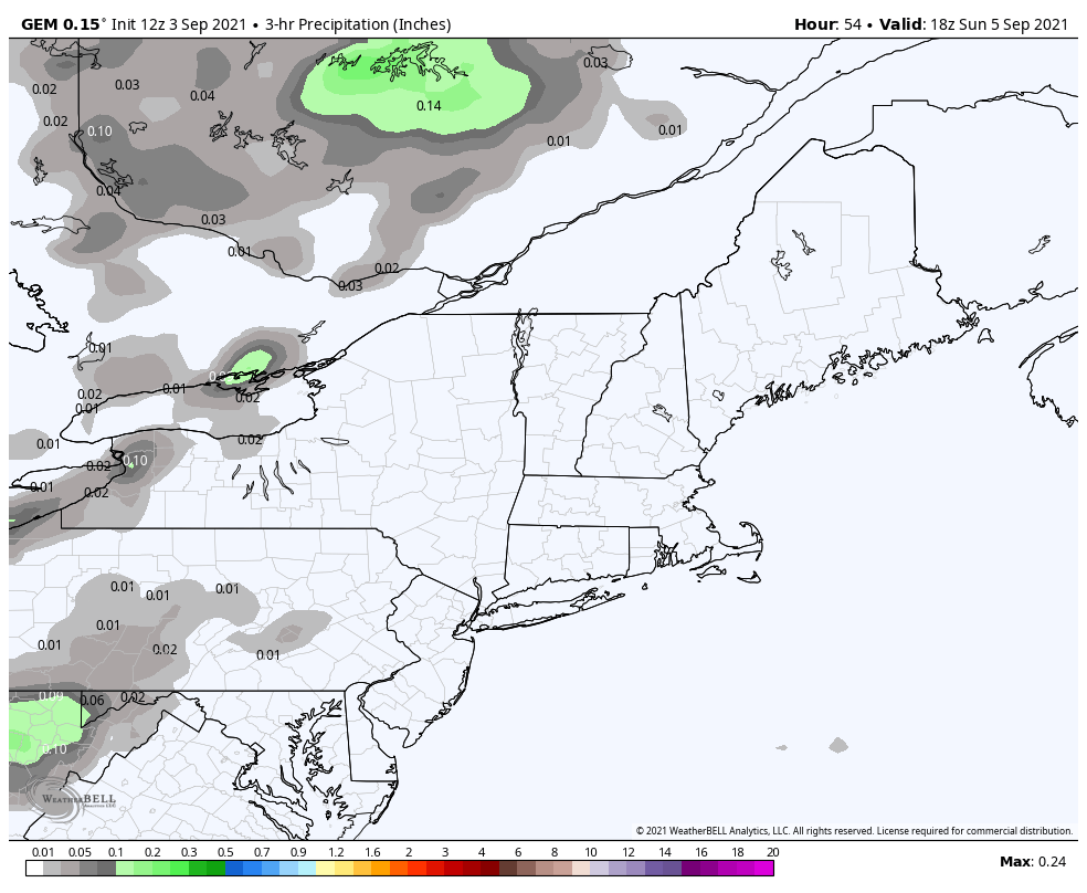 Clouds are on track to increase on Sunday as the high departs and a frontal boundary approaches from the west. Showers may reach southern and western areas late in the afternoon, but the day appears mainly dry overall. The slow-moving front brings showers to the region Sunday night into Monday, with another round possible late Monday into Tuesday. It won't be a washout, but it may be enough to be annoying for any outdoor activities you may have planned. Tuesday looks to be mainly sunny. Wednesday sees another frontal boundary on approach which may bring showers into Thursday.  Tracking Larry I bring up Larry as something to keep watch on. The storm is intensifying and expected to turn into a major hurricane. The storm is on track to work northwest to Bermuda heading into next week. 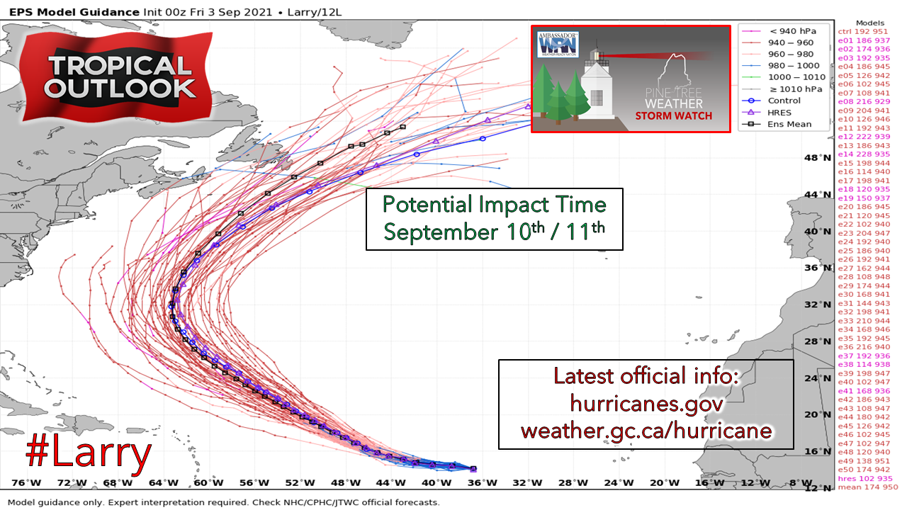 A look at spaghetti plots shows the storm tracking perilously close to Bermuda, then begins to shift northeast. The timing of an approaching trough midweek appears to keep the storm out to sea for now, but I am not comfortable writing off a westward shift just yet. Any slowdown of the trough may bring the storm closer to the Canadian Maritimes and New England. It would be wise to stay updated on Larry over the weekend and into next week through the National Hurricane Center and / or the Canadian Hurricane Center. Temperature outlook through WednesdayWhile the humidity may tick up slightly on Sunday into Monday as the front approaches, it may barely be noticeable. Overall, it will be comfortable into the middle part of the week. 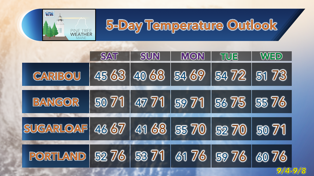 Be prepared to receive alerts and stay updated!
For more information in between posts, please follow Pine Tree Weather on Facebook and Twitter.
Thank you for supporting this community-based weather information source which operates by reader supported financial contributions. Stay updated, stay on alert, and stay safe! - Mike |

Mike Haggett
|