|
Snow in late April. The coastal plain does not see it that often. Looking over data history, Augusta recorded 3" of snow on May 11, 1963 and Portland picked up 5" on May 11, 1945. It can happen. This is life around the 45th parallel. Cold air is stubborn. This time of year, it can bring surprises. This is a situation where it could happen. This is an interesting and complicated storm. Low level cold the key on how this storm plays out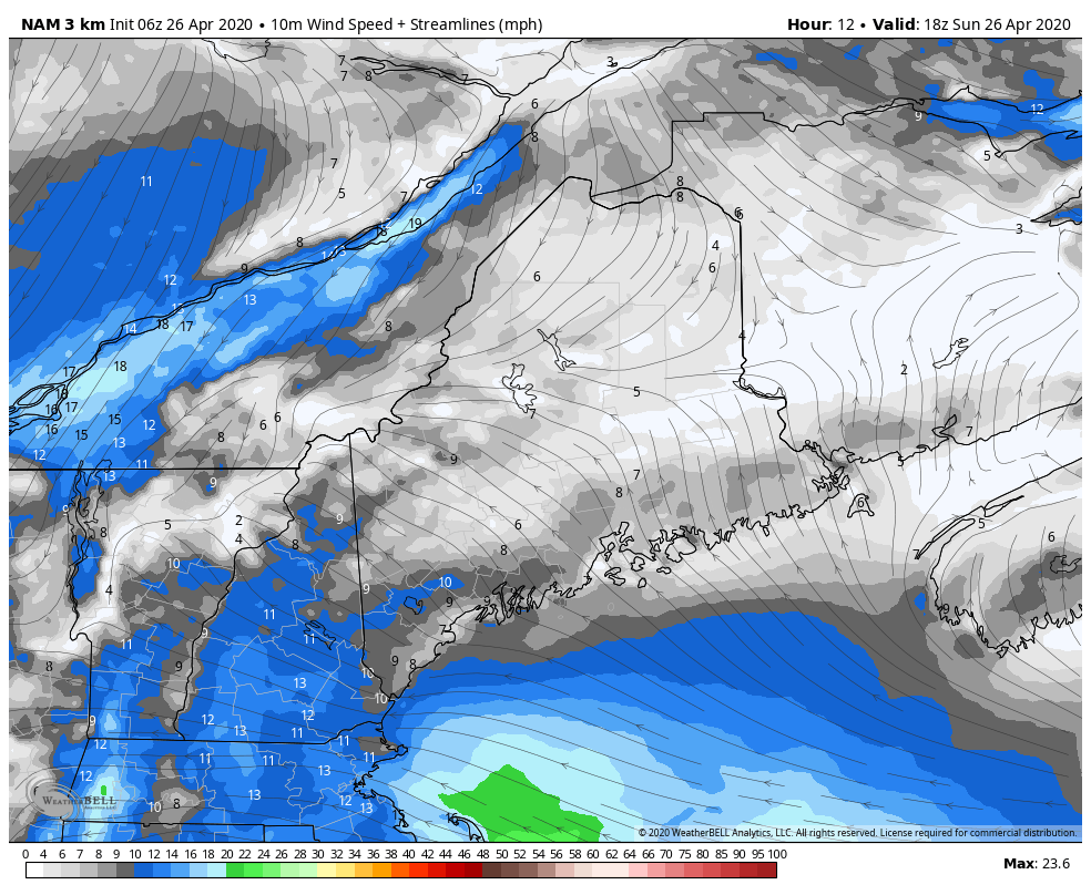 NAM model 10m wind estimates from Sunday 2 PM to Tuesday 8 AM I am going to start off with wind because it is an important part of this storm. Cold air lurks to the north in Quebec. As the storm moves in, it taps into that cold and north/northeast wind direction brings it down into Maine. Sustained speeds of 10-20 mph with gusts in 30s is possible with this storm. Add heavy wet snow to the picture, this brings the likelihood of power outages. 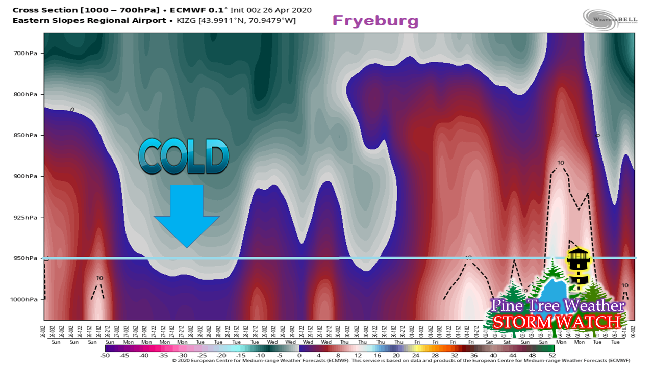 This is a horizontal profile of temperature, using Fryeburg as the example. Cold air will be sinking downward. This is the dynamic cooling feature I've discussed here in previous updates on this storm. This is a somewhat similar set up as to what we experienced with the storm earlier in the month. It doesn't matter what the 2 meter temperatures read. For most of western and southern Maine, the thermometer may read anywhere between 30-38° overnight and into Monday. With the cold ceiling this low, snow won't have the chance to melt before it reaches the surface. As a result, it is this part which will dictate snowfall amounts and how much. 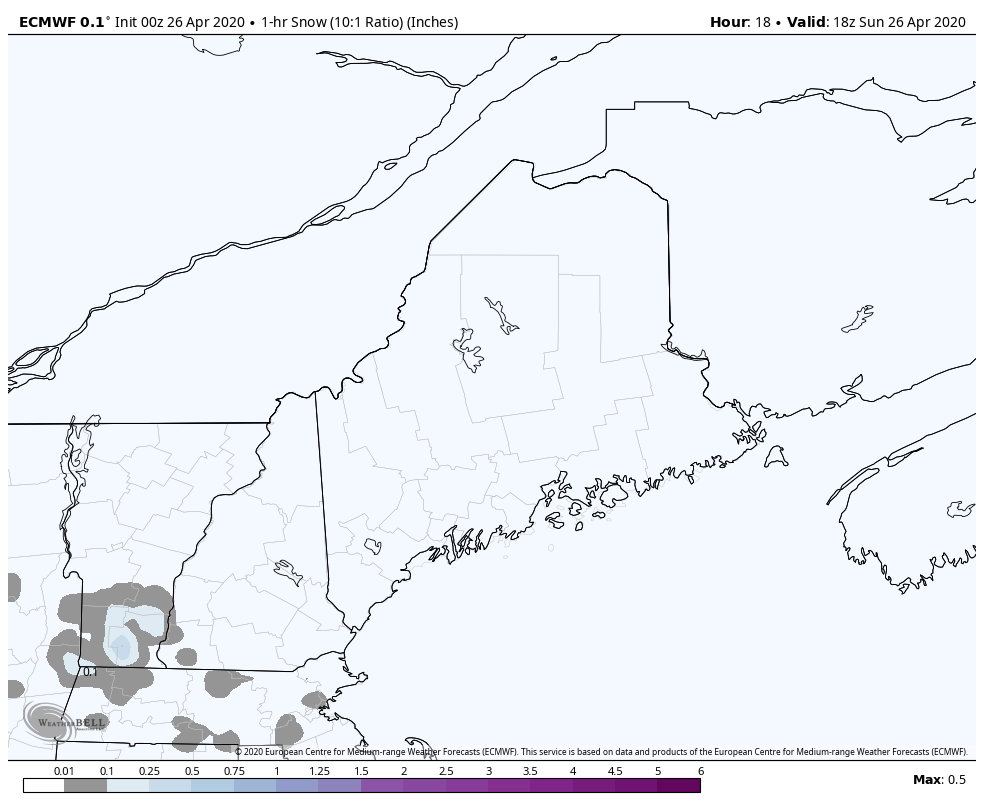 1-hour model snowfall estimates from 2 PM Sunday to 8 AM Tuesday Looking at projected model snowfall hour by hour, it does not appear to be that big of a deal. There is likely to be some banding and areas where snowfall could reach ½-1" per hour, but for most of the time and most areas, it will be less than that. With the dynamic cold in place, it will allow for snow to pile up over time. 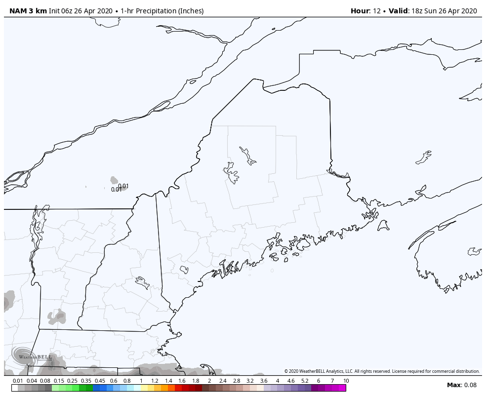 1-hour rainfall model accumulation estimates from 2 PM Sunday to 8 AM Tuesday Looking at it from the liquid angle, it looks like a light rain event. There will be spurts of 0.10-0.25" per hour here and there. How that makes landfall once again depends on the dynamic cooling. Most of the precipitation falls between Sunday night and Tuesday morning, but precipitation will linger through Tuesday as the storm pulls east. 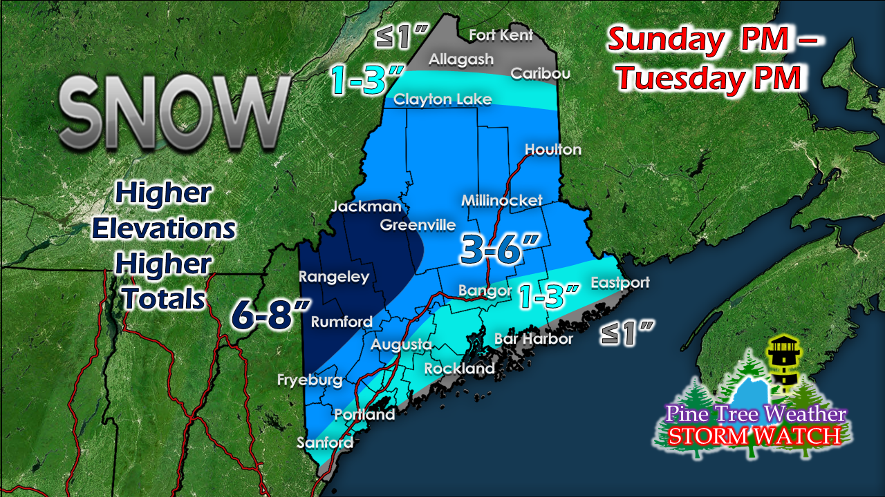 As I mentioned yesterday, snow will fall in clumps at times. Big fat thick flakes. It will stick to everything. It will pile up where heaviest. How the dynamic cooling plays out may increase or decrease snow amounts. The taller mountains could get a foot or more out of this. The ocean. with temps around 41-44° may spare the shorelines of snow, but a few miles inland, grass surfaces are likely to see at least some accumulation. The April sun angle will help heat up the lower atmosphere during the day on Monday, which may bring a mix of rain and snow in areas of the coastal plain. The best chance for accumulating snow for the coast appears Sunday night into Monday. 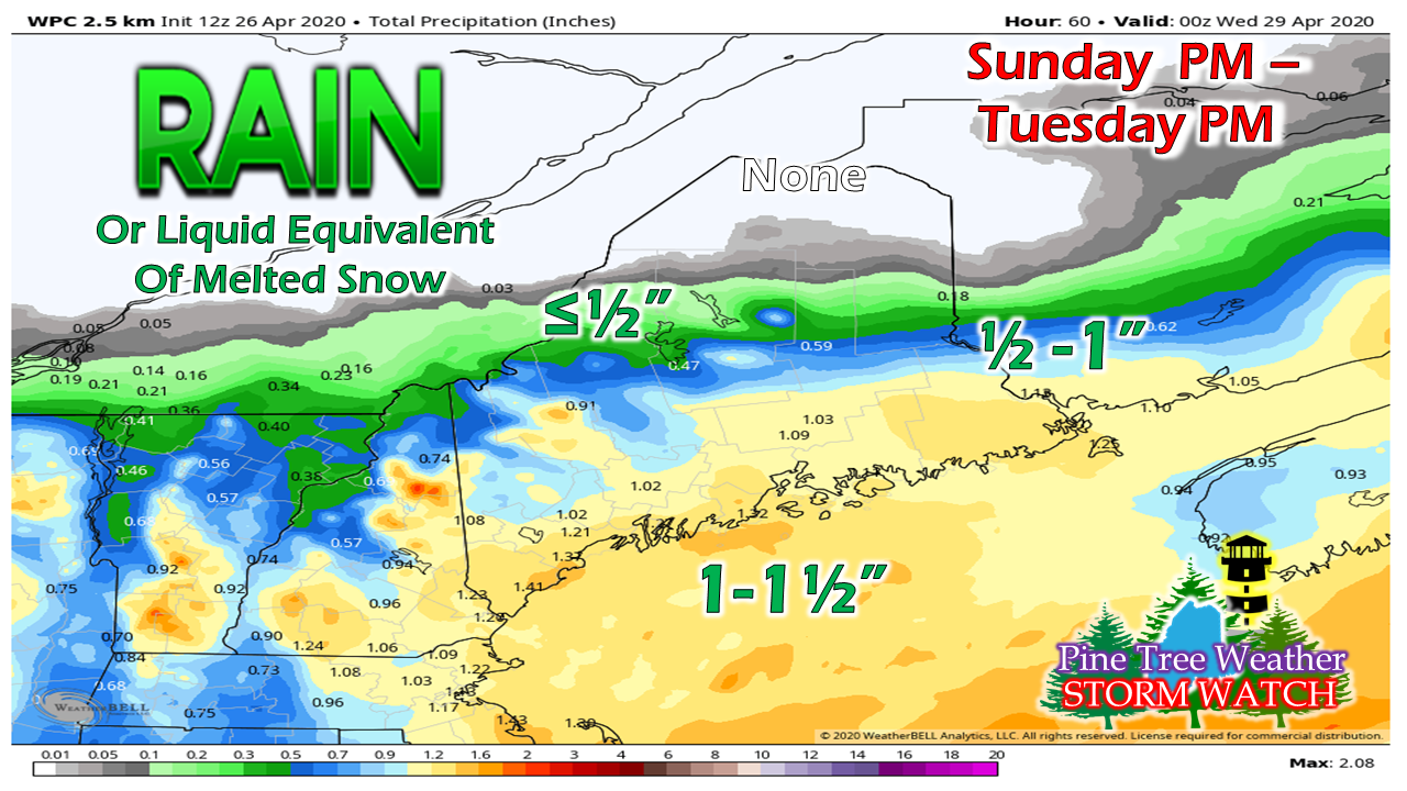 Also mentioned here previously, there is a plenty of moisture to work with here. An inch of rain or liquid equivalent in snow is possible for the higher terrain and much of the coastal plain. While it won't come heavy, it will total up over time Outlook for the rest of the week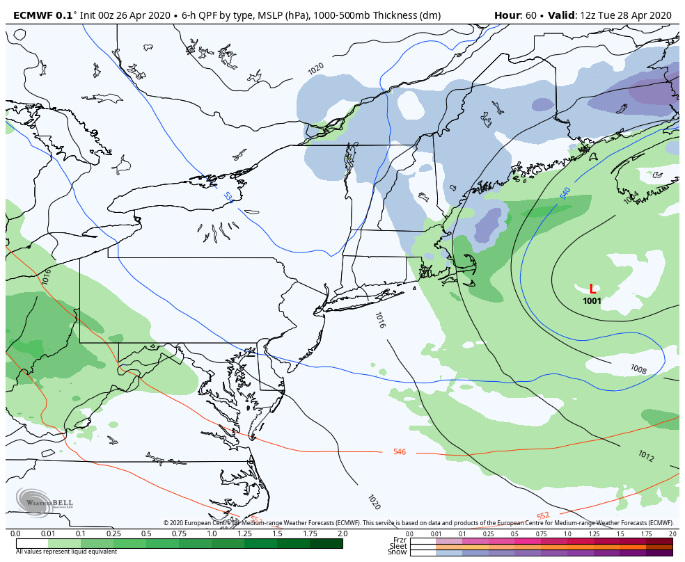 Tuesday sees light snow / rain activity coming to an end by Tuesday evening. There could be some pokes of clearing sky Tuesday night into early Wednesday. Clouds will increase Wednesday ahead of the next system on the way Thursday through Friday. This appears to be another slow mover, and could bring heavy amounts of rain. Temperature outlook through the weekThe below normal trend overall continues through the week. May appears to start off below normal. It could be the middle part of the month before we see an above normal shift. 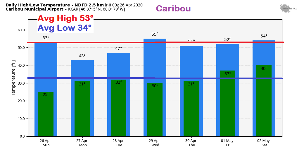 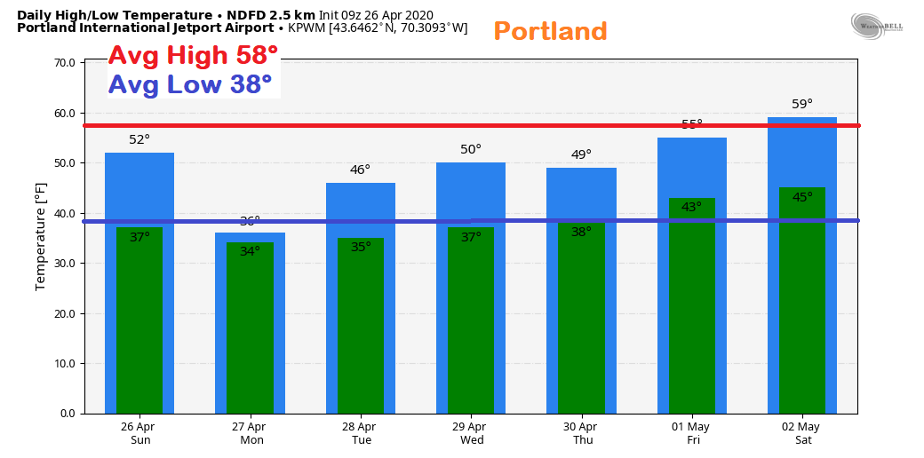 Help the weather community and stay informed!
► ► For the latest official forecasts, bulletins and advisories, please check in with the National Weather Service in Gray for western and southern areas, or Caribou for northern and eastern parts of Maine.
Thanks as always for your support! - Mike |

Mike Haggett
|