
Still some questions, but timing is improving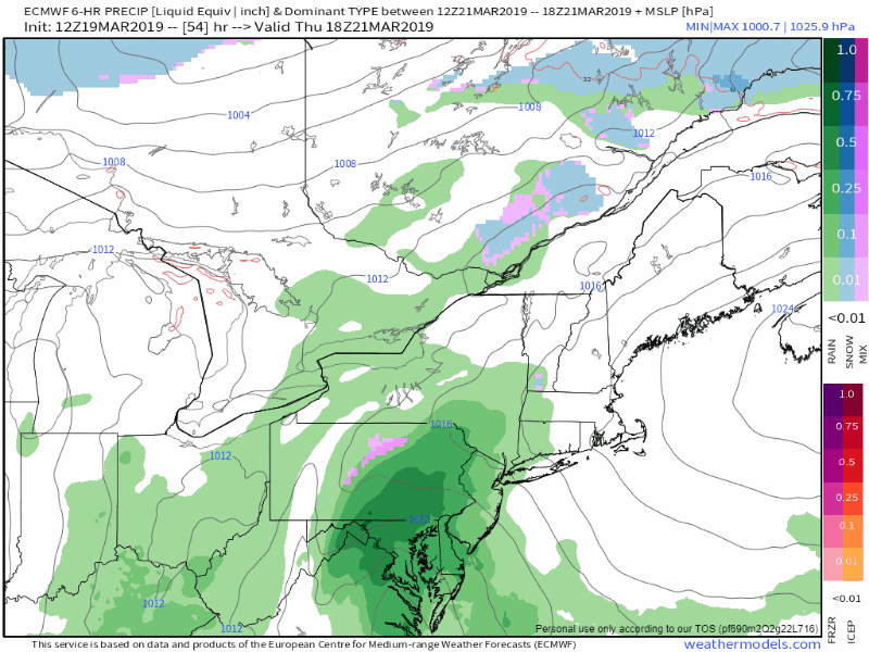 This much is known, there will be a storm that will bring snow and rain or a mix thereof to the region starting Thursday night, all day Friday and into Saturday. There appears to be some snow to start off over the mountains Thursday night into early Friday. Snow changes to rain for most, if not all of the region on Friday. As the storm moves eastward Friday night, cold air gets dragged down behind it, and this is where the snow comes into the picture. 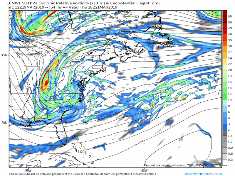 What is causing forecast uncertainty is the timing an position of two pieces of upper level energy, one from the north, the other from the south. The southern stream brings the moisture from the south, the northern piece brings the cold. The two come together over Northern New England, forming what is known as a TROWAL, which is an acronym for TRough Of Warm Air aLoft. This warm air brings the moisture and energy over cold air that could produce a decent snow event, especially for higher elevations. There is a whole bunch of moving parts with any storm system. This one is more complex, hence why the forecast has been a bit of a challenge. 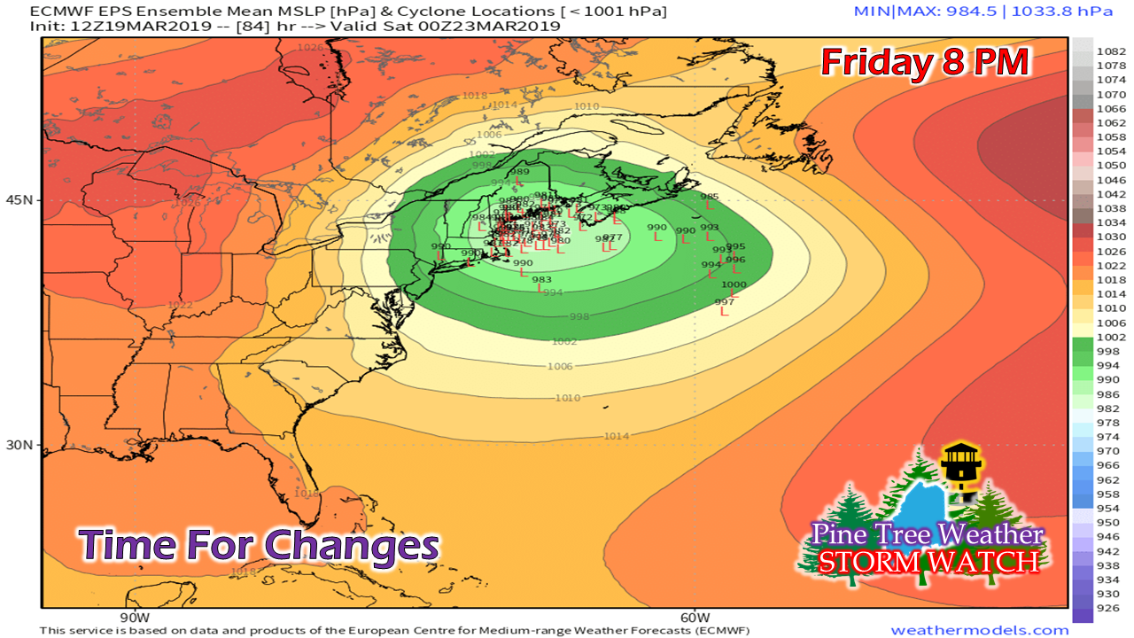 Basically, what it boils down to at this point is where the southern stream comes together and sets up the surface low. The more east of the Outer Banks of North Carolina, that sets up a more snow event. If the storm forms closer to Cape Hatteras, the storm tracks closer to the Maine coast and brings more rain. The ensemble idea above shows the spread very well. At first glance, it may look all jammed together, but a couple hundred miles in this case is the ballgame for who shovels and who doesn't. 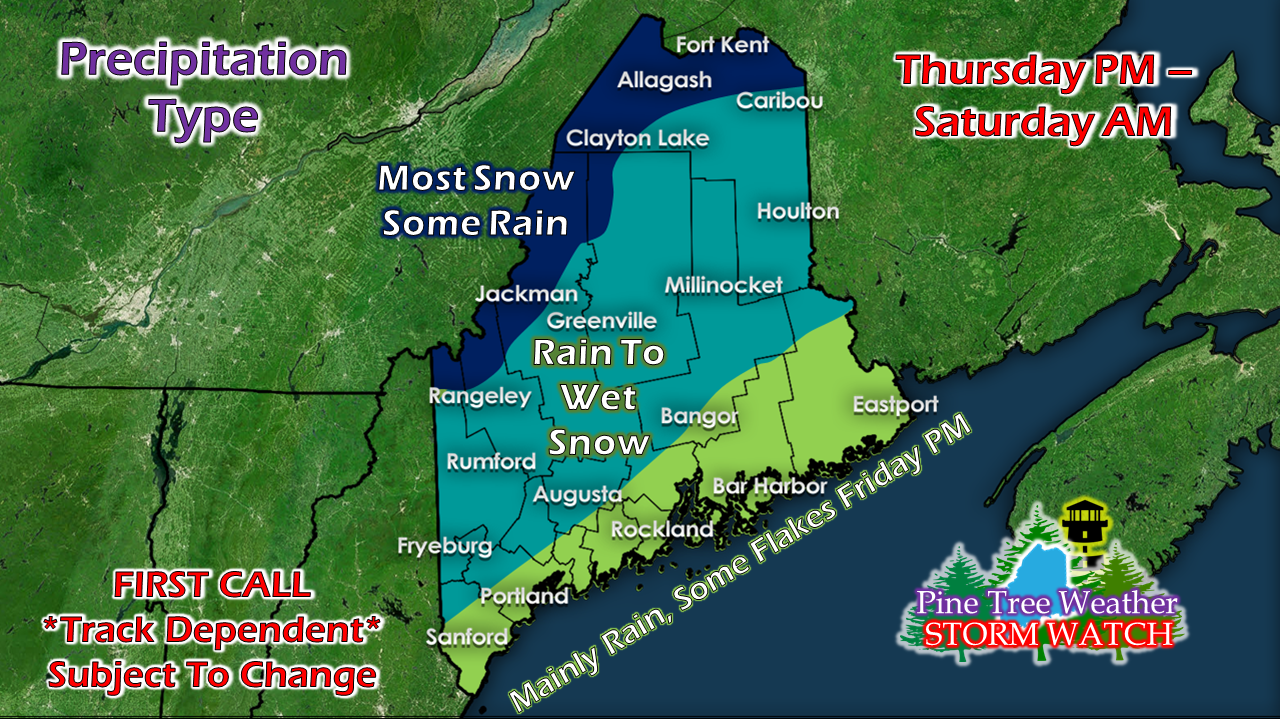 This a rough idea of what to expect for now. Keep in mind that this could change pending on where and when the northern energy meets up with the southern piece. There could be upwards of an inch or more of water with this system. That raises flooding concerns for the ice covered rivers, brooks and streams. There could be some wind issues. This will be more of a concern Friday night into Saturday when the heavy wet snow comes. There could be coastal concerns due to astronomical high tides, pending on the timing and strength of the storm. Regional outlook through Sunday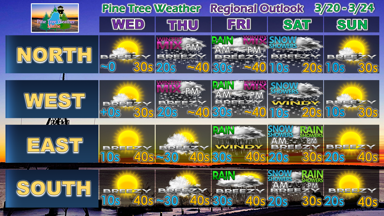 I will update on potential snow amounts, as well as other impacts Wednesday.
Stay tuned. ► ► For the latest official forecasts, bulletins and advisories, please check in with the National Weather Service in Gray for western and southern areas, or Caribou for northern and eastern parts of Maine. ► ► Your financial donations are much appreciated to keep this site funded and for further development. I sincerely appreciate your support not only financially, but also in sharing my efforts with others. Always stay weather aware! - Mike |

Mike Haggett
|


