Complicated system to impact the region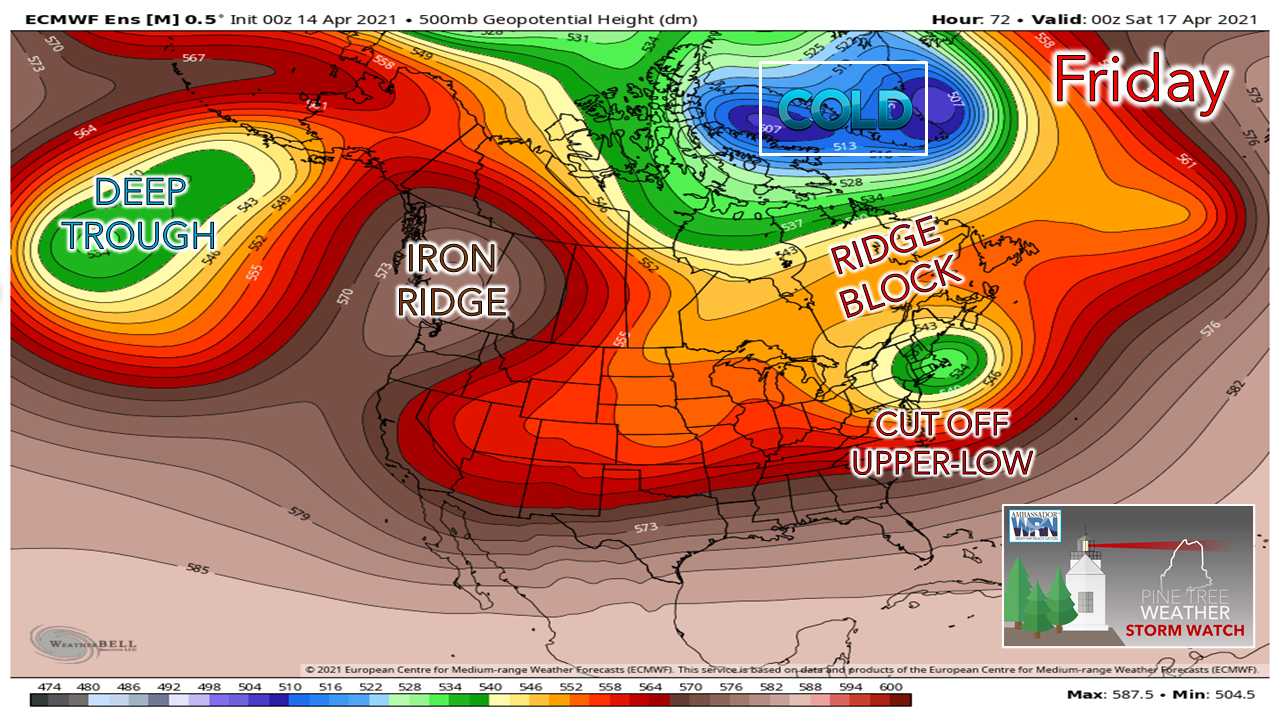 The setup for the storm is clear, a cut-off upper level low over the Great Lakes moves eastward. Deep cold stays to the north. As I mentioned on Facebook yesterday, what cold air is generated from this storm will be self-generated, meaning from the top down. That occurs with intensification of the storm. 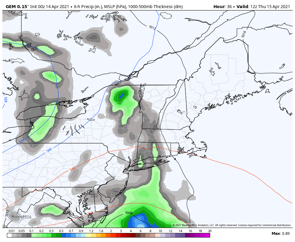 Throwing a wrench into all of this is the fact that as quickly the storm intensifies, it begins to weaken. The questions at this point are how low does the pressure go, how soon does the system become vertically stacked (all areas of low pressure from the surface upward at higher altitudes), which at that point it begins to weaken? Models have various ideas on that, and it is not clear yet. 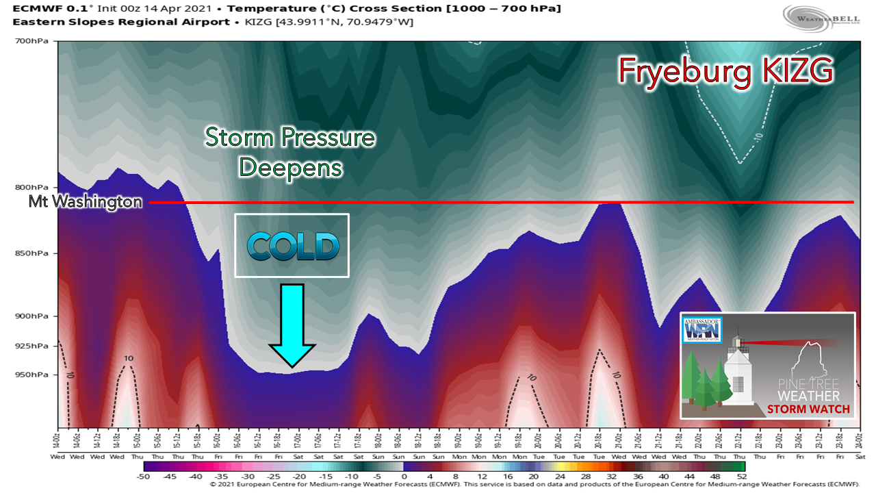 The cold that is self-generated due to the rapid intensification will dictate snow amounts. The quicker the intensification, the more dynamic cooling, and thus more snow. The slower the storm comes together, that delays the flip to snow, and thus lesser amounts. I expect much of the state to stay above freezing at the surface, as a result, this is a heavy wet snow event where snow does fall. It will stick to everything. This could be a crocus crusher for interior areas. If you can, cover up any blooms you may have going on. Along with the heavy wet snow potential comes wind. A rapidly developing storm could bring gusty wind along with it, and consequently the risk of power outages. 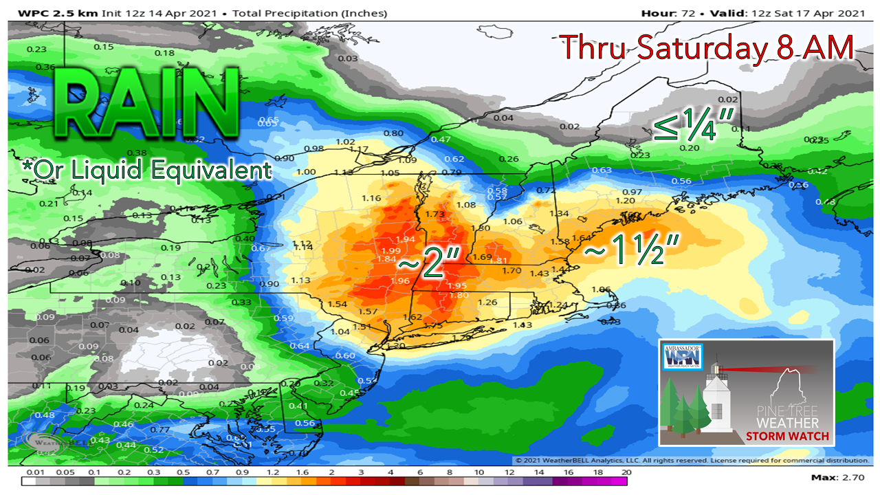 There is a good amount of moisture associated with this system for southwestern areas. The snow that comes will be a low water to snow fall ratio, in the 4-6:1 range. The idea at this point is the higher the elevation, the higher amounts of snowfall are possible. Snow could be seen all the way to the coast, whether flakes or accumulations on grassy surfaces. Stay updated on the latest forecast information. Be prepared to receive alerts and stay updated!
For more information in between posts, please follow Pine Tree Weather on Facebook and Twitter.
Thank you for supporting this community-based weather information source which operates by reader supported financial contributions. Stay updated, stay on alert, and stay safe! Thank you as always for your support! - Mike |

Mike Haggett
|