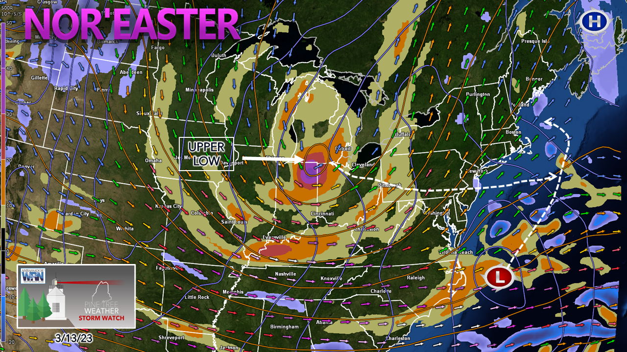
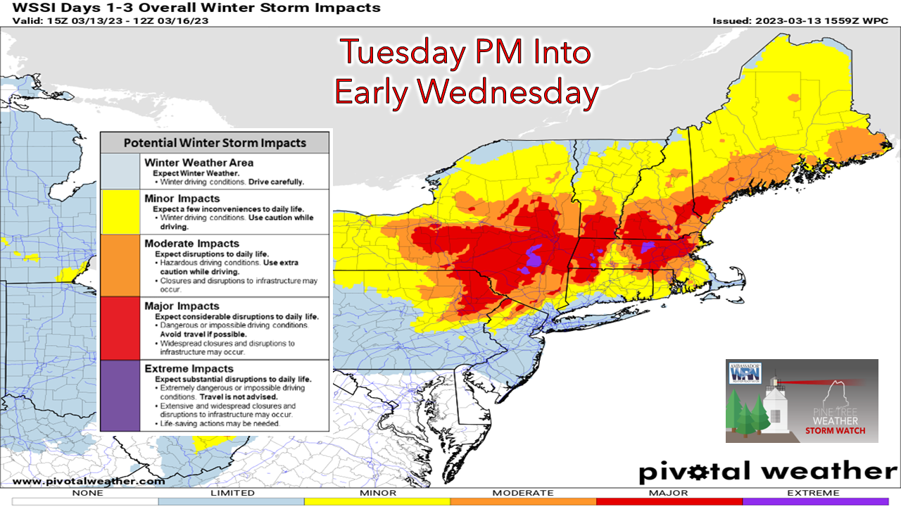
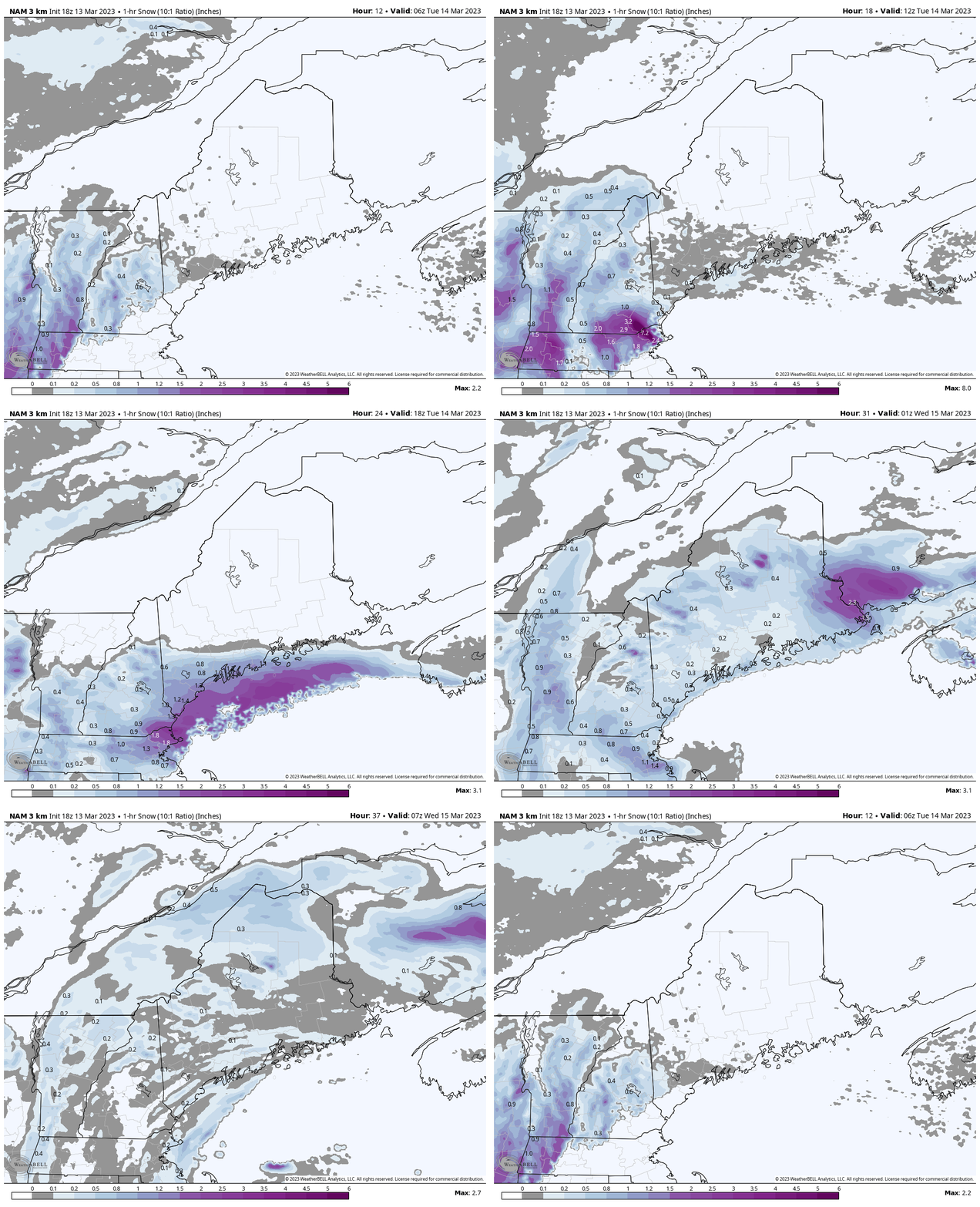
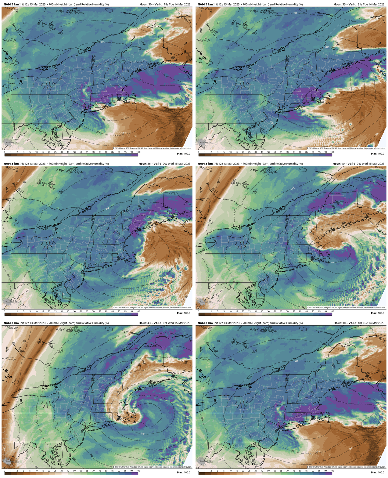
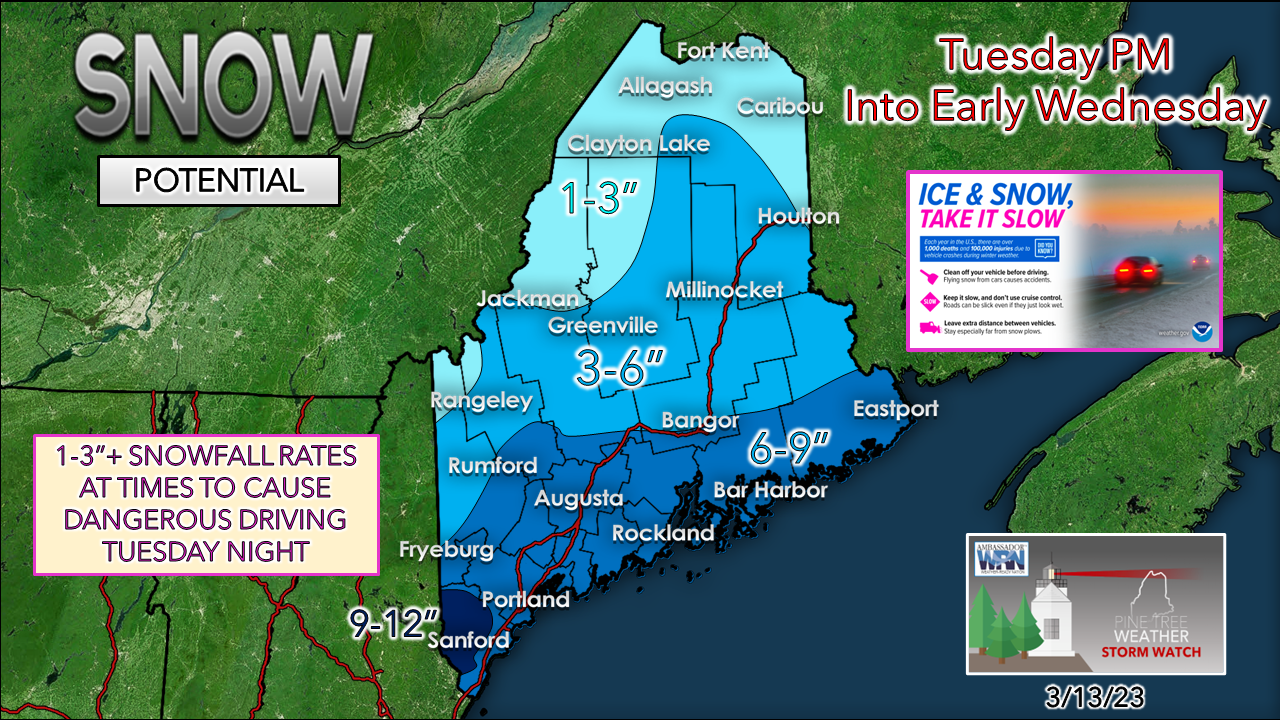
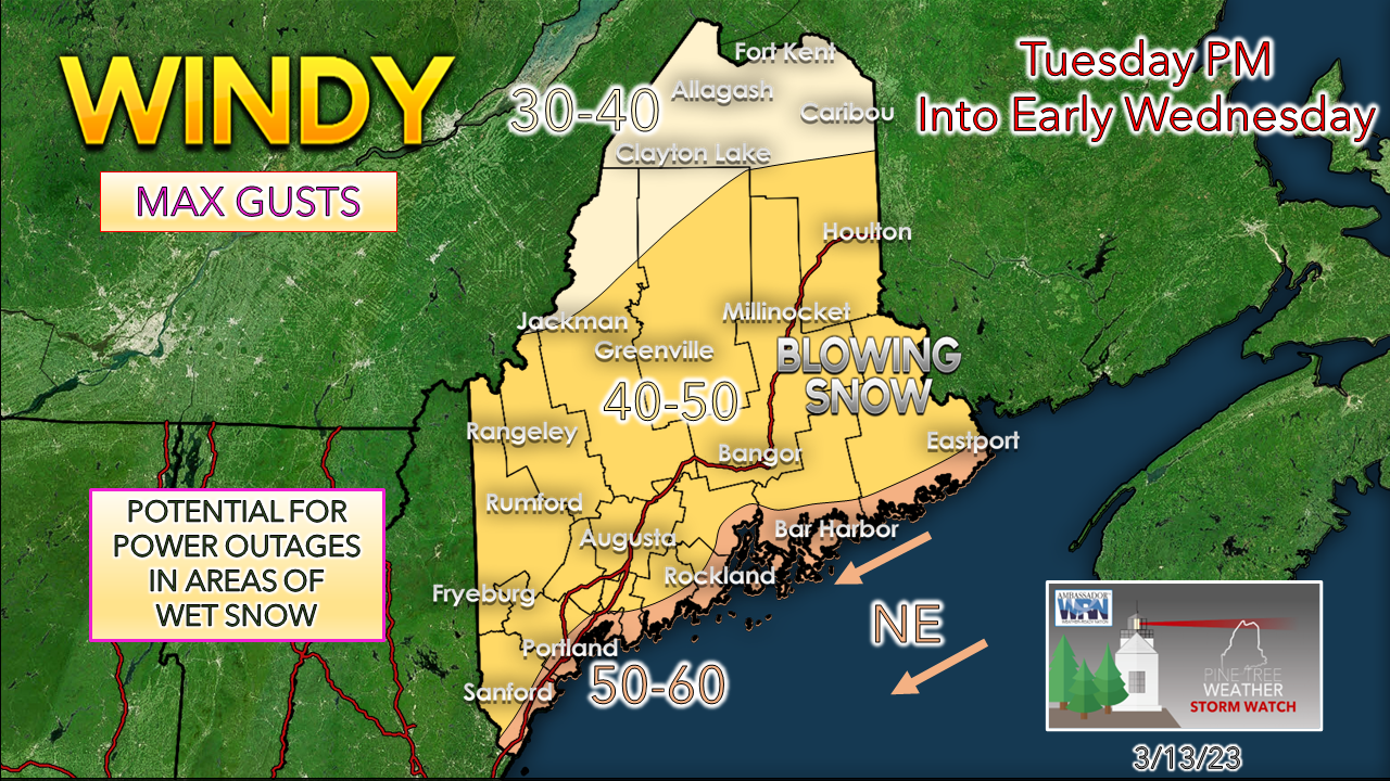
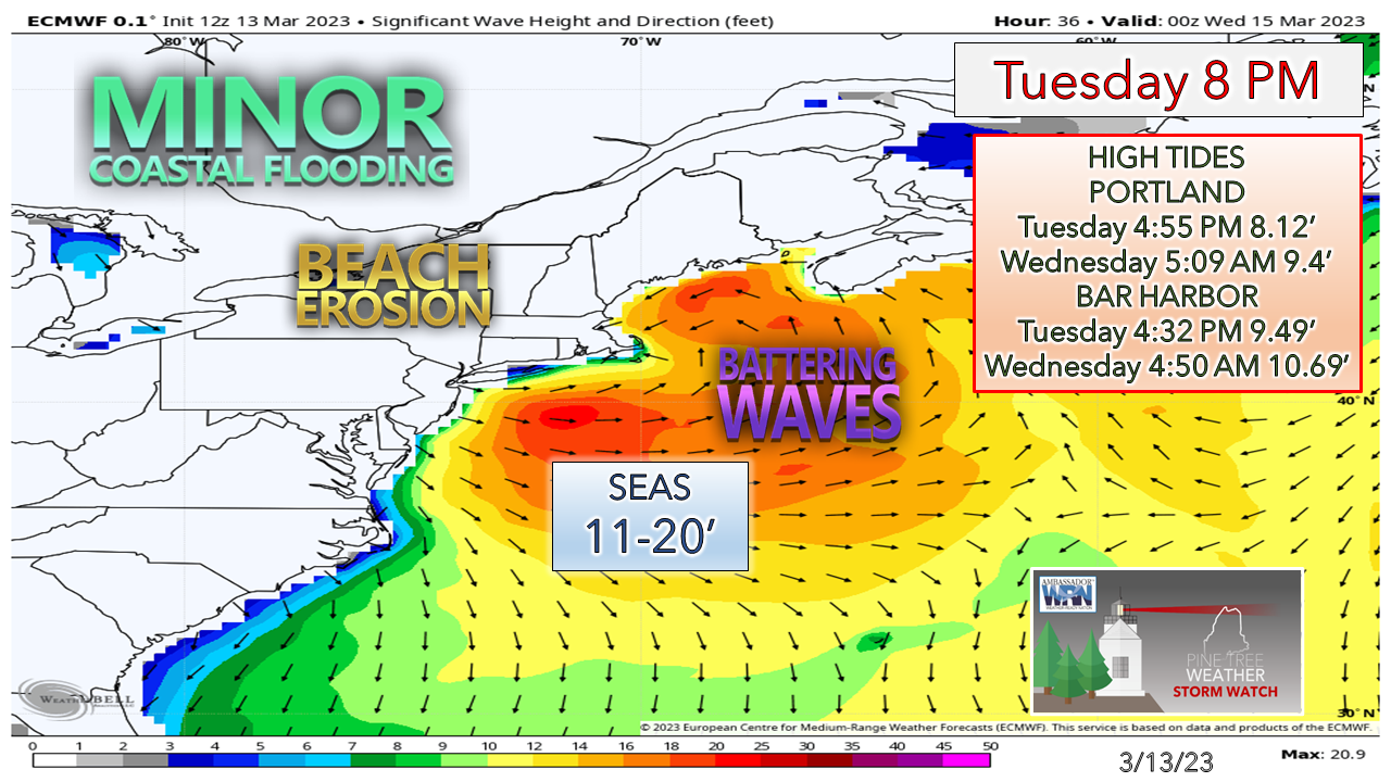
Upper-level vorticity looks like a ghostIt's comical given all that has gone trying to track this storm that I captured this image off the real time weather software I have. While the upper-level low and the vorticity wrapped around it looks like a ghost out of Halloween, it may appear scarier than what may come out of it, for most of Maine, anyway. These late season storms are a real challenge when it comes to forecasting, especially with rapid development, sun angle, marginal temperatures, and potential for dry slotting. This set up is like the blizzards we had back in 2015 and 2016. The one key element missing is the deep cold, hence why there are red flags of bust potential all over the place with this one. March does that sort of thing. Conditions go downhill Tuesday afternoonFor those travelling Tuesday afternoon into the evening, my humble suggestion is to get to where you need to be by 2-4 PM if you want to avoid slowdowns and delays. It will be a mess as heavy snow bands work inland off the ocean and dump snow at rates of 1-3+" per hour. Conditions appear to begin to improve overnight into Wednesday as the storm weakens, and the moisture stream runs out of juice. TimingTuesday 2 AM to Wednesday 8 AM - I will be right up front with this and say I see discrepancies with short term model ideas, which is yet another frustrating issue in forecasting this. Snow is expected to start over western areas heading into Tuesday morning, and while there could be periods of heavy snow, time will tell if that piles up on the roads or not, given the sun angle. The main event cranks up in the afternoon as the storm rounds the horn of Cape Cod and barrels into the Gulf of Maine. After the thump of snow early evening, it becomes steady overnight for most western areas, with eastern Maine getting the heavier bands overnight. As the storm weakens, it will keep snow showers going into Wednesday and end Wednesday afternoon. On a side note, you may hear thunder embedded with the banding coming onshore Tuesday evening. Dry Slot 101Tuesday 2 PM to Wednesday 5 AM - I've mentioned the term "dry slot" several times over the years and rarely define it, so when I stumbled over this loop, I thought it was a perfect Exhibit A to show what that means. This is the 700mb altimeter level, roughly 10,000 feet above the surface. This is the critical level for moisture. This is where forecasters read precipitation potential. The purples show the greatest level of relative humidity, the browns are the driest. In typical fashion of rapidly developing synoptic cyclones like this, the pressure drops so fast so quickly that dry air gets sucked into the core. When this happens, the storm reaches maturity and then weakens, scientifically known as occlusion. This is why these storms fizzle out. I am not saying this model is correct, but that is one large dry slot that affects a substantial amount of the area where the heavier snow has been anticipated to fall. This is one of the rather serious red flags that are flying with the outcome of this one. Updates on snow, wind, and shoreline concernsThe horses I have been beating on over the past few days about the issues around sun angle, lack of deep cold, compaction of snow, along with dry slotting has me reducing snowfall amounts a bit. The snow to water ratio is likely to vary from hour to hour along the coastal plain from light and fluffy to wet and sloppy. I do think this is a York County Special with interior areas there in the jackpot zone. Some areas may come in a bit higher due to banding. The shorelines may see less due to the ocean temperatures. With the storm track into the Gulf of Maine east of Boston and south of Portland, the region won't escape the wind. The stronger gusts come Tuesday evening, then gradually diminish as the storm weakens overnight into Wednesday. Since the storm will take its time leaving, expect breezy conditions to continue through Wednesday night and then settle by Thursday morning. Again, we are most grateful that the worst of the battering waves come in overnight when the tide is low. A Coastal Flood Watch is in effect for the Cumberland and York County shorelines. Expect rocks and debris on the beachside roads and some splash-over and beach erosion, but other than that, the coast escapes without too many issues. Thank you as always for your support as I deal with rheumatoid arthritis. I appreciate your patience. Pine Tree Weather is funded from followers like you. I would appreciate your financial support. Click here for how you can contribute. You may not like the weather, but I hope you like what I do! Please hit the like button on Twitter and Facebook, and share! Stay updated, stay on alert, and stay safe! - Mike NOTE: The forecast information depicted on this platform is for general information purposes only for the public and is not designed or intended for commercial use. For those seeking pinpoint weather information for business operations, you should use a private sector source. For information about where to find commercial forecasters to assist your business, please message me and I will be happy to help you. |
Mike Haggett
|

