Post-Laura thoughts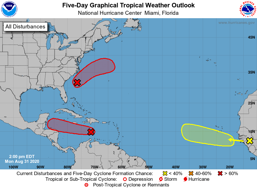 Laura left much of Louisiana a mess, which was expected. The storm was slightly under CAT 5 levels when it made landfall in the early morning hours. It was the strongest storm to hit the state since 1856, tied the estimated wind of 150 mph with that storm, and had stronger wind than Katrina (125 mph) when it made landfall in 2005. As we head toward peak tropical season, two more waves are under investigation by the National Hurricane Center as a very active season continues. 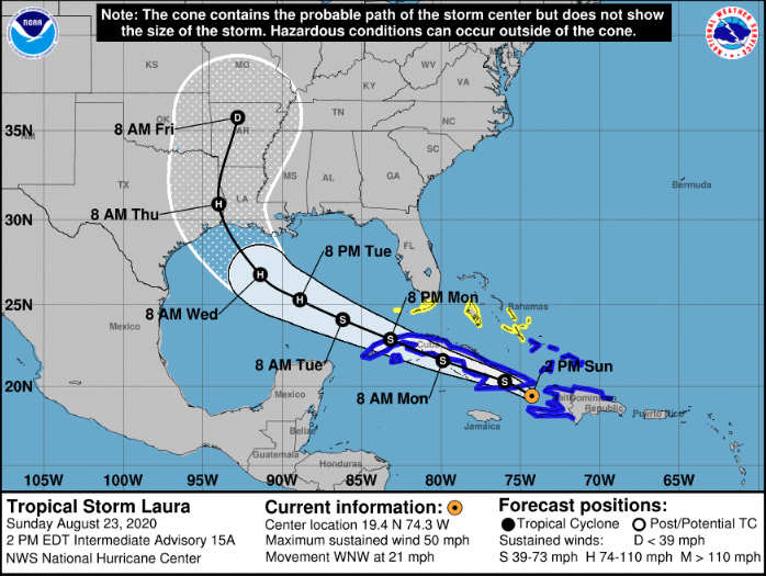 A hat tip is in order to NHC for nailing the forecast track three and half days out. It may have come in stronger than initially thought at that point, but the right areas had fair warning, which is the most important part. Forecast skill and technology continue to improve for tropical forecasting. We still have plenty of tropical season to go through. Make sure you stay updated on the forecast, and look over your storm supplies and plans. Drought continues, wetter signals ahead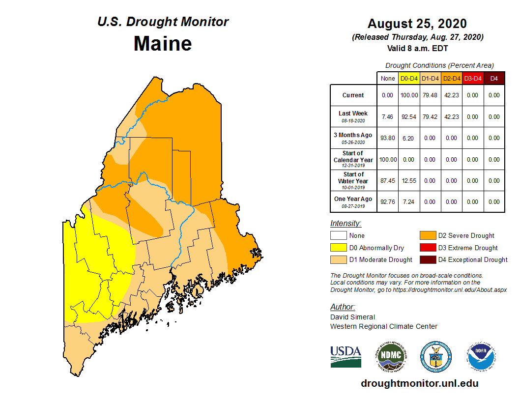 Through Tuesday, the entire state was feeling some sort of effect from the ongoing drought. Nearly 80% of the state was at least in moderate level, and 42% was viewed as severe. 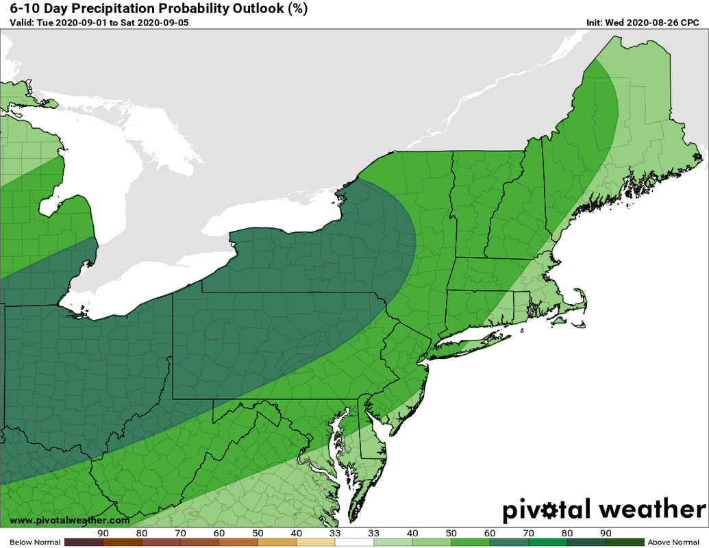 Not including the rain on the way for Saturday, the Climate Prediction Center indicates potential for the first 5 days of September to feature above normal rainfall amounts. The west to east zonal pattern, which has been the main feature for most of the dry summer, appears to dip a bit further south. This will help tap into moisture from the southwest, which will assist in potential rain events. 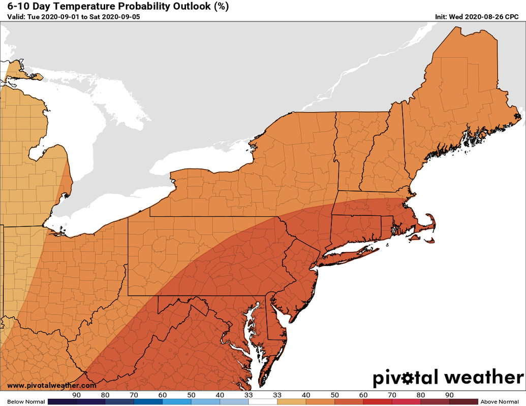 With more of a southwest influence, that means warmer than average temperatures appear possible. As tempting as it is with the short term cooler pattern the state is in, I would not put the box fans and air conditioners away just yet. You can see the 6-10 day outlooks on the CPC Outlook page here on the website. You can also see the Weather Prediction Center 7-day rain forecast on the Rain Outlook page also. These pages update as they update. Some beneficial rain for Saturday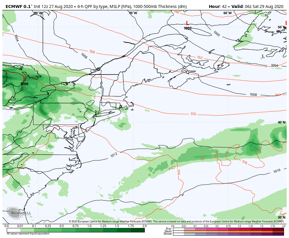 After a dry Friday, rain moves in for Saturday. Southern and western areas see shower develop in the morning, eastern areas by midday, and northern areas by the afternoon. The precipitation appear to end in the overnight hours for southern areas. Showers continue for the mountains, north and eastern areas into Sunday. 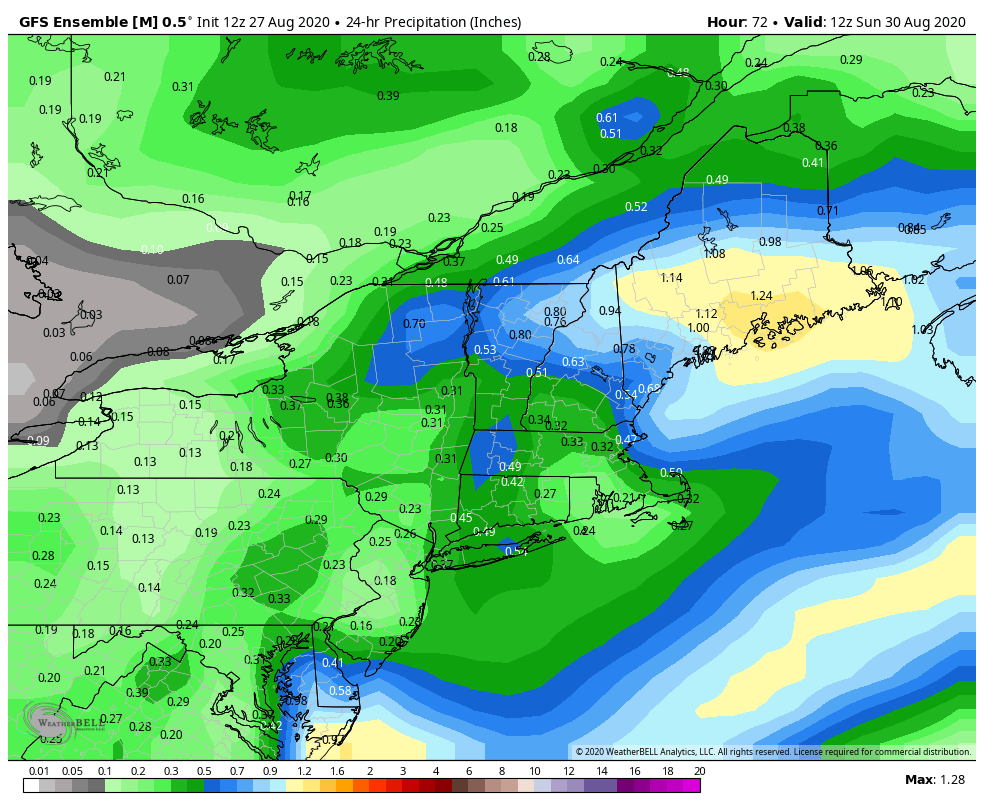 How much rain continues to be the question. I would love to say with confidence that the whole state will get a soaker (1"+) out of this, but I am hesitant to do so. This GFS ensemble idea I think shows a reasonable range of what to expect, between roughly a half inch to 1.25". There are questions about the timing of the phasing as the GIF loop from the European model indicates above. If the pieces come together, 1-2" are possible. If they don't, a general half inch will come to a good portion of the area, with some areas pushing 1" or more. Any thunderstorms that come could bring locally higher amounts in areas where that happens. We'll see what happens, and will update on Friday. Temperature outlook through Wednesday 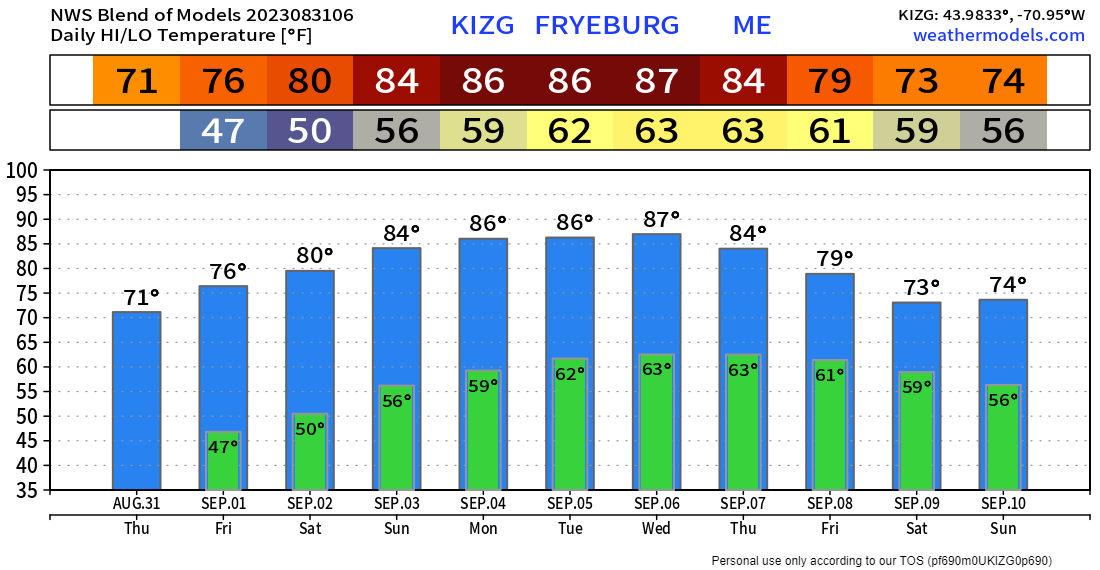   Rain reports needed statewide! Ever wanted to take rain or snow measurements? Join CoCoRaHS or Community Collaborative Rain, Hail, and Snow Network. This volunteer network of observers measures precipitation from their backyards. Any age can volunteer. Data is used by NWS and broadcast meteorologists to help with forecasts. www.cocorahs.org Be ready for alerts and stay updated!
For more information, please follow Pine Tree Weather on Facebook and Twitter.
Thank you for supporting this community based weather information source that is funded by your financial contributions. Stay updated, stay on alert, and stay safe! - Mike |

Mike Haggett
|