|
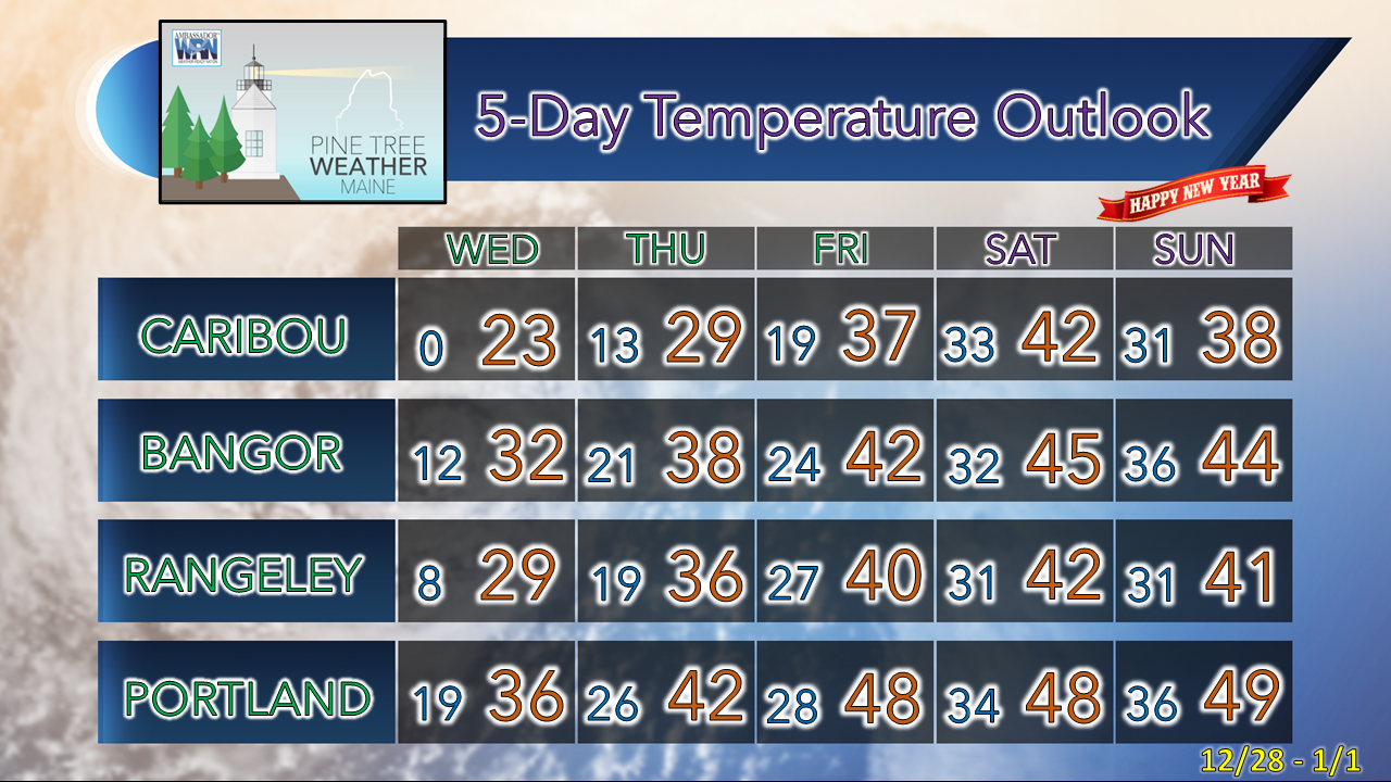
Before I get into the update, I hope everyone made it through the storm and was able to enjoy the holiday as best as you could. Power outages topped 250,000+ which was unfortunate, but not a surprise. The damage to the coastline was substantial in areas. Driving around western Maine over Christmas I could see first hand the tree damage, along with the flooding and the freeze up that came after. I saw power crews getting rest and food at several hotels along Route 26. As they walked in to where my family and I stayed to get their room keys, they were visibly tired, cold, and hungry. They worked hard to get as many folks online as quickly as possible for the holiday. A hat tip is in order to each of them, who no doubt would have rather been with their families. Four days after storm at 3 PM Tuesday, 5,127 are still without power across Maine, most in Hancock County at 2,860 followed by York at 1,249. Only county not reporting an outage out of the 16 was Somerset. Hopefully the rest of the outages are plugged back as soon as possible. Thankfully after the 1-2 punch over the past two weeks, no major storms are foreseen anytime soon. Warmer times ahead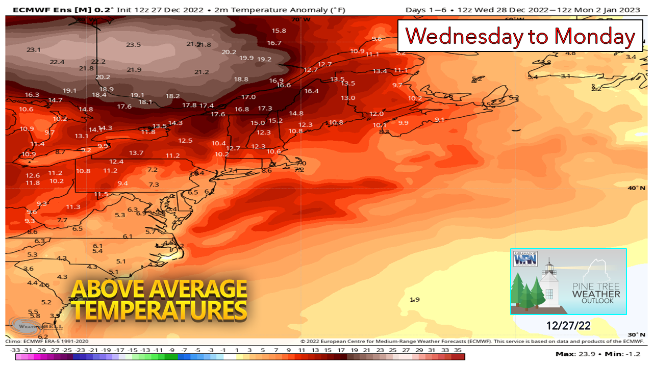 The recent cool down that came in behind the Grinch Storm is about leave the area and yield to a warmer trend going into January. The idea all along here is that winter (December-January-February) was to be front loaded with cold before above normal temperatures returned. It didn't quite work out that way. We've had some cool shots periodically, but reporting observation stations to the north and south are going to finish above normal. January to this point appears warm. Meteorological voodoo says February may be the same way. It's like 2020 all over again with the moderate La Niña in place. We won't be running to the coffee shop in flip-flops, mind you, but where it may be noticed the most is in thickness of the ice in the lakes and ponds, as well as precipitation type. For those with the itch to get out on the frozen pond for opening day of ice fishing, know what you are getting into. The blessing of the rain is most bodies of water are sheer ice with no snow. My observations from the holiday showed some ponds iced well, others not so much. The currents have kept some parts wide open due to the high water level and runoff. The warm up and potential rain on Sunday does not bode well for opening day. As a former ice fisherman, I feel your pain. Cleats and rain gear. Insert a choice four-letter word here. Waves to bring some snow for the interior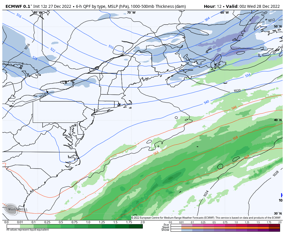 Tuesday 7 PM to Friday 1 AM - Disturbances riding along the approaching upper-level ridge are expected to bring areas of snow showers to the western mountains on up into the north for Wednesday into Thursday. The far north is expected to get the most out of this with 4-6" for the rooftop (Caribou, Frenchville, Allagash) 2-4" for Masardis and Mars Hill, 1-2" for Houlton, Greenville and Jackman and the western mountains through Thursday. Fryeburg, Rumford, Farmington, Augusta, Waterville, Bangor, the MidCoast around Rockland and DownEast areas may pick up a dusting to an inch on Wednesday. I am not expecting any widespread travel issues, but a few slick spots are possible. A soggy New Years weekend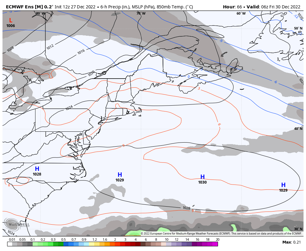 Friday 1 AM to Monday 1 PM - I am showing the ensemble idea here because I do not completely trust the deterministic output that I have seen with this. It all looks like rain, but it may not be to start off as liquid over the interior on Saturday New Years Eve into Sunday New Years Day. There could be a mix of snow, sleet and freezing rain for a time, and northern areas have the best chance to keep frozen precipitation a bit longer, thanks to a weak area of high pressure near St. James Bay. I do think most, if not all areas warm up for liquid before this ends late Sunday into early Monday. The good news for ski country is the model ideas for liquid aren't crazy with ¼ - ¾" the general rule. It's not what you want, but far from the fire hose that hit with the Grinch Storm. Stay tuned for fine tuning on this. If you appreciate what I do, |

Mike Haggett
|