Interior areas to get a freshening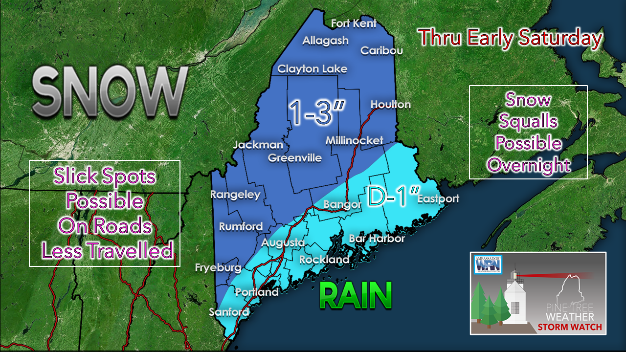 No real changes to the forecast posted here yesterday. The coastal plain may see some flakes to start off, but the idea is that it flips to rain before long. The higher elevations in the mountains and northern areas appear to see a couple inches. 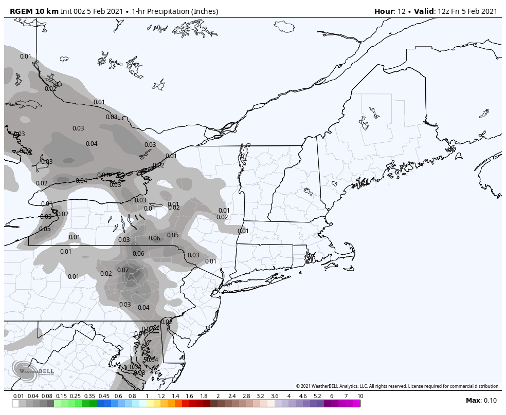 The moisture is associated with a cold front that sweeps through the region. Southern and western areas see precipitation mid to late morning. It appears to be mid to late afternoon for the far north and east before flakes or drops arrive there. There is not a whole lot of moisture here with this. It could be enough to slick up the secondary roads, and could bring bursts that cause brief whiteouts. After the front kicks through, northwesterly winds pick up which could bring snow showers to the higher elevations, along with the risk of isolated snow squalls. Precipitation clears the far north by early Saturday morning. The start of the weekend features a mix of sun and clouds and breezy conditions as high pressure moves in. Snow chances Sunday and midweek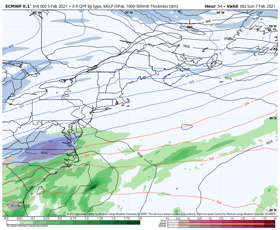 Earlier this week the Sunday storm idea was a thing, then models drifted away from it, and now it's back on the table again. Why do models drift in thinking? The lack of upper level atmospheric data. There are "black holes" across the hemisphere where data cannot be captured due to sporadic weather balloon release areas. Every day at 00z (7 PM EST) and 12z (7 AM EST) radiosondes are released worldwide to capture that data, which initializes weather models to provide information. Where population is remote to the north, along with the oceans, that leaves gaps of information. This causes the "windshield-wiper effect" and causes deterministic models fade or in cases to become jerky. That is the situation going on here. Confidence is growing that the coast may pick up a couple of inches out of this. How far inland is yet to be determined. I will have an update and a snowfall map on this posted on Facebook Friday afternoon. 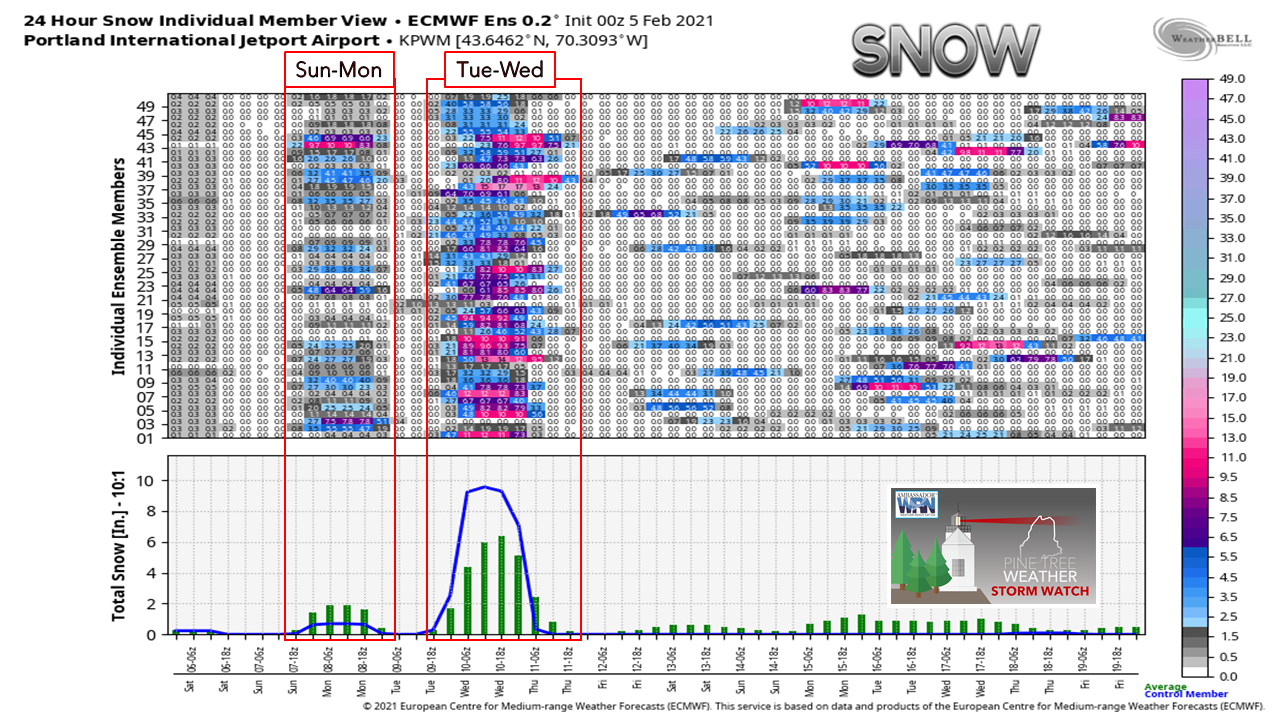 Looking here at the ensemble ideas for the European model for Portland shows the chance for a couple inches of snow for Sunday, along with a stronger signal for Tuesday into Wednesday. I will caution that while the signal is there, confidence for now is low given the erratic nature of models as I explained. There will be better ideas on this potential later in the weekend. 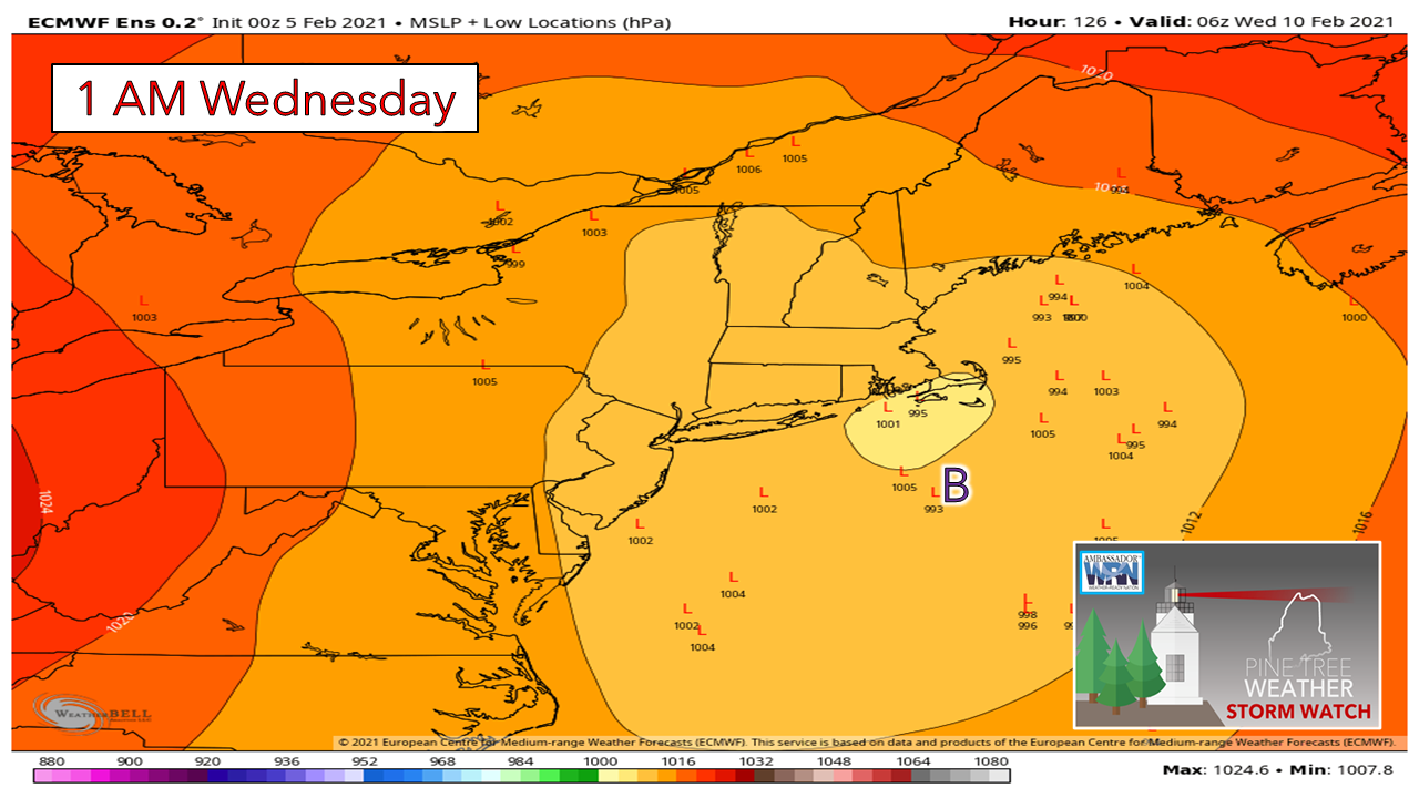 Looking at individual members shows a fairly good consensus of a track inside benchmark, which if that plays out could bring a sloppy wet snow / rain mix for the southwest and MidCoast and their interior areas, snow for the mountains and north, and rain DownEast. For now, it is too early to get into specifics. Updates to come on this over the weekend. Snow Squalls & WEAs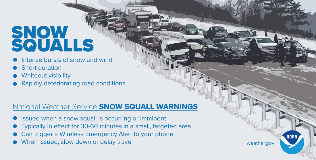 Snow squalls are intense bursts of snow and wind with whiteout visibility that are extremely dangerous, especially while on the road. The National Weather Service helps you be ready by issuing Snow Squall Warnings that can trigger a Wireless Emergency Alert on your phone. If you receive one, know that a snow squall is occurring or imminent, and slow down or delay travel. weather.gov/safety/winter-snow-squall Temperature outlook through Thursday  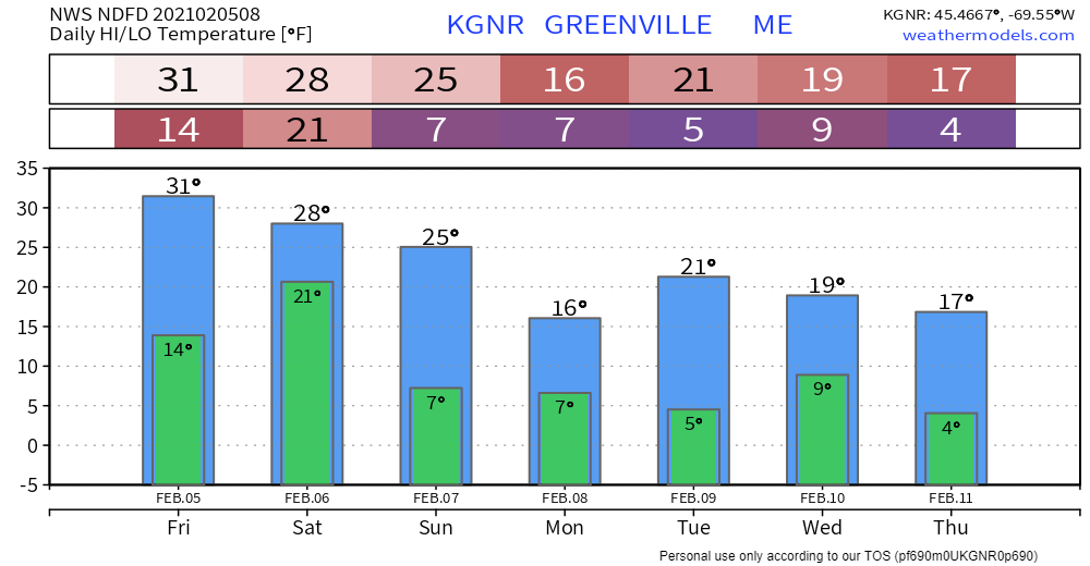 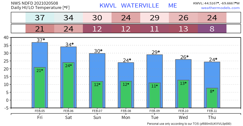 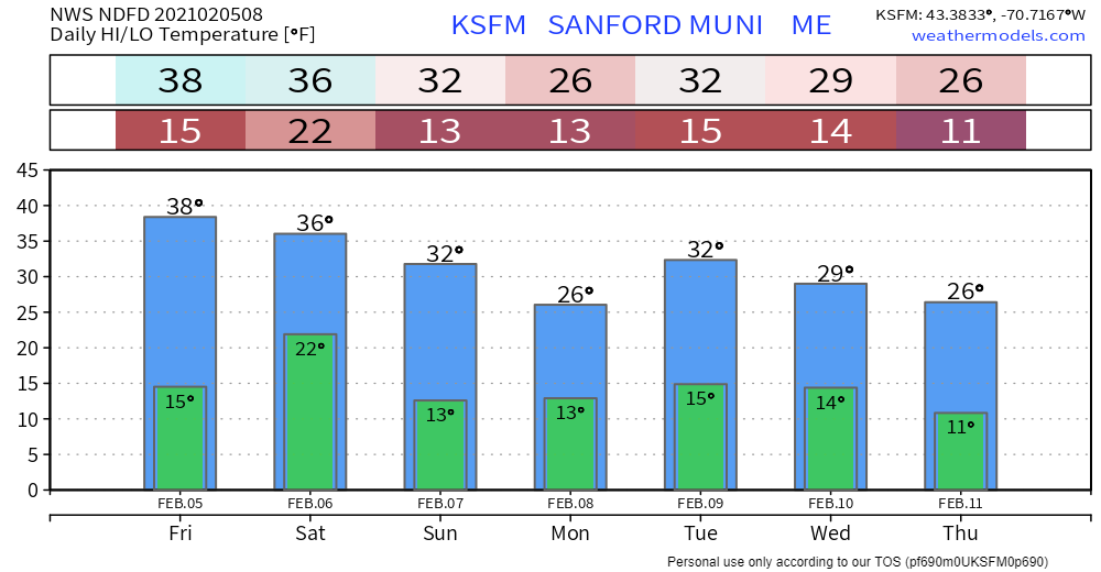 Be prepared to receive alerts and stay updated!
For more information in between posts, please follow Pine Tree Weather on Facebook and Twitter.
Thank you for supporting this community based weather information source operates by financial contributions. Stay updated, stay on alert, and stay safe! Thank you as always for your support! - Mike |

Mike Haggett
|