
A few showers around overnight into Monday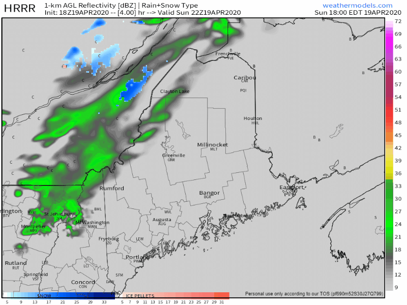 A moisture starved cold front passes through overnight Sunday into Monday which may bring a stray rain or snow shower. Any accumulations will be light, and will end by around daybreak Monday morning. Winds out of the southwest shift to the northwest behind the front. Overnight lows range from the 20s north and mountains to the 30s for the coastal plain. Wind speeds range from 5-15 mph with gusts to 20 mph possible. Monday temperatures cool down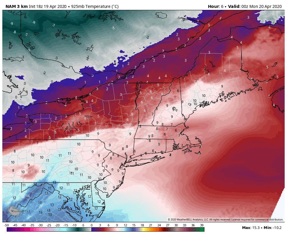 As the cold front departs, it drags down cooler air from Canada. Low level atmospheric temperatures depicted here (roughly 1700') show temperatures around 0° C (32°F), which translates into 40°-50° for highs with the April sun angle. Any clouds clear out as high pressure moves in during the morning. After a bit of a breeze from the northwest, the wind settles by evening. Tuesday morning will be a frosty start for most as temperatures tumble to the teens and 20s. Light snow potential Tuesday into Wednesday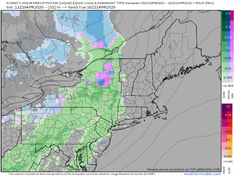 An area of low pressure drops down from Ontario Monday and gains strength while doing so. It sets up a cold front that approaches the region Tuesday afternoon. Low pressure forms along the front over Maine, and taps into cold air to the north. The parent low over Quebec transfers energy to the newly formed low over Maine Tuesday night, then intensifies as it heads into New Brunswick on Wednesday. The result is some light snow for the mountains and north, maybe a light mix over the foothills, and rain for the coastal plain Tuesday afternoon through Wednesday morning. 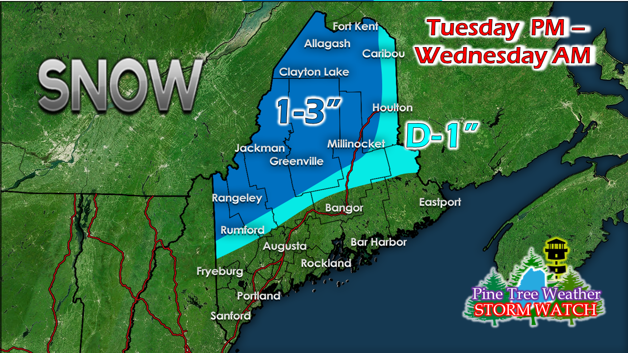 For areas that have snow on the ground, 1-3" of snow is possible. For areas of where snow has melted off over the foothills and eastern Aroostook, a dusting to an inch is possible. The departing low gets caught in a traffic jam over eastern Quebec Wednesday afternoon and slowly moves eastward Wednesday night into Thursday. Expect a breezy and cold day Wednesday and Wednesday night as a west /northwest breeze makes it feel more like February than April. As the storm moves away, temperatures modify, but remain below normal through the rest of the week. Temperature outlook through the weekFor those eager to get the garden started, I would hold off for now. Overnight lows appear to continue to dance around in the 20s & 30s for the foreseeable future. 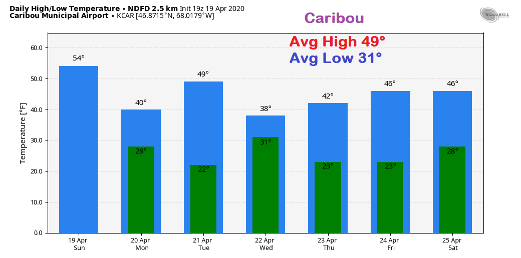 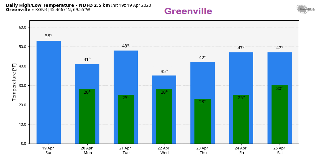 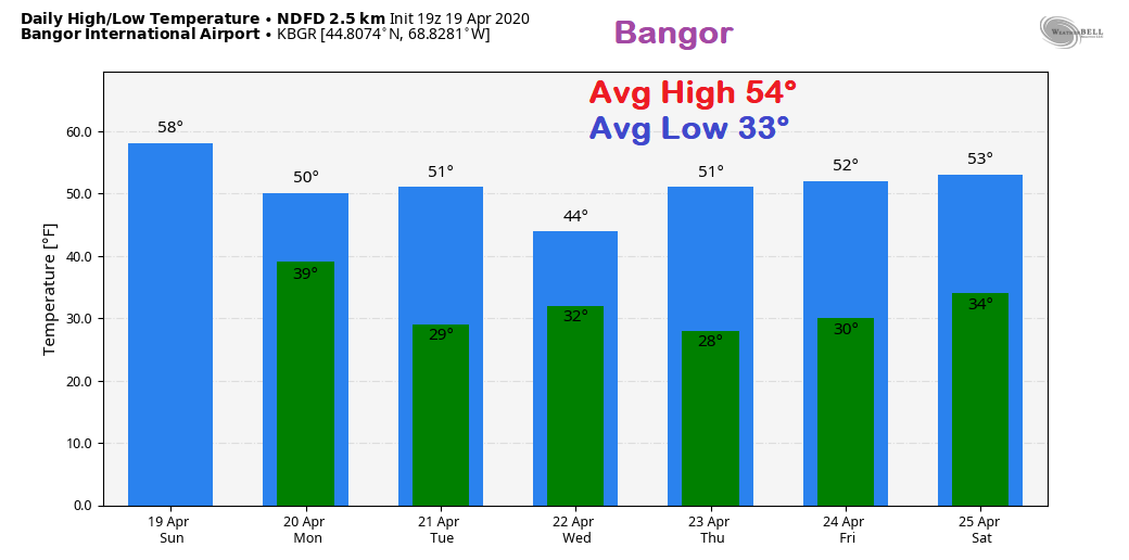 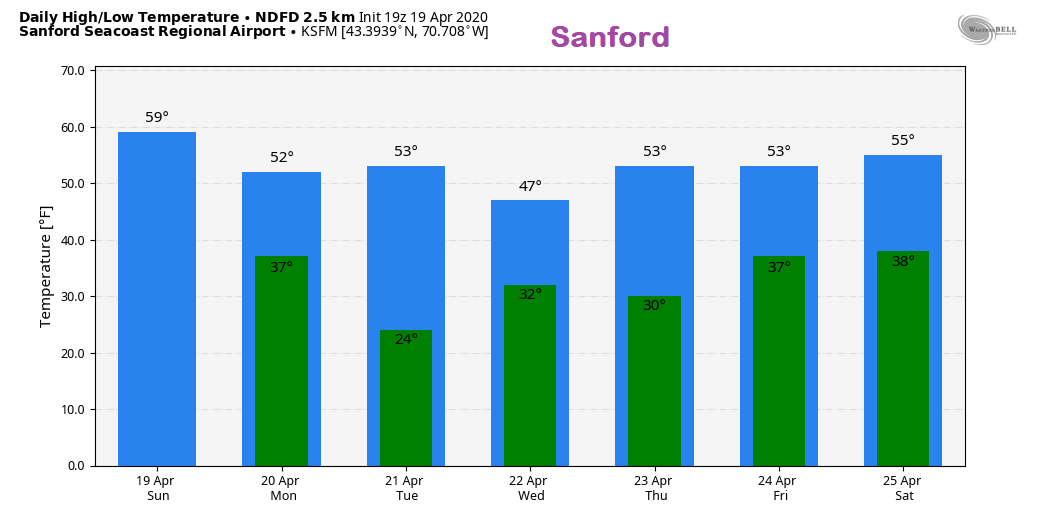 Become a SKYWARN Weather Spotter!SKYWARN spotters are an important part of forecasting. Whether you are a weather nut or just interested in weather, this is an informative webinar that gives you the insight and training necessary to participate. Due to COVID-19, both the Gray and Caribou weather offices are offering these virtual sessions. If you have not been able to attend a SKYWARN session before due to scheduling, this is your opportunity to do so. CLICK ON ONE OF THE PICTURES BELOW to redirect you to the weather office where you can register, and for additional training times. If you need any further assistance, send me a message on Facebook or tweet me and I will make sure you get in contact with either office. 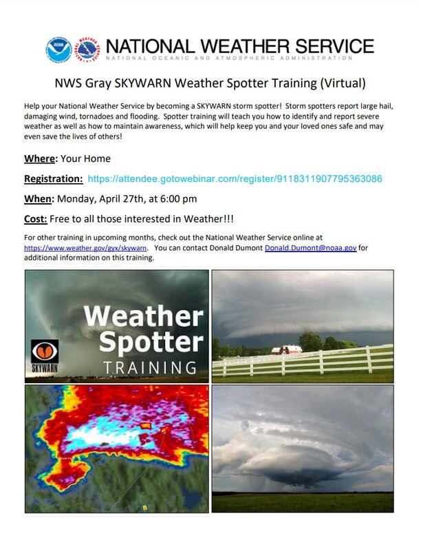 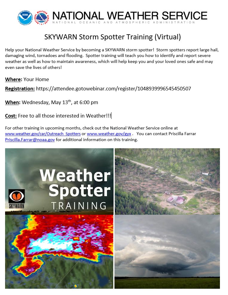 Stay updated, be on alert, and stay safeWith the recent loss of power, internet and cell phone disruption, it would be wise to consider a small investment into an NOAA Weather Radio. For $20-$40, it could provide important information to you when you need it. The weather bands are standard on most public safety scanners, and newer scanner models and weather radios can be programmed for auto alert. Click here for more information.
► ► For the latest official forecasts, bulletins and advisories, please check in with the National Weather Service in Gray for western and southern areas, or Caribou for northern and eastern parts of Maine. Thanks as always for your support! - Mike |

Mike Haggett
|


