|
Before I get into the discussion, I want to note that I am going to move into storm watch mode, meaning that will be my main focus for information to provide to you. I will continue to update here on the website a couple times a week at least, but in quiet times I may just do a drop on Facebook. Rest assured that when storms come, this medium will be used to get into details. You can always check my Twitter for other quick nuggets I may drop there during the weekdays. Life is a balancing act, and as much as I love doing this, I need to pace myself and be present for family and the job that pays the bills. Active pattern continues through the weekend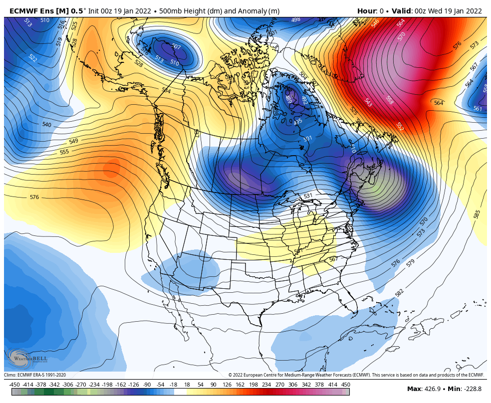 Tuesday 7 PM to Monday 7 PM - I say "active pattern" in this case it means there will be a lot of movement in the sky above, but that doesn't mean big chances for precipitation. While a key component to a more active snow pattern is a strong western ridge as you can see develops in this loop, the piece that is missing is a blocking ridge over the north in the vicinity of Labrador and Greenland to increase chances for snow. Pieces of the polar vortex break off from the north and spin through the region (noted with the blues and greens) and bring a chance for snow showers ahead of it and a blast of cold when it arrives. The cold passes through quickly as the atmosphere continues to churn. The region is just past the midway point for winter (January 15th), and this is typically the coldest time of the season, and it is shaping up to be. When I set up the temperature forecast graphic (later in the post) my bones bristled a bit. We can expect below normal cold overall through the rest of the month. Chances for precipitation are likely to be limited as well, but with the cold, there is the chance for snow. Light snow for Wednesday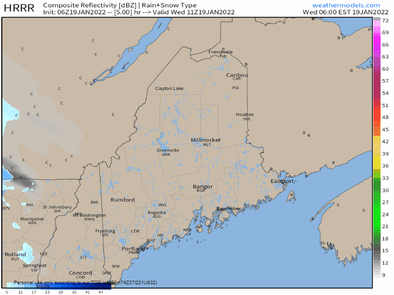 Wednesday 6 AM to 6 PM - For the folks in Ontario and Quebec, this will be a decent storm, but the clipper runs out of moisture as it passes through Maine. There could be a few slick spots over the interior but not a big deal. A southwest flow modifies the temperatures along the coast as DownEast areas may get clipped with a rain shower as the last of the steady precipitation passes through. High temperatures range in the teens north, 20s for western and eastern interior areas, and 30s for the coast. Southern York County may reach 40°. It will be breezy along the shorelines and in the mountains with gusts 20-30 mph thanks to a south/southwest wind ahead of the front. 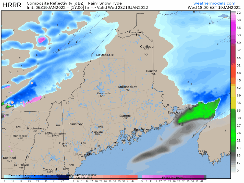 Wednesday 6 PM to Thursday 6 AM - After the frontal passage, upslope snow showers are possible over the higher terrain with the potential for a squall or two. The wind settles along the coast, but amps up a bit over the mountains with the northwest flow into the morning. Wind chill temperatures are likely to be below zero once again in the mountains, but not as bitter as it has been in the past couple of days to start Thursday. 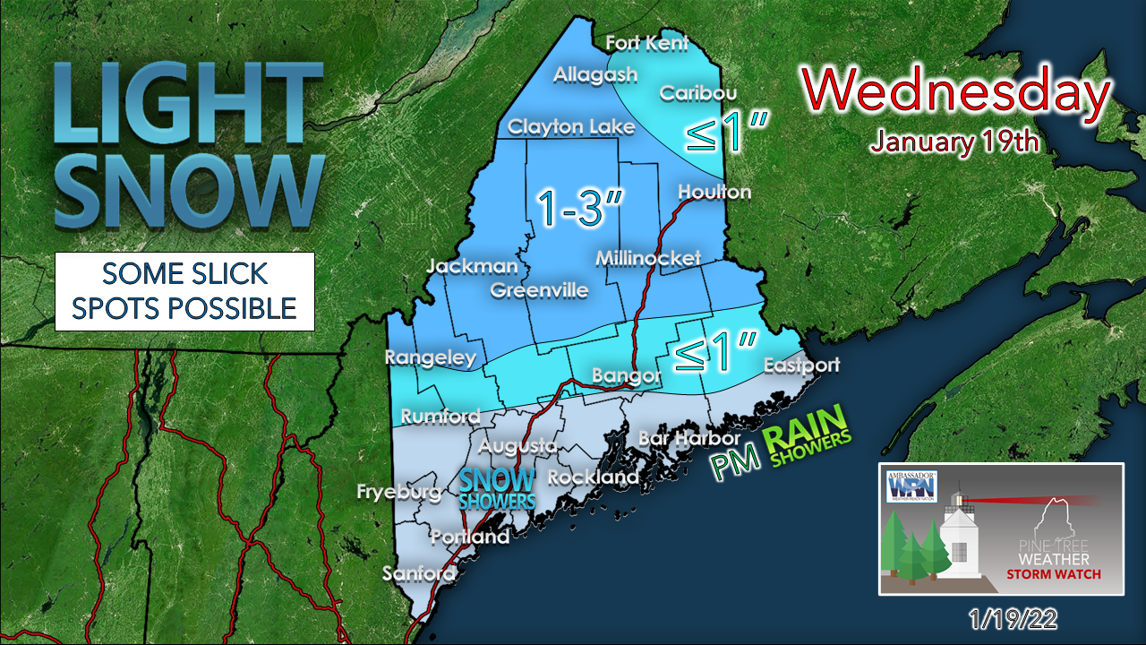 A slight adjustment northward on accumulations. Higher elevations see the most from the upslope. Dry air helps keep accumulations down elsewhere. Coastal snow showers possible Thursday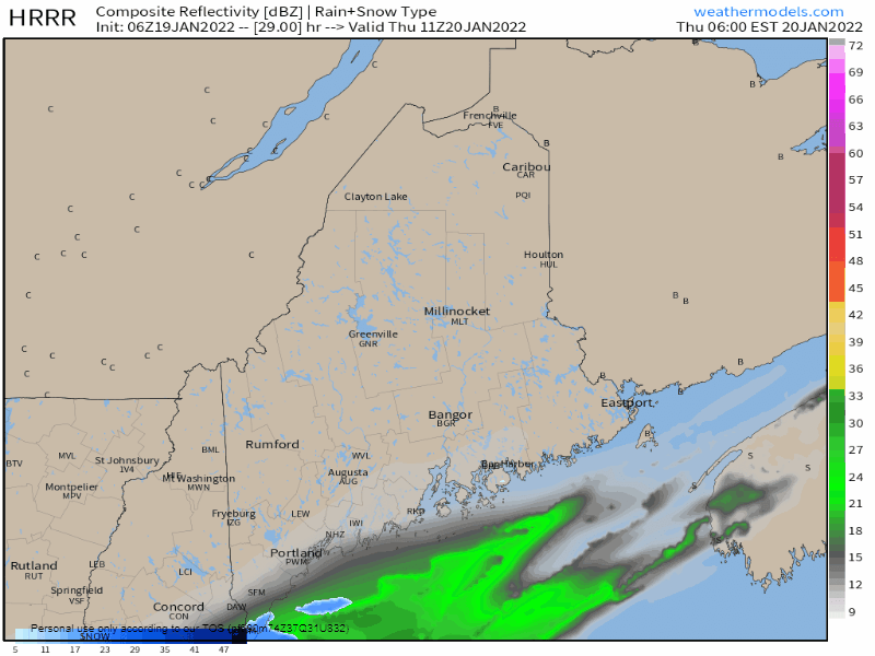 Thursday 6 AM to 6 PM - The clipper front slows to a crawl over the Gulf of Maine. A weak disturbance passes along it and pending on location of the front will dictate snow shower activity for the coastal plain. The shorelines have the best chance to see flakes, but whether accumulation occurs, time will tell. I will update on Facebook about this either Wednesday evening or Thursday morning. The Big Chill returns for Friday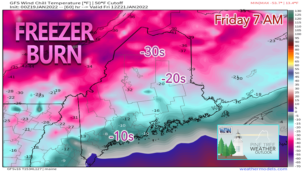 The GFS model has a cold bias so this may be a bit strong, but you get the idea. The sun will be out statewide, and the wind gradually drops during the day. Expect wind chill warnings to be issued for the mountains and north Thursday ahead of this. The arctic high moving Thursday night into Friday in plays a factor in the weekend. Saturday storm heading out to sea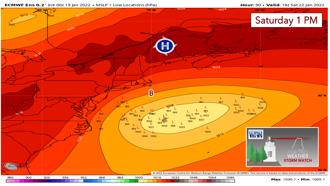 The trend has been further south over the past couple of days and the overnight runs have the ensemble ideas well south and east of the benchmark "B" 40°N / 70°W point which takes the mountains and foothills out of snow chances, and the coast may see their chance evaporate into cold dry air by later Wednesday. 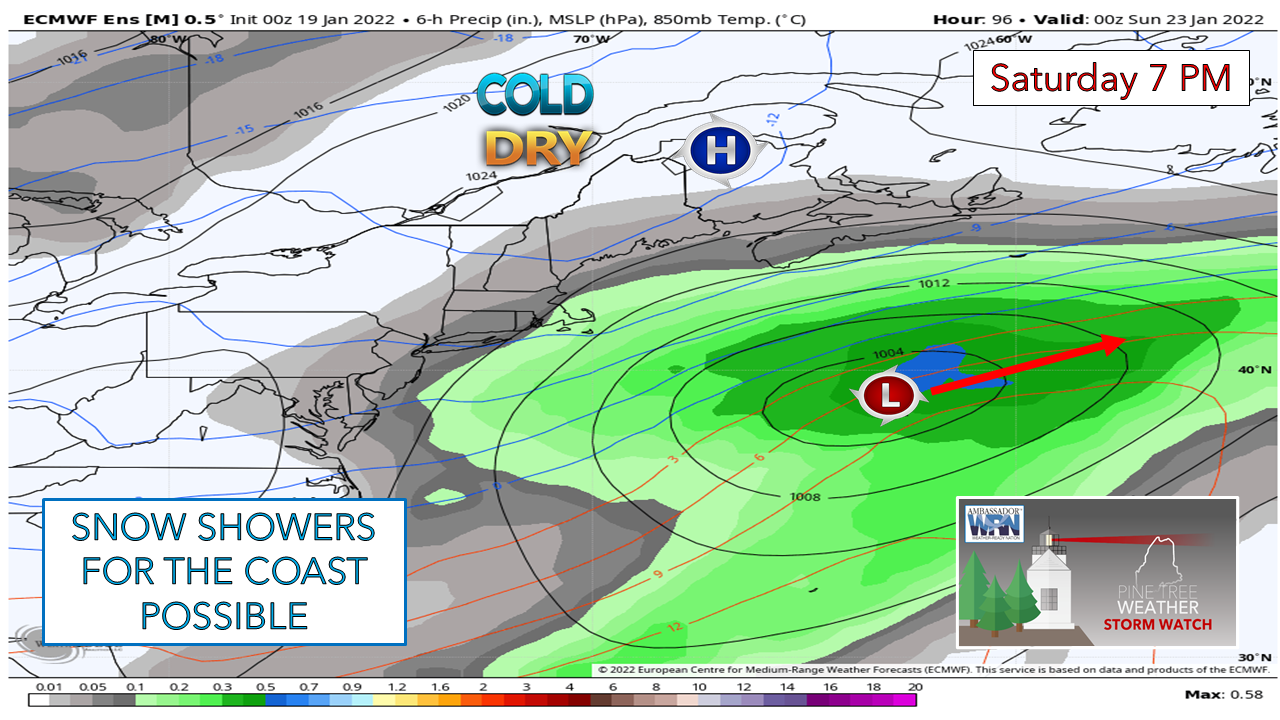 For now, I am going to stick with a snow shower chance for the coast, but with cold, dry air from the arctic high and a flat, weak low, I am not inspired for much of anything except clouds south of the mountains and north. It looks like a fabulous day for the ski hills with a bluebird sky and little wind.  Temperatures and outlook through MondayA weak frontal boundary approaches the region for Sunday which brings clouds and perhaps snow showers to the mountains. High pressure returns to start next week with temperatures bit warmer in the north. No storms of significance in sight for now. 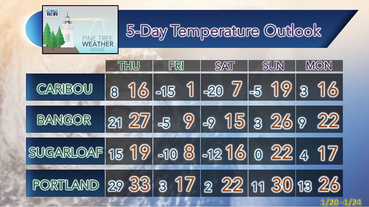 Upslope Snow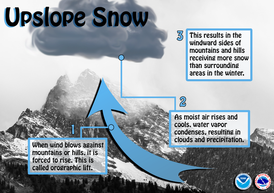 Have you wondered why the windward side of mountains or large hills receives so much more snow than surrounding areas? This is due to upslope snow. When moist wind blows against the side of mountains/hills, the air is forced to rise (called orographic lift). As the air rises and cools, water vapor condenses, resulting in clouds and precipitation over the windward region. Conversely, the leeward side often receives less snow due to the descending air. Be prepared to receive alerts and stay updated!
 For more information in between posts, please follow Pine Tree Weather on Facebook and Twitter. Thank you for supporting this community-based weather information source which operates by reader supported financial contributions. Thank you as always for your support! - Mike NOTE: The forecast information depicted on this platform is for general information purposes only for the public and is not designed or intended for commercial use. For those seeking pinpoint weather information for business operations should use a private sector source. For information about where to find commercial forecasters to assist your business, please message me and I will be happy to help you.
|

Mike Haggett
|