
Enough snow Wednesday night to dust the roads up A warm front pushing northeastward stalls over southern New England by Wednesday night. A weak disturbance passes across the frontal boundary, and will bring a period of light snow over southwestern areas Wednesday night. The timing of it appears around 6-7 PM and ending by around 3-4 AM Thursday morning. 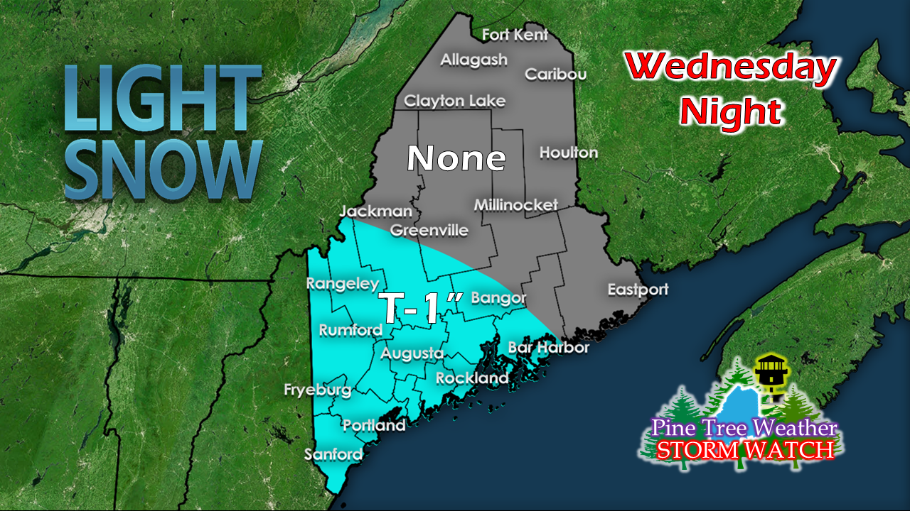 Not expecting a whole lot of accumulation. The ski hills in the western mountains may get a couple of inches, but elsewhere may be an inch or so. Areas around Bangor and Bar Harbor may get a dusting, if that. It'll be enough to grease up some roads, and with the melting of the day on Wednesday, some icy spots may develop with the refreeze. For those travelling overnight Wednesday into the morning rush on Thursday, take it easy on the speeds and drive carefully. The warm up heading into the weekend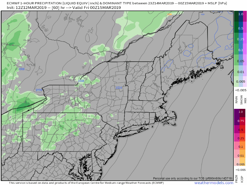 While the middle part of the country gets hammered with a blizzard and severe weather, a ridge moves northeastward through Friday. A cold front moving southeastward will bring rain shower activity to Maine out ahead of it. This does not appear to have a whole lot of rain associated with this (a half inch at best), but there will be mild temperatures that could cause problems. 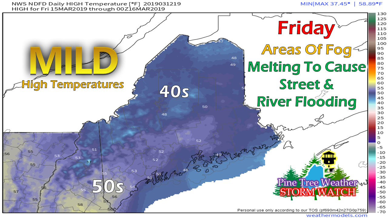 Nothing eats snow quite like fog does, and with temperatures headed into the upper 40s to upper 50s (~60° York County) there will be plenty of it given the frozen landscape. While this will be nice change given to the cold the region has endured, it's also concerning for flood potential. Rivers, streams and brooks that have dealt with ice jams from December and January are especially at risk. Streets could turn into mini-rivers where the snow pack is high from the run off. Temperatures are expected to stay above freezing for most areas starting Thursday daytime through Saturday night. Between that and the fog, the recipe is for a mess. For those who are susceptible to basement or garage flooding, this is your notice that you may have an issue on your hands. Welcome to mud season. Regional outlook through Sunday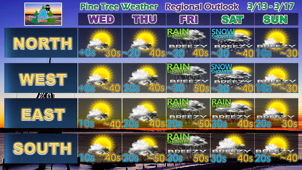 For now, there does not appear to be any significant snow events in sight, although there does appear that storms will be lurking offshore next week. With a cool down on the way heading into next week, time will tell if they stay out to sea as guidance currently suggests, or back in and bring some flakes.
Stay tuned. Again, watch for areas of black ice in the overnight hours into the morning commute through Thursday. What thaws will refreeze everywhere. ► ► For the latest official forecasts, bulletins and advisories, please check in with the National Weather Service in Gray for western and southern areas, or Caribou for northern and eastern parts of Maine. ► ► Your financial donations are much appreciated to keep this site funded and for further development. I sincerely appreciate your support not only financially, but also in sharing my efforts with others. Always stay weather aware! - Mike |

Mike Haggett
|


