
March to roar in like a lion As I mentioned on Facebook earlier Friday, the storm pattern is beginning to shift as we start meteorological spring. While the mountains and north have received incredible snow amounts through the winter, the coastal areas get in on the game after dealing with repeated mix precipitation events. For those longing for spring, we have more winter to get through before we cross the finish line not only in the form of snow, but also with cold. Slick spots for coastal areas Saturday Two parts to what happens on Saturday. First, low pressure works passes south of New England during the day. Second, an inverted trough potentially flares up in the wake of the storm Saturday evening. Most of the snow appears to be on the ground after the first wave, but I cannot rule out a potential for a bonus dusting to an inch from the inversion. 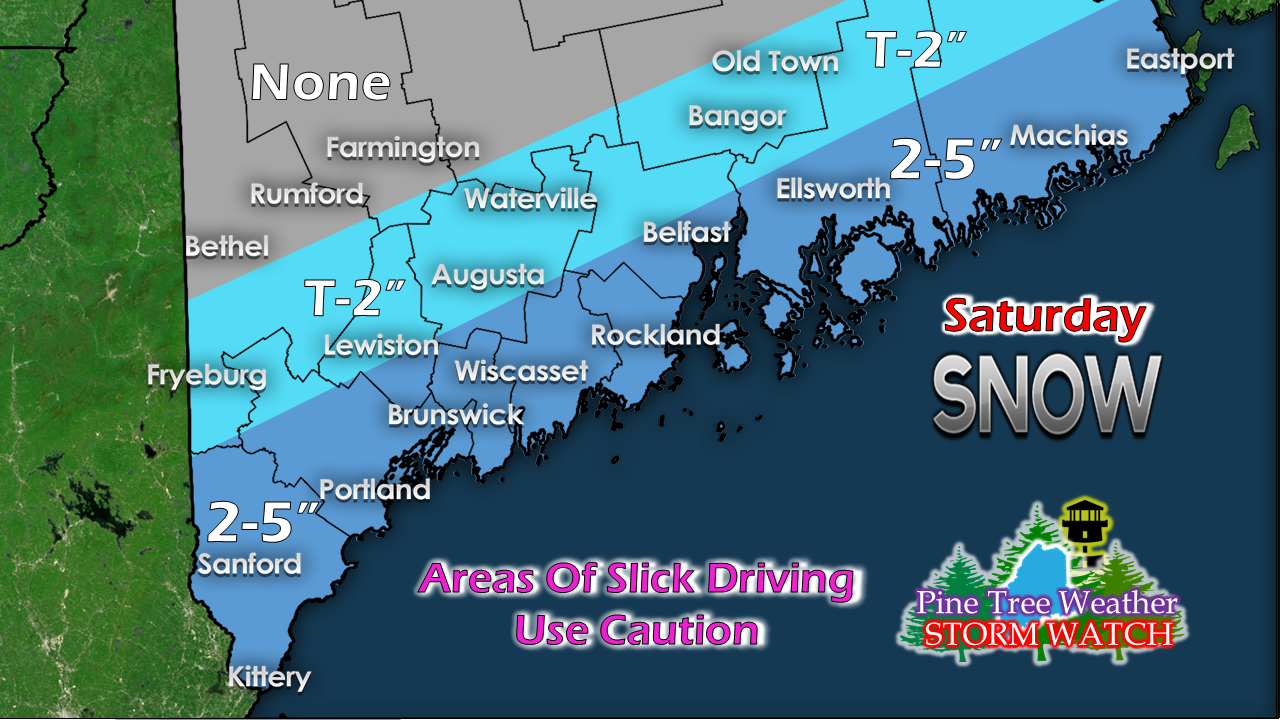 This is yet another "fringe" storm situation, which brings some bust potential. With cold air in place and storm track, the areas closest to the shorelines are likely to receive the higher totals. Folks in the western mountains may see some light accumulation from the inversion, but it does not appear to be a plowable event. For those running a sander, you may want to be ready to operate just in case. Monday storm looking impressive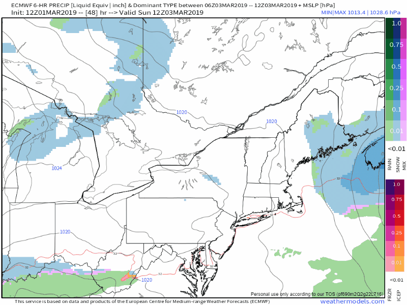 Still time for changes, but the idea of a solid snow event for much of the state appears likely. Model ideas are still vary in track, and for the coast, that is critical for accumulation outcome. One thing for sure is the model ideas have indicated a progressively colder outcome, which raises snow totals. One thing guidance agrees on is there is plenty of moisture associated with the system, so what falls is likely to be abundant. Due to lack of blocking to the northeast, the storm passes through the region in roughly 18 hours, but when it comes, it's going to dump. 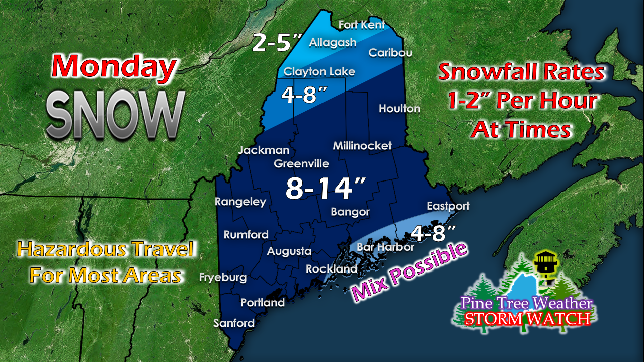 I have adjusted the projected snowfall map factoring in potential mix along the DownEast coast. Immediate shorelines southwest of there down toward Portland to Kittery may see a coastal front develop which may knock totals down in the 4-8" range. If the track of the storm moves further southeast, this will be an all snow event for the coast. It won't take much of a track shift to do that. I suspect there could be many double digit snowfall totals coming out of this event. Stay tuned. Funding update I have finally been able to get caught up on the books to get ready for tax preparation. I sincerely appreciate your belief in Pine Tree Weather and what I do here. I took a leap of faith last summer to ask for financial assistance. This is not a cheap entity here. My operating budget it $3,300 a year, and that is just to pay the bills. I love to do this as a service to you, but after seven years, it came to a point where I was not going to continue to pay out of my own pocket. I spent well over $15,000 of my own money, not to mention thousands of hours analyzing data, creating graphics, and typing out posts, for free. Many of you responded to that request for funding. All I asked for was $1 per month / $12 per year. Several of you pledged or mailed checks for much more than that, which blew me away. I am pleased to say that between the checks mailed to me and donor pledges on my Patreon page, that I have enough of a financial commitment to make it to October. While the bills are covered, I am still doing the work for nothing. Please consider sending me a tip so I can take my family out to dinner to thank them for my sacrifice of time to serve you. You can message me on Facebook, or tweet at me to get my address to mail a check, or you can pledge monthly on Patreon. Again, I sincerely appreciate your support. This kind of commitment on your part takes the edge off the 2 AM wake up calls when necessary to keep you informed, so you can make the decisions necessary to protect yourselves, your family and friends, and your property and / or business interests. Outlook through Wednesday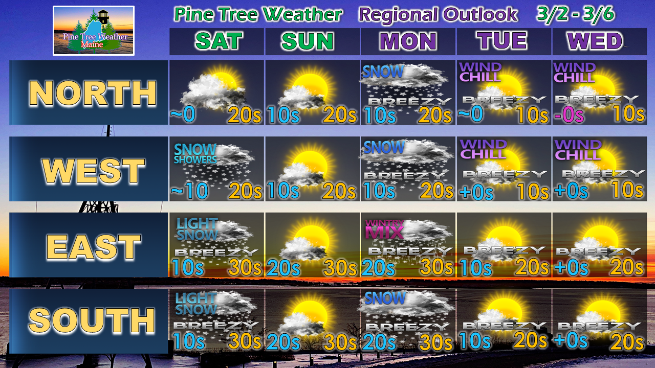 After the snow leaves us on Monday, below normal cold filters in as we head into the middle part of the week. Temperatures modify a bit as we head into next weekend. As long as it stays cold, the risk for snow remains on the table, which may come roughly next Saturday.
NOTE FOR SATURDAY: I will be traveling out of state, so I may not update here again until Sunday. I will do my best to post some thoughts on Twitter and/or Facebook. ► ► For the latest official forecasts, bulletins and advisories, please check in with the National Weather Service in Gray for western and southern areas, or Caribou for northern and eastern parts of Maine. ► ► Your financial donations are much appreciated to keep this site funded and for further development. I sincerely appreciate your support not only financially, but also in sharing my efforts with others. Always stay weather aware! - Mike |

Mike Haggett
|


