Pine Tree Weather
  • DISCUSSIONS
  • MAPS
  • BRIEFINGS
  • SATRAD
  • MARINE
  • RAIN OUTLOOK
  • SNOW / ICE OUTLOOK
  • CPC OUTLOOK
  • Kennebunk
  • Weather Geekdom
  • Who We Are
  • DONATE
  • My Photography
  • DISCUSSIONS
  • MAPS
  • BRIEFINGS
  • SATRAD
  • MARINE
  • RAIN OUTLOOK
  • SNOW / ICE OUTLOOK
  • CPC OUTLOOK
  • Kennebunk
  • Weather Geekdom
  • Who We Are
  • DONATE
  • My Photography

Light snow for the north overnight; a messy Sunday into Monday for interior areas

3/26/2020

Comments


Accumulations generally light 

Picture
A weak frontal boundary crosses the northern half of the region Thursday night and brings some light snow along with it. Precipitation kicks into gear this evening and works into northeastern areas in the wee hours of Friday. It will be over and done with in western zones about that time. Steadier snow activity give way to snow showers by mid-morning over eastern Aroostook, and end by around noon. This may cause a few slick spots across The County early in the morning, but will improve through midday.   
Picture
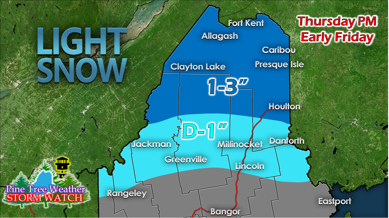
Higher elevations end up with the higher amounts. Clean up may be optional with this one as temperatures rise above freezing Friday. 

Stormy Sunday and Monday

Picture
A warm front moves into the region Sunday. Old friend cold air damming may have a say in who gets what for precipitation type and amount over interior areas, however. The warm front appears to hit a road block and stalls out over the region, and hangs out over the region until the parent low over Quebec transfers energy to a coastal low, then the precipitation fizzles out as the coastal low moves eastward. The western mountains, northern areas over to northern Washington County are likely to plow and shovel this one. Time will tell how this plays out for the western foothills across central areas and the interior DownEast region. Southern & MidCoast shoreline areas appear to escape this one with raindrops only.

​I will update on this on Friday.  

Friday & Saturday temperatures

Picture
Picture
Picture
Picture
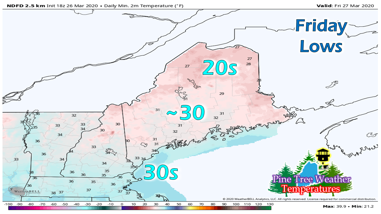
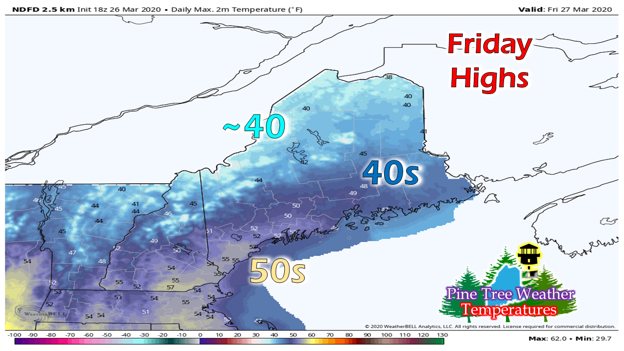
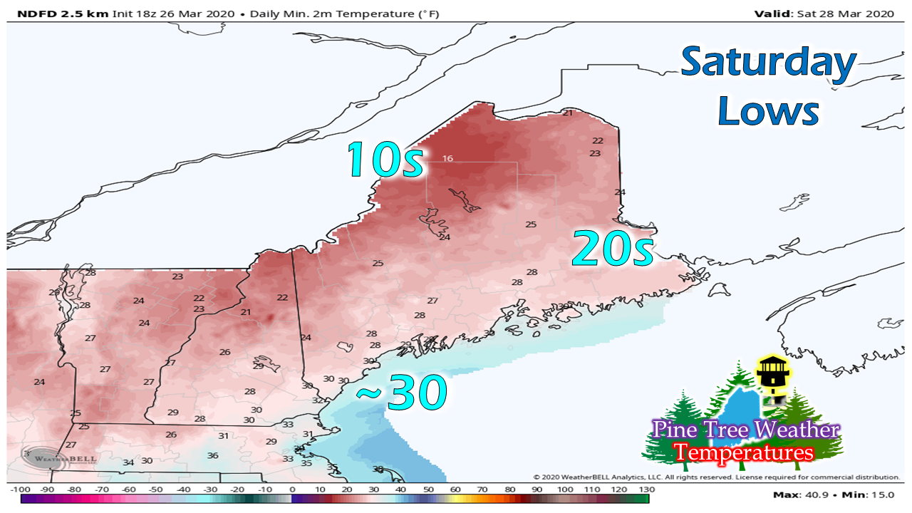
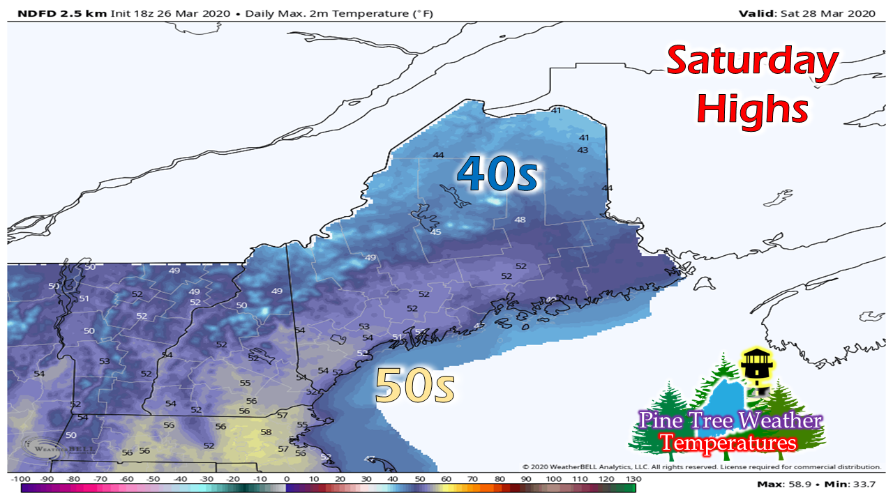
​Feel free to use the many pages available on this website for many types of forecasts on rainfall, snowfall, marine, longer range CPC outlooks and maps. 

Thank you as always for your support! 


​► ► For the latest official forecasts, bulletins and advisories, please check in with the National Weather Service in Gray for western and southern areas, or Caribou for northern and eastern parts of Maine.

Always stay weather aware!

​- Mike
Comments
    Picture

    Mike Haggett
    Kennebunk, ME

    Penn State
    Weather Forecast Certification '21.
    AMS / NWA
    Weather-Ready Nation 
    ​SKYWARN-CWOP

    Picture

    Alex Hatfield
    Wakefield,MA


    Penn State
    Meteorology and Atmospheric Science ‘21
    PSUBAMS
    Campus Weather Service
    PSU Storm Chase Team
    PSU College of Earth &  Mineral Sciences Ambassador

    Picture

    Kaitlyn Lardeo
    ​Syracuse, NY

    SUNY Oswego
    Atmospheric Science
    Lake Effect Storm Prediction and Research Center
    Northeastern Storm Conference Contributor

    DONATE
    Picture

    Archives

    January 2021
    December 2020
    November 2020
    October 2020
    September 2020
    August 2020
    July 2020
    June 2020
    May 2020
    April 2020
    March 2020
    February 2020
    January 2020
    December 2019
    November 2019
    October 2019
    September 2019
    August 2019
    July 2019
    June 2019
    May 2019
    April 2019
    March 2019
    February 2019
    January 2019
    December 2018
    November 2018
    October 2018
    September 2018
    August 2018
    July 2018
    June 2018
    May 2018
    April 2018
    March 2018
    February 2018
    January 2018
    December 2017
    November 2017
    October 2017

    Categories

    All
    Maine Weather
    Pine Tree Weather

    RSS Feed

Proudly powered by Weebly