Forecast for Tuesday remains on track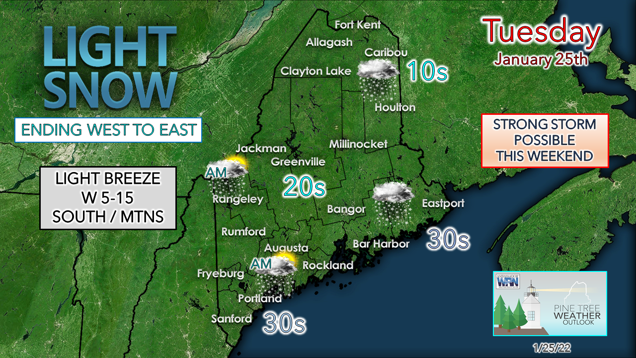 Winter is "wintering" across the region on Tuesday. Light snow with minimal impacts for those that behave on the roads. Temperatures have a chance to climb slightly above freezing for the shorelines in the afternoon. Southern and western areas have a chance to see the sun pop out before sunset. 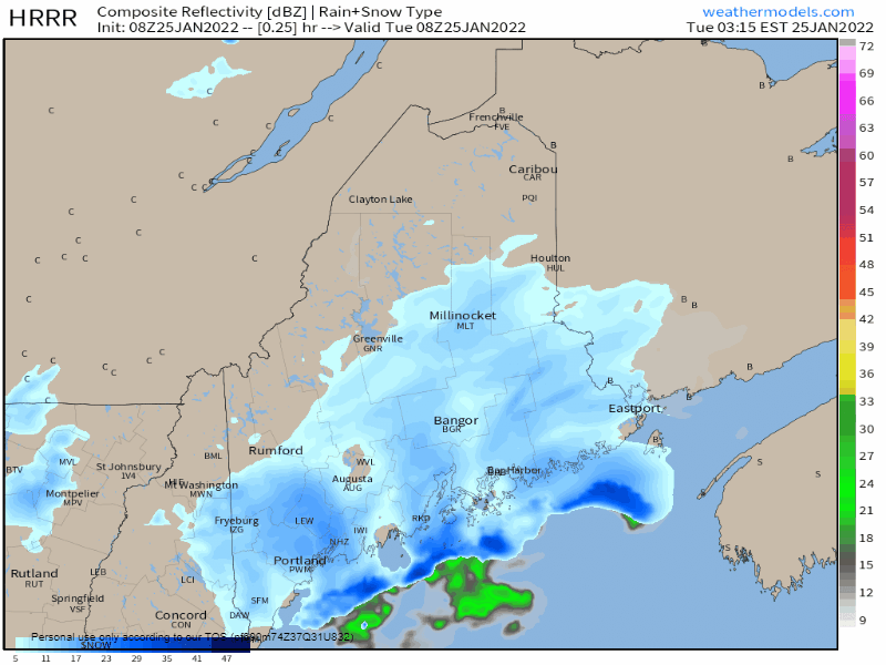 Tuesday 3:15 AM to 9 PM - Off and on snow showers are the rule through the morning. As the cold front passes through the region, a bit of surge of moisture off the water may bring bursts of moderate to heavy snow for MidCoast and DownEast areas late morning into the early afternoon. Shorelines for Hancock and Washington Counties may see a bit of a mix or a rain shower as the steadier precipitation wraps up. Snow showers are possible for interior areas heading into the latter part of the evening. 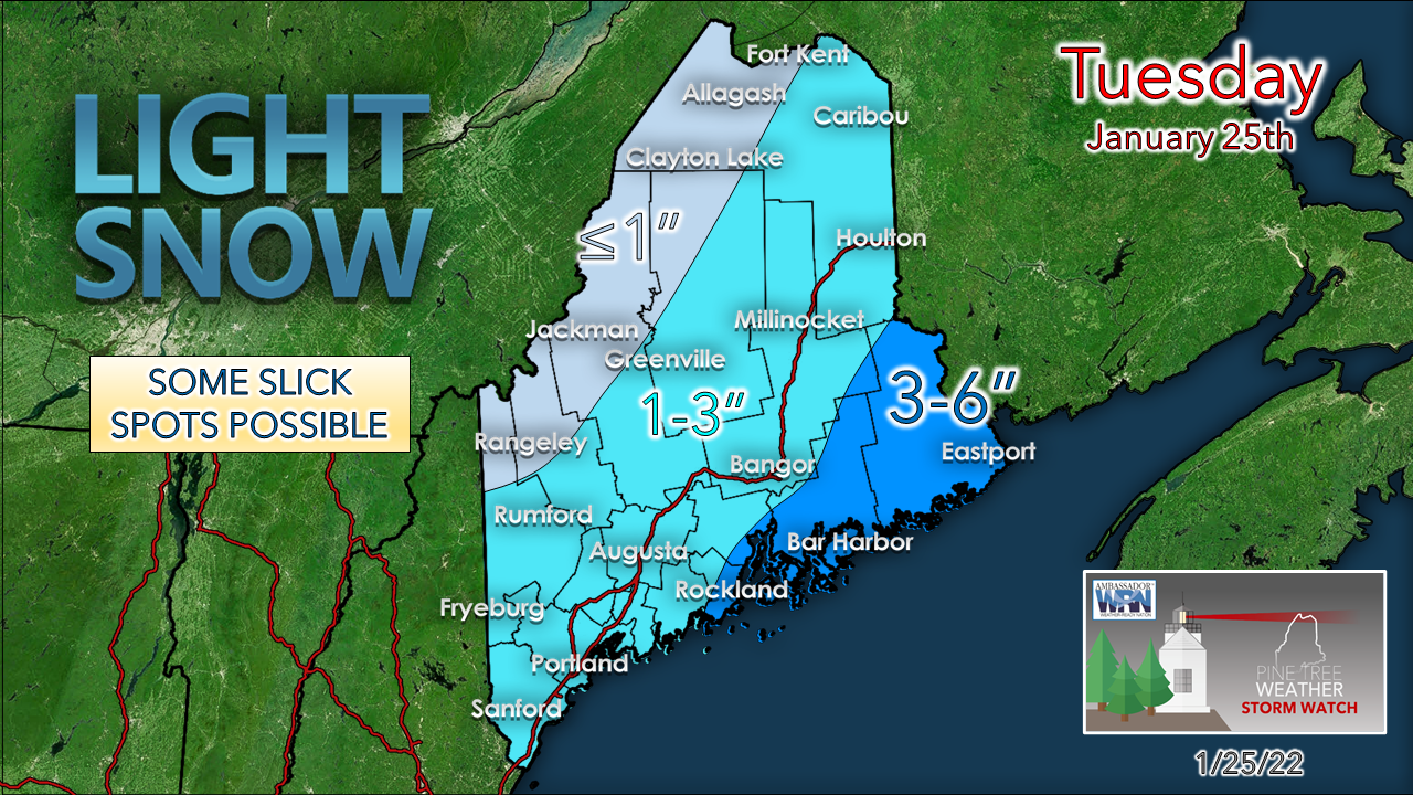 No changes to forecast snowfall amounts. A minor event to freshen up the snowbanks and sledding hills, and easy to move with a leaf blower. Sifting through uncertainty for the weekend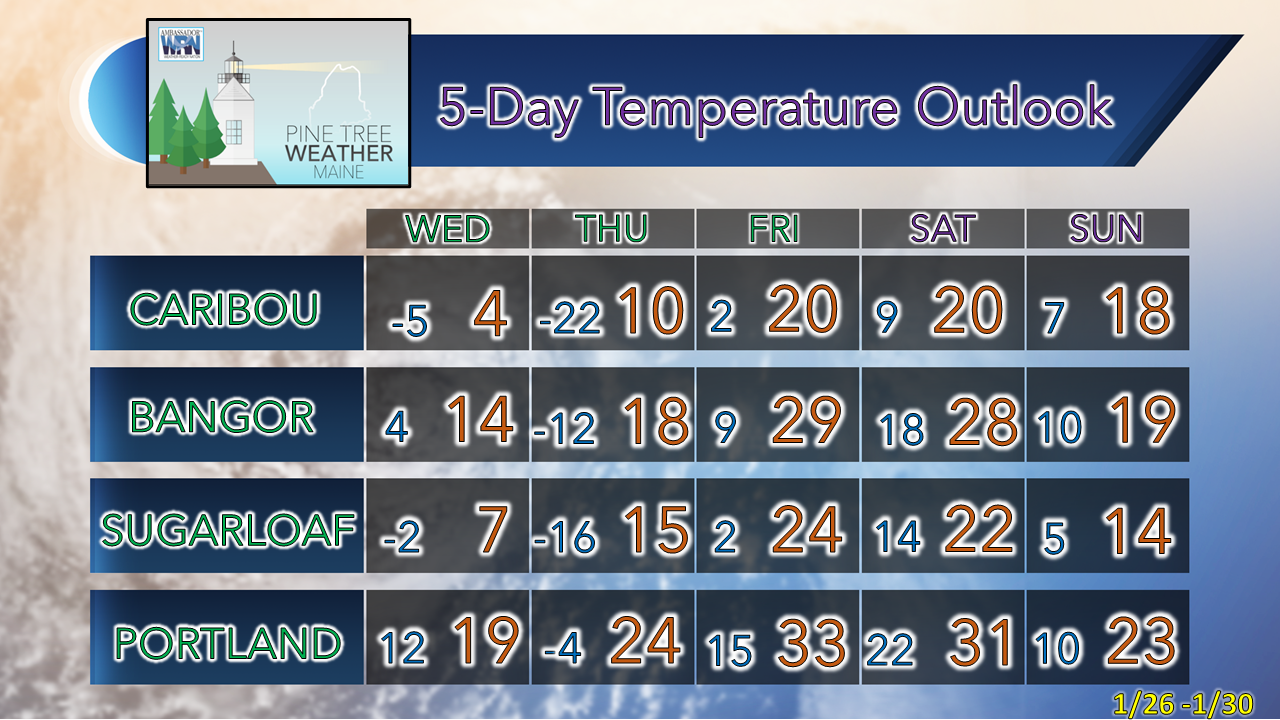 I am starting this section with the temperature outlook through the weekend to indicate one key factor and that is cold air is likely to be in place as a key ingredient for snow. Does this make for an all-snow event? That depends on track, which may not be figured out with a reasonable confidence level until Friday when all the parts come together. As I mentioned on Facebook Monday, a key piece of energy that holds the cards in how this plays out won't make it into radiosonde range in the Pacific northwest until Tuesday night. By Wednesday morning, ideas are likely to provide a general idea on impacts, with fine tuning on precipitation type and amounts as the event gets closer. There is a fairly substantial range of possibilities from minor to significant. What is consistent to this point is eastern Maine is jackpot area. Ensemble means are the safer way to look at potential for now given the lack of all the pieces involved on the continent. 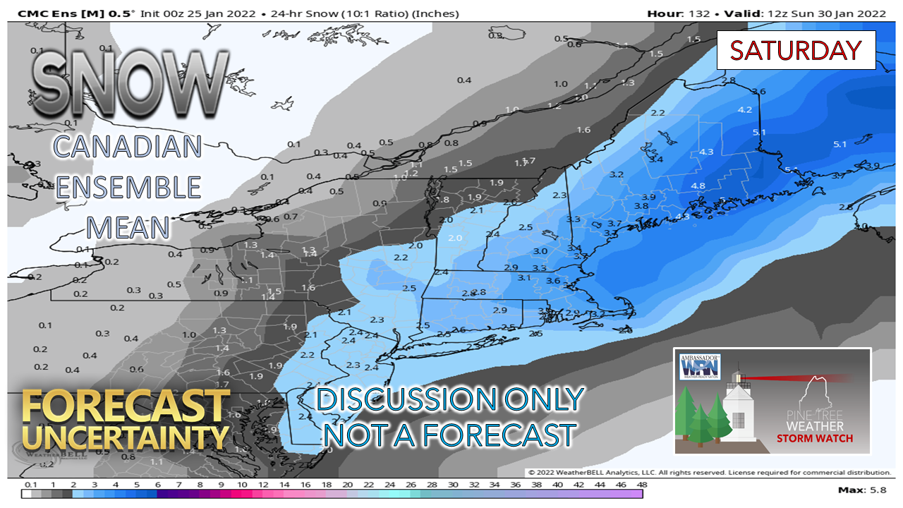 The Canadian ensemble mean is hinting on a more easterly track and a less intense storm, and thus less snow. 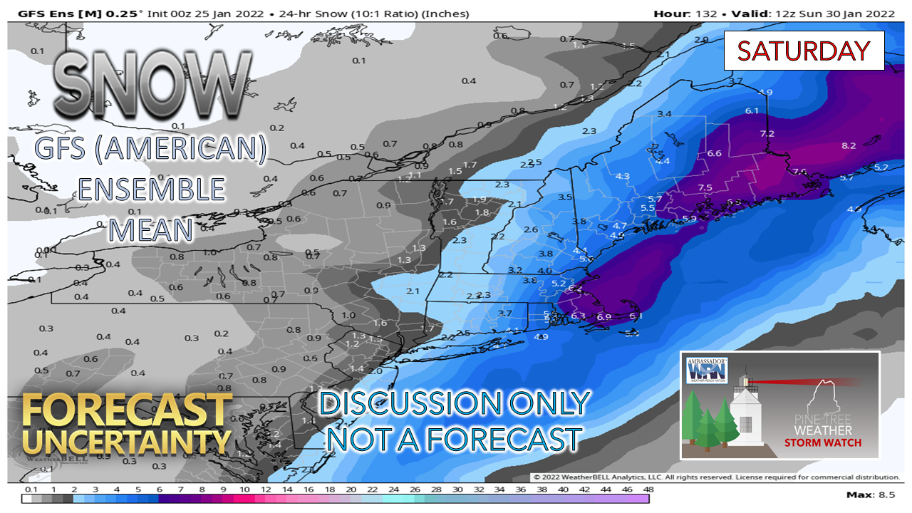 The GFS ensemble mean has the track closer and a bit more intense, and more snow as a result. 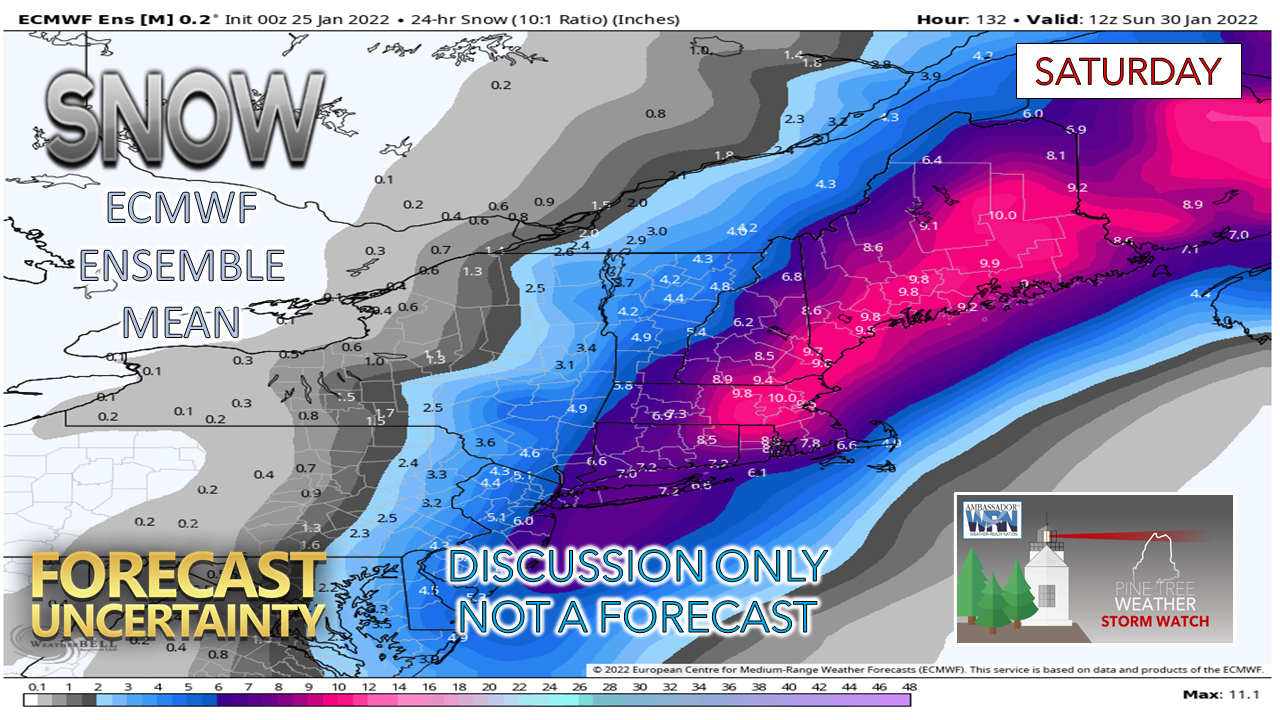 Unsurprising to this forecaster, the European ensemble mean idea is the most impactful, closest of the three in track, and stronger with intensity. 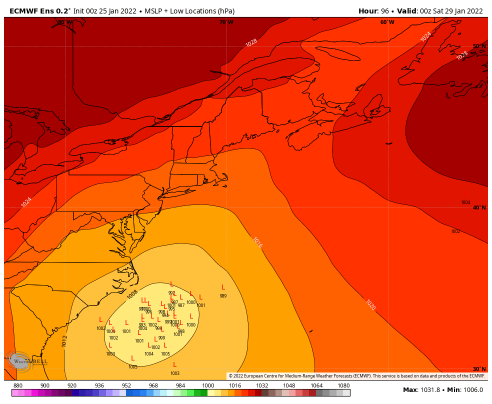 Friday 7 PM to Sunday 7 PM - The look at the individual European ensemble ideas shows a very wide range of potential, which means there is plenty of room for operational ideas to shift. For planning purposes, it would be wise to anticipate a snow day for Saturday. Time will tell how big of an impact the storm will bring. Astronomically high tides are a concern for the shorelines, and that will be something to factor in this as well. The forecast begins to come together on Wednesday morning. Stay tuned!  Winter’s Fury: Nor’easters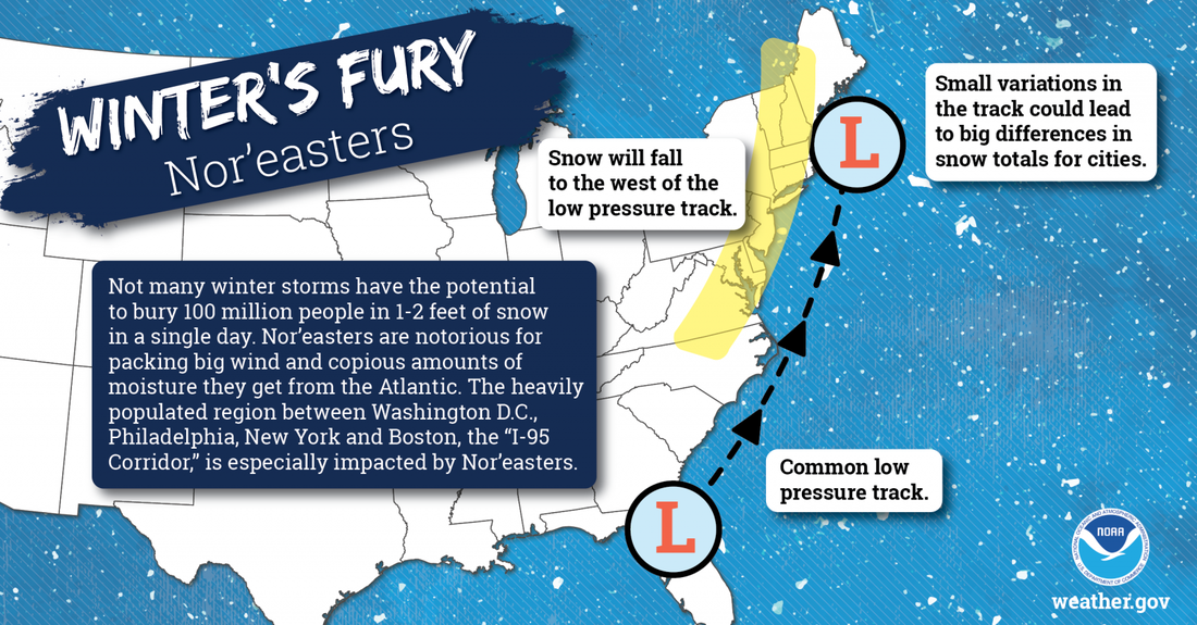 Few winter storms have the potential to bury 100 million people in 1-2 feet of snow in a single day. Nor’easters are notorious for packing strong winds and copious amounts of moisture they get from the Atlantic. The heavily populated region between Washington D.C., Philadelphia, New York City, and Boston -- the “I-95 Corridor” -- is especially impacted by Nor’easters. weather.gov/safety/winter-noreaster Be prepared to receive alerts and stay updated!
 For more information in between posts, please follow Pine Tree Weather on Facebook and Twitter. Thank you for supporting this community-based weather information source which operates by reader supported financial contributions. Thank you as always for your support! - Mike NOTE: The forecast information depicted on this platform is for general information purposes only for the public and is not designed or intended for commercial use. For those seeking pinpoint weather information for business operations should use a private sector source. For information about where to find commercial forecasters to assist your business, please message me and I will be happy to help you. |

Mike Haggett
|