Trend to warmer temperatures to begin Tuesday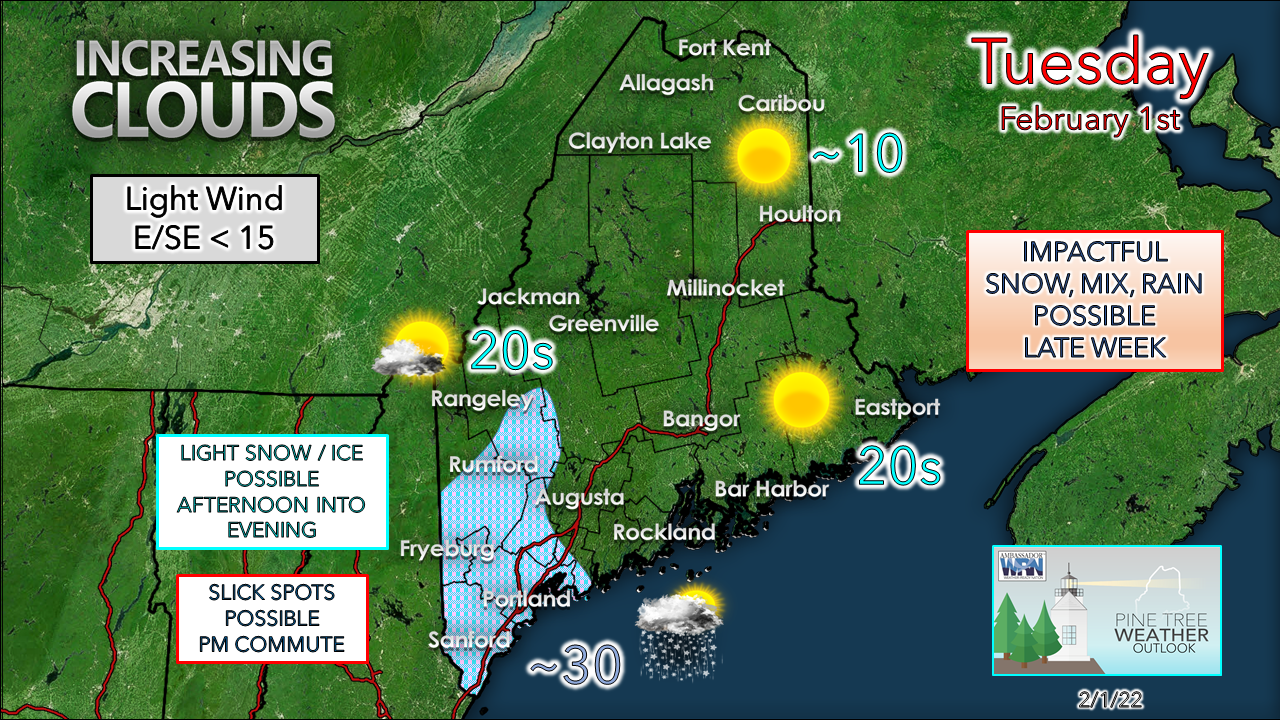 High pressure over northern Maine slides to the east for the day. This sets up an east / southeast fetch off the ocean as it crosses into northern New Brunswick in the afternoon. As that happens, clouds increase over southwestern areas, and brings a chance for light snow and perhaps freezing drizzle heading toward the evening commute and into the evening. While accumulation is expected to be light, it could be enough to cause slick spots on secondary roads and untreated areas. For areas to the north and east, sun rules much of the day, with clouds on the increase later in the day as warmer air moves in aloft with the high heading east. Temperatures to start on Wednesday are expected to be 20-30° than Tuesday. Impactful storm appears likely to end the weekThe idea of a sloppy end to the traditional work week is still on track. There is fine tuning to be done which will begin on Wednesday, but the chance of an impactful event is increasing. 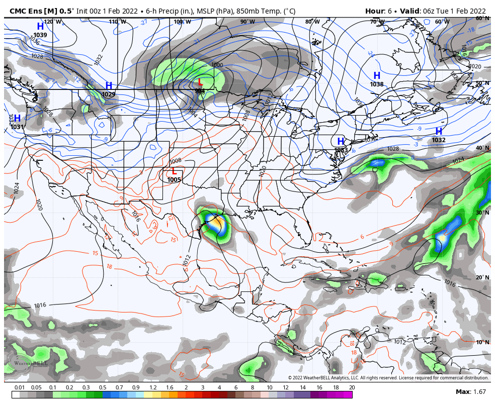 Monday 7 PM to Saturday 7 AM - A wide look here at an area of low pressure racing across central Canada moving east. Arctic cold to the north, Bermuda high pumps in moisture from the southwest and sets up a long wave frontal boundary. If you get the idea this looks more like a spring or fall set up, you are spot on. 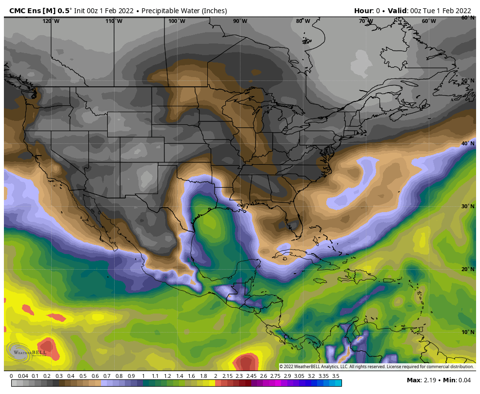 Monday 7 PM to Saturday 7 AM - Looking at precipitable water values here, it looks even more like a spring or fall set up. There will be plenty of moisture to work with as the frontal boundary approaches Thursday afternoon. For southern areas, it may feel a touch humid. 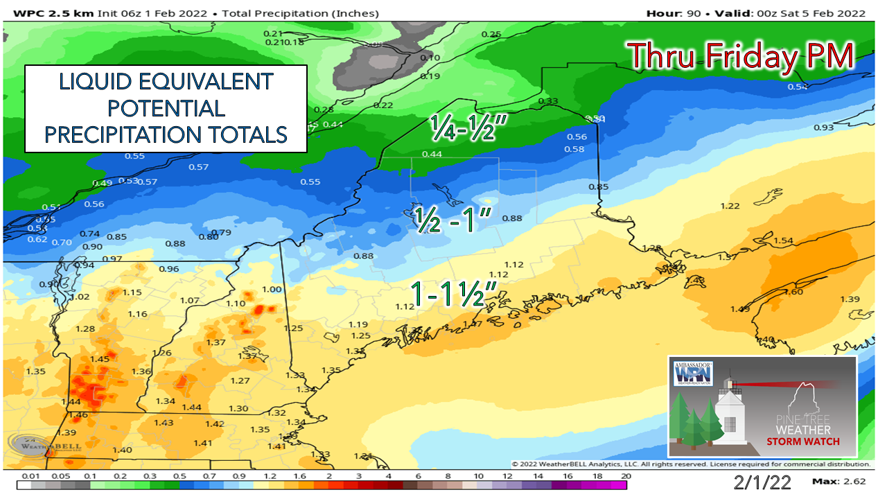 There is reasonable model agreement on the amount of moisture that could be involved. Coastal areas are likely to see the most, with lesser amounts further to the north. 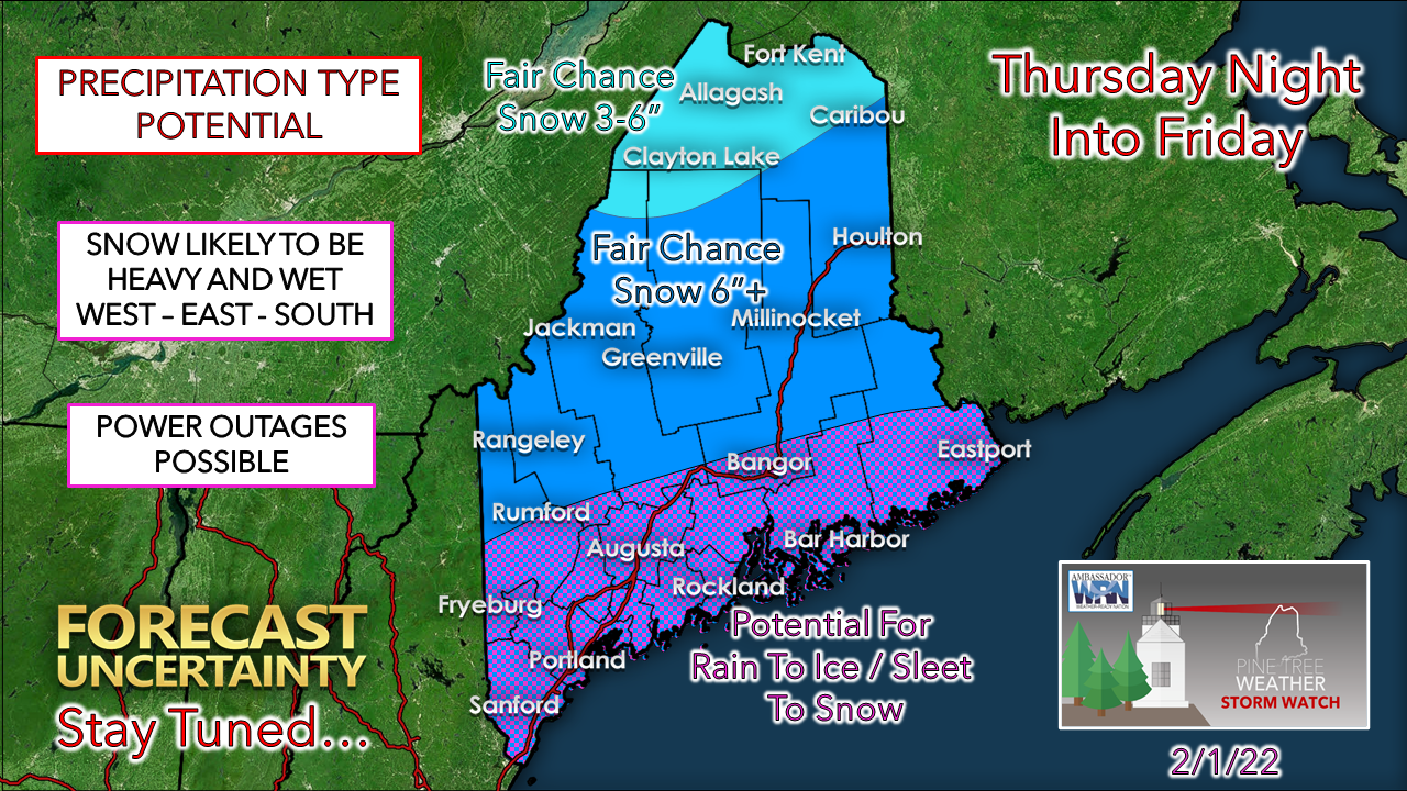 It's a meteorological squeeze play over Maine is the way it appears now. The timing of the frontal passage will be key here. That will depend upon the strength of the high to the southeast. Disturbances riding along the front could enhance precipitation output. Where the cold and mild air clash along the boundary could also up the ante on amounts and impacts. For a system that resembles more like mid-March rather than early February, this is something to keep updated on. Stay tuned! Temperature outlook through the weekendThe warmup will be a brief one. An arctic high moves in behind the front for another trip to the freezer. There is potential for a storm early next week as an active pattern continues. 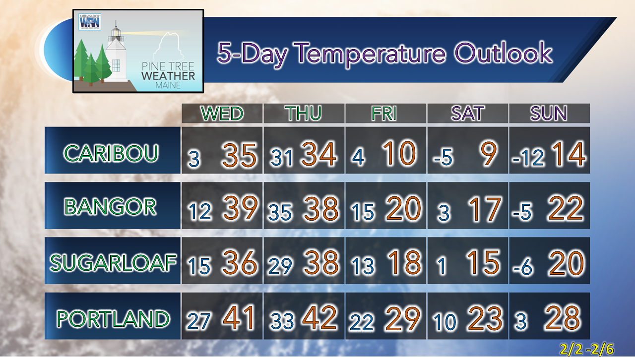   Be prepared to receive alerts and stay updated!
 For more information in between posts, please follow Pine Tree Weather on Facebook and Twitter. Thank you for supporting this community-based weather information source which operates by reader supported financial contributions. Thank you as always for your support! - Mike NOTE: The forecast information depicted on this platform is for general information purposes only for the public and is not designed or intended for commercial use. For those seeking pinpoint weather information for business operations should use a private sector source. For information about where to find commercial forecasters to assist your business, please message me and I will be happy to help you. |

Mike Haggett
|