|
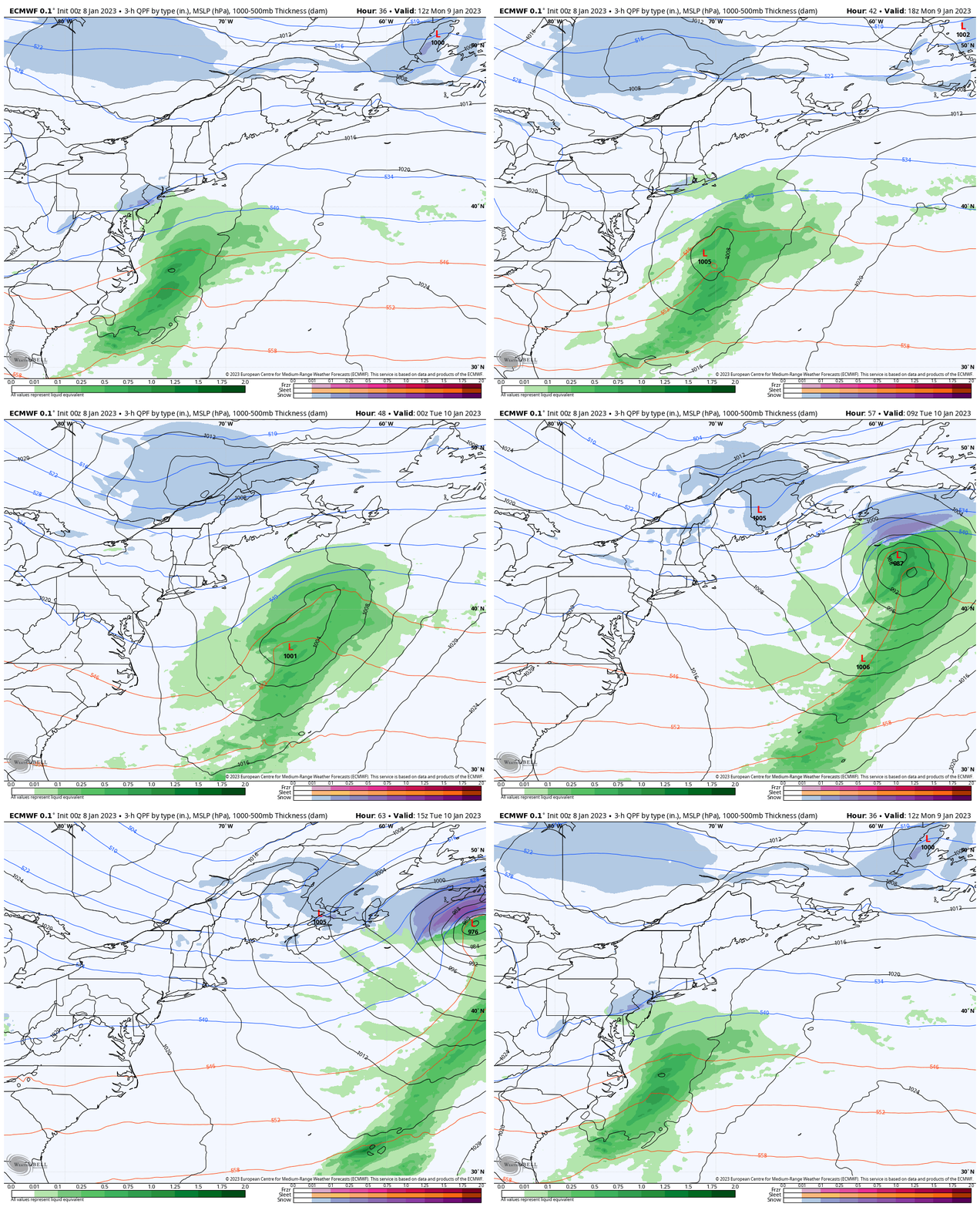
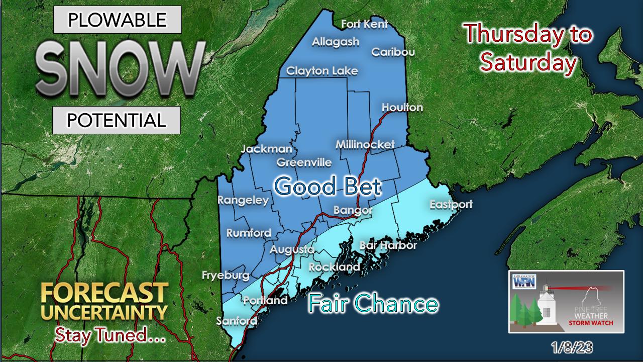
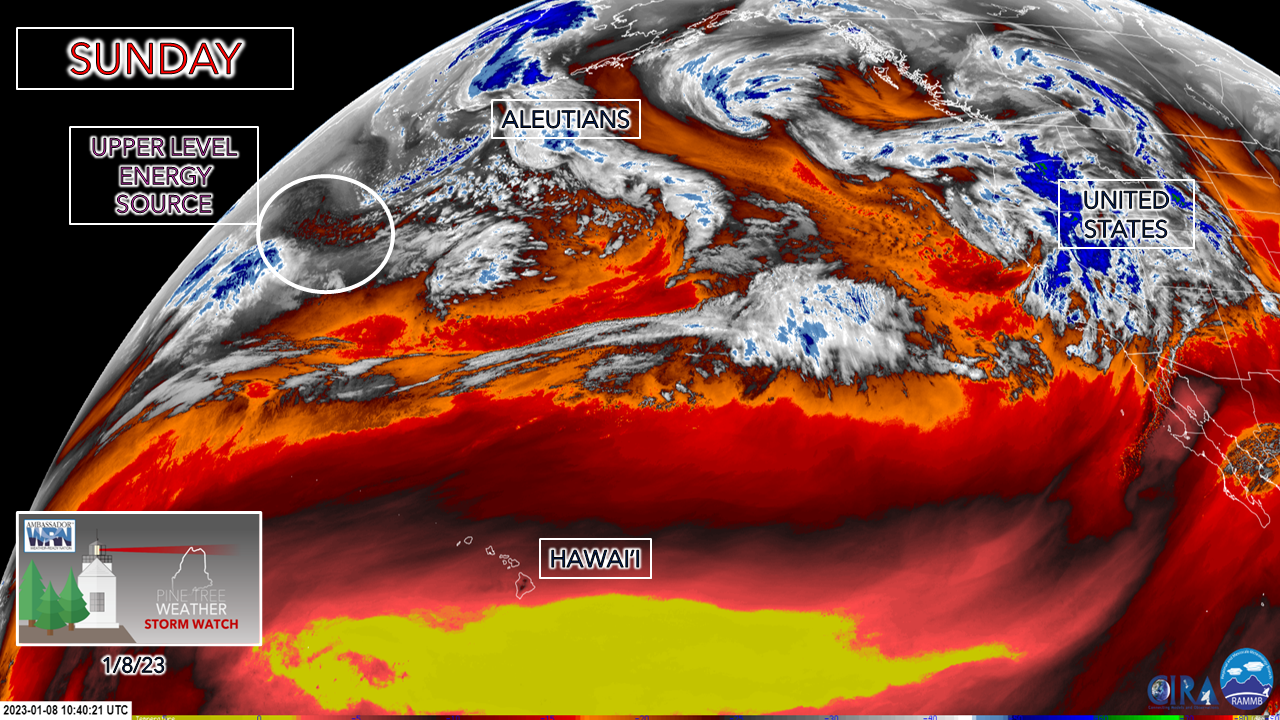
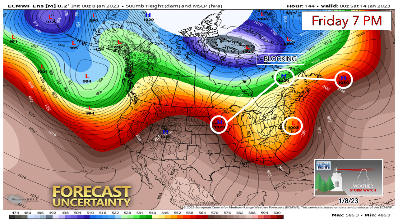
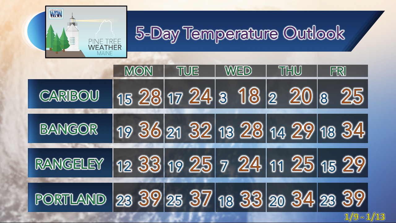
Before I get into the forecast, I want to say thank you for hanging in there with me as I navigated through crazy week with numerous appointments regarding medical, family, and weather-related matters, all of which worked out well. It was a "perfect storm" that it all ended up in the same week, but it's finished, and I will get back into this on a more regular basis. Expect updates in the afternoon / early evening through Wednesday, with the rest of the week to be determined. A bit of light snow on the way for the north Monday nightMonday 7 AM to Tuesday 1 PM - A week ago this looked like it could turn into something, but as the week progressed the idea fizzled out. Guidance has been in this annoying habit of phasing the polar jet with the sub-tropical jet in a progressive nature in the long term, but Lucy steals the football away from Charlie Brown on the kickoff and this ends up happening. Folks who follow in Newfoundland get the goods on this one. Seeing reports from folks up there, they have no snow on the Avalon Peninsula, which is amazing for early January, but not surprising given La Niña right now. For northern areas, a few snow showers, an inch or two of fluff potential for the Allagash region, otherwise not much else from this one. After this, the next focus turns to late week. Storm potential for the second half of the weekWhile there are more questions than answers at this point, which is typical for this range, ensemble ideas of the European, GFS, and Canadian models agree with a potential snowmaker for the second half of the week. There is some uncertainty with Thursday as there are some discrepancies on ideas of whether a wave ahead of the main event gives the region a jumpstart on snowfall or not. Friday is where the agreement is good. Part of the reason Thursday is a question mark is the upper-level energy that will drive the trough to the southeastern United States late week is over the north Pacific, southeast of Russia, southwest of Alaska, consequently away from weather balloon observation points. This energy source is not expected to make landfall in California until Tuesday morning. I expect some help from bits and pieces of energy that will iron out Thursday on Monday. The main event on track, precipitation type(s) and timing for Friday will be better known by Tuesday afternoon. What I like about snow chances with this event is the potential blocking set up locking in the cold over the interior, combined with an anomalously high moisture pump from the south to feed into it. The forecast trough is expected to be deep and strong. What I don't like for snow chances for the coast is that moisture pump coming in from the south/southeast over 43° ocean water. This sets up a potential junk storm situation (sleet, freezing rain) which could throw a wrench into this. I'd like to see the forecast high to north a bit further southeast and a bit stronger to feed more cold air in to cut down on the mixed precipitation aspect. With ideas trending cooler, that idea may happen, but for now it is wait and see. Stay tuned! Temperature outlook through FridayThe normal high and low temperature for Caribou for January 8th is 22° and 4°. For Portland, 33° and 17°. Expect temperatures to be slightly above normal overall through the week. Thank you as always for your support! You may not like the weather, but I hope you like what I do! Please hit the like button on Twitter and Facebook, and share! Stay updated, stay on alert, and stay safe! - Mike NOTE: The forecast information depicted on this platform is for general information purposes only for the public and is not designed or intended for commercial use. For those seeking pinpoint weather information for business operations, you should use a private sector source. For information about where to find commercial forecasters to assist your business, please message me and I will be happy to help you. |
Mike Haggett
|

