
A weak front passes through to end the week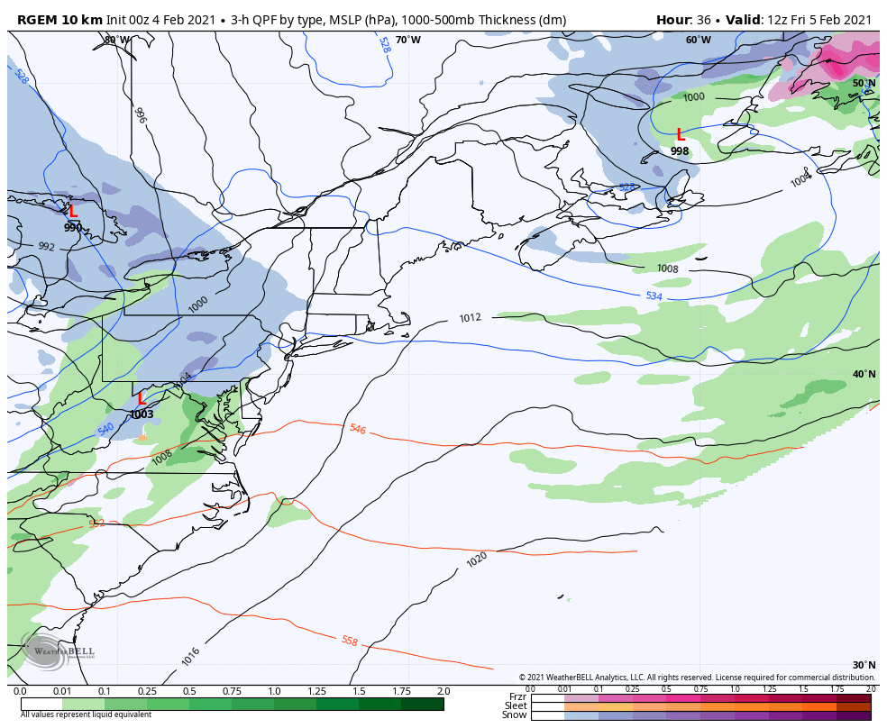 The upper level low that has been the primary feature over the northeast finally clears out Thursday, which may bring some light snow to the mountains. Surface high pressure slides in behind the upper low for a cameo appearance, but passes east Thursday night. A weak frontal boundary moves into the region on Friday, and passes into the Canadian Maritimes on Saturday. 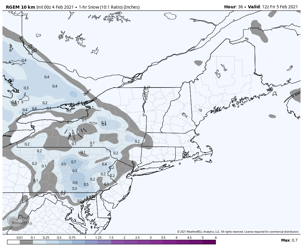 The morning commute appears to be clear of precipitation for western and southern areas, flakes begin to fly soon after. Bangor may see flakes around noon-2 PM. It appears northern and far DownEast regions stay dry until early evening. Precipitation ends over southern areas Friday evening. The last of the flakes depart northern areas around sunrise Saturday morning. The snowfall rates depicted above are generally light, and easy to manage for the road crews. 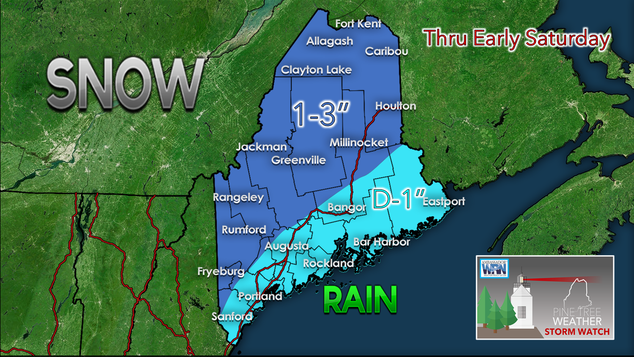 For coastal areas, flakes may start off, but the flip to rain comes soon after. There is not a whole lot of moisture here. The average liquid equivalent is around 0.20". Northern areas have the better chance to see upwards of 3" of snow. Outlook through Wednesday The previously mentioned Sunday/Monday storm is one for the fish as that stays to the southeast. There is a slight chance Washington County may get a few flakes from that Sunday night, but that appears to be about it. The next potential storm appears to be Tuesday.  Temperatures trend below normal next week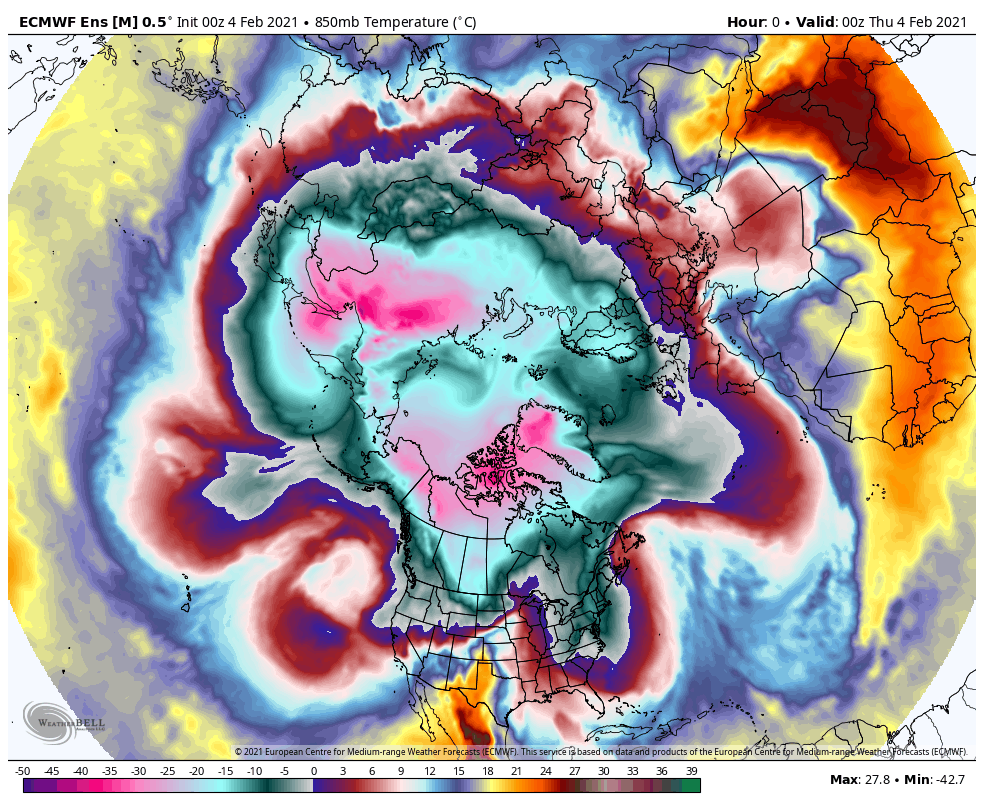 Looking at the top of the world, it does not take much effort to see where the train is going here. Deep cold that has been bottled up over northwestern Asia begins to move southeast over North America in the coming days. A weather station at Howard Pass in northern Alaska reported wind chill at -90° F on Wednesday. While it won't get that bone shattering cold in our region, there will likely be records broken over the heartland of the country, and some impressive observations from places like International Falls, MN. Maine is on track to head well below normal, however. Once the weekend clears, it may be a week before a reading above 32° is recorded. This also sets up chances for all snow events if systems materialize. The normal high and low for Caribou is 21° and 1°. For Portland, 32° and 14°. The chill is coming. Make sure your wood is ready for the stove and/or oil tanks are filled. 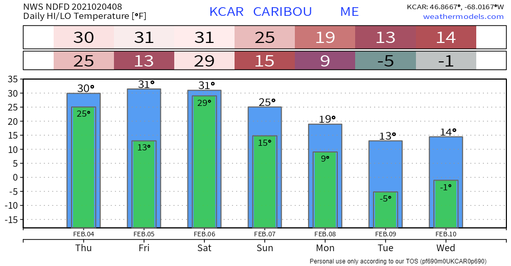 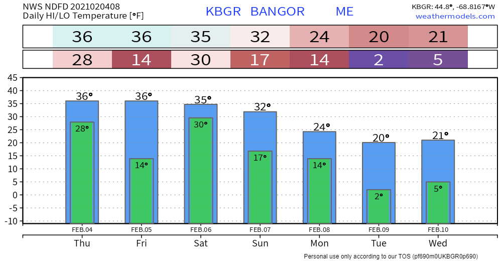 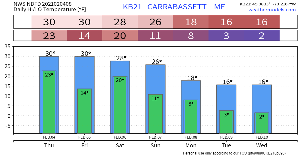 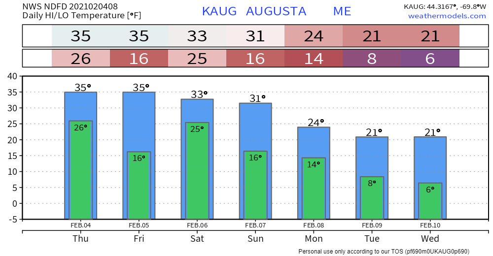 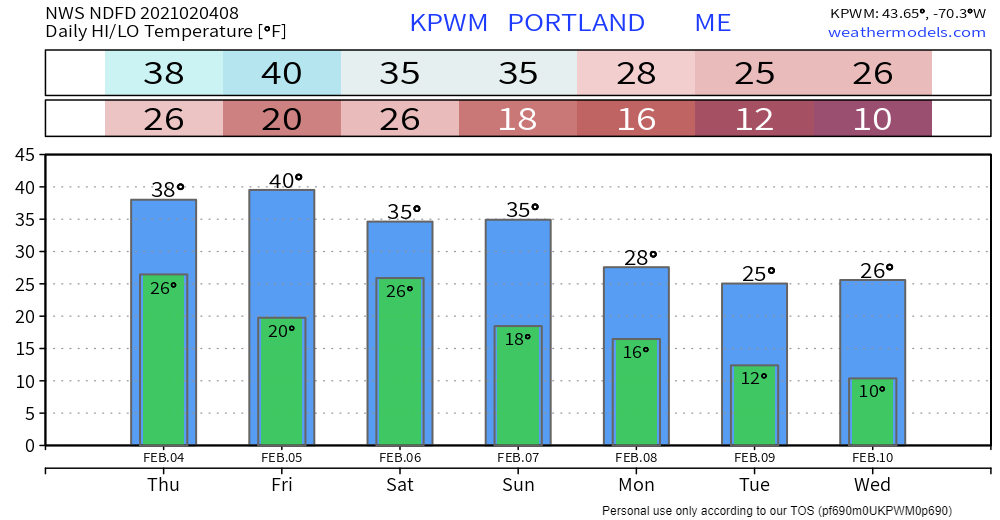 Snow water cycle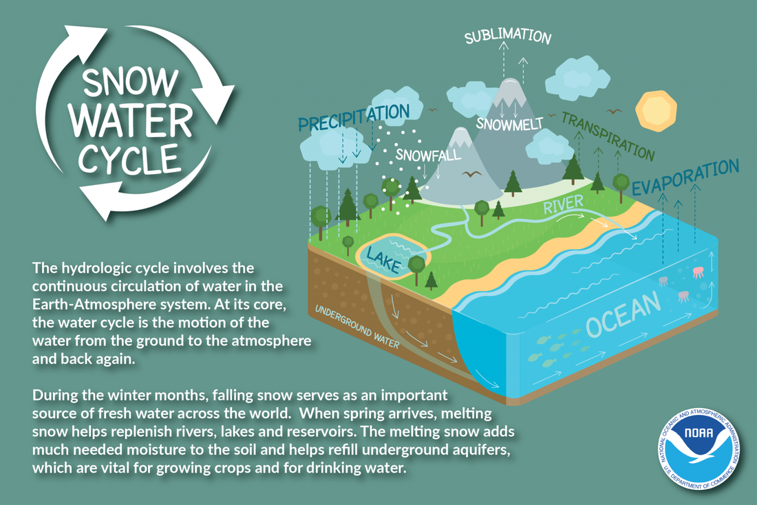 During winter months, falling snow serves as an important source of fresh water across the world. When spring arrives, melting snow helps replenish rivers, lakes, and reservoirs. The melting snow adds much-needed moisture to the soil and helps refill underground aquifers, which are vital for growing crops and for drinking water. weather.gov/jetstream/hydro Be prepared to receive alerts and stay updated!
For more information in between posts, please follow Pine Tree Weather on Facebook and Twitter.
Thank you for supporting this community based weather information source operates by financial contributions. Stay updated, stay on alert, and stay safe! Thank you as always for your support! - Mike |

Mike Haggett
|


