|
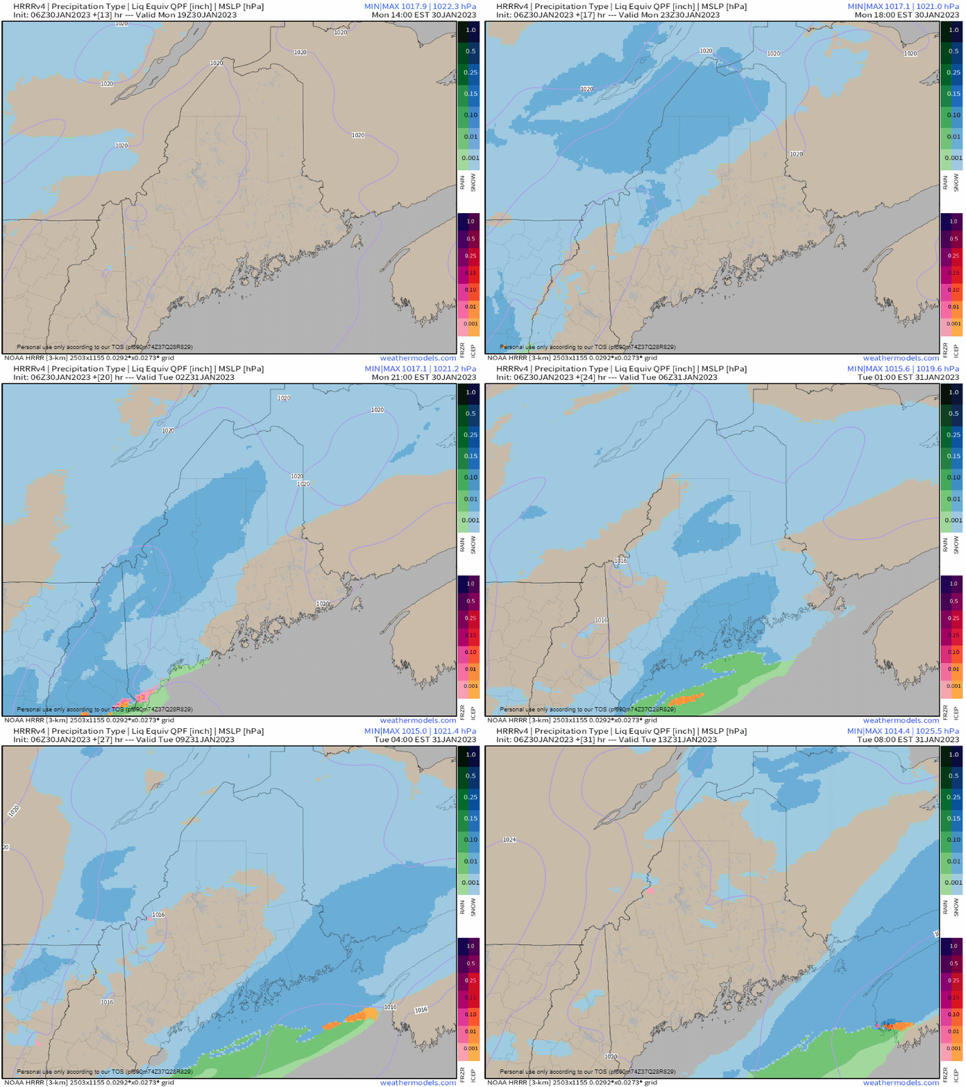
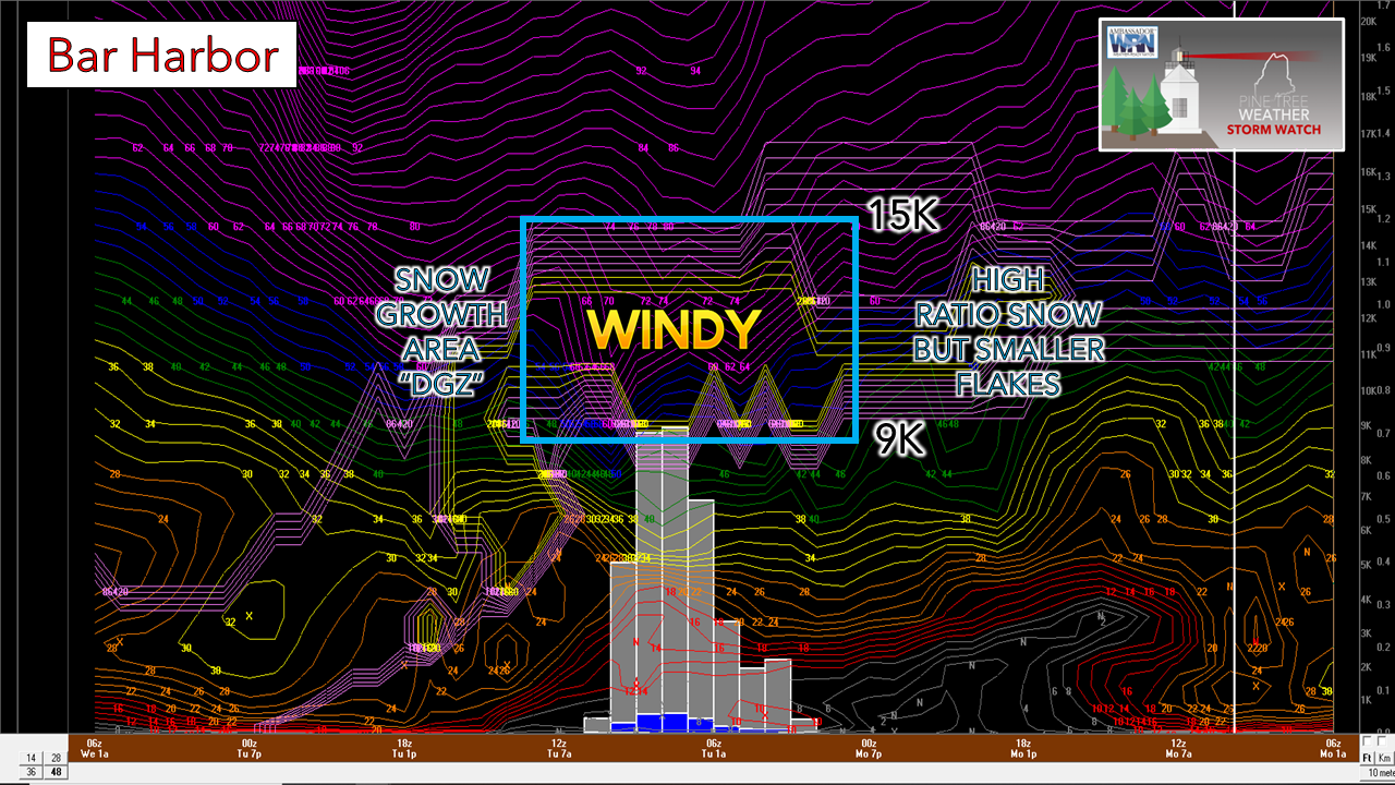
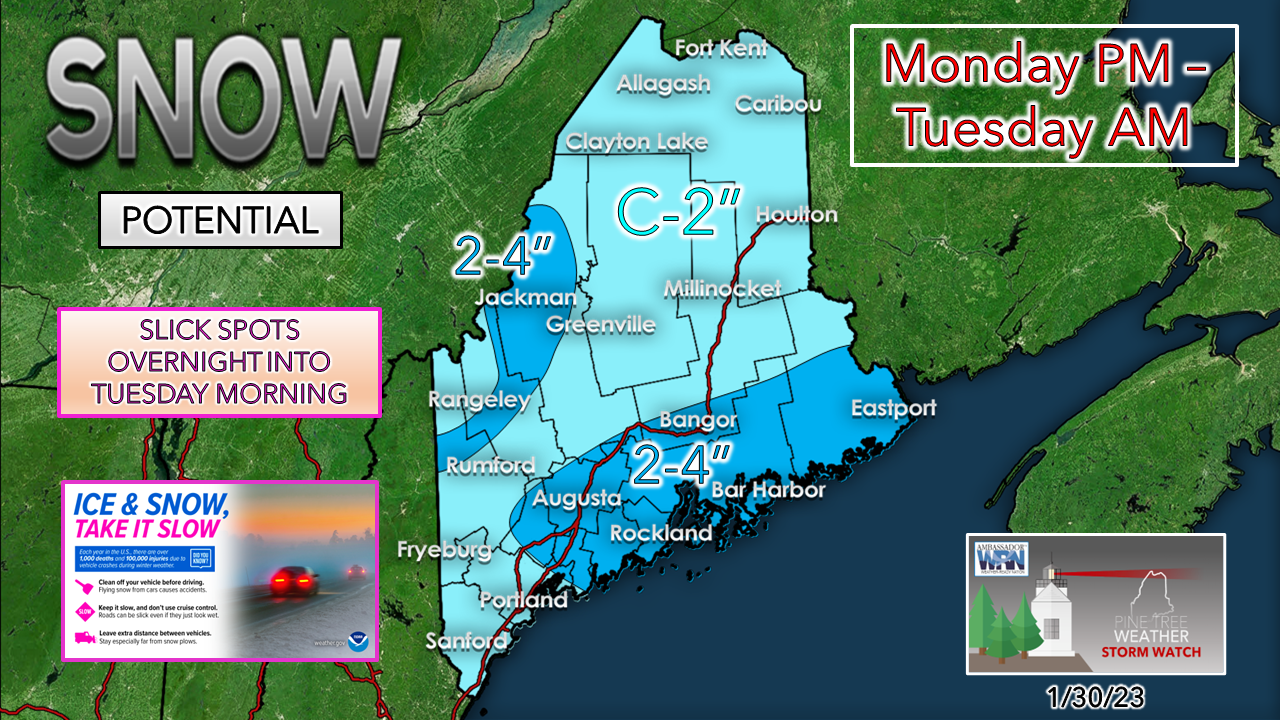
A weak disturbance passes through the region Monday afternoon into early Tuesday. The energy intensifies as it moves over the Gulf of Maine on its progress to the east. This brings snow showers in various intensity over the region, enough to create slick driving conditions for overnight and early morning travel across the region. Enough of a nuisance to cause slick spotsMonday 2 PM to Tuesday 8 AM - While southern areas get through the evening commute without precipitation, it will be a close call for the foothills and mountains. Snow showers overspread the region affecting all areas by around midnight Tuesday. As the developing storm moves to the east, snow tapers off from west to east by Tuesday morning. Looking at the HRRR 06z BUFKIT idea for Bar Harbor shows the idea of a nice low level snow growth area between 15,000 and 9,000 feet but will be hampered by a mid-level jet stream that may gust 60-80 knots. This could limit the size of the snowflakes, which may keep accumulations down. This is a consistent theme with many stations sampled across the region. A total of one to two tenths of an inch of liquid equivalent is expected here, which may generate snow to water ratios of 15-20:1. As the storm departs, banding sets up which may enhance the overall amounts for the Lewiston / Brunswick area eastward along the coastal plain. Warm surfaces along the shorelines may keep totals down there. A brief period of mixing may occur over southwestern areas in the evening before flipping to snow as cold air filters into the area as the disturbance passes to the east. While this snow can easily be cleaned up with a leaf blower or a broom, it will be enough to make travel slick in spots, especially on the roads less traveled. Thank you as always for your support! You may not like the weather, but I hope you like what I do! Please hit the like button on Twitter and Facebook, and share! Financial donations to fund what I do are always appreciated! Stay updated, stay on alert, and stay safe! - Mike NOTE: The forecast information depicted on this platform is for general information purposes only for the public and is not designed or intended for commercial use. For those seeking pinpoint weather information for business operations, you should use a private sector source. For information about where to find commercial forecasters to assist your business, please message me and I will be happy to help you. |
Mike Haggett
|


