
A Norlun trough kind of night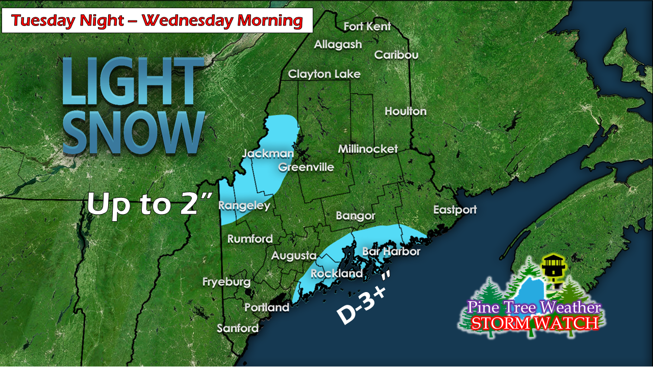 At the time of the post, some areas around Penobscot Bay are already receiving snowfall as a result of an inverted (Norlun) trough set up. Some areas could see as much as 3" and the islands may pick up higher amounts as the system generates as it moves eastward. Some shorelines areas along the southwest coast and Washington county may see a few flakes to a dusting, but the hot spot is centered in the MidCoast / Hancock County region. The western mountains may pick up an inch or two in snow showers overnight and into Wednesday morning as wind increases. Another round of wind chill for Wednesday The inverted trough intensifies as it passes through the Canadian Maritimes and a gusty northwest wind will be the main weather concern for Wednesday. Wind speeds of 5-15 mph with gusts 20-25 mph are possible in areas statewide through the day, settling overnight into Thursday morning. Saturday system starts the weekend stormy The forecast for the first half of the weekend still has a few question marks, but it is growing more apparent this will be more of a liquid affair than a frozen precipitation type for most of the state. An upper level low passes to the south and spins a surface low out ahead of it. The northern jet stays over Quebec and keeps a disturbance to the north with it. The game at this point is the interaction between the two and the timing. The Euro has been running the idea the surface low stays south and favors little interaction, but it is a close miss. It's close enough that if the timing is off by a scant handful of hours that it may drag steadier rain northward IF the connection is made. If it stays a miss (as this loop represents), the mountains and north escape most of the liquid precipitation, and the coastal plain gets the heavier amounts. It's a close call. Stay tuned. Outlook through Sunday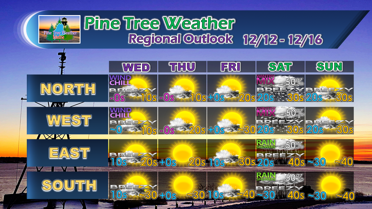 After a chilly end to the week, temperatures rise over the weekend. Sunday will be the better of the two days. Temperatures remain mild until the middle part of next week before the cold appears to return.
For the latest official forecasts, bulletins and advisories, please check in with the National Weather Service in Gray for western and southern areas, or Caribou for northern and eastern parts of Maine. Please consider making a donation to keep Pine Tree Weather going through the year ahead. My data cost expense is increasing. The operation is 90% funded and needs your help to get through the winter. You can set up a monthly pledge on my Patreon page or send me a message from the Facebook page or direct message on Twitter to get my address to mail a check. For more information from me, please follow the Pine Tree Weather Facebook page and my Twitter feed. Always stay weather aware, and thank you for your support! - Mike |

Mike Haggett
|


