Snow ends and the cold comes in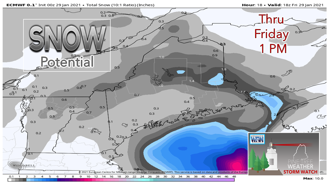 The axis of energy associated with an inverted trough spun well to the east, which consequently moved the areas of accumulation way DownEast up into southern Aroostook. The snow appears all but over by around noon as the big storm offshore continues it's trek eastward and takes the energy associated with the trough along with it. With the ocean storm intensifying in departure, northwesterly winds pick up. This could cause some blowing and drifting of snow, and may cause brief white out conditions. The coldest airmass of winter arrives for the weekend. 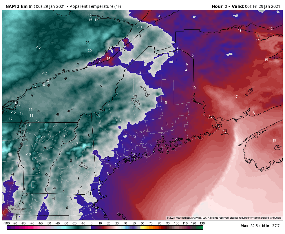 Temperatures factoring in the wind chill above on high speed through 1 PM Sunday shows below zero for the mountains and single digits for most areas until the wind drops and incoming high pressure slides east on Sunday. The upside here is sun will be the prevalent sky feature through the weekend. With the sky clear, that sets up radiational cooling and brings actual temperatures around 0° statewide to start Saturday and Sunday. NorEaster potential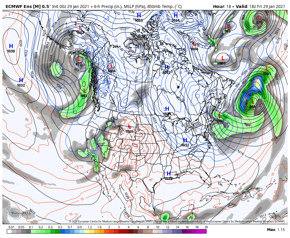 Low pressure associated with an atmospheric river which has dumped several feet of snow over the Sierra Nevada region tracks slowly eastward over the weekend. The storm is forecast to track through the Ohio River Valley Sunday. Low pressure transfers offshore of the DelMarVa early Monday, and appears to move east northeast from there. 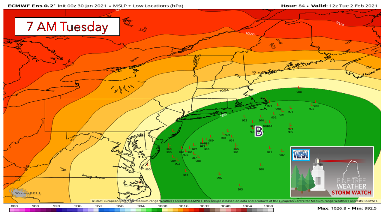 At this point, the majority ensemble trend of the potential storm is tracking south and east of the benchmark "B" (40° N / 70° W). 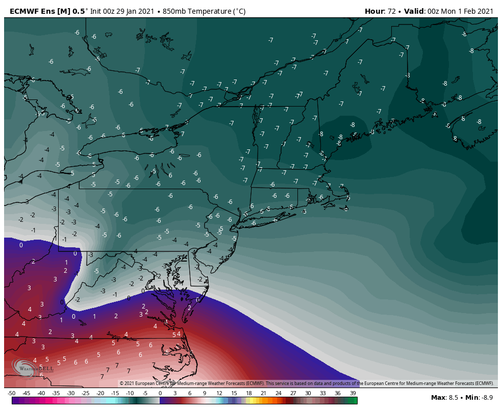 With the trend to the south and east, that idea all but insures cold air aloft stays in place, and increases the likelihood of this being an all snow event for most, if not all of the region. 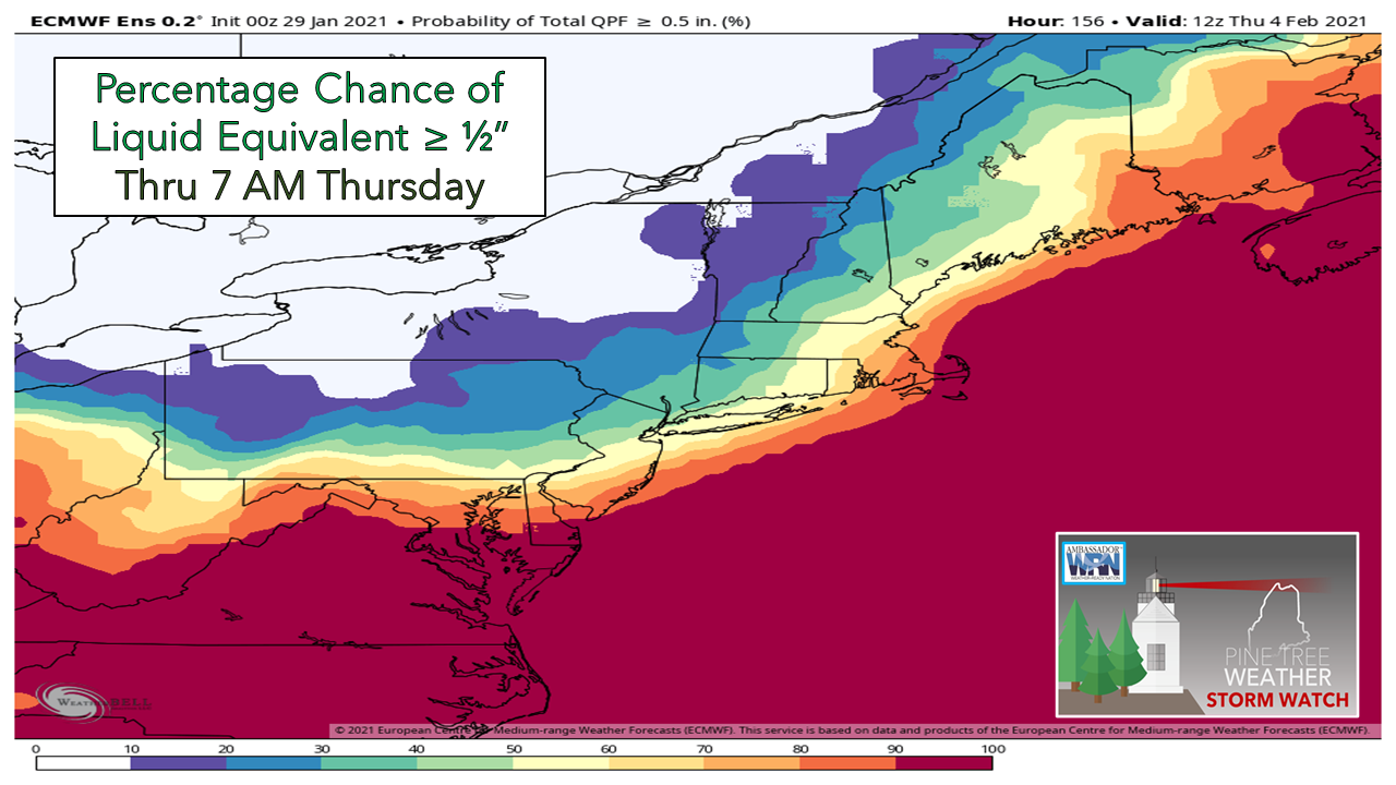 With the potential track to the south and east of benchmark, that cuts down on snow amounts for interior areas. Taking this chart idea here of the chance of ½"+ of liquid (think roughly 6" of snow) shows eastern areas with the best potential for now. If this trend is to continue, the storm would bring little to no accumulation to the mountains and north. The coastal plain would be on the fringe of the storm. It's important to note here that for now guidance has this storm moving slowly. Timing for now appears that southern areas may see snow begin Monday afternoon/evening. The snow would advance to the northeast Monday night, continue all day Tuesday, then taper off late Tuesday into Wednesday, ending over eastern areas roughly that afternoon. Bottom line is there is still many details to figure out here. Stay tuned for updates.  Join mPING Nation and help improve forecasting! Check out mPING (Meteorological Phenomena Identification Near the Ground) project. Weird name, cool app! You can report the type of precipitation you see where you are. No need to measure! Use the free mobile app to send reports anonymously. Reports are automatically recorded into a database, which improves weather computer models. The information is even used by road maintenance operations and the aviation industry to diagnose areas of icing. mping.nssl.noaa.gov Temperature outlook through Thursday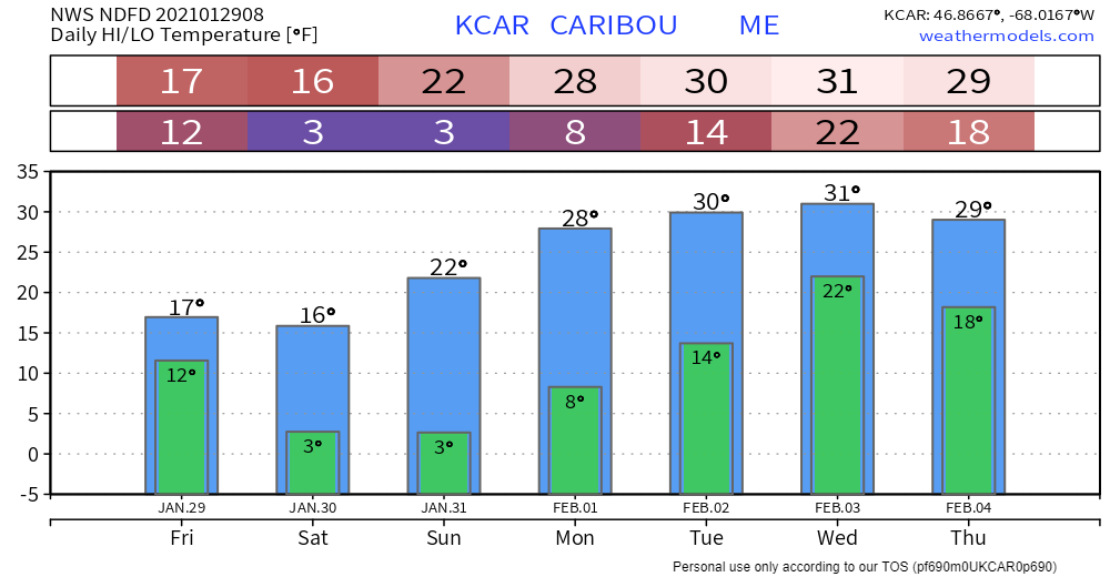 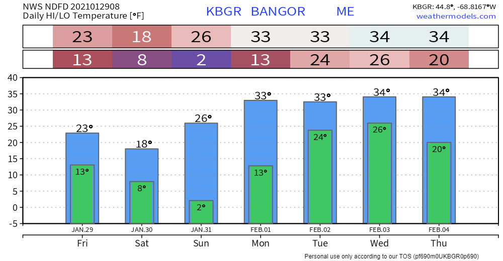 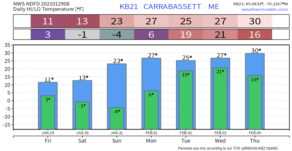 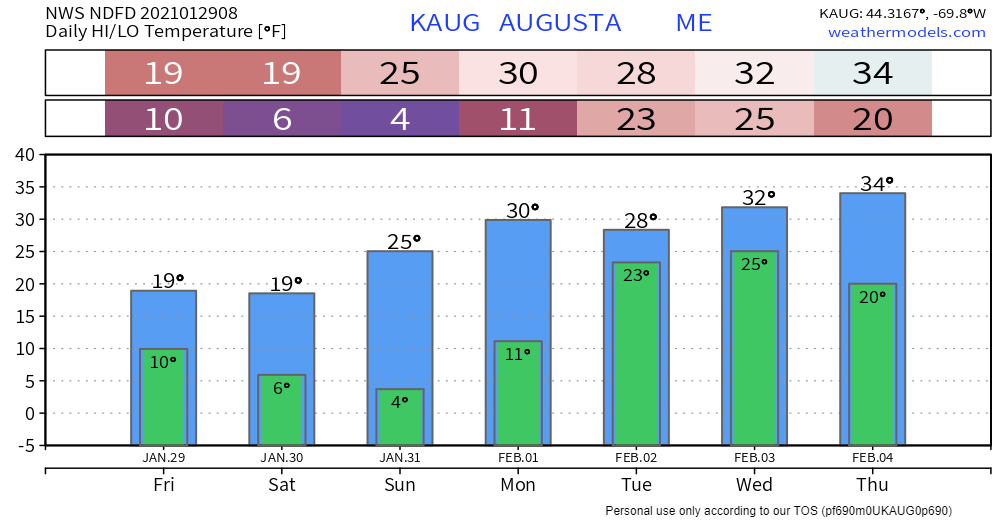 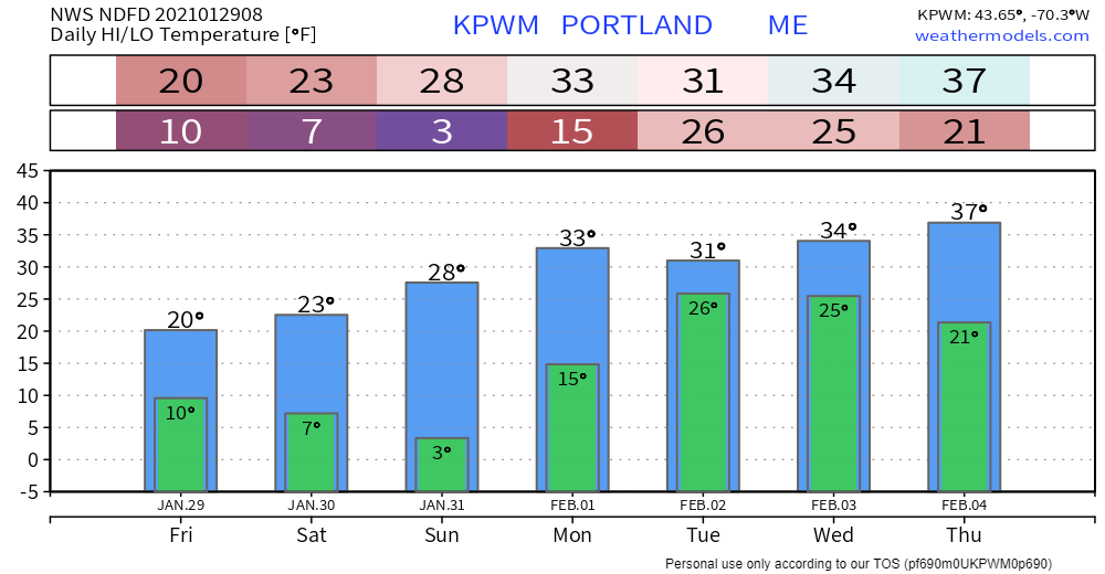 Be prepared to receive alerts and stay updated!
For more information in between posts, please follow Pine Tree Weather on Facebook and Twitter.
Thank you for supporting this community based weather information source operates by financial contributions. Stay updated, stay on alert, and stay safe! Thank you as always for your support! - Mike |

Mike Haggett
|