Time to share some news Recent sunrise from Parsons Beach towards Great Hill Point, Kennebunk. The future of Pine Tree Weather is looking good. As many of you know I have been juggling this, my day job, my family, along with being in my final semester at Penn State. The journey I started in January 2012 continues to come together piece by piece, and it looks better every day. I have been contacted by Dr. Jon Nese, who you may remember worked for The Weather Channel for a number of years and is currently a teaching professor / associate head of undergraduate programs in the Department of Meteorology and Atmospheric Science at Penn State. I have received his stamp of approval to work with future meteorologists for internships and resume building opportunities here with Pine Tree Weather. Last summer, Alex Hatfield and Kaitlyn Lardeo worked along side of me, which was a wonderful experience. As a result of the success with them, I am going to do allow others the opportunity to work along side of me to sharpen their forecasting and communication skills year round. Along those lines, for you long timers from the Western Maine Weather days, you will see a young man from that bygone era come back and work with me over the summer. I have received several inquiries from current Penn State students already, and will conduct interviews over the course of the next few weeks. I will have a formal announcement on the team once everything is finalized. Important to note here that it is your financial support is what makes all of this happen. If not for the contributions, this opportunity for would not be possible for myself or the students I work with. For that, I am most grateful. On a somber note, my mother has been moved into hospice care. The time will come fairly soon where she will pass. This may interrupt what I do here for a short period. I will cross that bridge when I get to it, and I will let you know what my posting status will be a that point. Thank you for your support and understanding in all things. A freshening snowfall on the way to end the week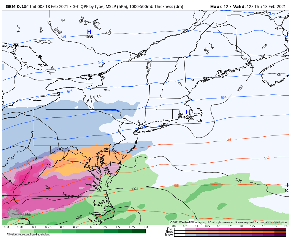 Finally there is reasonable amount of agreement with guidance on how this storm plays out. This will be a long duration event for southern New England, For Maine, the snowfall appears to be mainly for the coast with lesser amounts to the north. The system is flat and slow to intensify. As a result, a low impact event. 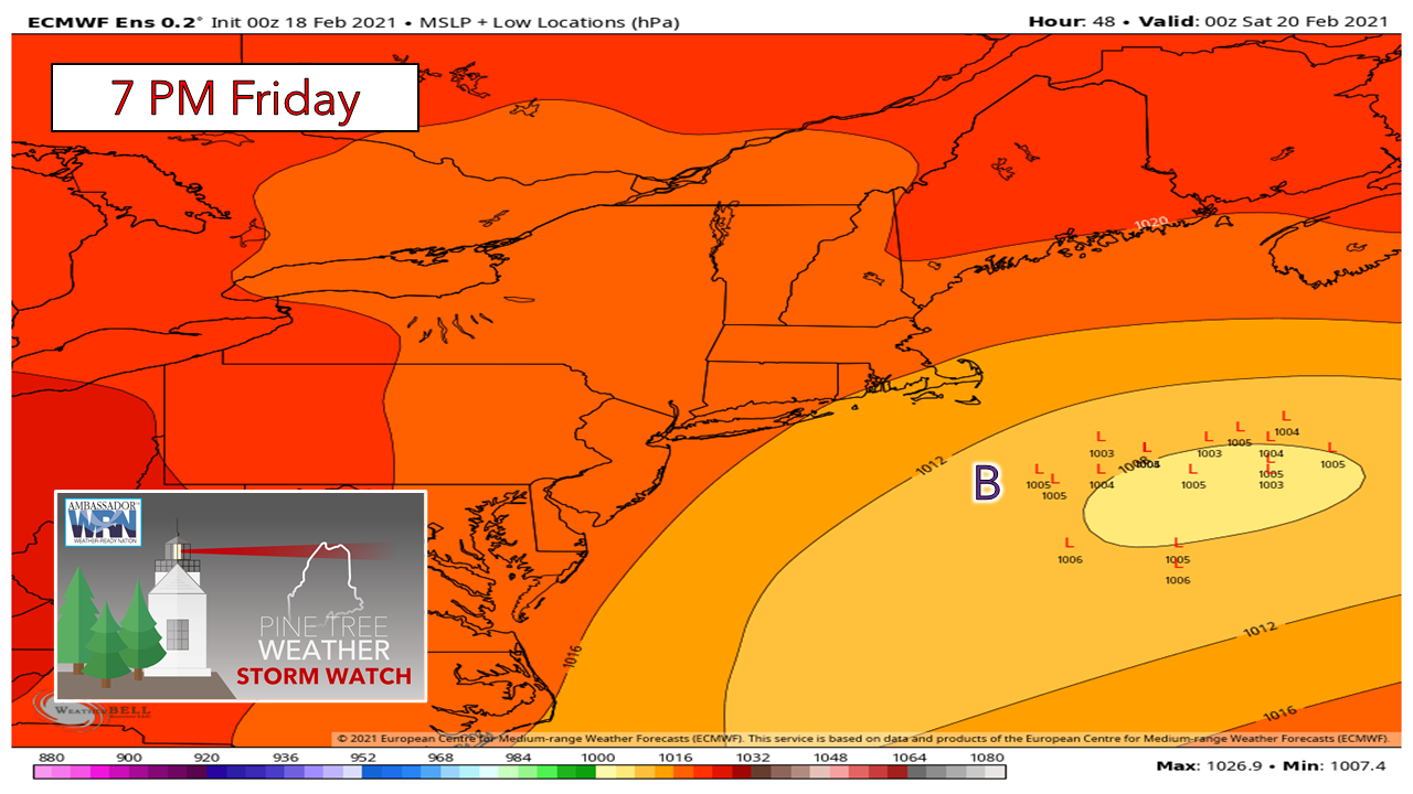 Ensemble ideas point to low pressure moving south and east of the benchmark 40° N / 70° W point, which means an all snow event for all of New England, including Nantucket. The northern and southern streams do not appear to merge together until Saturday morning south of Nova Scotia. Given track and position, it appears to be a light snow event for Maine. 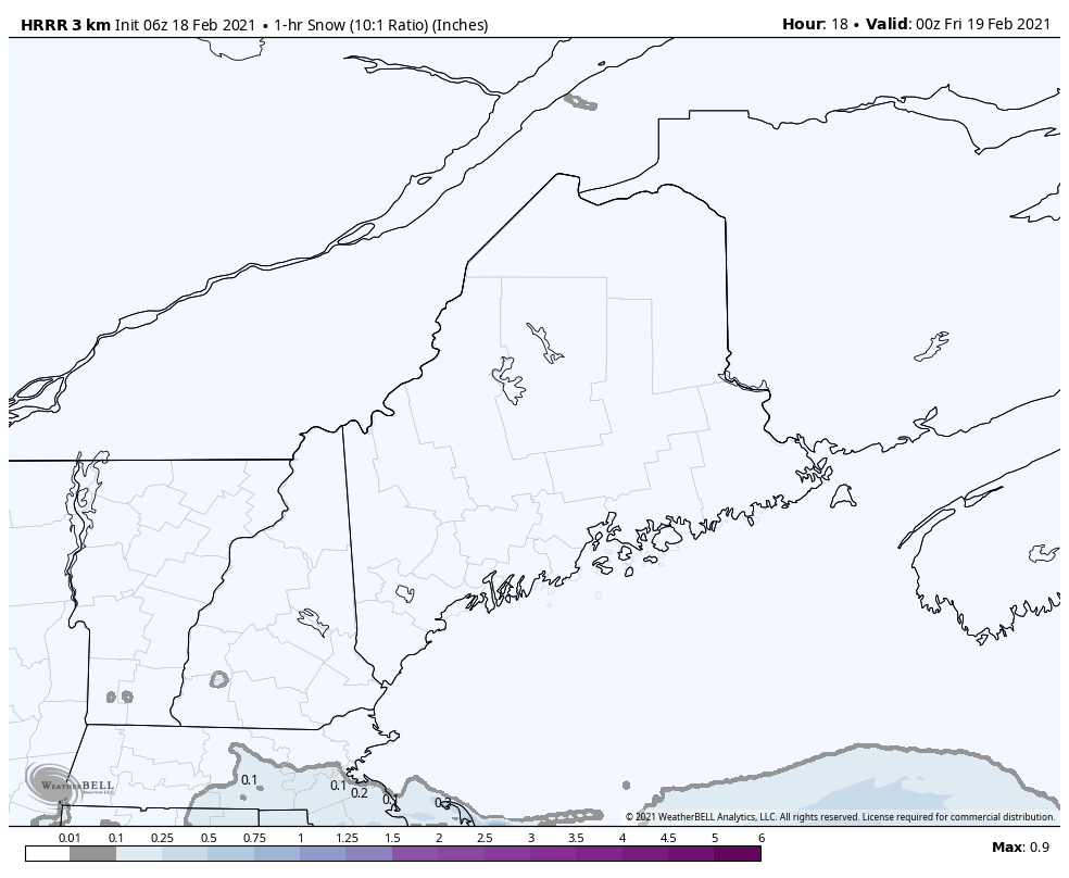 Snow appears to begin over southwestern areas late Thursday evening or in the wee hours of Friday. A good portion of the snow appears down for southern areas by mid-morning Friday. There could be some slick spots on the roads less traveled. Snowfall rates appear generally light, with spurts of heavier snow showers here and there through early afternoon. Steadier snow showers appear to linger all day for the coast, ending Friday night. Off and on snow showers appear to linger into Saturday, ending Saturday evening. 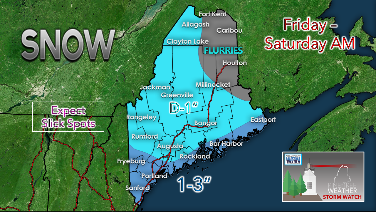 If the storm jogs a bit more north, it may push the 1-3" area further inland. Parts of York County could see 4-5" in that case. This is a high ratio snow event. Fluffy, with very low water content. 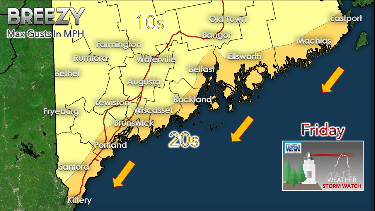 The gustier winds will be for the shorelines, where speeds may reach the mid-20 mile per hour level. There could be reduced visibility in spots of heavier snow showers, but otherwise, no major concerns. Looking ahead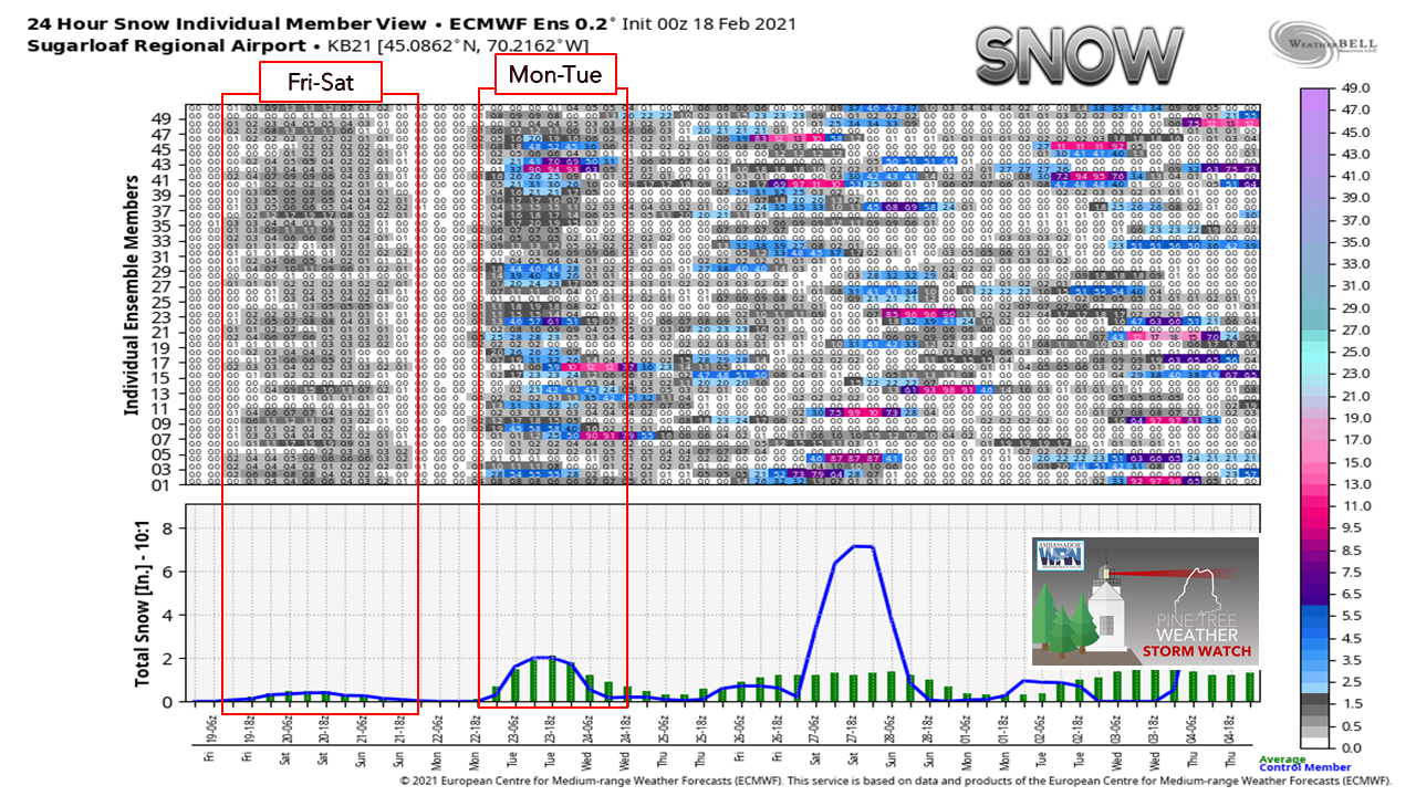 Looking at ensemble ideas for Sugarloaf shows the next chance for snow early next week. There is still a fair amount of noise after that, but nothing definitive. As volatile guidance has been as of late, the main takeaway out of this is stay tuned.  Temperature outlook through WednesdayThe normal high for Caribou is 25° with a low of 5°. For Portland, 35° and 17°. The trend is below normal over all until above normal temperatures appear to arrive toward the middle of next week. 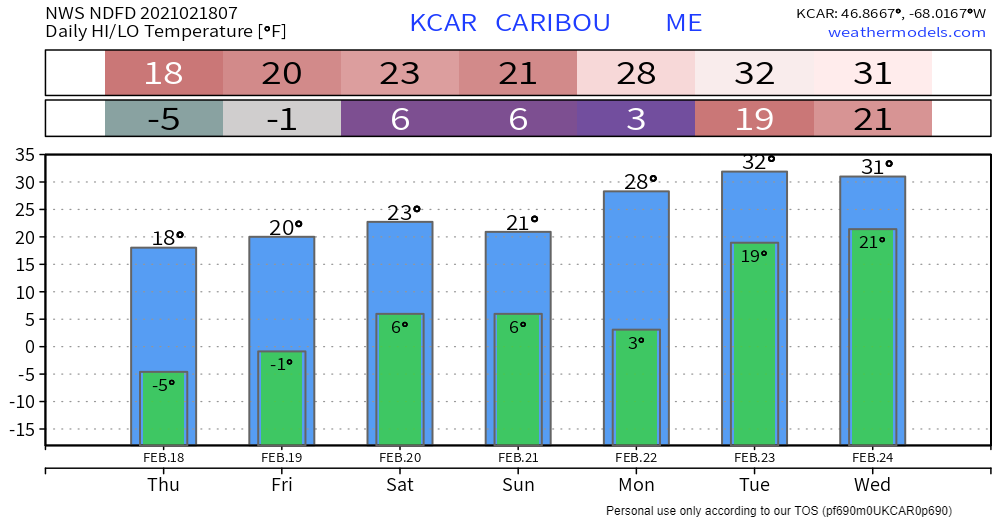  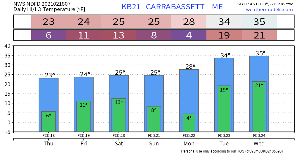 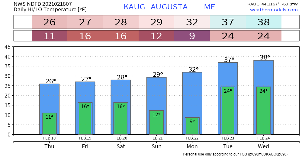 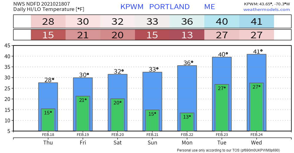 Science of Snowflakes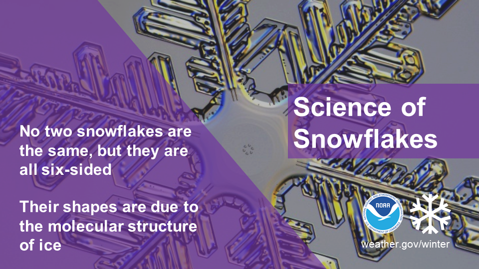 Did you know that while no two snowflakes are exactly the same, they are all six-sided? Snowflakes’ hexagonal shapes are due to the molecular structure of ice. Learn more about the science behind snowflakes: noaa.gov/stories/how-do-snowflakes-form-science-behind-snow Be prepared to receive alerts and stay updated!
For more information in between posts, please follow Pine Tree Weather on Facebook and Twitter.
Thank you for supporting this community based weather information source which operates by reader supported financial contributions. Stay updated, stay on alert, and stay safe! Thank you as always for your support! - Mike |

Mike Haggett
|