Tuesday evening commute could be a rough one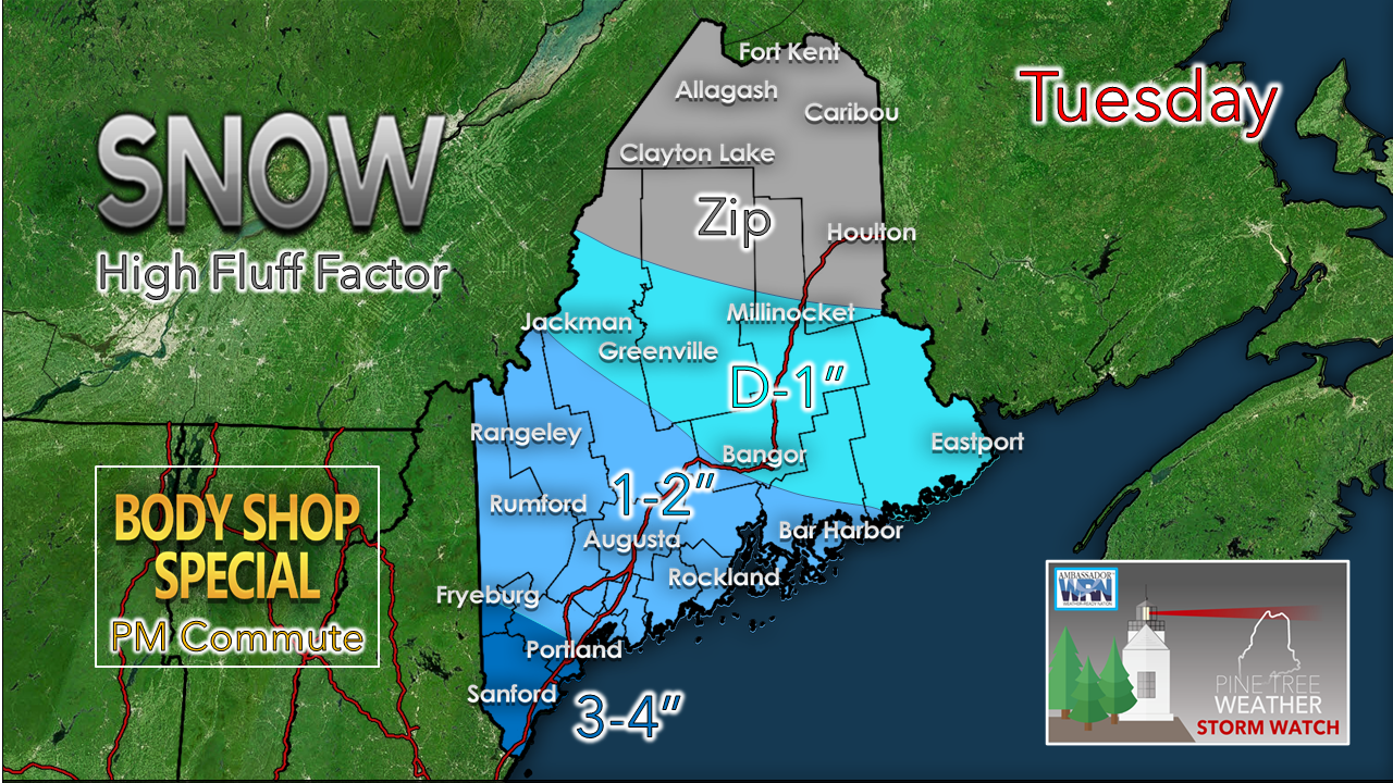 For those who have not followed for long, you may be curious to know what a "Body Shop Special" is. I've been in the commercial truck parts business for nearly 23 years now. Anytime we get these storms that don't reach winter weather advisory criteria, and at times catch people by surprise, it can turn into a wreck fest. With the parade of tow trucks hauling off damaged vehicles to body shops, which to them brings a boom in business. That is exactly what is going on here. This is appearing to be a high ratio snow event, which brings high fluff factor. This makes surfaces extra slick. There is not a lot of water content (0.10-0.20"), but the atmosphere appears that it could have the right conditions for poofy flakes that will pile up fairly quick. Anytime there is what is scientifically known as enhanced dendritic snow growth, it brings bust potential on the high end. That is the case here for southern areas. You are on notice.  Far southern areas may see a few flakes to start off around 7 AM, but snow does not appear to get going until around 11 AM - noon. The surge of warm air aloft hits a brick wall dry air and high pressure over northern and eastern areas, so the forward progress is cut off to areas there. Most of the snow falls in western areas to Bar Harbor to the south. As quickly as it comes, it ends. Outside of flurries, the snow is over for most areas between 6-8 PM. If there is potential for surprise here, there is a very low chance of an inverted trough setup in the aftermath for MidCoast areas. Some guidance has hinted at it, and as of early Tuesday morning, that idea has backed off. As I mentioned already, the element of bust potential on the high end is real possibility for Fryeburg to Portland south. If you are travelling, please use extra caution once the flakes begin to fly. In ice and snow, take it slow. Outlook over the next 10 days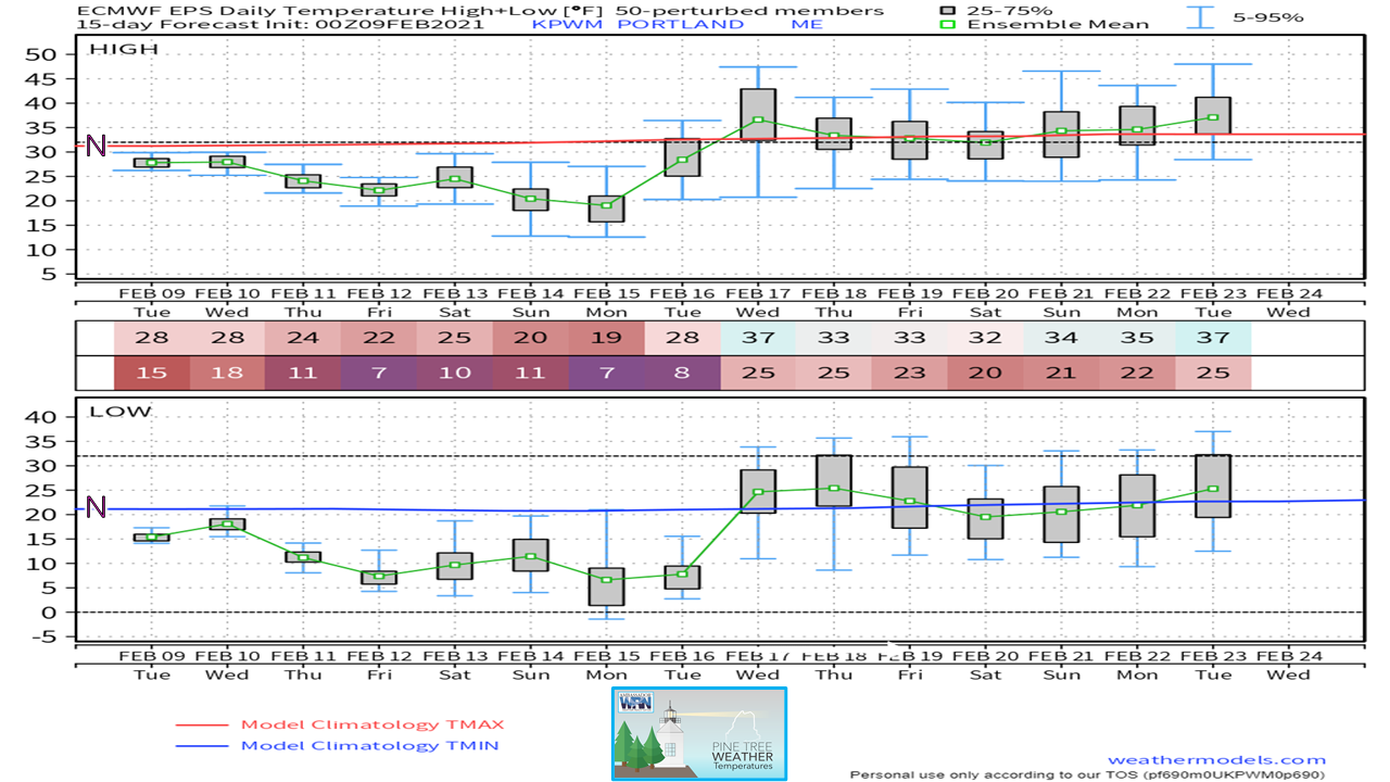 It took awhile, but the region is finally in a period of below normal cold and that could last for a week. We're going to have some chilly nights (the temperature outlook below may make your teeth chatter, just be forewarned) and cold days, so if any storms can get organized, they would be all snow events. 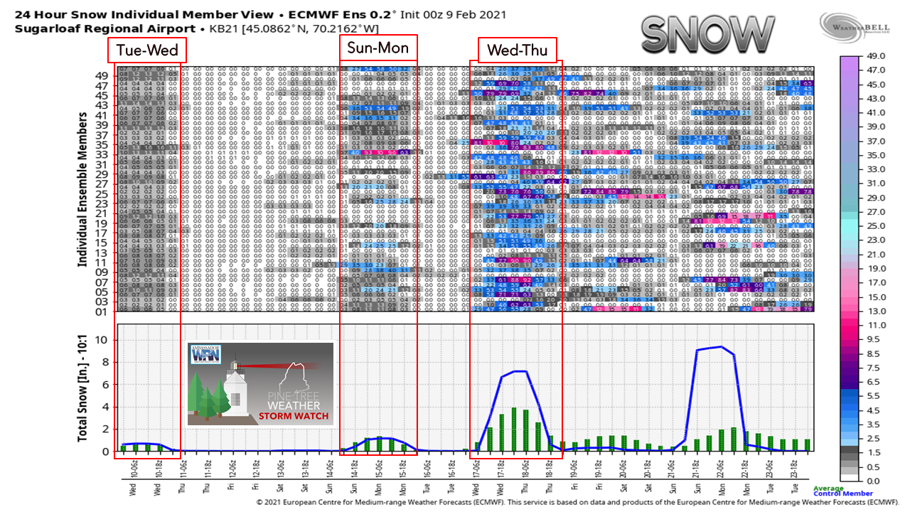 After Tuesday's storm passes, the Friday storm idea has pretty much fizzled out. High pressure appears to be the dominant feature until Sunday. After that, the volume increases for a potential storm 8-9 days out, and some noise for an unsettled pattern after that. While this is the idea for now, none of this can be taken to the bank. Ensembles have looked really good on a long term idea, and then backed completely off on several occasions. There are strong hints here, and it will be important to stay tuned as we head into the middle part of the month. 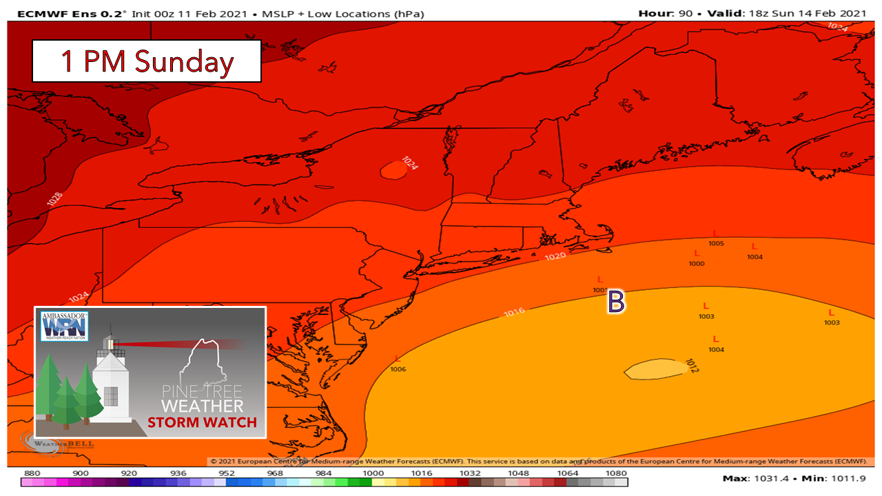 Sunday for now shows some subtle hints of potential, but nothing with any real definition at this point. A bit less than 18% of the European ensembles show some potential. The position of a strong arctic high over the Midwest will set the storm pattern up. If that happens to set up a couple hundred miles more to the west, it could be game on for snow here. It's definitely something to watch.  Ice and snow, take it slow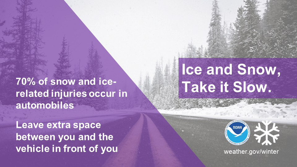 Winter driving can be hazardous. One simple way to keep yourself and everyone on the road safe is to slow down. Remember, “Ice and snow, take it slow”. Learn more at weather.gov/winter Temperature outlook through Monday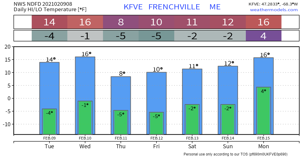 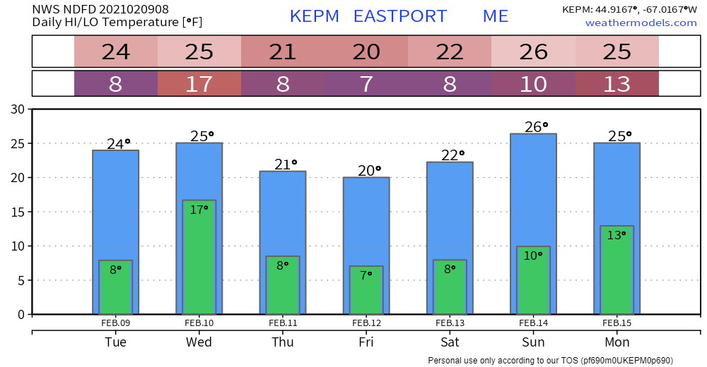 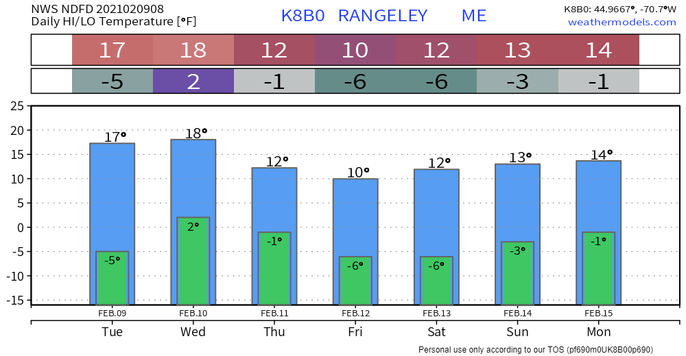 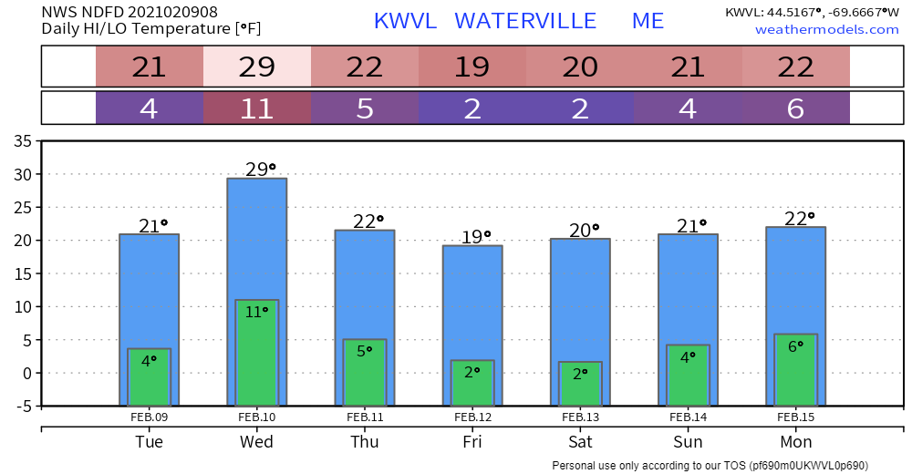 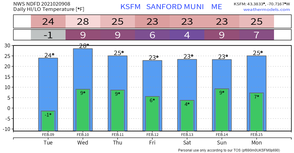 Be prepared to receive alerts and stay updated!
For more information in between posts, please follow Pine Tree Weather on Facebook and Twitter.
Thank you for supporting this community based weather information source which operates by reader supported financial contributions. Stay updated, stay on alert, and stay safe! Thank you as always for your support! - Mike |

Mike Haggett
|