Pine Tree Weather
  • DISCUSSIONS
  • DONATE
  • MAPS
  • NWS BRIEFINGS
  • SATRAD
  • MARINE
  • SNOW / ICE OUTLOOK
  • RAIN OUTLOOK
  • CPC OUTLOOK
  • Kennebunk
  • OBSERVING WEATHER
  • Who We Are
  • My Photography
  • DISCUSSIONS
  • DONATE
  • MAPS
  • NWS BRIEFINGS
  • SATRAD
  • MARINE
  • SNOW / ICE OUTLOOK
  • RAIN OUTLOOK
  • CPC OUTLOOK
  • Kennebunk
  • OBSERVING WEATHER
  • Who We Are
  • My Photography

Light snow Tuesday night, mixed event Thursday night into Friday

2/7/2023

Comments

 
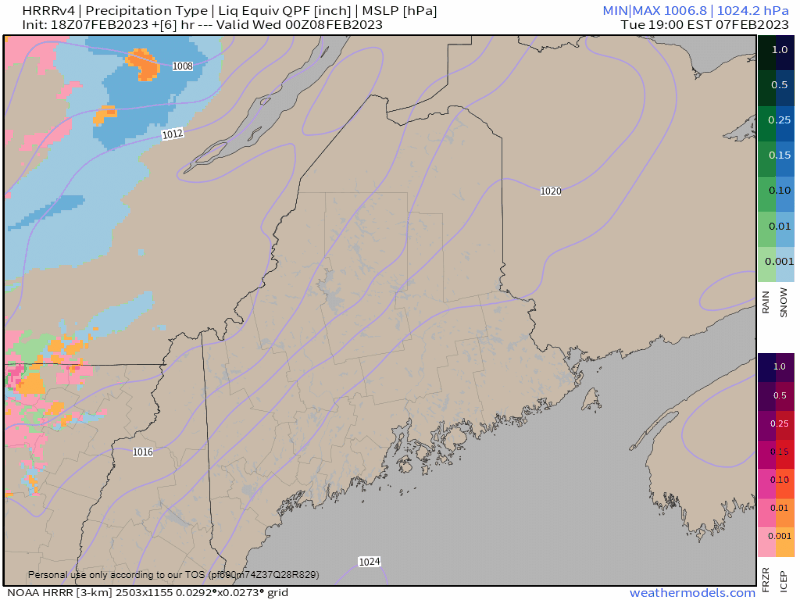
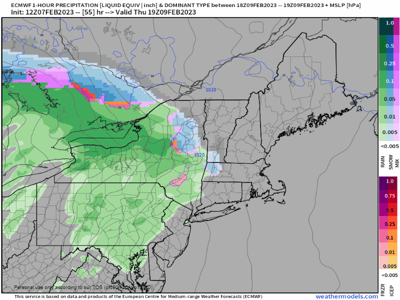
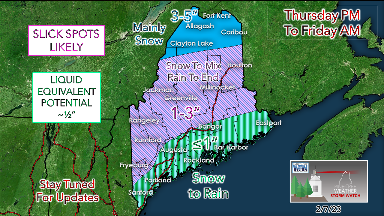
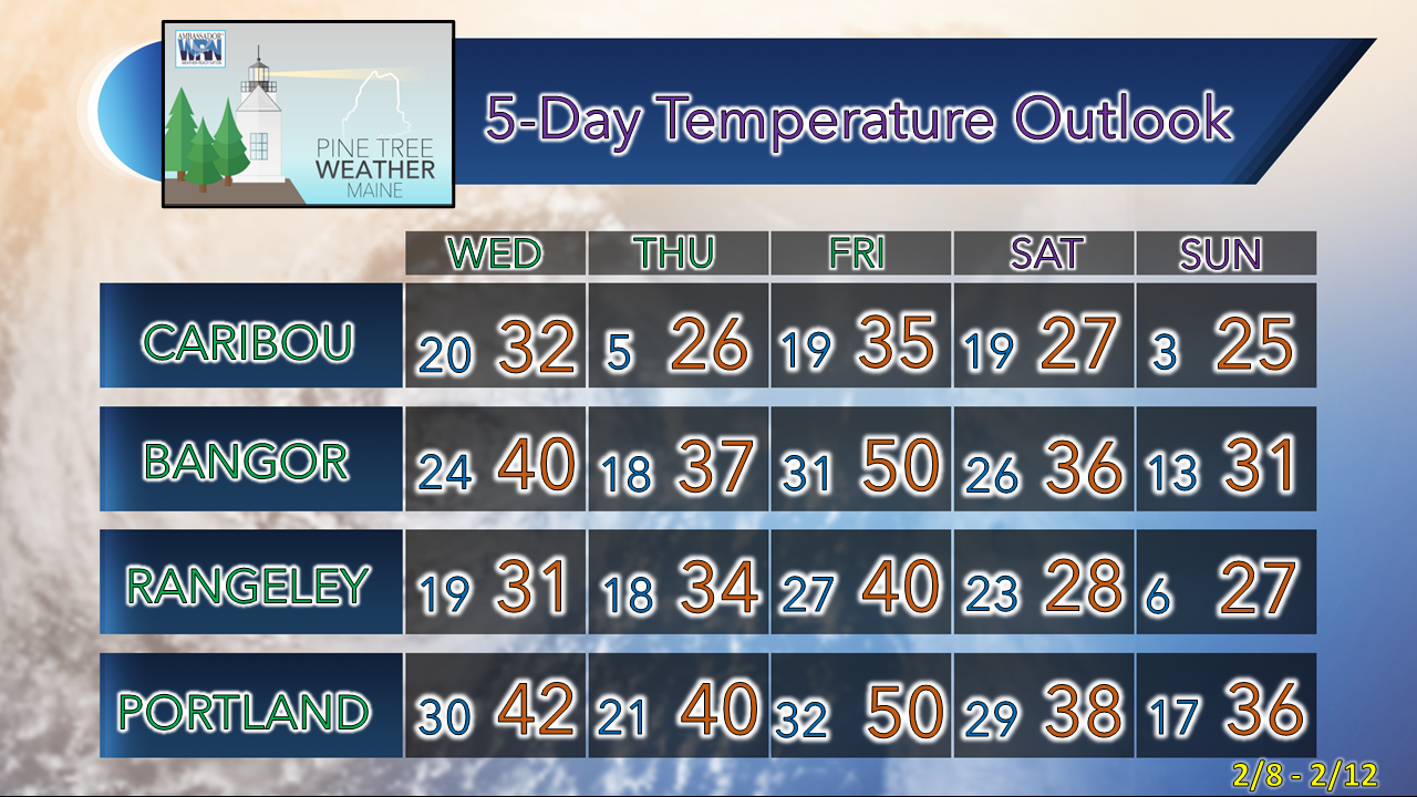
First off, a word of appreciation to my financial contributors, and especially my Patreon monthly donors who are the foundation for my yearly budget. While I do the work, you folks keep me working by helping me pay the bills for the website, data sources, and other materials I need to do this as best as possible. I am forever grateful for this opportunity to give back to the area in a unique way. Thank you!

Pattern outlook through Sunday

Picture
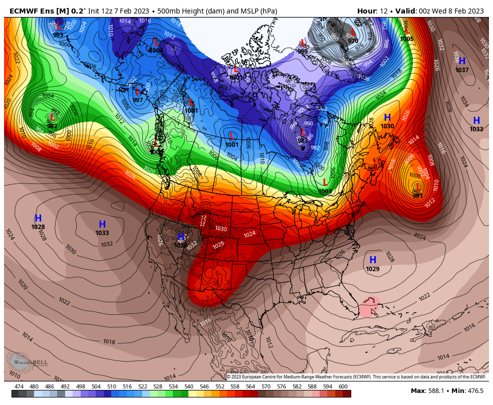
The brutal cold stays bottled up in the north for now. The popular question I have been asked over the past couple of days is, "Is that going to happen again?!". I am not into meteorological tarot cards and 8-ball fortune tellers, so I can't say no. The stratospheric polar vortex will unload at some point somewhere. That is a game of Russian roulette as far as who gets it, and just how deep a cold it may deliver. The longer it takes, the less impactful as the hemisphere gradually warms. 

The pattern is a couple weak systems Tuesday night and then again Thursday night. We'll go into a more zonal flow next week and that keeps the action to the south to start.

Hit or miss snow showers Tuesday night,
light ice to the south

Picture
Tuesday 7 PM to Wednesday 6 AM - I haven't talked much about this outside of a couple tweets and a Facebook post because there isn't much to talk about here. This loop looks worse that what it is. For most areas, less than a measly tenth of an inch of liquid here brings some snow flakes over most of the state, with trace ice amounts possible along the coastal plain. Some places will have to brush the car off, some won't. Shoveling, if you get that much, is optional as temps warm into the 40s south of Route 2 on Wednesday. 

The main issue here is potential for a few slick spots on the roads overnight, but as you can see, outside of mountain showers, this over by daylight on Wednesday.

A bit more of a mess Thursday into early Friday

Picture
Thursday 2 PM to Friday 1 PM - As far as junk storms go (snow, sleet, freezing rain, rain) this doesn't appear to be too bad. Again, like Tuesday night, this is mainly an overnight affair with the exception of the north that will be dealing with morning snow Friday morning.  The mountains get some snow showers through the afternoon as a cold front works in in the afternoon. 
Picture
The trend of late with ideas is a bit warmer, but my cold air damming senses aren't buying it since this is an overnight event. I can see warm noses aloft bringing in sleet and freezing rain, which is why I am keeping the rough draft of snow amounts down over most of the region. The crown of the state sees the most snow out of this. For the nervous snow lovers, don't worry about liquid here as that comes in at the end, and it may not be much, if any, especially further inland. 

Shoveling may be optional here for the areas south of Route 2 again as you will see below. 

Outlook through the weekend

Temperatures overall run above normal. With the inside runner passing through Thursday night, that puts the state in the warm sector, which along with sun will clean up whatever junk falls on Friday. A cold front passing through Friday afternoon cools us off, and high pressure takes over for the weekend and controls the weather into next week. 
Picture

Picture

Thank you as always for your support!

You may not like the weather, but I hope you like what I do! Please hit the like button
​on Twitter and Facebook, and share!

Financial donations to fund what I do are always appreciated!

Stay updated, stay on alert, and stay safe!

- Mike

​NOTE: The forecast information depicted on this platform is for general information purposes only for the public and is not designed or intended for commercial use. For those seeking pinpoint weather information for business operations, you should use a private sector source. For information about where to find commercial forecasters to assist your business, please message me and I will be happy to help you.

Comments
    Picture

    Mike Haggett
    Kennebunk, ME

    Certified Weather
    Forecaster
    Penn State '21

    American Meteorological Society

    National Weather Association

    Weather-Ready Nation 
    Ambassador
    ​
    ​SKYWARN-CWOP

    Matthew 19:26


    Support
    Pine Tree Weather

    DONATE

    Picture

    Picture

    Picture

    Picture

    Picture

    Picture

    Picture

    Picture

    Picture

    Picture

    Archives

    April 2023
    March 2023
    February 2023
    January 2023
    December 2022
    November 2022
    October 2022
    September 2022
    August 2022
    July 2022
    June 2022
    May 2022
    April 2022
    March 2022
    February 2022
    January 2022
    December 2021
    November 2021
    October 2021
    September 2021
    August 2021
    July 2021
    June 2021
    May 2021
    April 2021
    March 2021
    February 2021
    January 2021
    December 2020
    November 2020
    October 2020
    September 2020
    August 2020
    July 2020
    June 2020
    May 2020
    April 2020
    March 2020
    February 2020
    January 2020
    December 2019
    November 2019
    October 2019
    September 2019
    August 2019
    July 2019
    June 2019
    May 2019
    April 2019
    March 2019
    February 2019
    January 2019
    December 2018
    November 2018
    October 2018
    September 2018
    August 2018
    July 2018
    June 2018
    May 2018
    April 2018
    March 2018
    February 2018
    January 2018
    December 2017
    November 2017
    October 2017

    RSS Feed

Proudly powered by Weebly