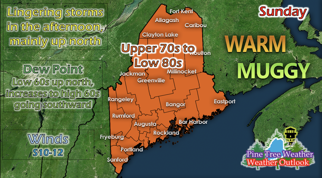
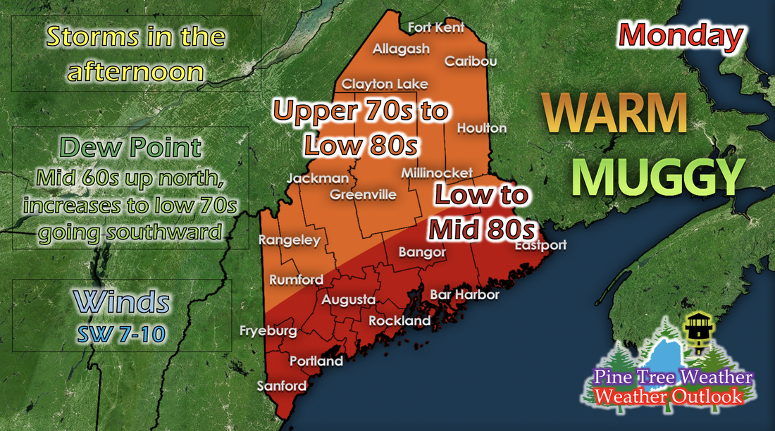
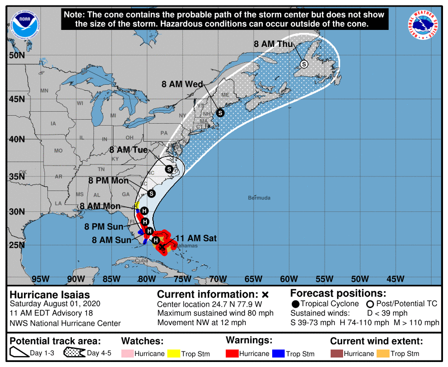
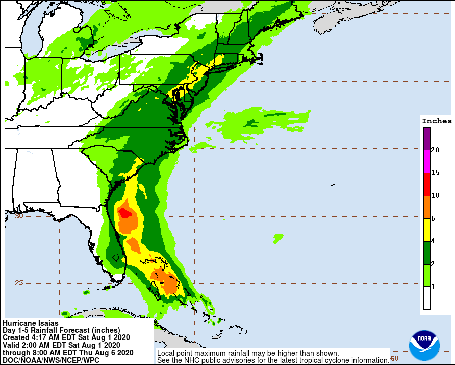
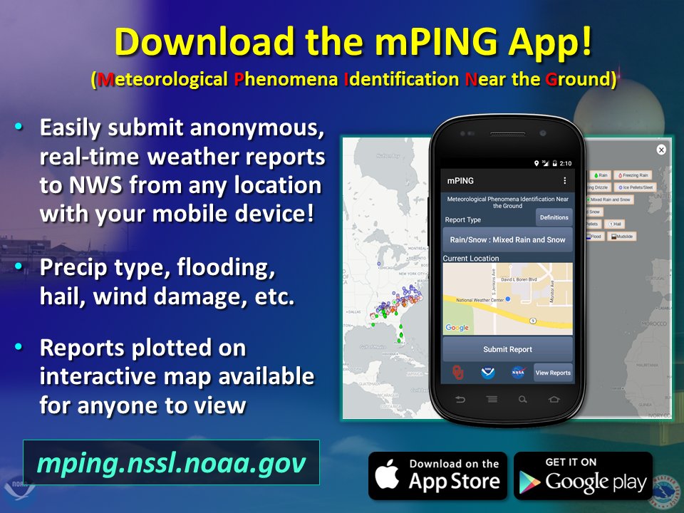
Sunday: Lingering storms and warm temperaturesA low pressure system from the west is coming towards Maine and will begin to impact the state in the mid to late afternoon with scattered showers and small thunderstorms and last through Sunday night and into Monday. Temperatures remain warm, with the state in a general blanket of upper 70s to low 80s. Dew points increase as you go southward; with northern regions being in the low 60s and coastal areas in the high 60s, with some areas in the low 70s. Winds increase in speed as the afternoon storms come in; southerly and ranging from 10 to 12 mph. Monday: Ordinary afternoon storms and slightly warmer temperaturesOrdinary summertime thunderstorms will impact northern and parts of central and western Maine on Monday afternoon as the low pressure system passes the state. Southwesterly winds help to increase temperatures along southern and coastal Maine, bringing them into the low to mid 80s by the afternoon. Elsewhere will be in the upper 70s with some spots in the low 80s. Dew points increase slightly, with the similar north-to-south increasing gradient, except up north will have dew points in the mid 60s, and areas along the coast and down south will be in the low 70s. Tracking Hurricane IsaiasThe National Hurricane Center's cone of uncertainty for Hurricane Isaias has shifted slightly since Alex's discussion from yesterday. By 8 AM Wednesday of this upcoming week, Hurricane Isaias looks to downgrade back to a tropical storm, and looks to nestle itself right on the coast and in the Gulf of Maine. Though it will be downgraded back to a tropical storm, this system has potential to cause flooding, damaging winds, and high surf. The Weather Prediction Center has released an updated version of potential rainfall for Hurricane Isaias as the storm progresses up the East Coast. The main difference to center in on is the increase in amount for Maine since Alex's discussion yesterday. Right where Isaias will nestle itself by 8 AM Wednesday, and up to central Maine, rainfall potential has increased into the 2 to 4 inch category. The rain will be helpful since Maine has seen drought for a while, but there is potential for flooding since Maine hasn't seen rain up to 4 inches in a day or two in a long time. Hurricane and Tropical Weather SafetyOne of the greatest impacts of hurricanes and tropical weather is damage to property. Preparing the outside of your home when an impending storm is approaching will save time and money for you after the storm has passed. Use the graphic above as a checklist of sorts to prepare your home for tropical weather rainfall and damaging winds. Help forecast verification, and stay informed!
For more information, please follow Pine Tree Weather on Facebook and Twitter.
Thank you for supporting this community based weather information source that is funded by your financial contributions. Stay updated, stay on alert, and stay safe! Thank you so much for all of your continued support! This is my Venmo if you'd like to contribute: @Kaitlyn-Lardeo Have a great rest of your weekend! - Kaitlyn |
Mike Haggett
|

