Localized heavy rainfall Thursday night into Friday, pleasant weekend with chance for showers Sunday7/29/2021 Rain arrives Thursday night, breezy conditions through Saturday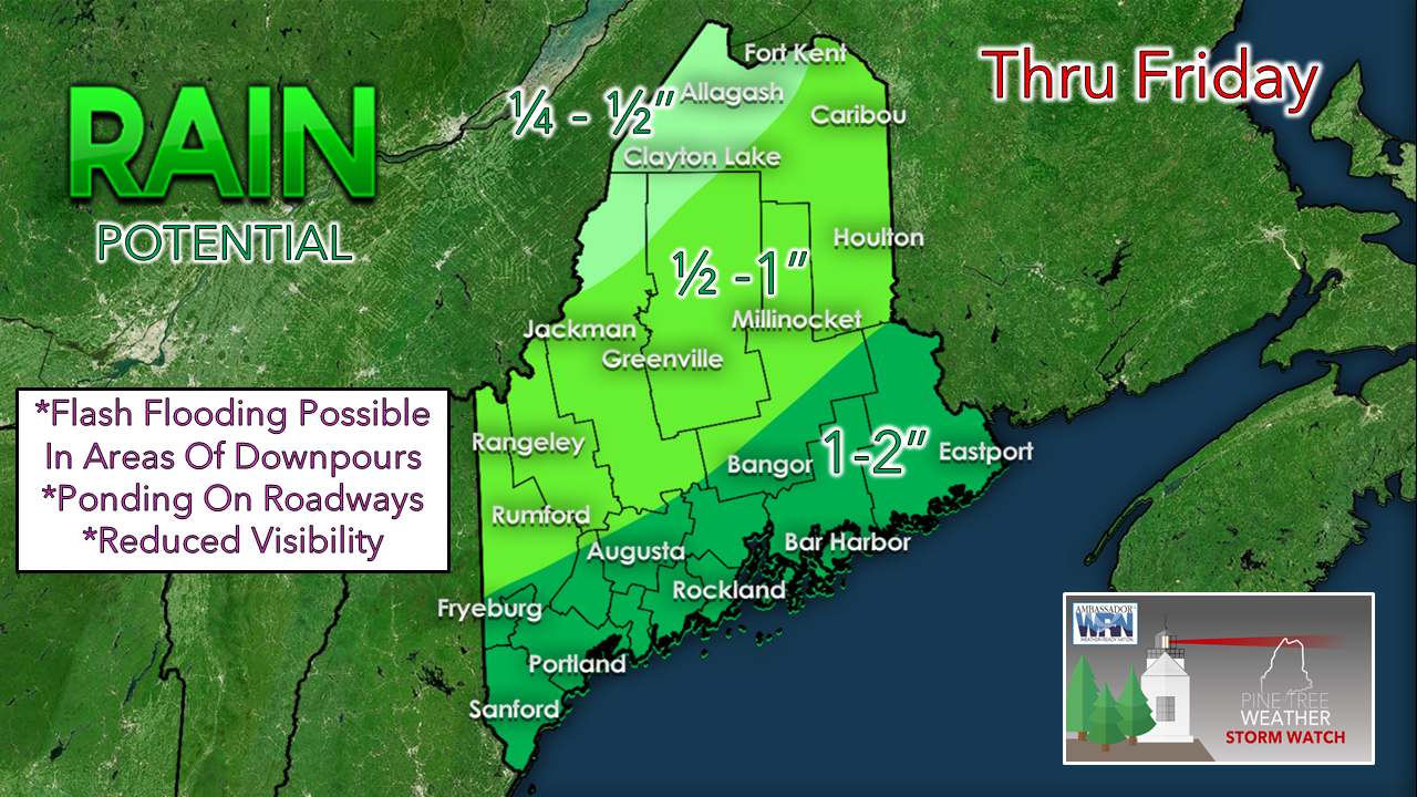 A low-pressure system is expected to arrive on Thursday night, bringing widespread rain through Friday as it spins along the coast. Convection is favorable with this system, meaning that thunderstorms may develop throughout the period. This brings the potential for bouts of heavy rainfall in locations that do see storms develop. Models disagree on exact timing and on which locations will receive the most precipitation. It will likely come down to who sees the most convective activity as well as to what degree the low-pressure system intensifies. The model above suggests a decent soaking for many, with potential for over one inch of rainfall through Friday evening. There is a chance for 2"+ in areas that receive strong thunderstorms. Precipitation should taper off by Friday afternoon as drier air is advected into the region. 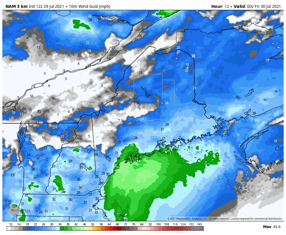 Breezy conditions are likely beginning Thursday night and lasting through Saturday. 20-30 mph wind gusts are possible throughout this period as the northwesterly flow allows for sufficient mixing in the lower levels in the atmosphere. Gusts exceeding 30 mph are also possible during this time. Be sure to secure any loose outdoor objects. 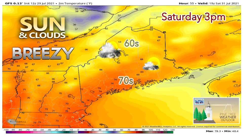 Temperatures on Saturday appear to be below-average for this time of year, with highs only reaching the 60s in the north and the low to mid 70s in the south. Winds gusts of 20-30 mph will make for a breezy, seasonably cool day. This northwest flow will likely carry in dry air from Canada, keeping the humidity at bay. Skies will be partly to mostly sunny with a slight chance of a passing shower or two in northern areas. Showers return Sunday evening lasting through Monday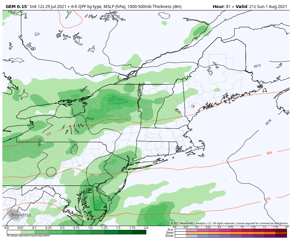 The chance for precipitation comes again on Sunday evening as an upper-level disturbance approaches the region. It is a bit early to talk about specific locations and rainfall amounts, but the potential is there for localized areas of significant rainfall. Downpours are possible in areas where thunderstorms are able to develop, but the precipitation otherwise appears showery in nature. This model suggests that most of the rainfall will be confined to southern and Downeast areas, and that the bulk of it will occur overnight on Sunday. Be sure to check back for updates in the coming days to get a better idea on timing and on how much rain you should expect to receive. Drought update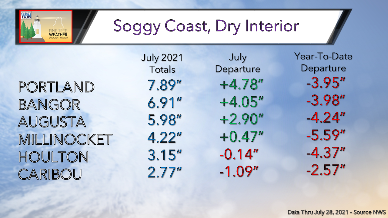 With all of the rain we've received recently, especially in the past month, it is interesting to assess where we stand with drought conditions. While the coast has been enjoying some much-needed rainfall, the interior remains very dry. The coast, however, still remains in an overall year-to-date deficit despite the very wet July, highlighting the extremely dry winter and spring experienced statewide that has proven quite difficult to overcome. These deficits near the coast have improved greatly since the end of June, however, with certain areas seeing close to a 6" change. 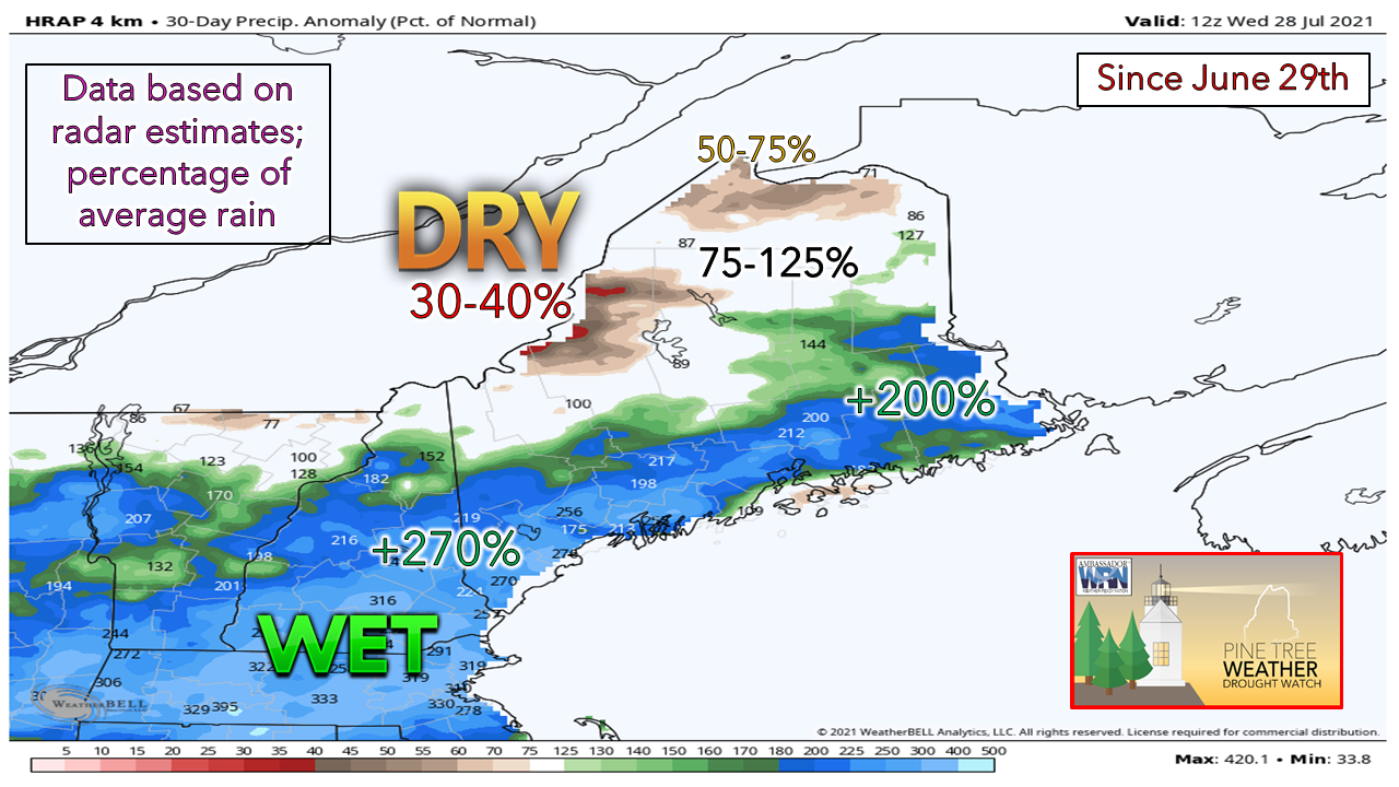 This graphic further emphasizes the extremely soggy July for the coast, and the continuing dry conditions for the mountains and north. Since the end of June, the coast and nearby locations have received well over 200% of the average monthly rainfall amount. Unfortunately, for the western mountains and areas far north, the ongoing dryness has persisted through July. There has been rain here and there, but not enough to put a noticeable dent in the drought. 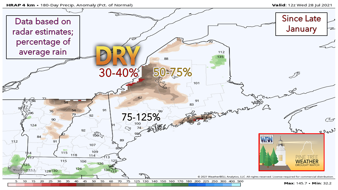 Looking back over the past 6 months, we can see that dry conditions are less of a concern for the south and eastern areas, as the total rainfall has improved to near-normal. There is an outlier along the coast near Bar Harbor where the 6-month average is drier than neighboring locations. Once again, the mountains stand out as the driest region of the state, with the worst areas only receiving 30-40% of the average rainfall amount for the 180-day period. 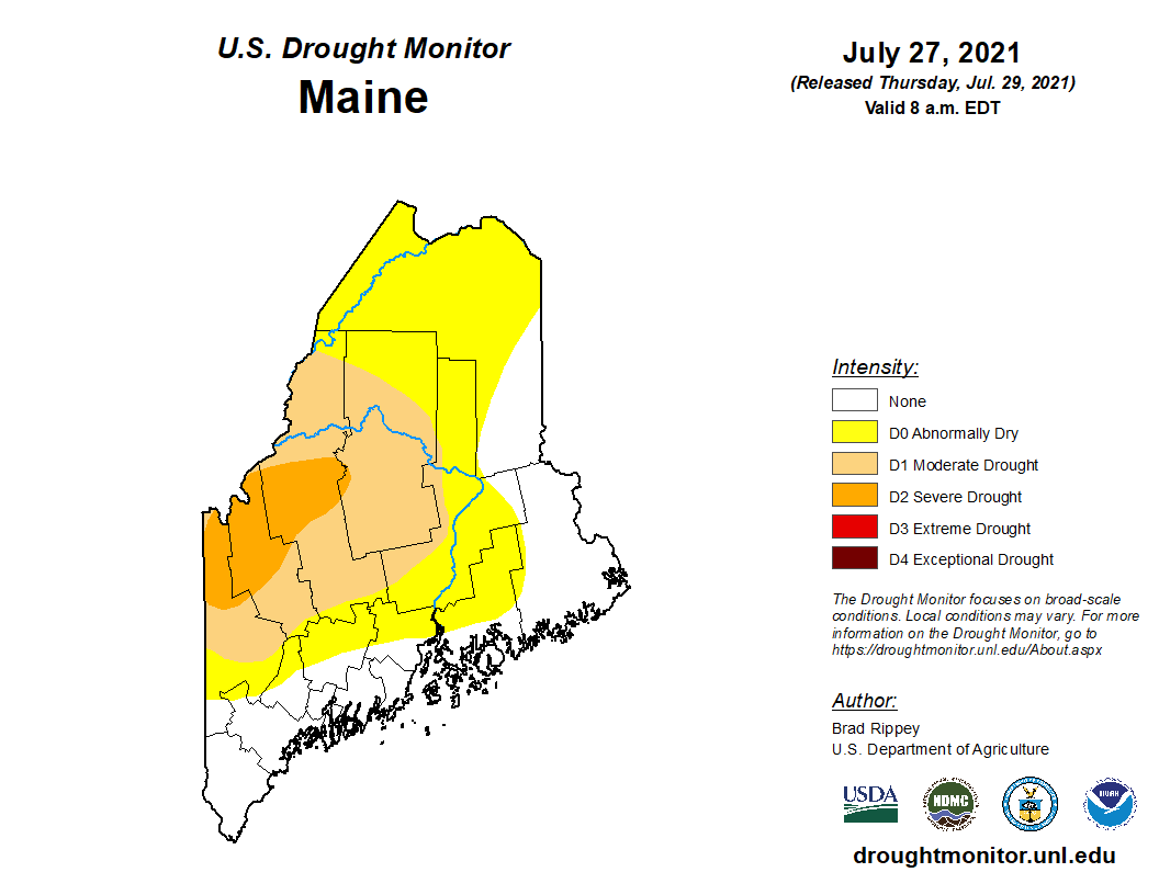 The latest U.S. Drought Monitor update displays varying levels of drought throughout the state of Maine. While the coast is no longer experiencing dryness thanks to a very wet July, the interior has not been as lucky. Portions of Oxford, Franklin, and Somerset counties are under Severe Drought conditions, indicated by the darker orange color. The lighter orange color extending outwards from this area indicates Moderate Drought. Locations shaded yellow are not yet experiencing drought but are at level D0 - Abnormally Dry. 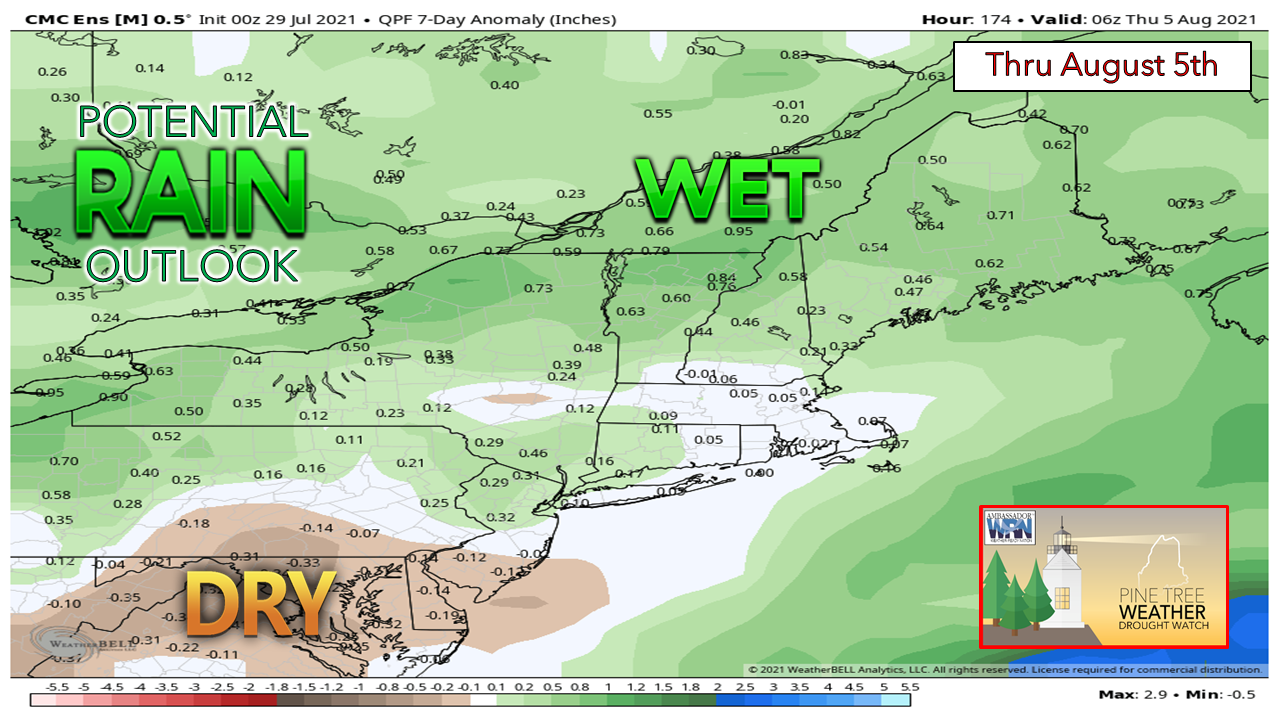 Looking forward into next week, models are trending above-average in terms of rainfall for the entire state. With the rain expected to fall Thursday into Friday along with the chance for unsettled, showery conditions beginning Sunday evening, there will be a few chances to improve the drought conditions in the short term. Precipitation will certainly be welcomed throughout interior Maine as these areas continue to try to overcome the rainfall deficits. Are you experiencing issues caused by the drought with your well water? Please report your findings to the Maine Emergency Management Agency via their anonymous online survey. This information is vital to authorities and for scientific study to better understand the impacts in your area. Flash flooding can escalate quickly Whether you’re on the road or camping, will you be ready for sudden flash flooding? Make sure to enable Wireless Emergency Alerts on your phone. If flooding occurs while you’re outdoors, immediately get to higher ground, and NEVER enter flood waters in a vehicle or on foot. weather.gov/safety/flood Temperature outlook through WednesdayHigh temperatures appear seasonably cool through the week with overnight lows dipping into the 40s in the north and mountains. Areas further south will likely be in the in low to mid 70s with a warming trend possible near the end of the period. 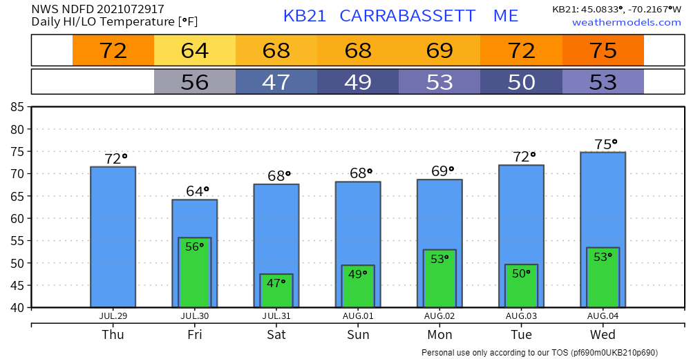 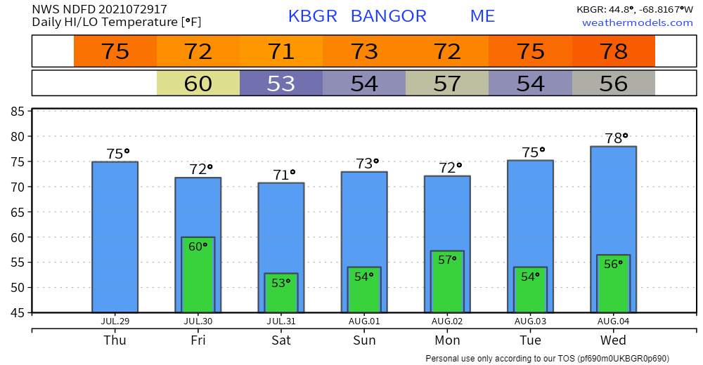 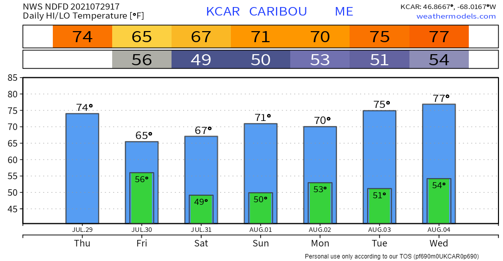 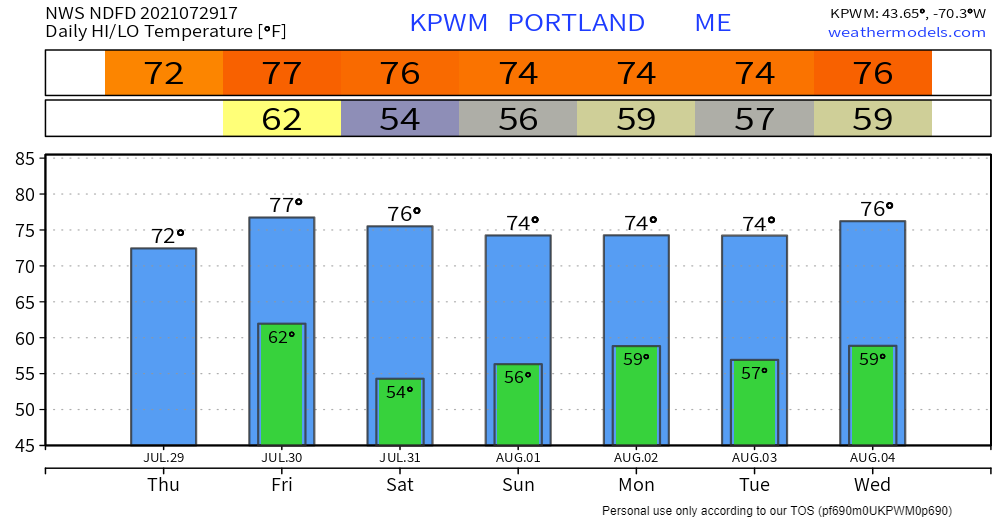 Be prepared to receive alerts and stay updated!
For more information in between posts, please follow Pine Tree Weather on Facebook and Twitter.
Thank you for supporting this community-based weather information source which operates by reader supported financial contributions. Stay updated, stay on alert, and stay safe! |

Mike Haggett
|