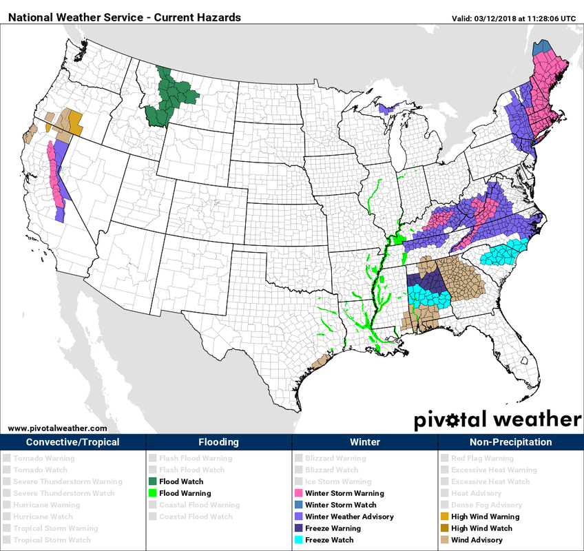
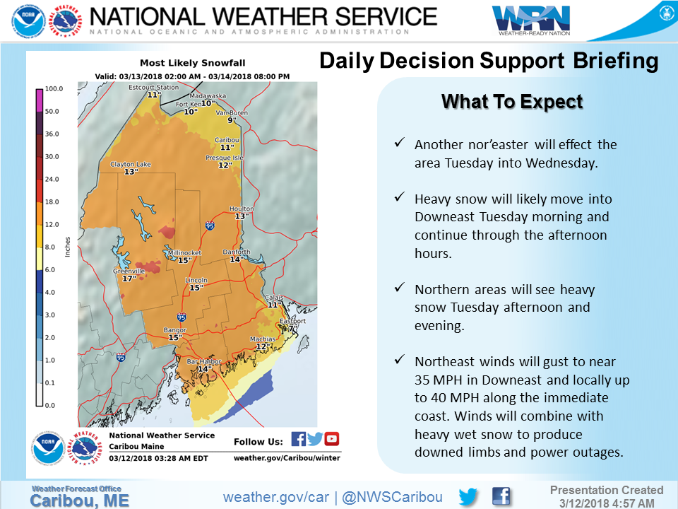
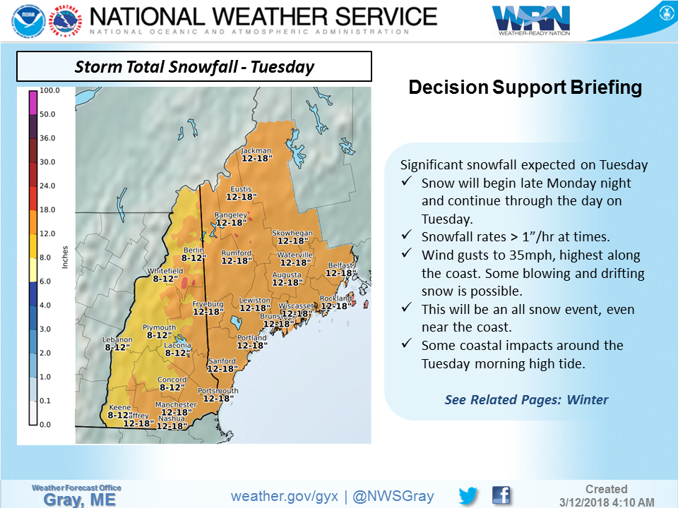
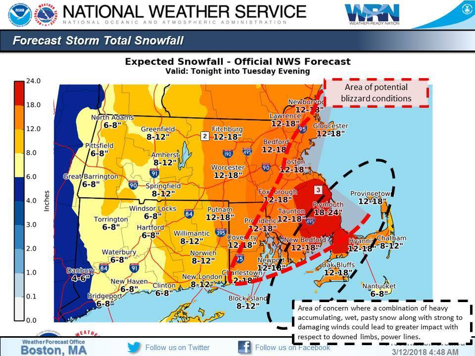
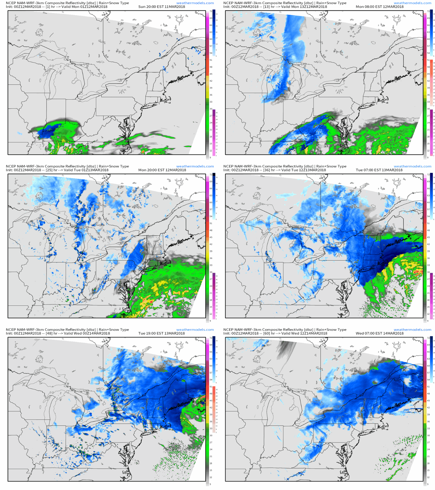
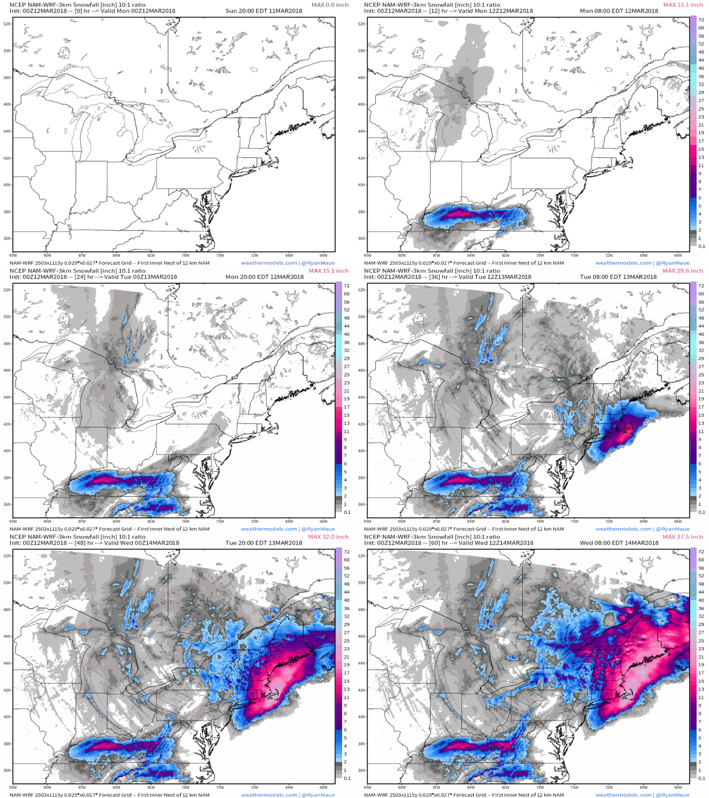
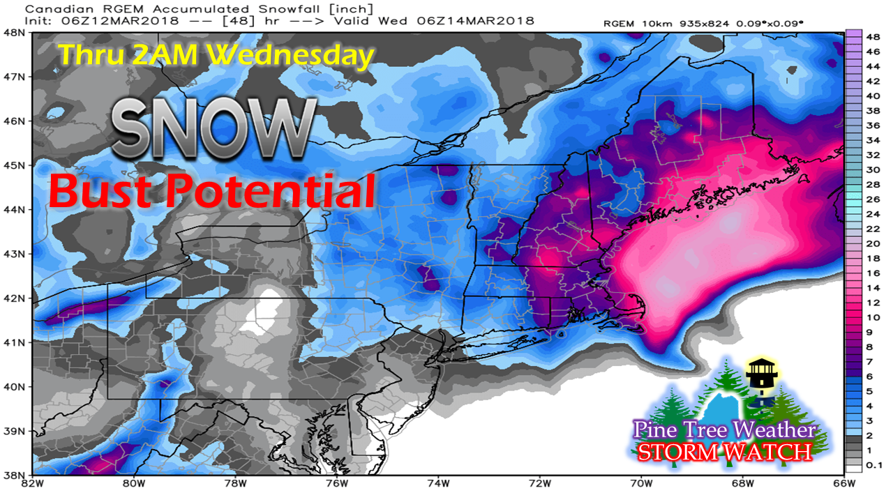
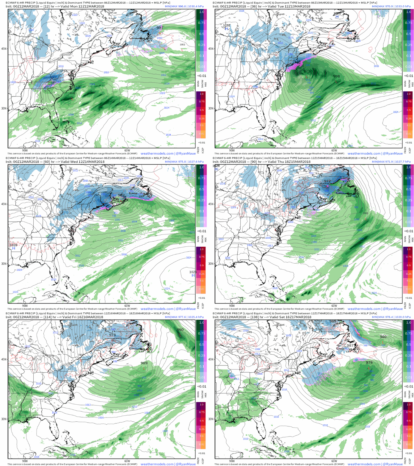
Winter Storm Warning for most of New EnglandLooking at the watch/warning map as of 7:30 AM Monday morning, pink covers most of the six state region ahead of the third NorEaster to impact the area since the start of March. Time will tell if Northern Aroostook will get in on the fun, as their criteria for a winter storm warning is 10" over a 24 hour period, which will be a close call. Gale warnings are posted for the bays, storm warnings are posted for the Gulf of Maine. The forecast remains to be a tricky one. Headlines from the regional weather officesEastern Maine continues to be an area of concern for me as far as high end jackpot snowfall is that for Bar Harbor, Bangor, Millinocket, Danforth to Eastport with this storm. It would not surprise me to see 20+" come out of this, with locally higher amounts. Projected storm track has the low hitting the nose of Nova Scotia before tracking into New Brunswick. Given that track, much of the DownEast coast appears to have little coastal front influence, with the possible exception of the Lubec / Eastport / Campobello region. For western and southern Maine along with New Hampshire, the ski hills will make out like bandits again. Amounts exceeding 18" are dependent on mesoscale banding. Locally higher amounts above 20" are entirely possible here as well. For my southern New England friends and followers, this looks paralyzing and big. It's rare we see the south shore, Cape Cod and Martha's Vineyard get hammered with heavy snow like this. This goes to prove how deep the cold is associated with this event. Much of eastern Massachusetts could see an epic blizzard out of this. It's all coming together...Simulated radar from the NAM model run at 2 AM Monday does a nice job showing storm formation along with the inverted trough coming together. It's that inverted trough that throws the wrench into this forecast. Models have struggled with this, and they continue to. This loop also shows that snow and snow showers will continue for Maine into Wednesday. The cut off here is 7 AM and there is still more snow to fall. And it appears that it will dump...Another loop of the NAM model at 2 AM shows the big blast of snow. Once it gets started, heavy accumulations appear to start soon thereafter. The Tuesday morning commute for southern New England is a non-starter. For western and southern Maine and all of New Hampshire, you may get to your destination, but getting home could be an adventure. For eastern Maine, the morning commute may be a bit greasy, but manageable. Getting home there is also a problem. Northern Maine may wonder what the fuss is all about to the neighbors to the south, as snow fall does not appear to amp up there until Tuesday evening. Snow fall at 1-2" or more per hour are likely. Add wind speeds at 20-40+ mph, snow will drift and blow around. This could be a borderline blizzard for the coastal plain of Maine yet again. Snow plows may have a rough time keeping the roads clear at times. Plan accordingly. Why this forecast is tricky...I saw this idea this morning and it raised a red flag for me. This is the Canadian RGEM model idea for snowfall in its 2 AM run this morning. I will make no bones about it... this is certainly an outlier, meaning its idea is differing from other guidance. Why this is rather peculiar is the fact this model handles snow events very well. It paints a different picture. The consistency in guidance is that Eastern Maine gets lit up, but to the west and south, guidance has been inconsistent somewhat. At the time of this post, there is still a decent spread with individual ensembles in the European model. Whenever there is discrepancy with key pieces of data, it brings in some level of doubt. I am not saying the RGEM idea is right, but I am noting that there is room for error here which could change the outcome. From NWS Gray's Area Forecast discussion at 4:12 AM Monday morning: A note about the storm track. While deterministic models seemed to make an eastward shift, their respective ensembles still showed wide variation in surface low positions, and at least in the case of the ECMWF the operational model was on the southern side of the ensemble cluster. The snowfall forecast is definitely not a final answer, but more the most likely outcome based on the current guidance available. Definitely expect to have to make some shifts to account for track variation, and mesoscale banding. One question still definitely not resolved is whether banding features with extreme snowfall rates will remain off shore or pivot into coastal Maine and New Hampshire. At this point there`s no clear answer to the question. Will have to wait for the storm to take better shape and give mesoscale models a better chance to resolve these features. There is your room for error. Snow continues for some areas through late weekAs with the storm from last week, this storm is also stuck in a similar pattern. Upper level energy gets trapped over southeastern Quebec and spins around and around for days. Energy gets siphoned off into other areas of low pressure which brings off and on snow showers to the north and mountains through the remainder of the week. A clipper system drops down from Ontario on Saturday, and with a system brewing over the southeast, that will have to be watched for another potential storm early next week. Keep yourselves updated!As with any heavy snow event, there are risks for power outages. Make sure you have enough supplies for a couple of days in case of power loss. Gas up your vehicles. If you don't have to travel, stay home. If you do have to travel, allow for plenty of extra time and be prepared in case you get stuck or end up off the road. Keep a blanket, have snacks and water in your vehicle in case you get stranded. Stay at a hotel if you must to cut down on commute distance.
For the latest bulletins and forecast changes, please stay in touch with NWS Caribou for northern and eastern Maine, NWS Gray for New Hampshire western and southern Maine, and NWS Taunton for most of southern New England. Feel free to follow on Twitter @WesternMEwx for quick hits of information. For those following on the Pine Tree Weather Facebook page, click on the Following tab on the page, then click on See First to get the latest information. - Mike |
Mike Haggett
|

