
Rain beginning tonight for the long weekend ahead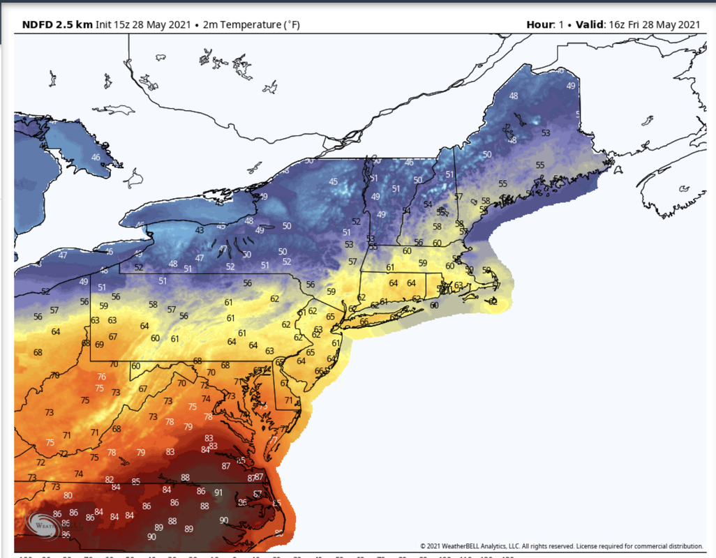 Temperatures for Friday climb steadily and reach into the mid 50's by midday and continue to climb into the low 60' s this afternoon. These temperatures are seasonally much cooler than usual due to a very dry Canadian air mass across the region and are likely to stay low and within this same range throughout this upcoming holiday weekend. Mostly sunny skies so far this Friday afternoon with minimal cloud coverage. However, it is likely that cloud coverage will increase later today as a low pressure system and associated warm front creep into the area. 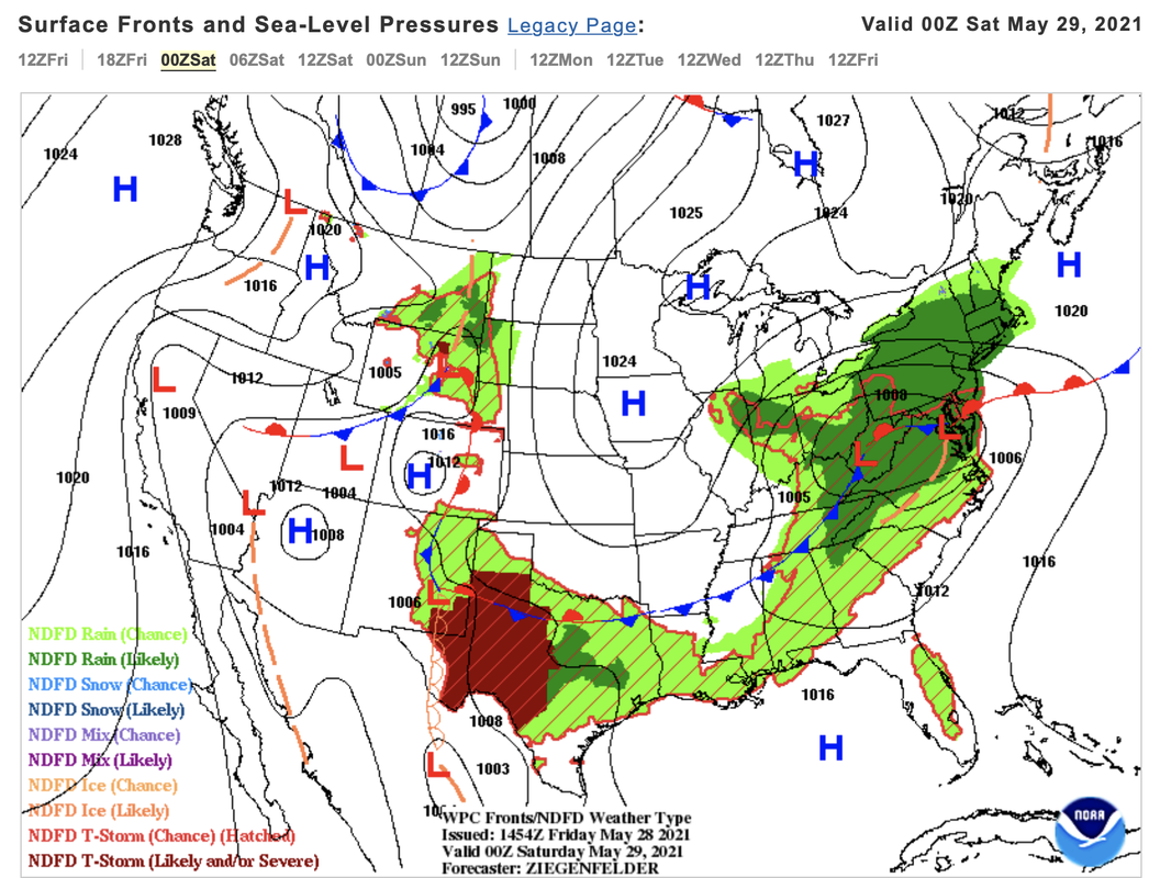 Friday night models show increased likelihood of precipitation for the southern region of Maine. The low pressure system moving in from the western United States is the cause of this precipitation and is projected to continue its trajectory into the northeast throughout the weekend. Therefore, it is likely that rain will be present in the southern and western region of Maine for Saturday, Sunday, and Monday. While chances of rain are become present for the rest of the state late on Sunday and for most of Monday. Precipitation across Maine most of the weekend and Monday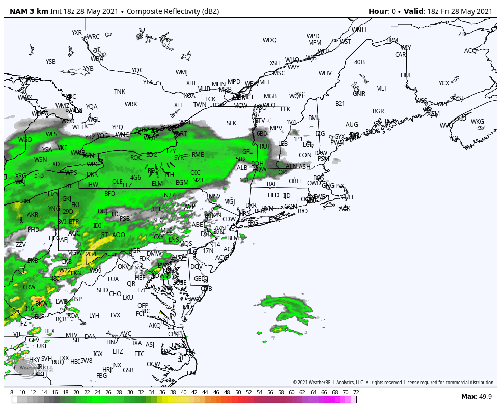 A storm system passes by late Friday and into early Saturday morning bringing rain showers into the entire southern portion of Maine. As Saturday continues rain will most likely persist and die out by the evening as the low pressure system moves offshore leaving overnight Saturday with little to no precipitation. Scattered rain moves back into the south of the state again by the afternoon Sunday as a second low pressure system comes into the area. The rest of the day on Sunday maintains rainy conditions and scattered showers begin to reach into the northern region Sunday night. Models for Monday predict that this rain will ramp up overnight and the a large portion of the state will experience a day of clouds and rain this Memorial Day. The reason for this pattern is the low pressure system that is likely to track across the northeast this weekend. A change in the pattern for Tuesday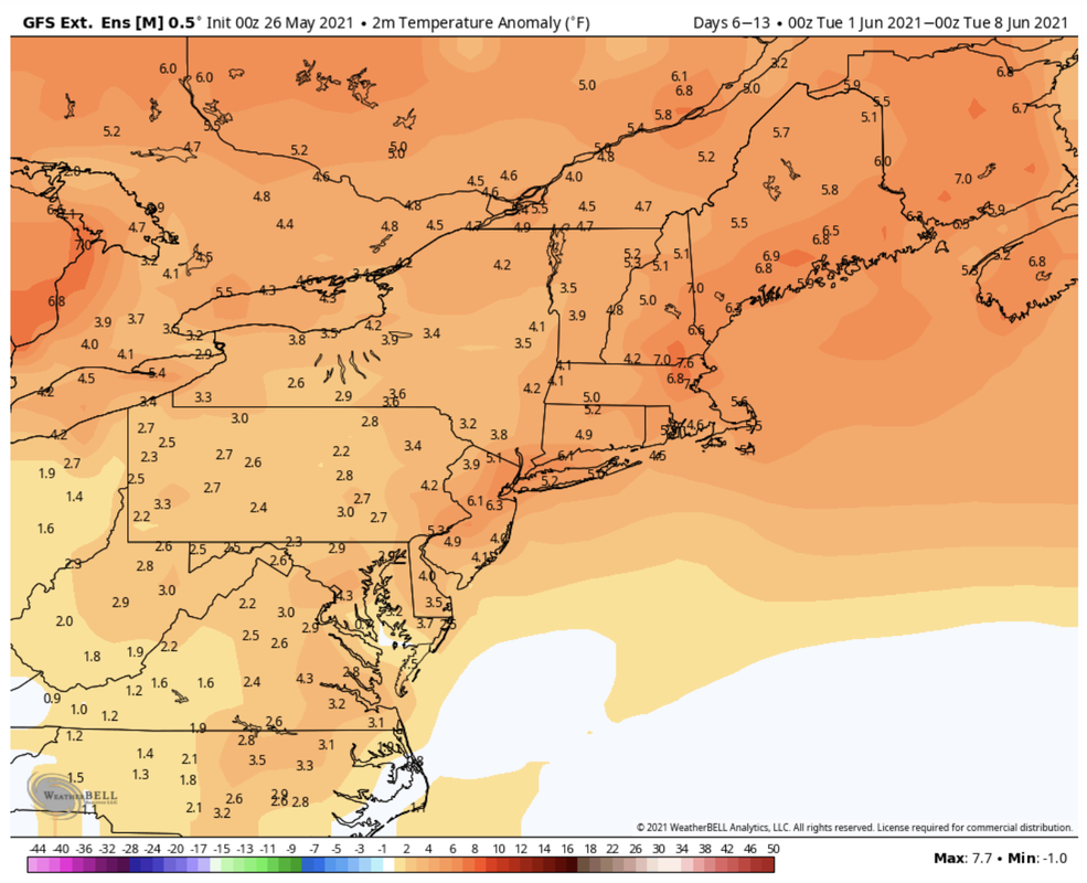 As the low pressure systems that tracked across the northeast this weekend finally move off the coast by Tuesday the weather pattern changes very quickly for Maine. The rainy conditions from this weekend die down by Tuesday morning making way for clearer skies and warmer temperatures. Temperatures are predicted to rise starting this upcoming Tuesday and continue to rise to next Tuesday by upwards of 6 degrees Fahrenheit. We can expect warmer weather in the upcoming week compared to the seasonally cooler temperatures that are likely to persist in the area over this weekend. 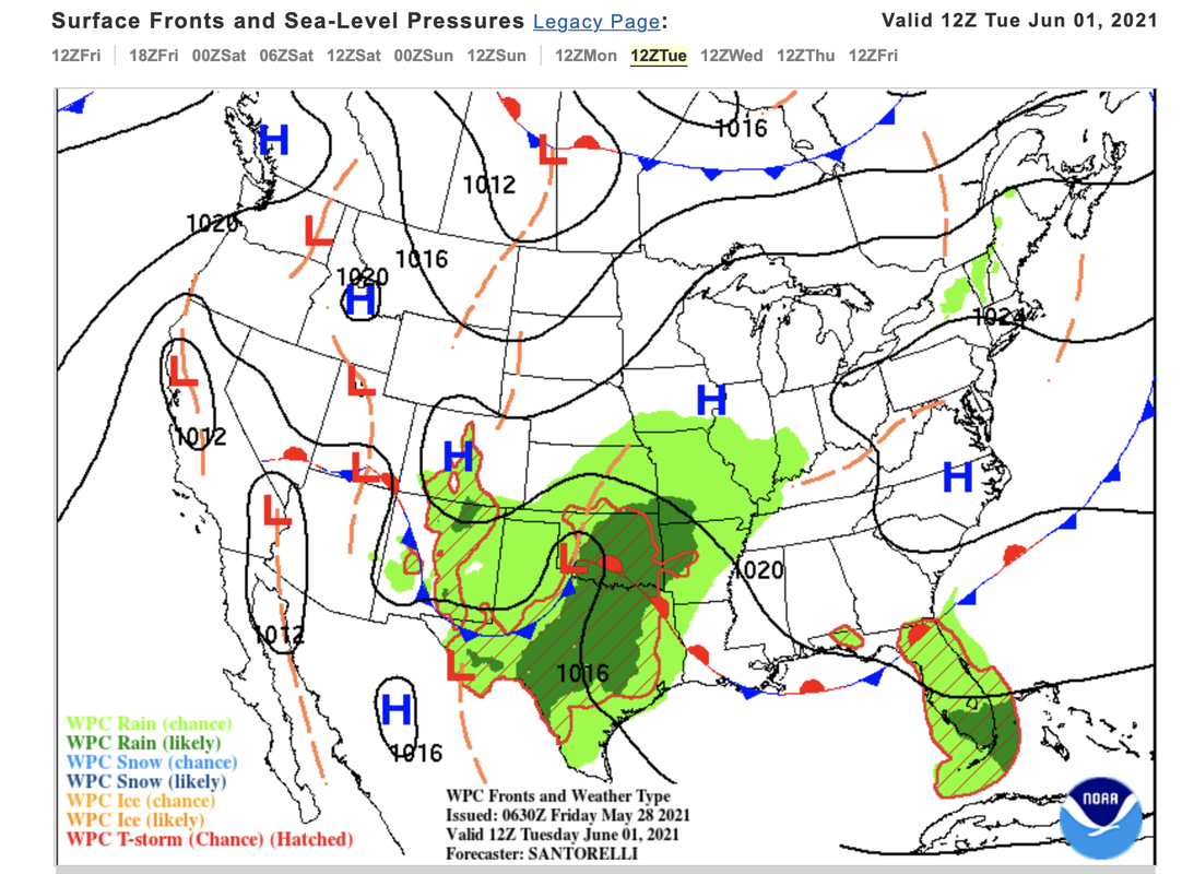 The low pressure from this weekend is no longer present in the northeast Tuesday morning and a new high pressure system is moving into the area, which means clearer skies likely for Tuesday and Wednesday. Your observations are SO important Rainy weather this weekend is really important for gathering information for future weather and conditions in the upcoming months. Downloading the app now and becoming familiar with how it works now can be very beneficial so that you can be prepared, and help us get critical information quickly for the upcoming severe weather season. Timing is everything! Humidity outlook for this weekendFriday dew points are very low in the low 20's in the interior regions giving a relative humidity of only 20%. However, this dry air is not likely to last long as rain moves in. Throughout this weekend relative humidity bounces back and fourth. As the rain comes and goes for Maine so does the humidity. You can expect the air to be much more humid during the weekend when rain is the most prevalent. These times include early Saturday, and Sunday into Monday. Relativity humidity percentages are projected to reach into the mid 80's when rain is heavy. A lull in this high relative humidity occurs as rainfall decreases Saturday afternoon and night. 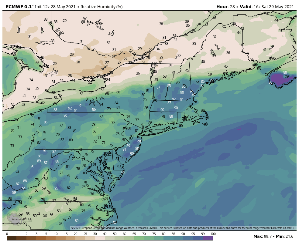 Be prepared to receive alerts and stay updated!BE PREPARED WITH A NOAA Weather Radio. For $20-$40, it could provide vital information to you when you need it. The weather bands are standard on most public safety scanners, and newer scanner models. Weather radios can be programmed for auto alert. Click here for more information.  ► ► For the latest official forecasts, bulletins, and advisories, please check in with the National Weather Service in Gray for western and southern areas, or Caribou for northern and eastern parts of Maine  For more information in between posts, please follow Pine Tree Weather on Facebook and Twitter.
Thank you for supporting this community-based weather information source which operates by reader supported financial contributions. Stay updated, stay on alert, and stay safe! Thank you for your support! |

Mike Haggett
|


