
Cold air on the way in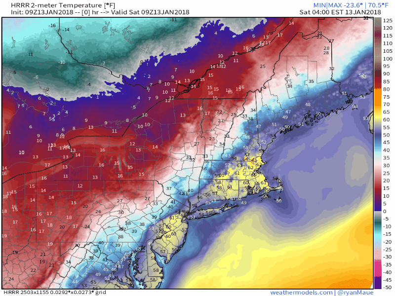 The cold air is a running a bit behind schedule in arrival, but it is well on the way. Many areas registered record daily rainfall totals on Friday, and all of that water is going to freeze up statewide as the day progresses. The results will be icy roads everywhere by mid-afternoon. 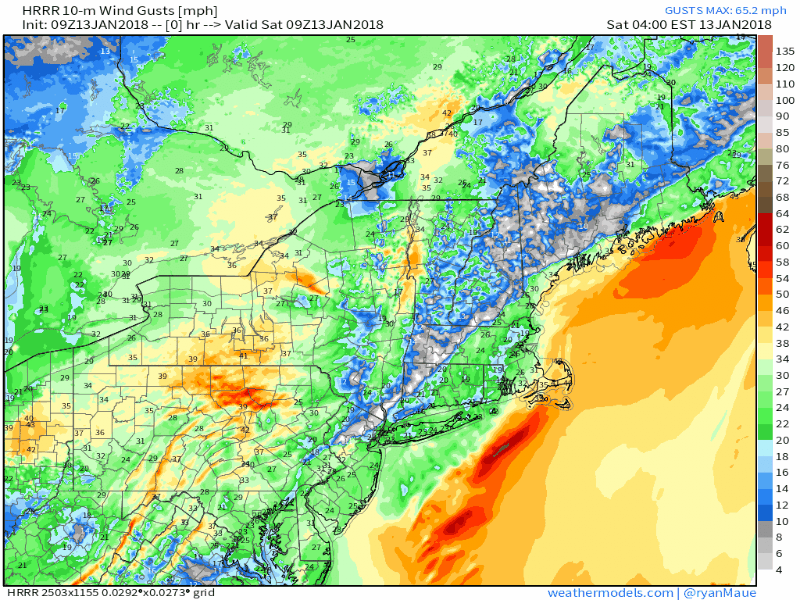 The freeze up will have help from gusty winds from the northwest as intensifying low pressure races to the northeast along the stalled front. Gusts in the 20-30 mph range are likely statewide, with 40 mph gusts likely for the shorelines and the islands. 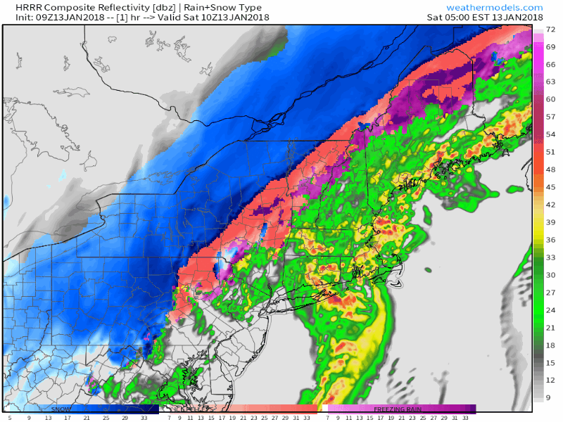 With the cold air being a bit late on arrival in conjunction with the storm moving rapidly to the northeast, the amount of frozen precipitation types will remain confined in the interior. The impact of freezing rain and sleet appear minimal over all. While that is the good news, the rapid freeze up is still going to ice everything up anyway, given the amount of water that has fallen over the state. Precipitation ends statewide by early afternoon.  Winter storm warnings have been posted for Aroostook County, where snowfall totals are likely to end up with a foot in areas. The snow will be heavy at times, falling well over an inch per this morning, ending by early afternoon. Ice to hang around for a week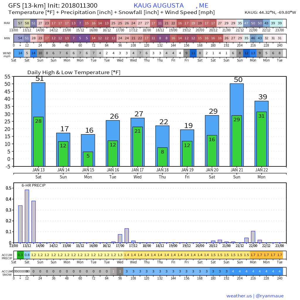 Using the Capital District through the eyes of the GFS model as an example, it may be next Sunday before the thermometer rises above 32° again. The state has another threat for snow in the middle part of the week with a weak low pressure system passing by to the south. Models are also toying with an idea of bigger impact storm possible for the second half of the week, which this graphic does not show. And about that late week potential snow maker...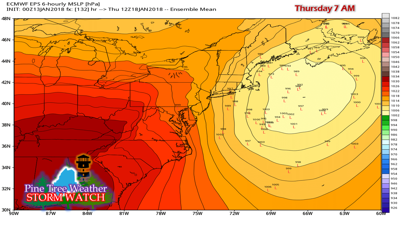 The European ensemble members are all over the place, so that idea is not carved into stone just yet. That said, there are some strong ideas with some of the ensemble members, so it is certainly something to stay tuned for.
I will update on the Tuesday/Wednesday snow threat, along with this potential in the coming days. - Mike |

Mike Haggett
|


