Mostly cloudy skies during the day Thursday with showers along the coast and DownEast during the morning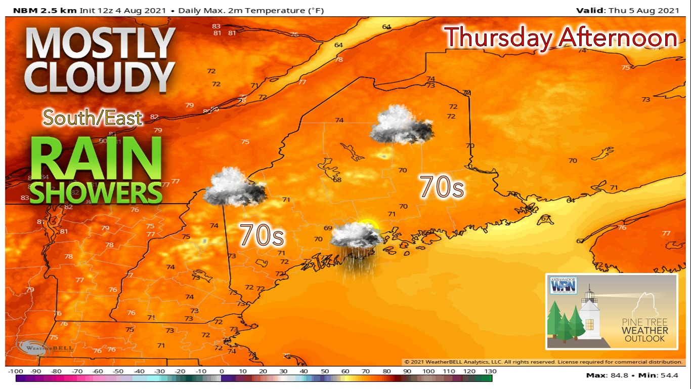 Thursday has been shaping up to be a rather tricky forecast thanks to lack of model agreement as well as the area of precipitation moving our way. Friday shapes up to be a better day as high pressure builds overhead briefly. A return to the heat and humidity is in store for the weekend with another chance of showers and storms then. A low pressure system continues to ride up the coast along a stationary front situated off the coast of the state. This low likely brings showers into the region beginning overnight Wednesday into Thursday Morning. 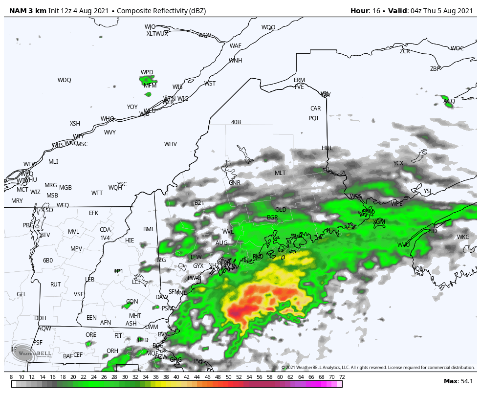 The first round of showers that likely moves through during the early morning hours Thursday appears to be a bigger impact for DownEast areas, as rain hugs the coastline through southern areas during this time. The main precipitation event moves onshore during the morning hours on Thursday. The main concern with this at the moment appears to the be the small area of precipitation associated with it along with the lack of model agreement. With the models not coming to similar solutions with this system, the difference in track of 30 miles likely will make a big difference in rainfall totals by the evening hours Thursday. 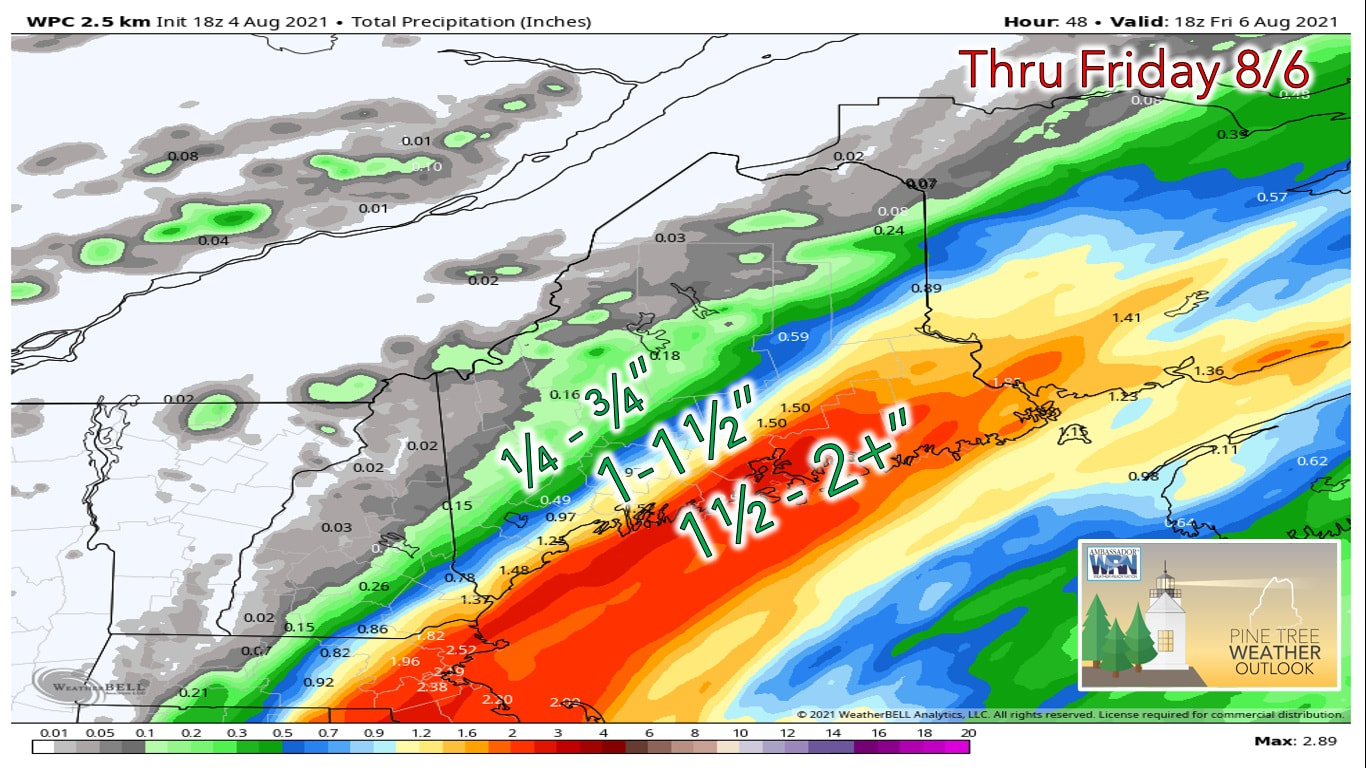 At this point the steadiest rain appears to remain along the coastline in southern areas, with a wider swath of higher amounts likely over eastern areas of the state. Places that see heavier downpours during the morning and afternoon Thursday will likely see between 1 and 2" of rain from this system. I will stress once again that the models are still showing some uncertainty with this system, and so the heavier rainfall amounts could easily shift west or east depending on where the heavier bans of rain setup. The mountains and far northern areas of the state miss out on precipitation from this event, which are the areas in the state that are still dealing with moderate drought conditions. High temperatures on Thursday likely climb into the lower 70s over DownEast and the southern coastal plain, with temperatures climbing into the mid and upper 70s further north and west through the mountains where the precipitation holds off. A nicer day on the way for Friday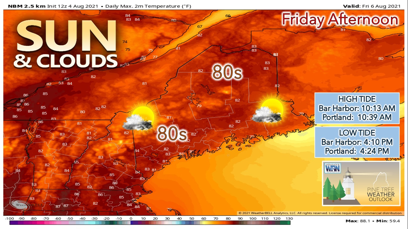 Friday looks to be a nicer day with high pressure briefly taking control of our weather. As the high pressure moves overhead, then off to the east by the afternoon, there's likely a better chance of seeing more clouds heading into the afternoon on Friday. Overall it looks to be a nicer day with high temperatures climbing into the upper 70s in the mountains, to lower 80s through the coastal plain. Spots along the midcoast will likely stay cooler during the day on Friday as winds shift into the southwest during the day on Friday. 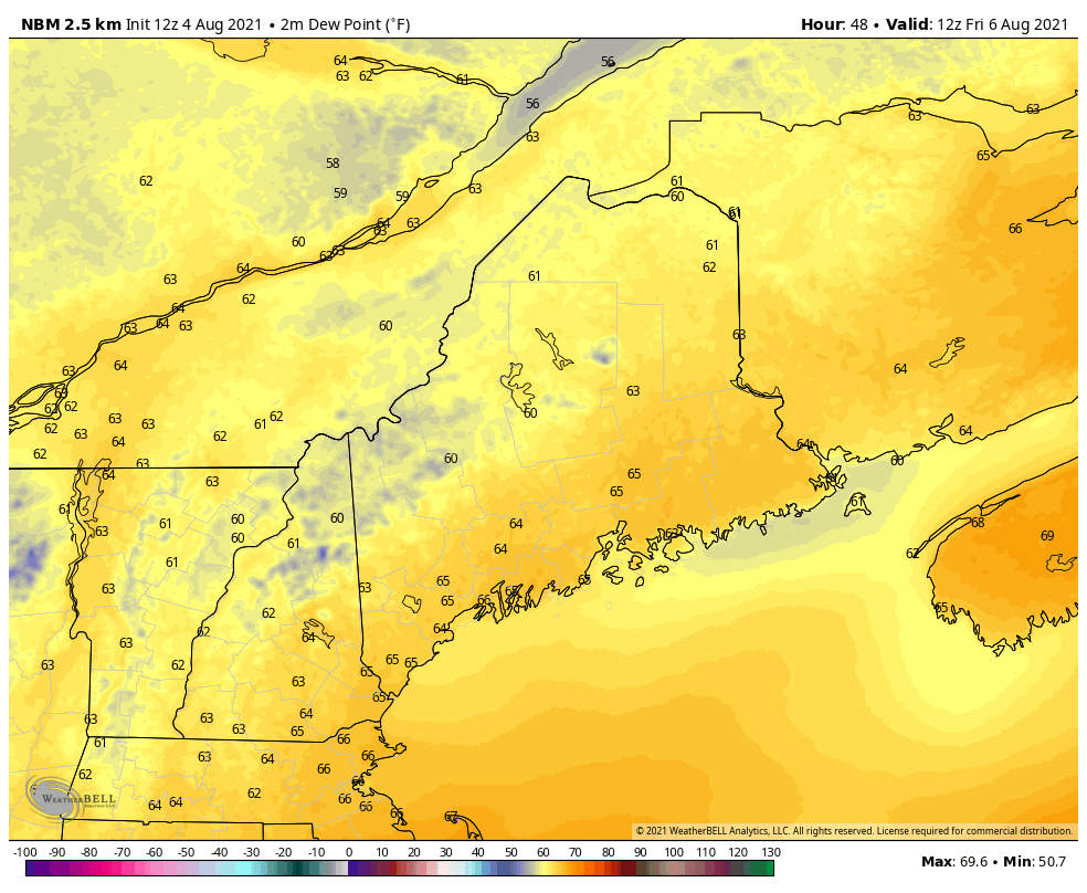 Most people will notice the change in air mass heading into the weekend as southwesterly winds likely bring a more humid air mass into our region. Friday afternoon dew points will likely be in the lower to mid 60s, which is starting to creep into the uncomfortable territory. By Saturday southern and central parts of the state will likely see dew points in the mid and upper 60s. Northern parts of the state hang on to dew points closer to the 60 degree mark. Sunday appears to be the stickiest of the two weekend days with dew points for southern and central Maine climbing into the upper 60s. A warmer weekend, but at the expense of shower chances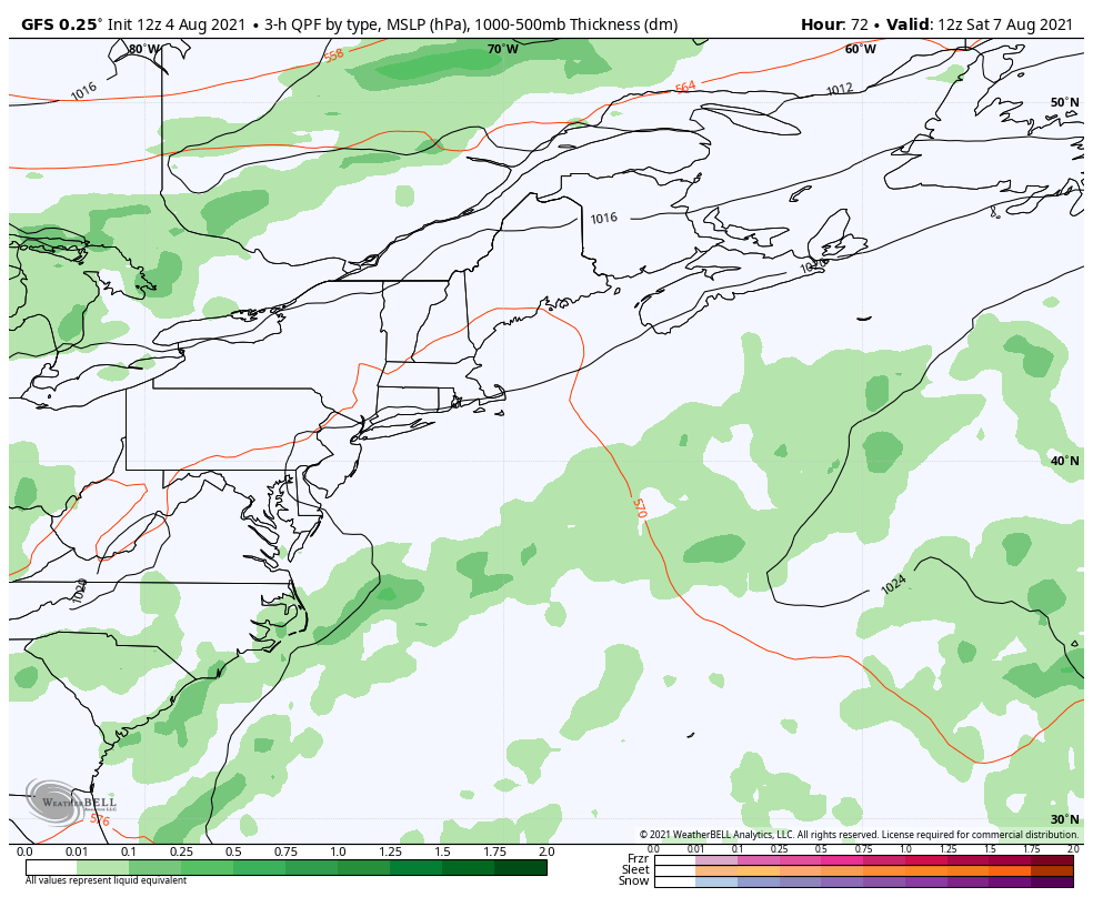 Our next chance of organized precipitation comes with a cold front likely to move through the area during the afternoon and evening hours Saturday. This front likely brings with it showers and the chance for a few storms as it crosses the state during the late afternoon and evening. Some of the models are indicating the front stalling out, bringing more clouds and scattered showers to the area on Sunday, but I'm remaining optimistic that the front clears the coast by Sunday morning, leading to less cloud cover and clearing skies by Sunday afternoon. 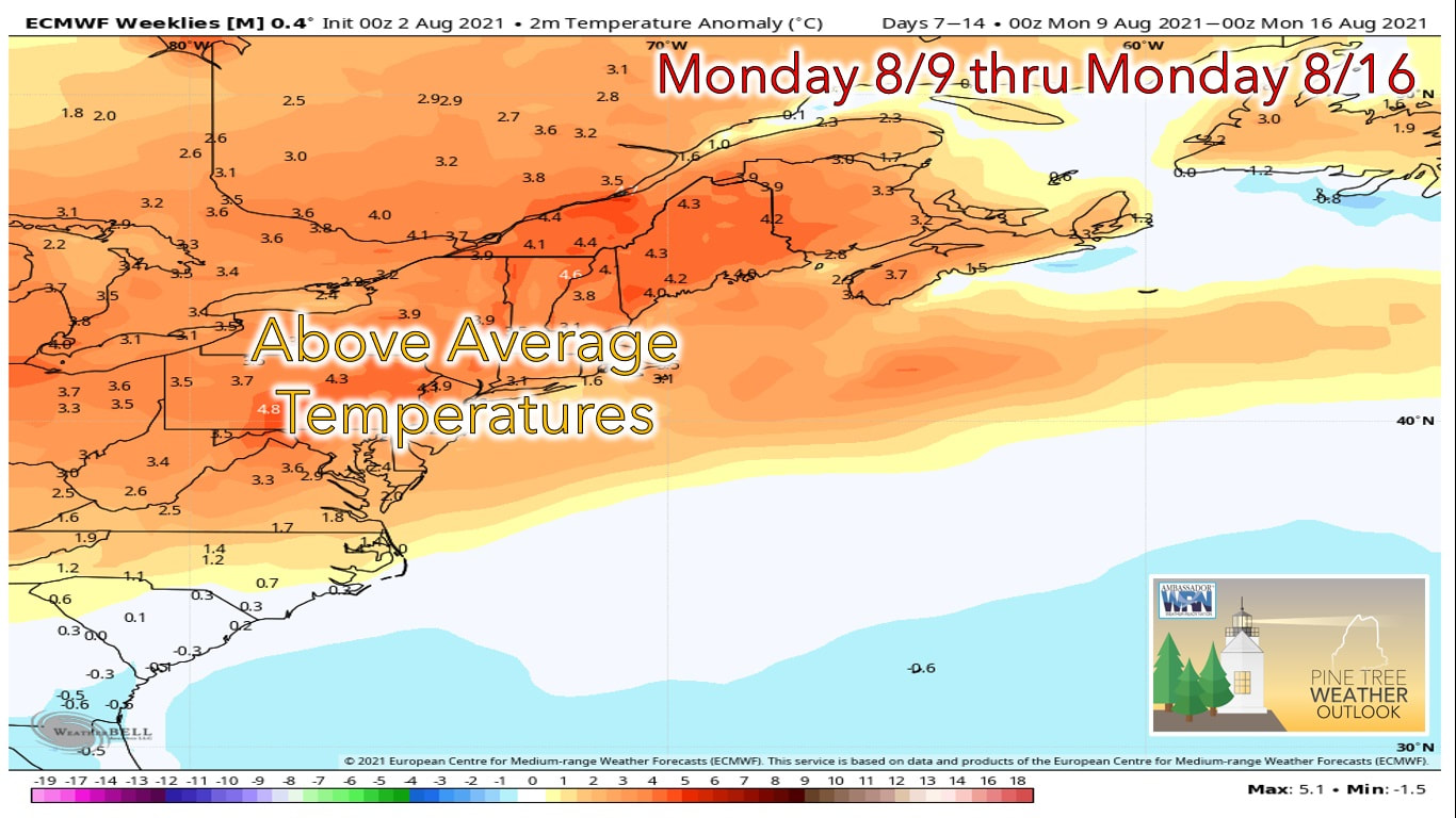 Heading into next week we're watching a possible pattern change, bringing warmer than average temperatures into the region. Over the past week we've been stuck under upper level troughs that continue to bring waves of precipitation and cooler weather to the state. By the middle of next week the pattern appears to shift and allows for a weaker upper level ridge to setup over us. This upper level ride will likely help to keep temperatures on the warmer side, indicating a return to the summer heat. The 2021 Atlantic Hurricane Season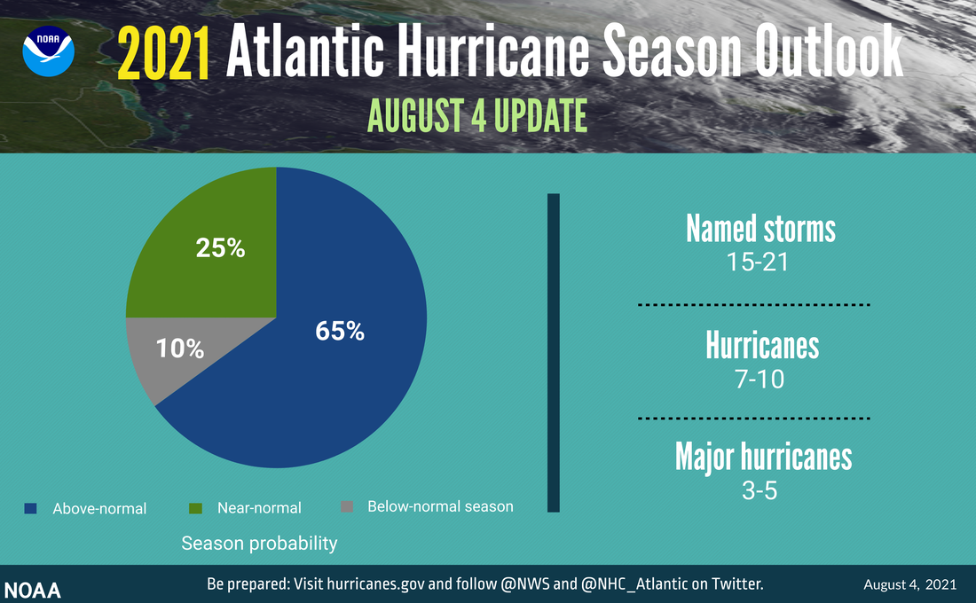 At this point we're about half way through the Atlantic hurricane season. So far we've seen 5 named storms, which puts us slightly below what the National Hurricane Center's 15-21 estimated named storms. While the past week or so has remained relatively quiet in the Atlantic, we are continuing to watch a couple of areas close to the equator that are showing possible signs of development. We'll have more information on these storms over the next few days if they develop. 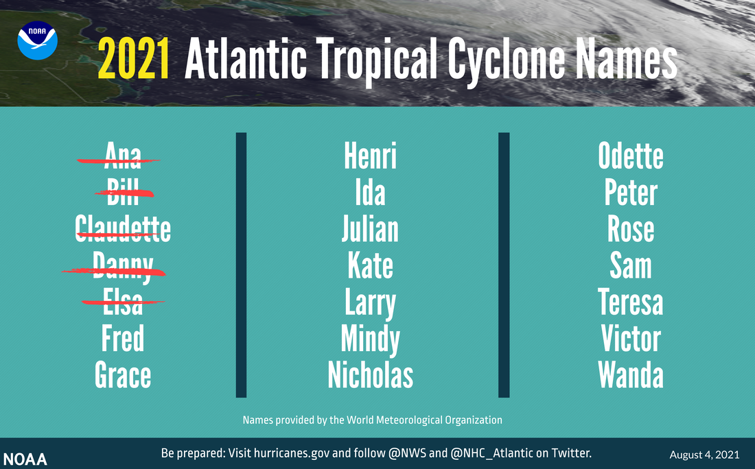 With 5 names already crossed off the list, we're almost a third of the way through the list of names for the 2021 season. Keep in mind that after last year's active season, the National Hurricane Center decided to retire the use of Greek letters for names of storms and has instead opted for an alternate list of names if we get to that point this season. Learn more about NOAA’s comprehensive expertise across all aspects of hurricane science and forecasting with their Hurricane Resource Guide on NOAA.gov. Visit FEMA’s Ready.gov for the latest information about hurricane preparedness and evacuation safety. Report your weather with mPING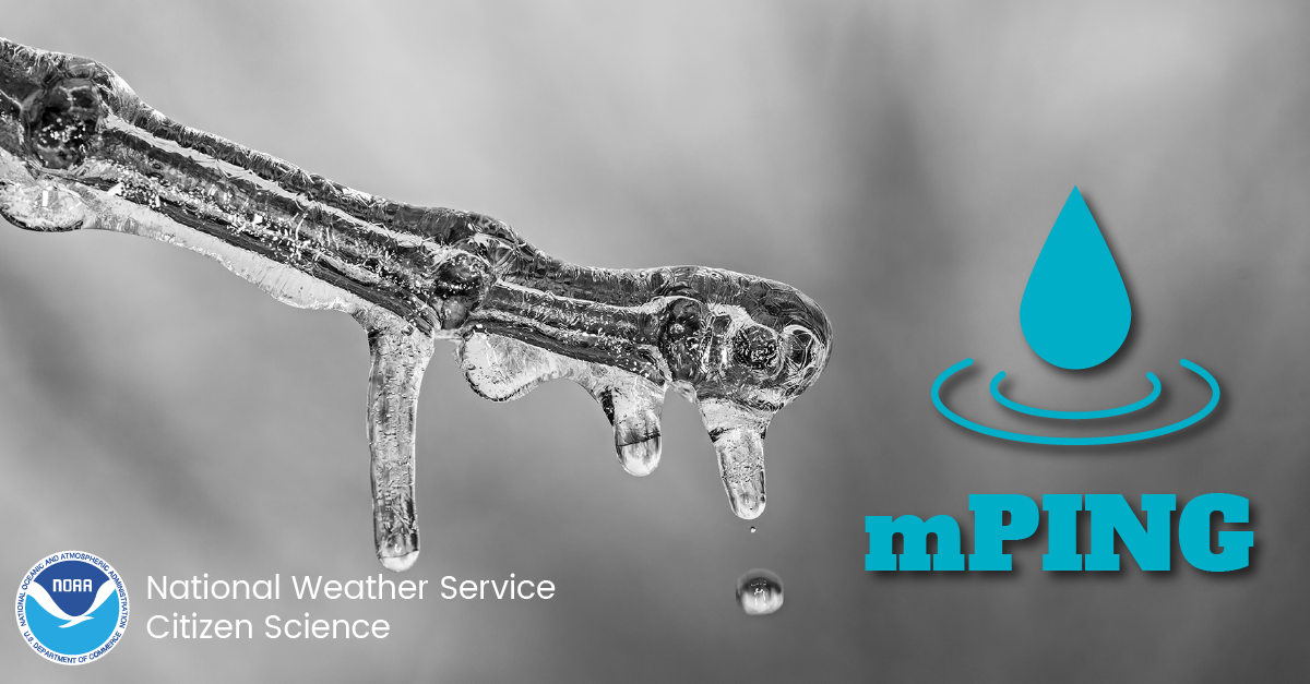 Check out mPING (Meteorological Phenomena Identification Near the Ground) project. Weird name, cool app! You can report the type of precipitation you see where you are. No need to measure! Use the free mobile app to send reports anonymously. Reports are automatically recorded into a database, which improves weather computer models. The information is even used by road maintenance operations and the aviation industry to diagnose areas of icing. mping.nssl.noaa.gov Temperature outlook through next SaturdayTemperatures over the next week will likely remain above average as the upper level ridge that I discussed earlier begins to setup over the eastern United States. While we likely see a brief "cool-down" during the day Sunday and Monday, temperatures likely remain a few degrees above average through the middle of next week.  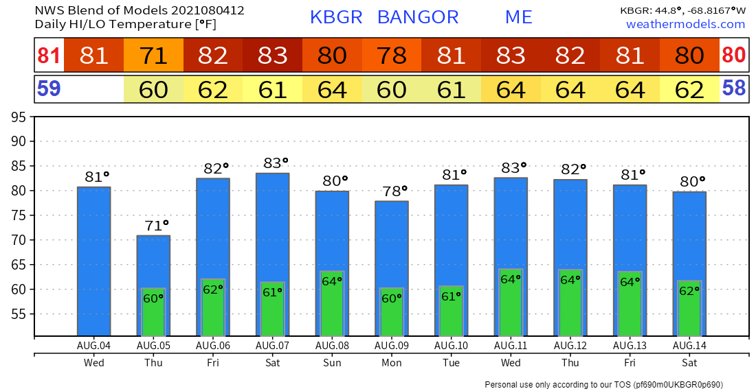 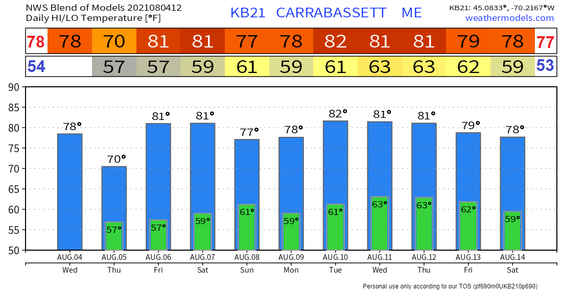 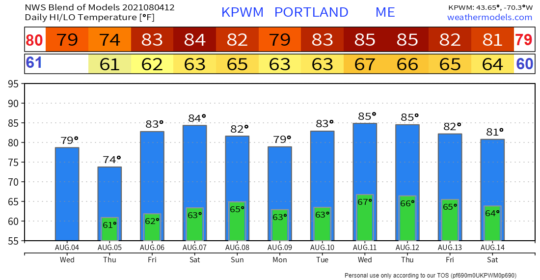 Be prepared to receive alerts and stay updated!
For more information in between posts, please follow Pine Tree Weather on Facebook and Twitter.
Thank you for supporting this community-based weather information source which operates by reader supported financial contributions. Stay updated, stay on alert, and stay safe! |

Mike Haggett
|