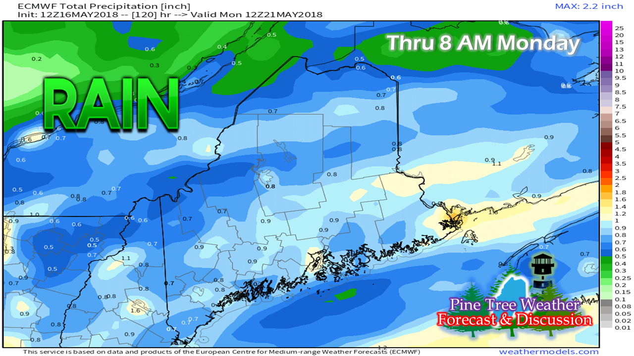
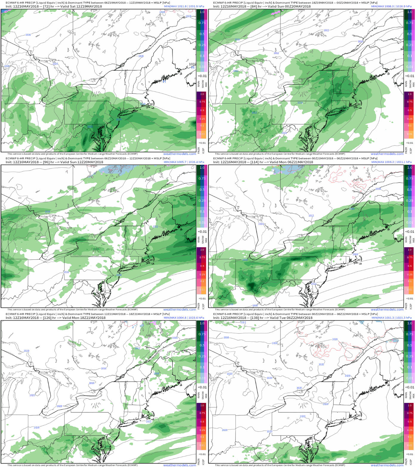
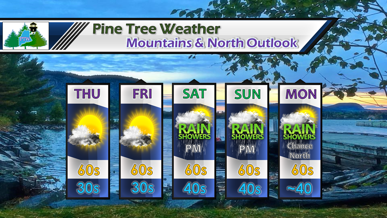
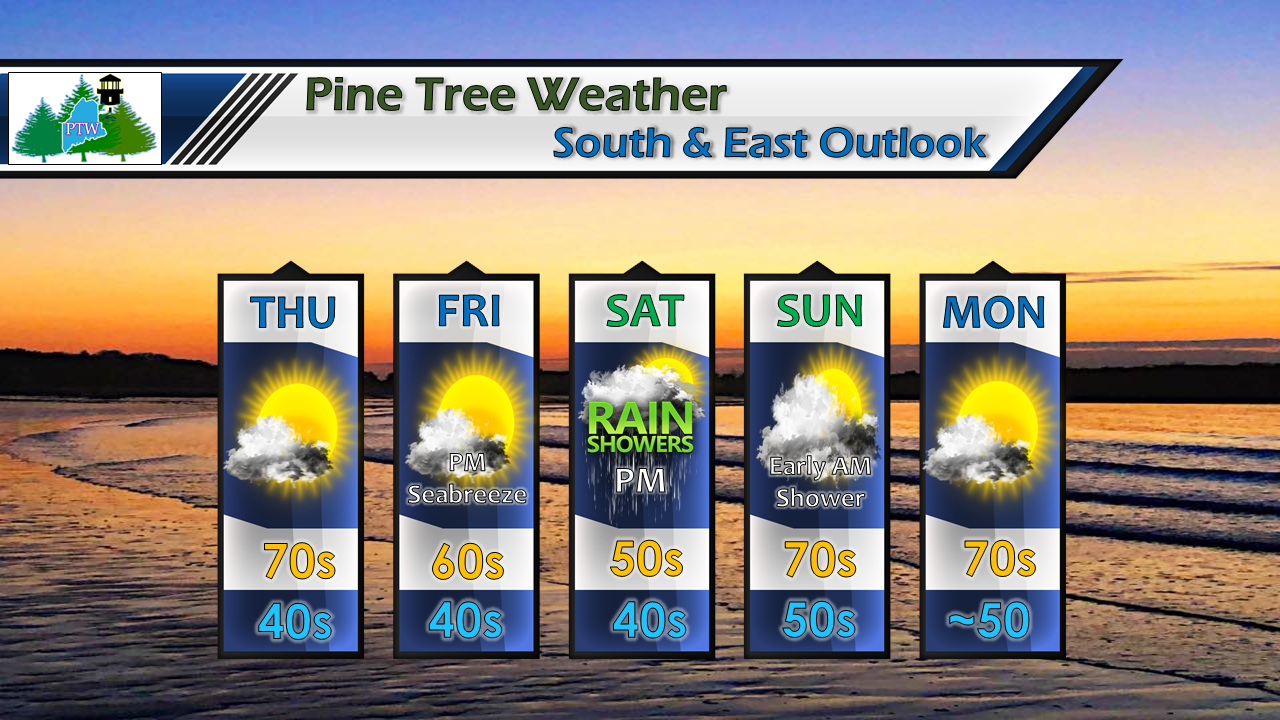
Beneficial rain to help reduce fire threatOutside of a chance of a sprinkle / shower in northern areas Wednesday evening, the state appears dry until Saturday. As high pressure that keeps the region quiet for the remainder of the week slides offshore, a southwest flow develops and brings showers to the state Saturday in the form of a warm front, with a trailing cold front bringing another round for Sunday. While the timing may not be great for weekend plans, the two systems will deliver some much needed rainfall for the parched region, helping to quell the wildfire threat and assist gardeners as they start the seasonal crops. The weekend won't be a total washoutSaturday daytime appears to be the damper one of the two for southern and central areas, with showers arriving in northern areas towards evening. As the warm frontal boundary moves northeast, a trailing cold front approaches the region for Sunday, with the steadier rain occurring Sunday night, ending early Monday. Mountains & North 5 Day OutlookThe main concern for the north country will be the frost threat for the remaining mornings of the work week. Overnight temps modify by the weekend. High temperatures will range in the 60s +/- for the entire region through the next five days. I can't rule out an early morning shower for Sunday, and a hit or miss shower in the early afternoon. Showers appear to become more numerous as Sunday evening approaches. South and East OutlookTemperatures that resemble something close to early summer are on tap for Thursday, then take a dip through the first half of the weekend. From Sunday onward, the daily highs spring back up to the 70s. Shoreline areas may see cooler temperatures from an onshore breeze late in the week.
Southern and eastern zones may see some shower activity late in the day Sunday into early Monday morning, with increasing sun to start the work week. For the latest official forecast information, please check in with NWS Gray for southern and western Maine, and NWS Caribou for eastern and northern Maine. Feel free to follow me on the Pine Tree Weather Facebook page and on my Twitter account. I will do my best to provide updates as we head into the weekend. Thanks as always for your support! - Mike |
Mike Haggett
|


