Signals continue for below normal rainfall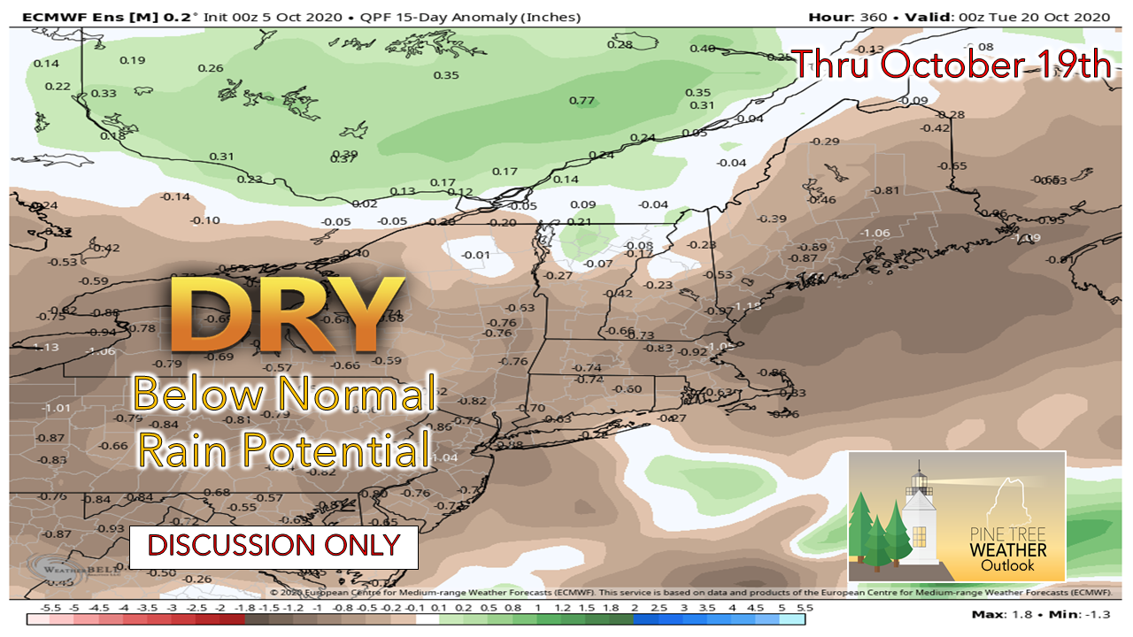 I am hearing more and more stories about people running into well issues, either that they have run out of water, showing signs of running out, or worried that they may run out. To quote the late Yogi Berra, "It gets late early around here". I keep looking for signs of any consistency that indicates wetter times, but for the one's I've seen are short lived. One would think with all the tropical activity this season that we'd get a little something out of it. Not this year, so far. We need rain and need a good amount before the ground freezes up. While temperatures appear to be generally above normal as we head into the heart of October, it does by us a bit of time, but the reality is we're beginning to run out of time. October tends to be stormy, and it is possible we may get some activity later in the month. We're going to need it. For those engaged in fall clean-up from the recent leaf drop, hold off on burning for now. I know that is going to be difficult. Check with your local fire department or forest ranger before you do anything. We don't want Maine to turn into California, where over one million acres have been torched so far. A bit of rain for midweek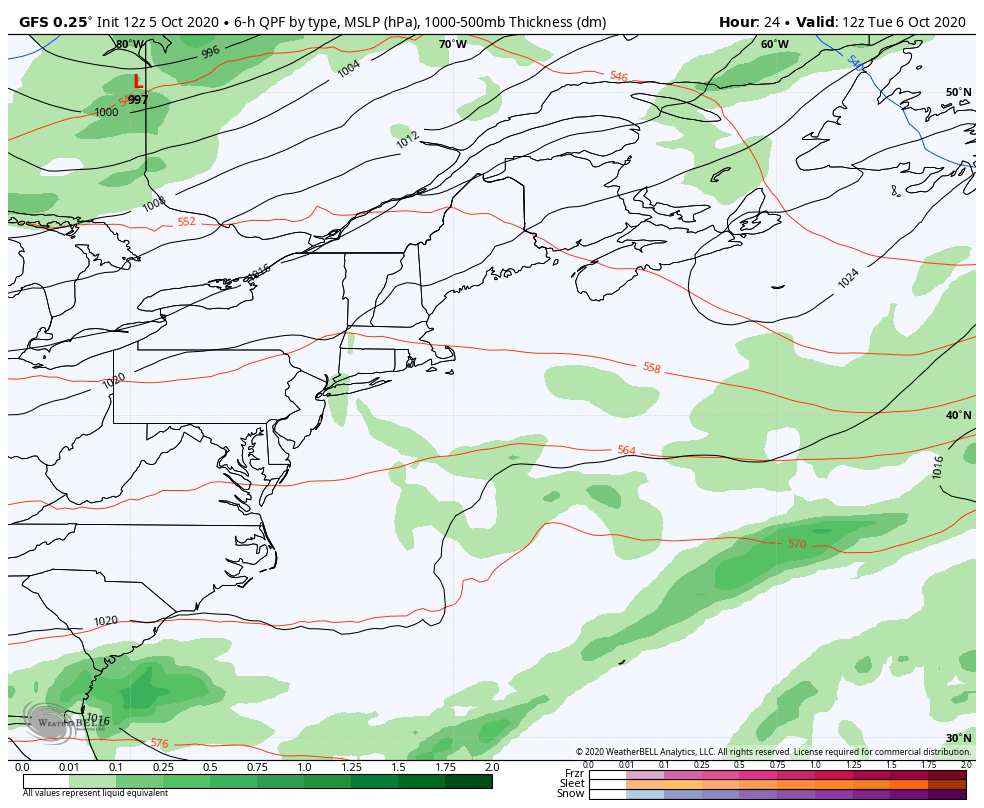 High pressure to the southeast moves east and a trough from Hudson Bay drops southeast Tuesday. This brings the best chance for showers primarily for the western mountains and north, with lesser amounts south and east. Oh, and just a reminder for where we are at climatologically, this model idea depicts the chance for snow flurries for the western mountains on Thursday. Below freezing cold will be moving in to the lower levels of the atmosphere with the trough moving in Thursday. Yikes. 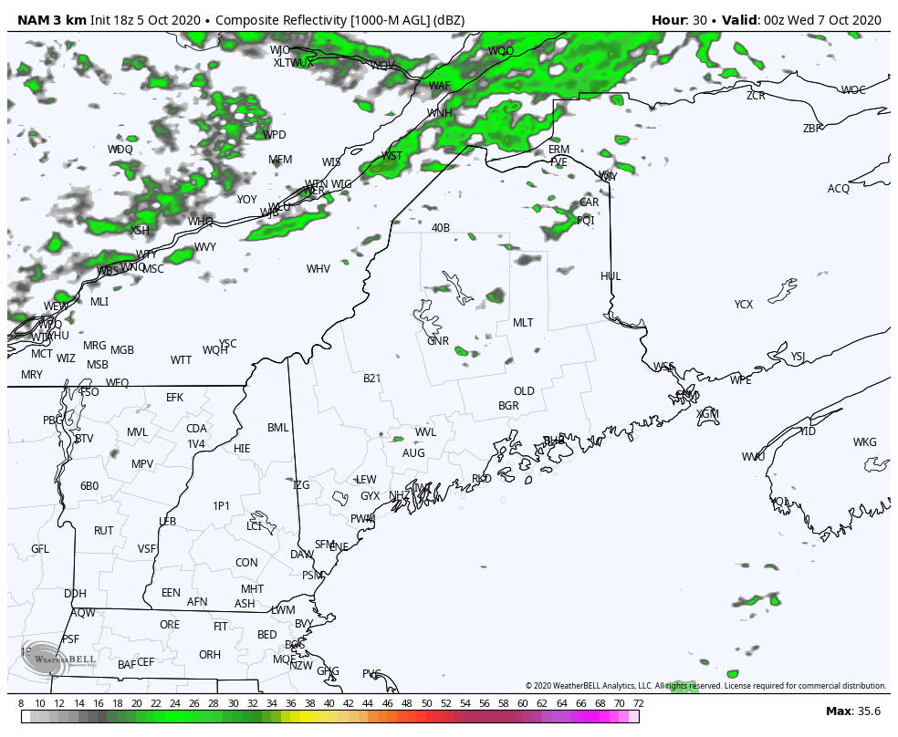 While there will be some fog around early Tuesday and some isolated light showers or sprinkles around in the morning, rain chances increase Tuesday afternoon into the evening. Shower activity appears to end over southern and eastern areas late Wednesday afternoon. Showers end over the north and mountains early Thursday. Yes, the higher hilltops may see a few flakes around sunrise Thursday morning. ❄ 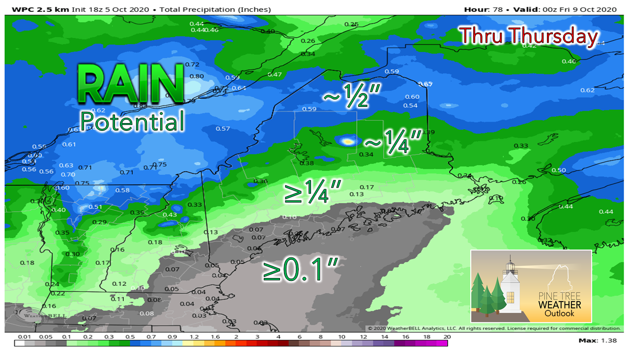 Best chance for any meaningful rain appears for the north and mountains. The western foothills on over to interior Washington County appear to get a bit in the rain can. For most of the coastal region, not much. The region may see some light shower activity Saturday afternoon into early Sunday morning as a warm front noses in from the southwest. That is it for rainfall ideas for now until next week, and it may be late next week. Temperature outlook through SundayThe fall southbound roller coaster ride continues with above normal temps through Wednesday, below normal values to end the week, then above normal for the weekend and into next week. 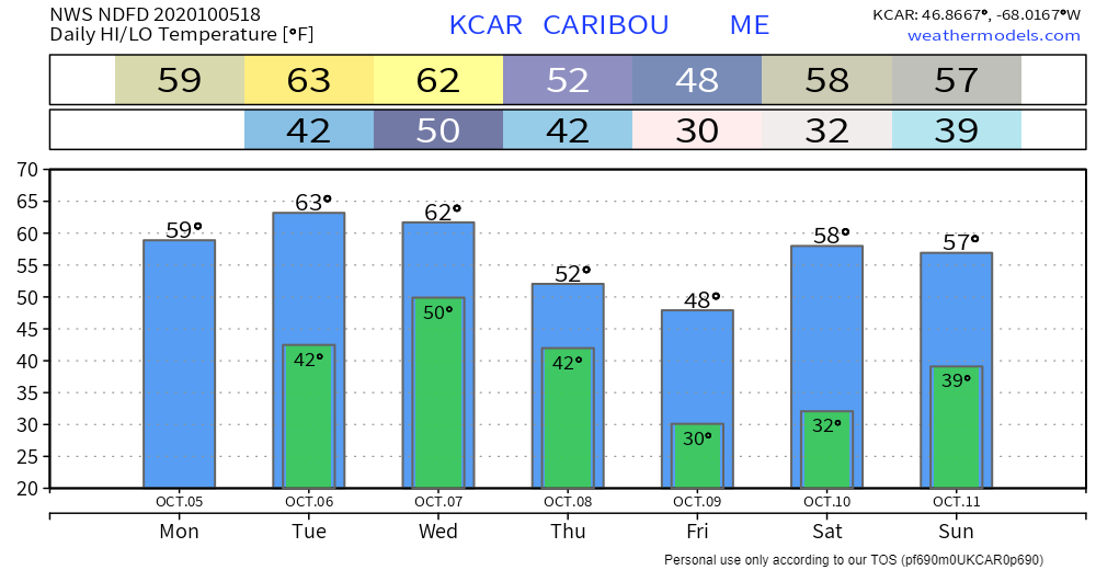 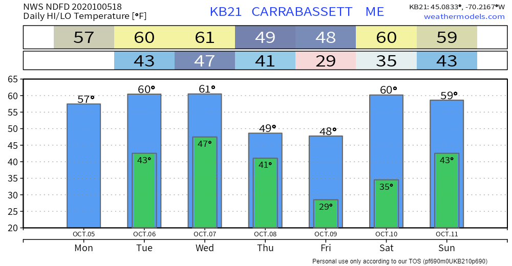 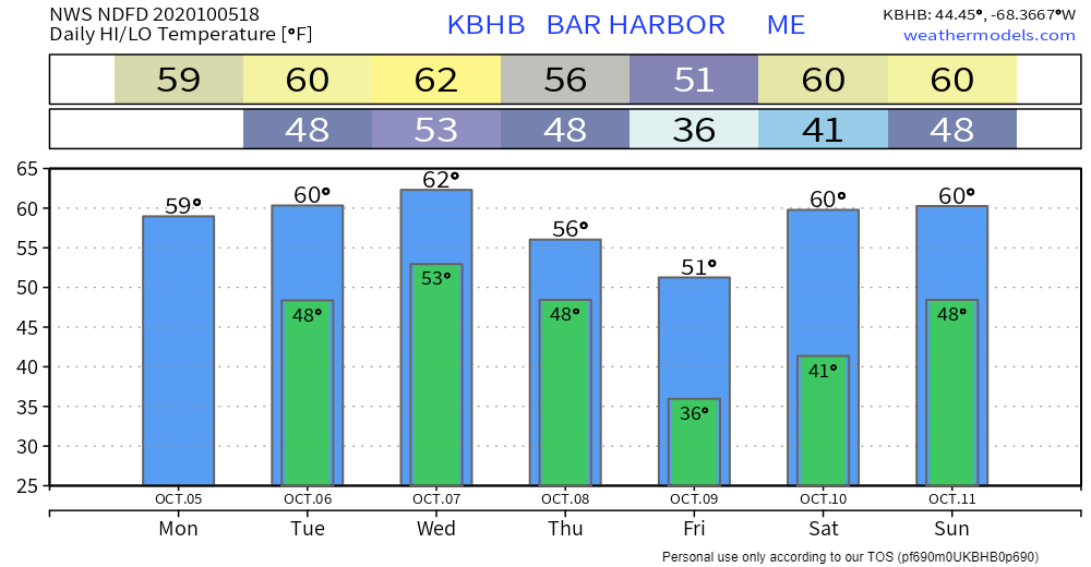 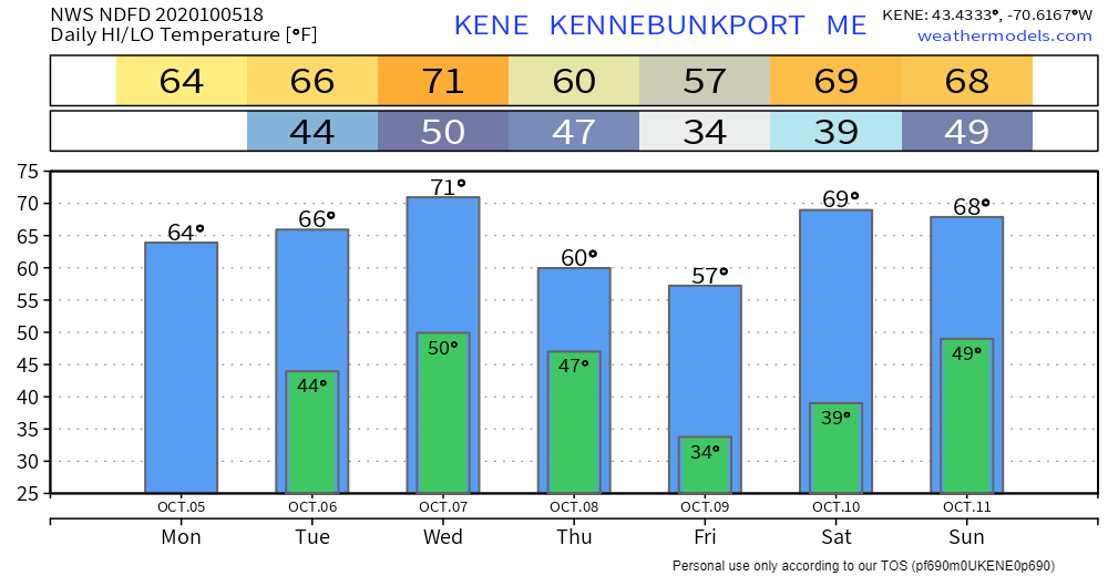 Please don't burn the leaves yet!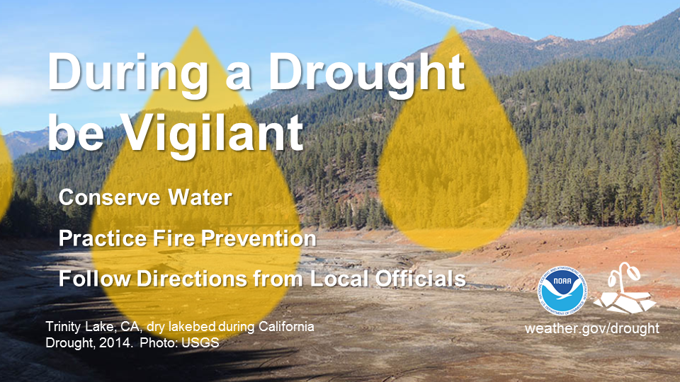 During a drought, be vigilant. Conserve water by taking shorter showers and not washing your car. Practice fire prevention by properly disposing of cigarette butts and not setting off fireworks. Follow any additional directions from local officials. For more information about drought safety, visit weather.gov/drought Be prepared to receive alerts and stay updated!
For more information, please follow Pine Tree Weather on Facebook and Twitter.
** FUNDING NEEDED FOR 2021 ** Thank you for supporting this community based weather information source that is funded by your financial contributions. Stay updated, stay on alert, and stay safe! - Mike |

Mike Haggett
|