
This is a strong storm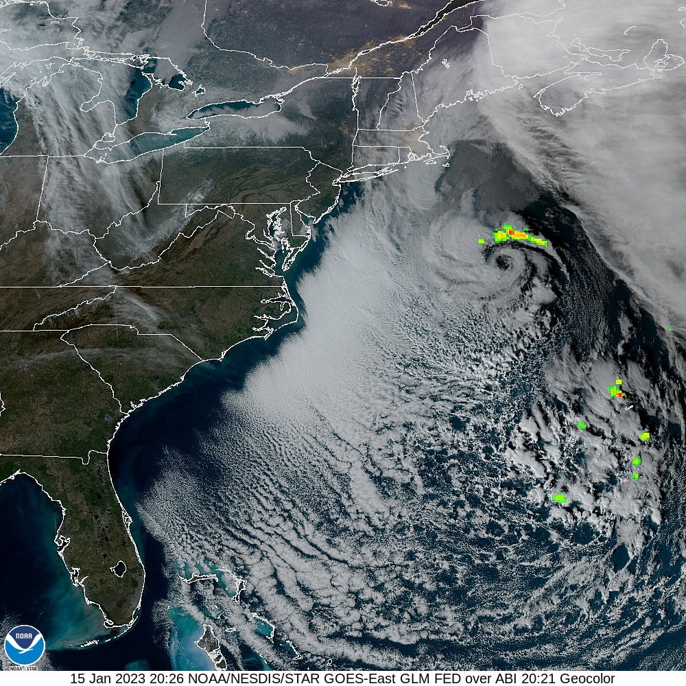 I mentioned that the center of this storm is likely to have hurricane force wind gusts around the low and that is a good bet given this satellite image from Sunday afternoon. The greens, yellows, oranges, and reds here are indicating lightning strikes. Judging by the wind gusts between 20-45 mph across the region, for a storm well to the south, it has some muscle to it. The eye is well defined as can be seen below the lightning near the core. Impressive. Timing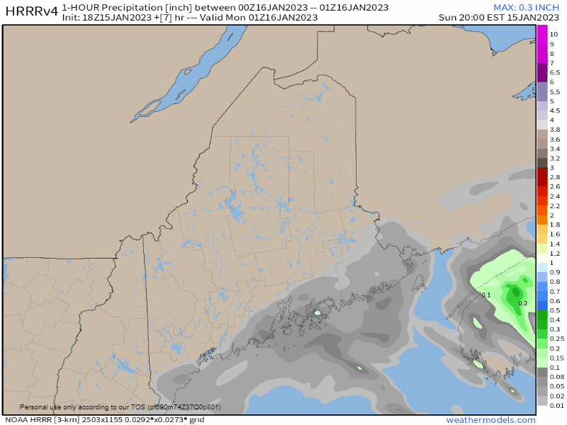 Sunday 9 PM to Monday 10 PM - While precipitation is occurring ahead of the start time here, the main point I wanted to capture here is the likelihood of waves of precipitation passing through the region in this time span. After the initial wave, precipitation is expected to taper off for a couple hours or more, then return heading into Monday afternoon and into the evening. Expect both the morning and evening commutes to be a slick affair in areas. Sleet and/or freezing rain may be falling in such velocity that it may be difficult for plow crews to keep up. 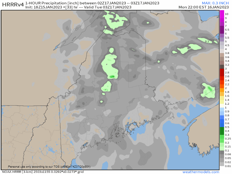 Monday 10 PM to Tuesday Noon - The storm heads to the northeast and the precipitation tapers off from west to east. By the time the Tuesday morning commute comes, most areas should be in good shape. I say most because eastern and northern areas may be hurting. Precipitation amounts, impacts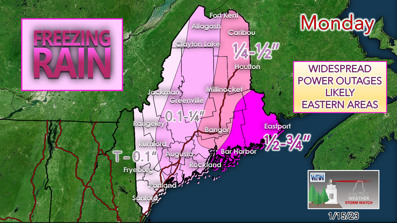 The outlook for eastern areas has gone from bad to worse with the ice potential. For those curious, to trigger an ice storm warning, the threshold is ¾" of flat ice as of the latest revision two years ago. For those in Hancock and Washington Counties, do not be surprised if one gets triggered at some point overnight. This is a bad storm as I have been saying for the past few days. Trees and powerlines will go down. Roads will be impassable. Thankfully, warm air builds in for Tuesday and Wednesday to melt the ice, but by then the damage has already been done. There could be folks without power for a week or more. The storm on the way for Friday won't help in the restoration efforts, either. 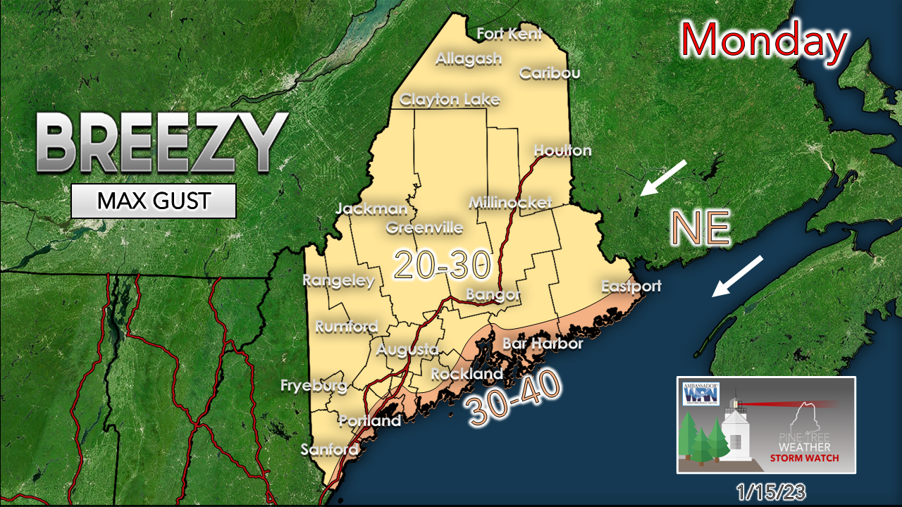 Having all that ice buildup along with a stiff northeast breeze is no bueño. The weight of the ice and the wind will cause a lot of damage over eastern areas. 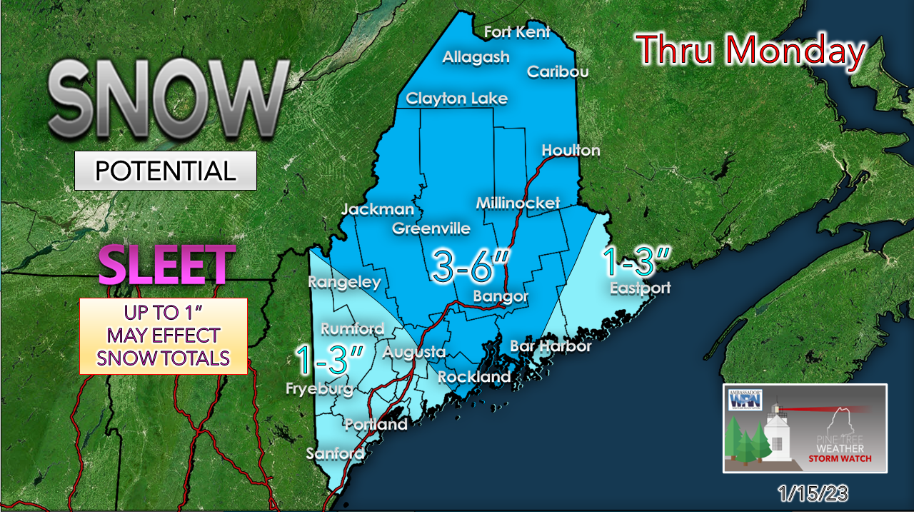 SLEET continues to be a concern along with the freezing rain eating away at snowfall amounts. This could bust on the low end in a lot of areas, but that won't be determined until Tuesday morning. As far as driving goes, a ½-1" of sleet is greasier than 6-12" of wet sloppy snow on the roads. Add freezing rain in with it... dangerous. The road crews are going to have more than enough to handle with this event, and they don't need people in the spin cycle taking out their truck to make matters worse. If you MUST drive in this storm, make sure you have blankets, water, and food. Make sure your phone is charged. If you go off the road, you may be sitting there for several hours or more. Quick thoughts on Friday's potential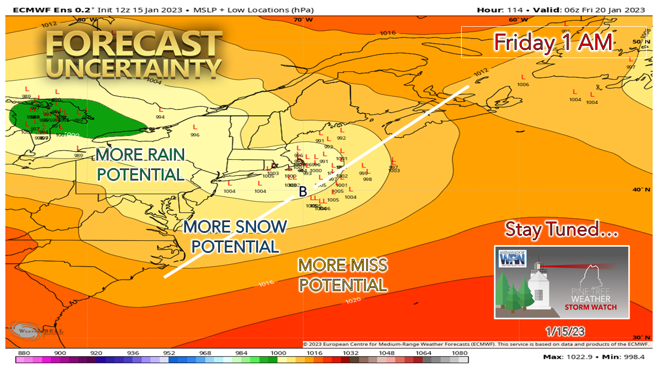 No real surprise here to see the variance in ensemble ideas this far out. The consensus for now has most inside the benchmark "B" at 40° N / 70° W so that does raise some questions about snow for the shorelines for now. 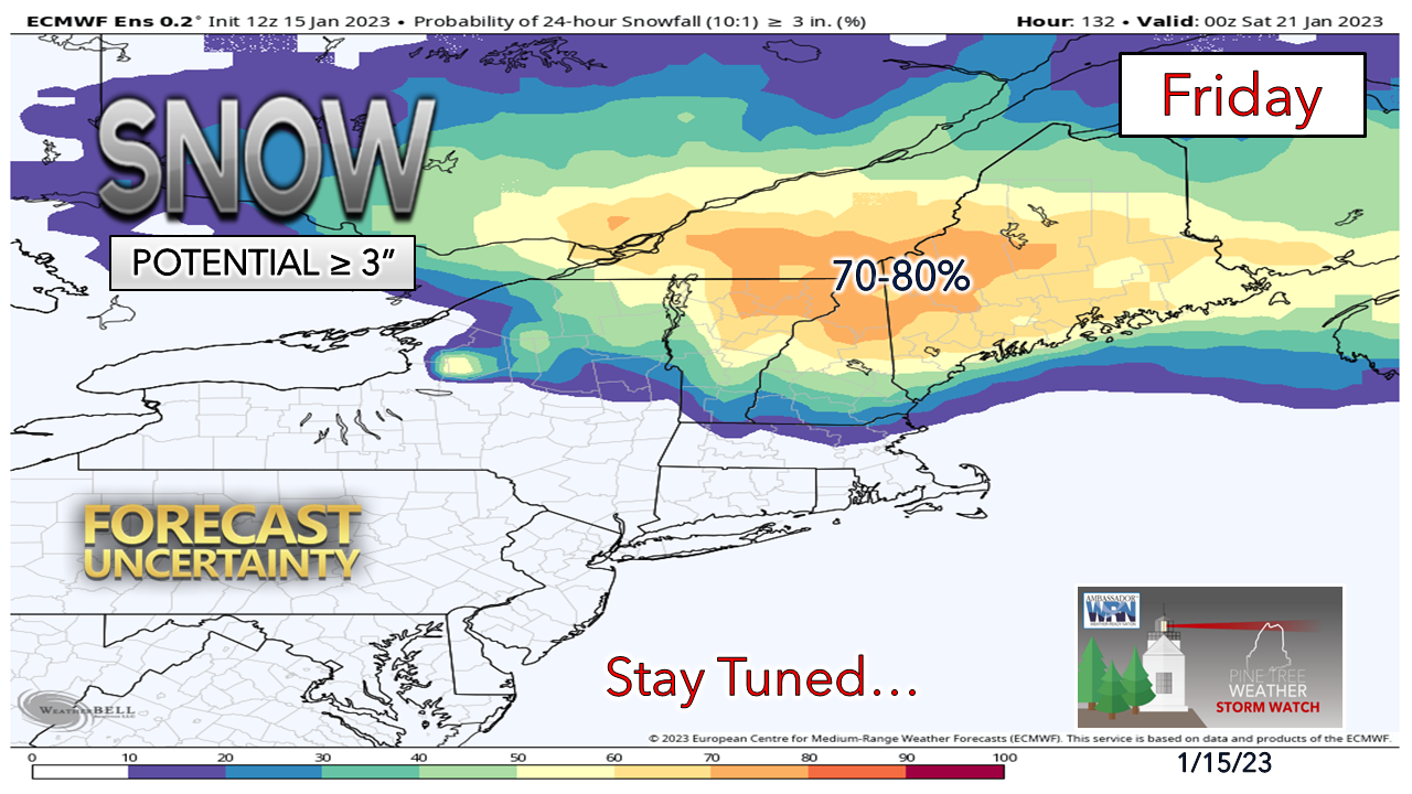 Take this with a grain of salt for now, but this is good signal for a plowable snow statewide. We'll see what happens as the week unfolds. Heads up for the shorelines... astronomical high tides are going to be a concern with this storm. It's too early to tell how much of a mess and abuse this may cause. The ideas will become clearer on that by Wednesday. The winter train is rolling. Temperature outlook through Friday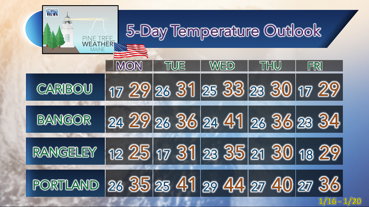 Thank you as always for your support! You may not like the weather, but I hope you like what I do! Please hit the like button on Twitter and Facebook, and share! Financial donations to fund what I do are always appreciated! Stay updated, stay on alert, and stay safe! - Mike NOTE: The forecast information depicted on this platform is for general information purposes only for the public and is not designed or intended for commercial use. For those seeking pinpoint weather information for business operations, you should use a private sector source. For information about where to find commercial forecasters to assist your business, please message me and I will be happy to help you. |

Mike Haggett
|


