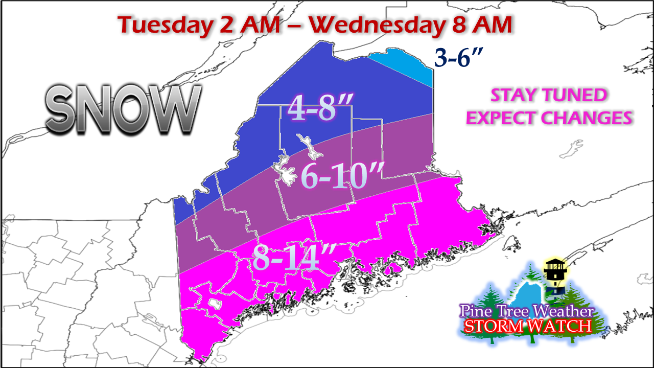
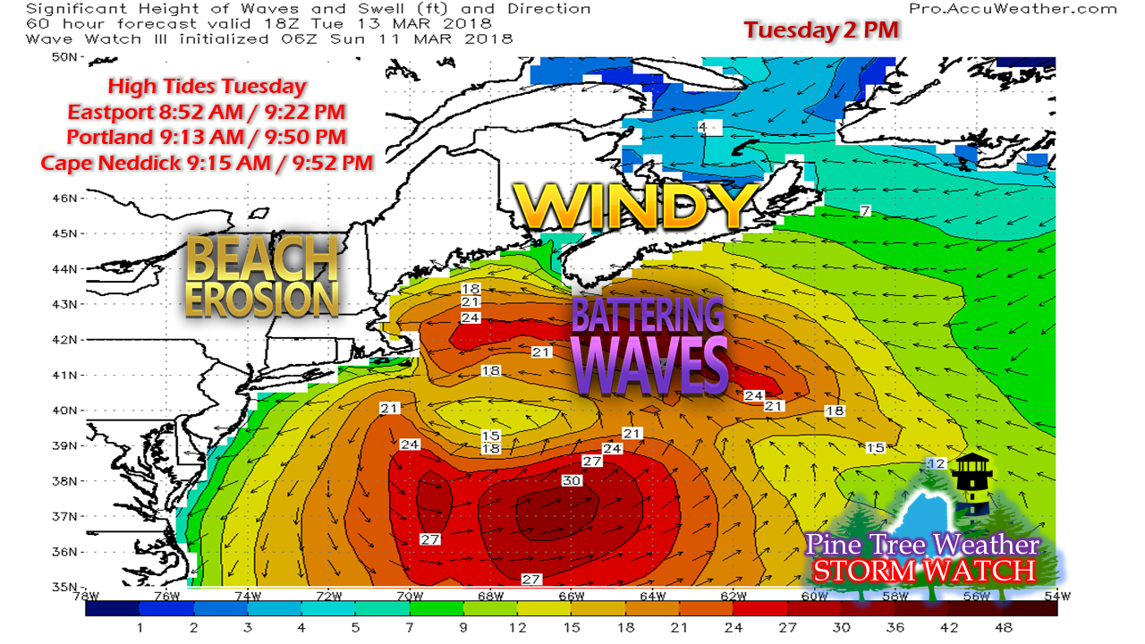
Heads upThis update will be a brief one. I am about to close on the property in Kennebunk and still going through the process of offloading my current home in Poland. This post will give you a rough idea of what to expect. The fine details are still to be worked out. You will need to stay updated through NWS Gray or NWS Caribou pending on your region of forecast changes and bulletins that will follow. I will do what I can to update. You will want to keep eyes on my Twitter account as that may be all I have time for. Here we snow again...This is a very fluid forecast and there is room for change. This storm has similar characteristics as the one did this past week. All that is circumspect at this point is the track, which as of Sunday afternoon is more over New Brunswick. That leaves Maine on the cold side of this from start to end. This isn't to say a coastal front may develop and knock down totals a hair from Rockland east, but for areas west of there, this does appear to be an all snow event. A Winter Storm Watch has been posted for the entire state. It's important to note that this isn't ALL of the snow that will come. The idea illustrated here is for the first 30 hours of the event. Snow showers are likely to persist into Wednesday morning for southern areas, Wednesday afternoon for eastern areas, and northern and western areas may see snow showers last into Thursday. This will bring some additional accumulation, although most of the snow will be on the ground by Wednesday morning for much of the state. Timing of the storm will impact the morning commute for southwestern areas Tuesday. Snow will overspread the state and intensify during the day and into Tuesday night. As I mentioned, snow showers are likely persist. There is a fair amount of bust potential here. If the storm skirts east, western and southern areas will get lesser amounts, and eastern and northern areas could see more. The track is not set in stone just yet. And the shorelines get another beating...Thankfully, astronomical tides aren't a concern. The ocean has settled from the previous two events. That said, the shorelines will get battered again. Timing is everything with this event. The morning tides will be the highest of the two. Potential flooding, splash over and storm surge will have to be monitored. Stay updated!I wish I could do a bit more, but this is the best I can do for now. Stay in touch in NWS and local media for more on the timing and specifics with this event.
- Mike |
Mike Haggett
|


