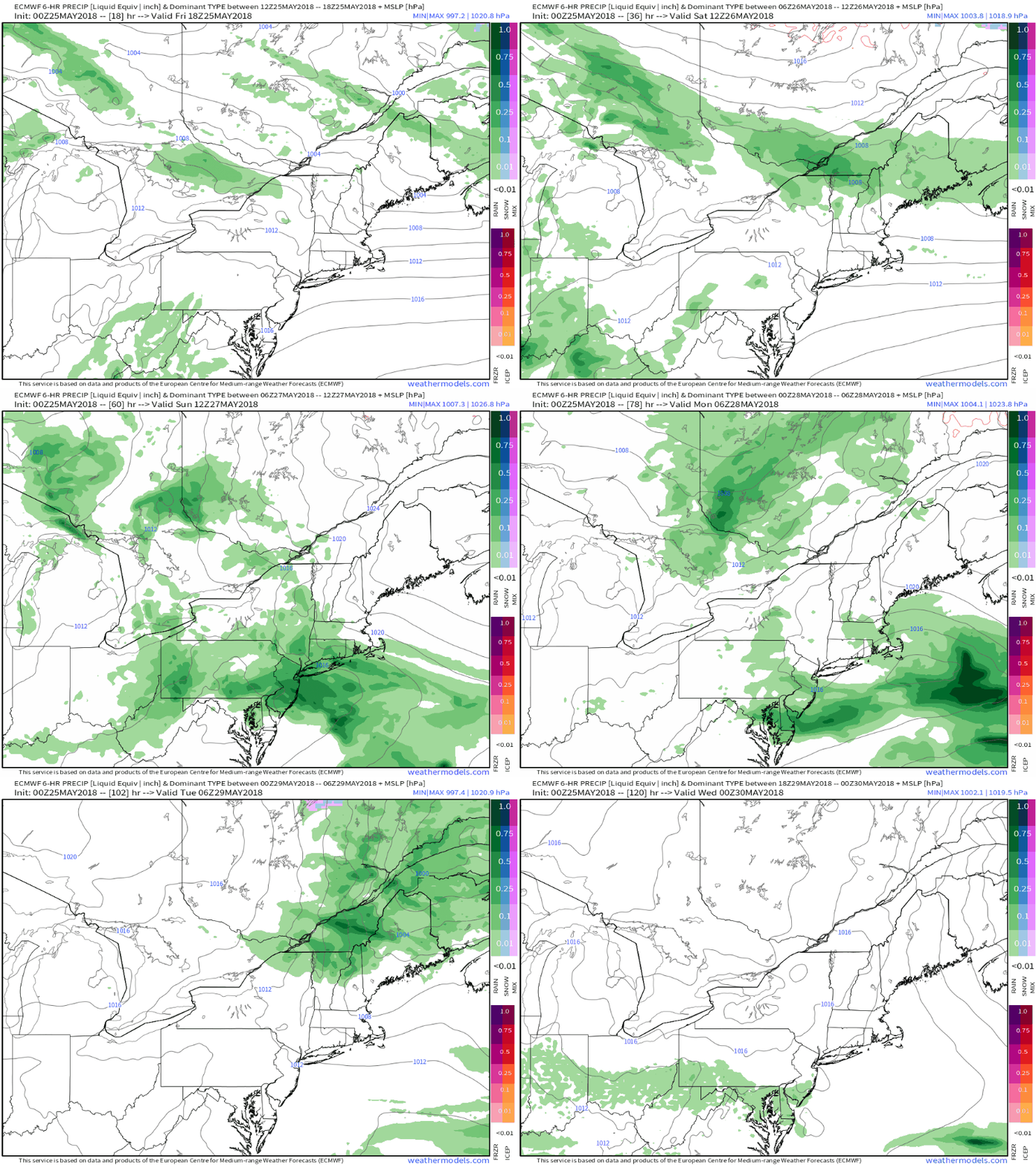
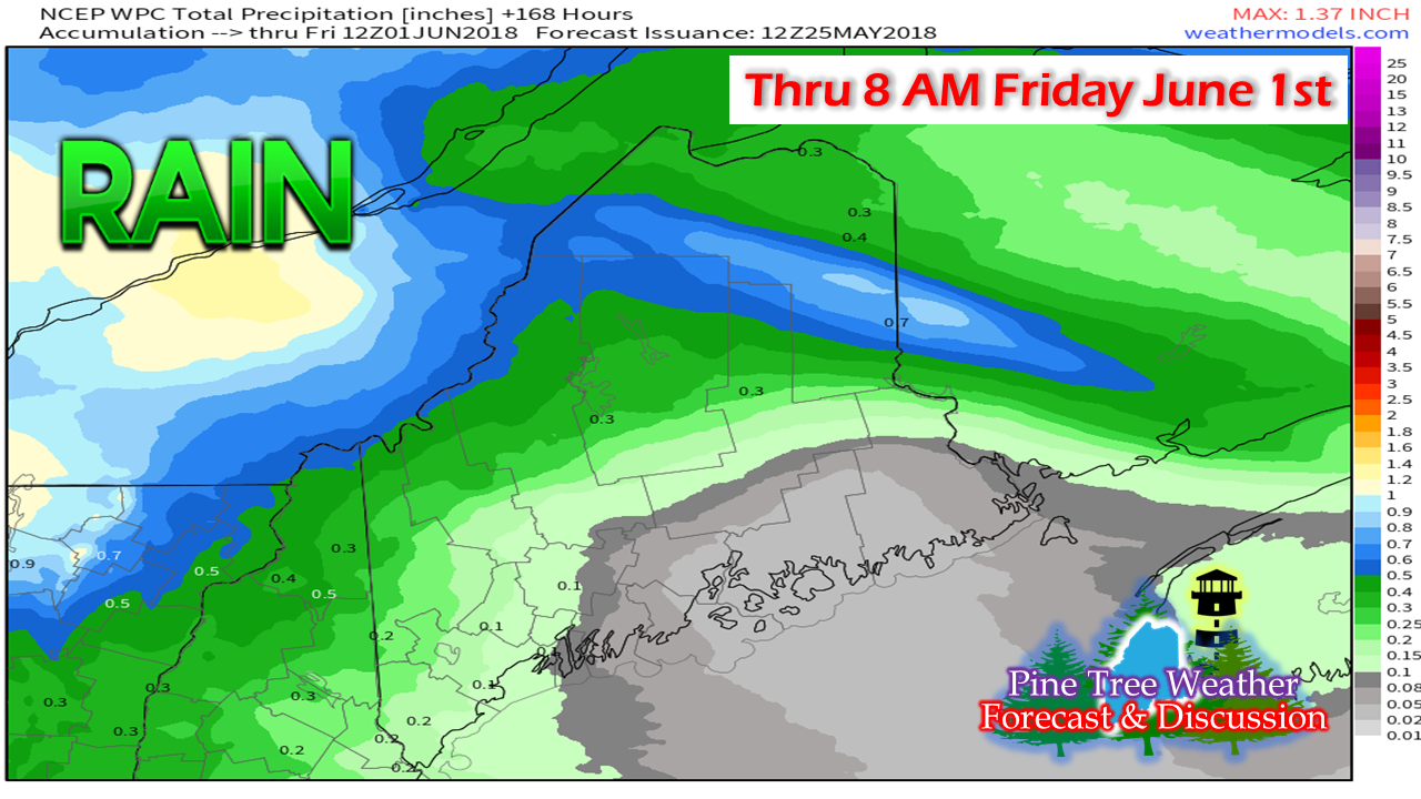
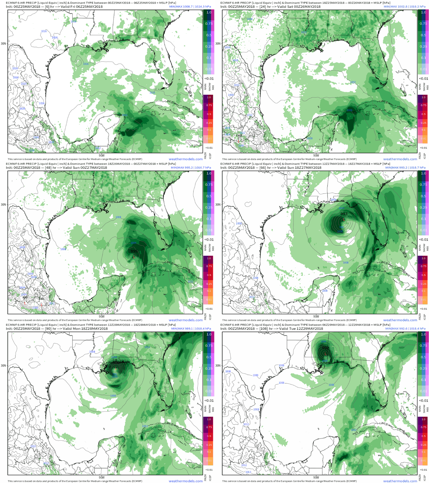
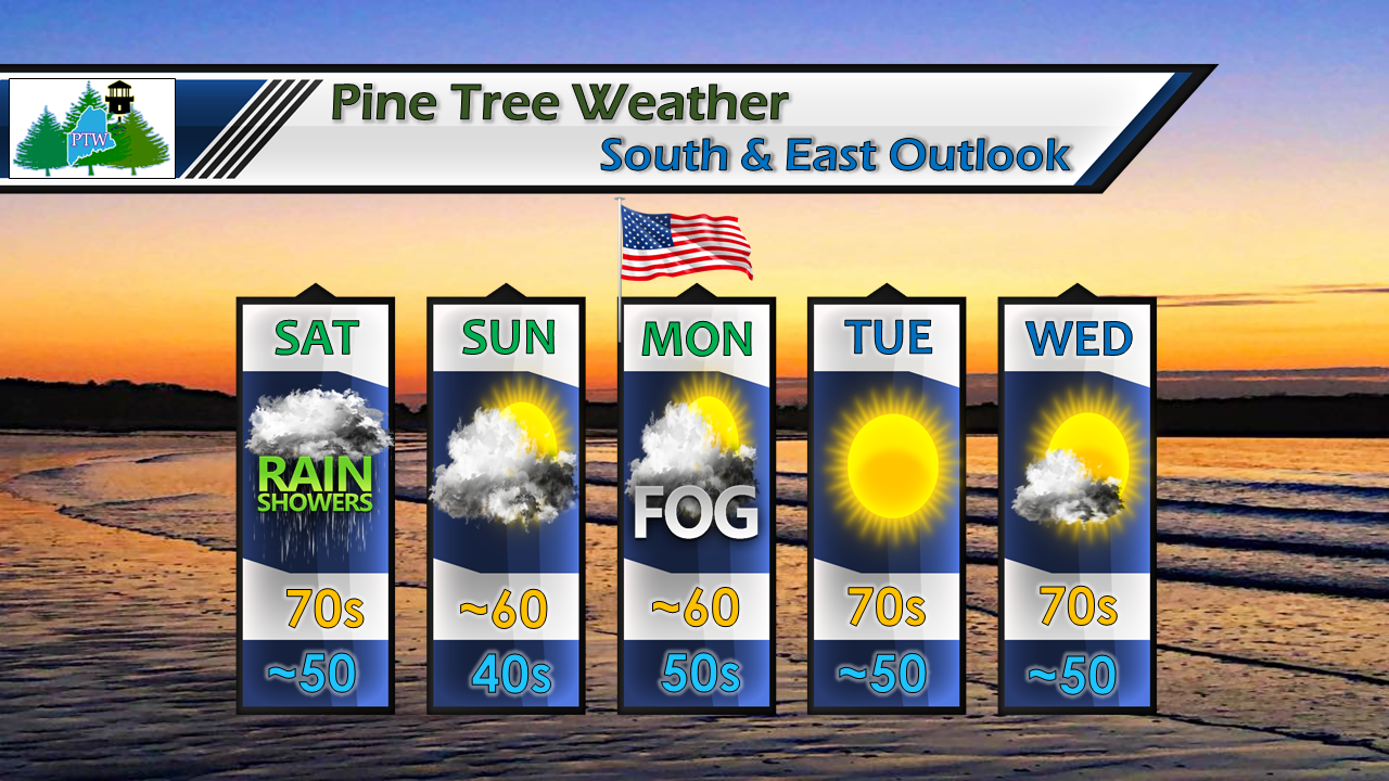
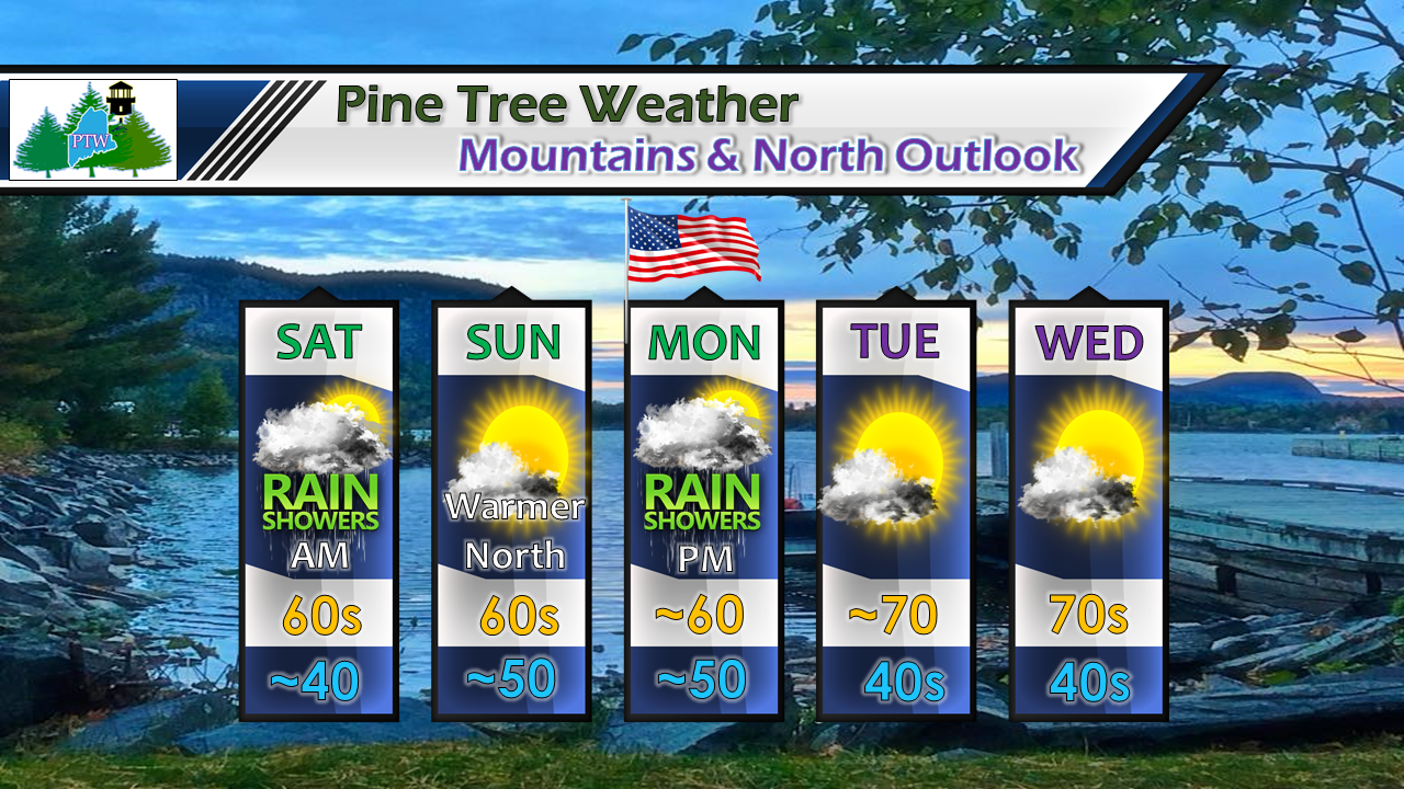
The unofficial start to summer is upon usI was sorting out some graphics and feel confident at this point to put the winter icons to rest. The region isn't out of the range for frost threats, but the snow idea is over. That noted, areas of Newfoundland picked up over a foot of the white stuff on Wednesday, and areas of northern New Brunswick saw some accumulation as well. While that is going on, there is a tropical system forming off the Yucatan Peninsula. While Friday will feel like summer for Maine, by Sunday the region will feel a temperature whiplash with highs only in the 50s and 60s. Ah, spring! The weekend appears in fair shapeSpring is known for back door cold fronts in this part of the planet, and that is exactly what is on tap for the weekend. The front sags from the northeast to the southwest Friday into Saturday bringing a chance for showers and thunderstorms. The front stalls to the south on Sunday, which will bring a decent but cool day for the north and east, which clouds persist over the south and west. Monday appears foggy and drizzly for the coastal plain, with a risk of a shower everywhere as the front moves through Monday afternoon into early Tuesday. Temperatures increase as we head into the middle part of next week. Weekend not a washout by any stretchDue to the change in forecast with the front sagging further to the south, what appeared as beneficial rain earlier in the week has backed off on that idea considerably. The mountains and north will get some, while much of the coastal plain won't see a whole lot of precipitation over the next week. Our first tropical system of the seasonFor folks with interest in the eastern and central Gulf coast region, consider this a public service announcement for you. This is for informational purposes only, and is by no means an actual forecast. Guidance is indicating the first tropical system of the season forming over the weekend and making landfall in the central region roughly Monday or Tuesday. Whether or not this system becomes named as Alberto time will tell, but there appears to be a good chance that it will. How strong the system will get remains in question. At the very least it will bring potential for flooding rainfall to parts of Florida up into Georgia, Alabama, Mississippi, and southeastern Louisiana, along with the Carolinas. As always, stay in touch with the National Hurricane Center for the latest official forecast information, along with the local National Weather Service office for the region where you have concern. 5-Day Outlook - Coastal PlainSaturday starts off dry with some sun which will allow temperatures to rise up in the 70s before the back door cold front drops down and kick off some showers in the afternoon. Sunday and Monday are likely to be mostly cloudy affairs, and cool. Memorial Day appears to be a fog/drizzle situation for much of the coast, with light scattered showers as frontal boundary approaches from the west later in the day. Skies clear out Tuesday, and temperatures gradually rise as the week progresses. 5-Day Outlook - North CountryFor the most part, the north country gets the better weekend, especially for the Crown. After the showers pass through Saturday morning, it appears dry until the afternoon on Memorial Day. The north will see more sun and warmer conditions on Sunday, with some areas of The County pushing 70°. With the front from the west pushing through on Monday, that will be the cooler of the three days ahead. Another front approaches the far north later in the week.
For official forecast information and bulletins, please check in with NWS Caribou for northern and eastern Maine and NWS Gray for western and southern Maine. Pine Tree Weather Facebook Have a safe and wonderful weekend! - Mike |
Mike Haggett
|


