
Status Update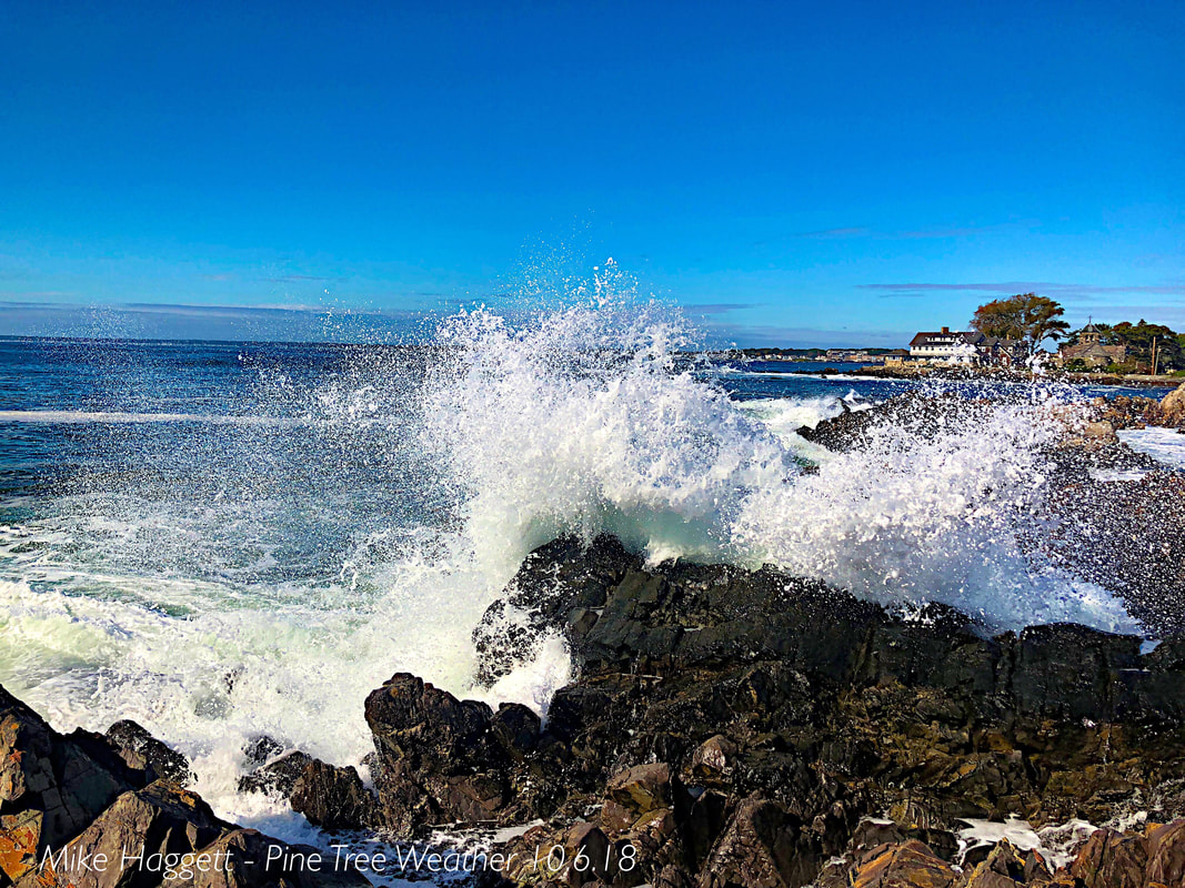 I apologize for the lack of updates. I am dealing with a touch of some sort of virus which left me flat on my back on Monday. I am going to do a synopsis update here as that is all I can muster at this point, so bear with me as I take care of myself. The tropics and October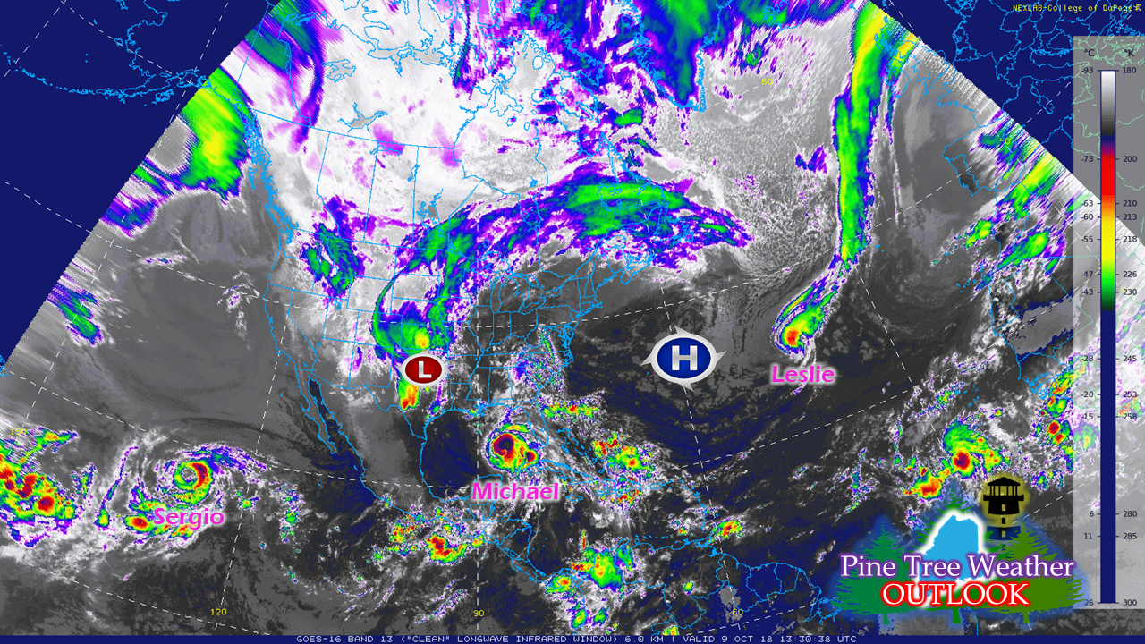 A look at the key players over the next several days via water vapor. A strong ridge to the east, a deep trough over the west. Leslie is still churning well to the south/southeast of Maine. Michael is barreling for the Florida panhandle, and Sergio is stirring the waters southwest of Baja California.  A look at the 500 mb height map shows the upper atmosphere a bit better defined. A bit of a squeeze play going on between the deep trough in the west and ridge over the east, with Michael threading the needle between the two. This a very typical set up for fall with the Arctic cooling off and sinking southward, and warm air trying to hold onto superiority but is slowly being eroded away. 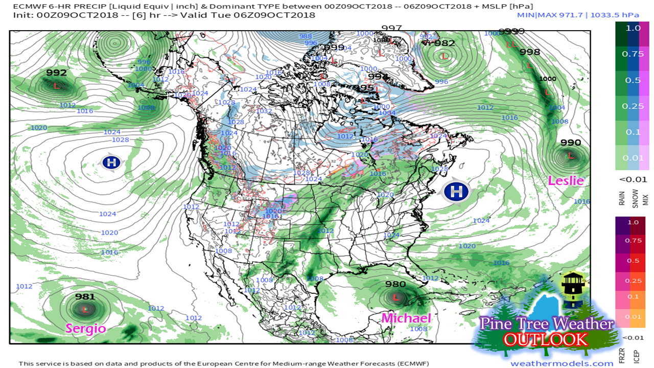 Surface map shows some subtle differences between the upper air and terra firma, but all the players are here. 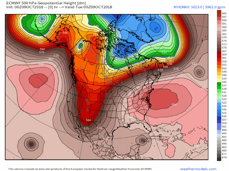 The 500mb put into motion shows Leslie moved well away to the east. The strong high over the east coast contracts allowing Michael to enter into the Florida panhandle and cross over Georgia and the Carolinas. Sergio gets caught in the vacuum and is drawn into Baja California and will bring rains to the southwestern parts of the country. 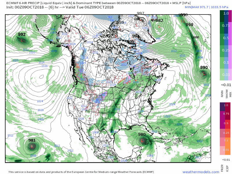 The surface map view shows Michael's progress through the southeast states, getting caught in a cold front that -may- take it out to sea away from Maine. Moisture from Sergio enters into the southwest and gets caught in a frontal boundary that may bring precipitation to Maine later next week. Michael's progress up the eastern seaboard will have to be monitored closely. The potential skunk in the long range forecast is the position of the cold air in Canada. Models, despite their latest "upgrades" are still not handling cold air well. Given the close shave to southern New England, and slowdown in the advance of the trough to the south could bring the storm system closer to Maine as we approach the weekend. At the very least, Maine will likely receive some high surf from this storm. Stay tuned... High Impacts for the Florida Panhandle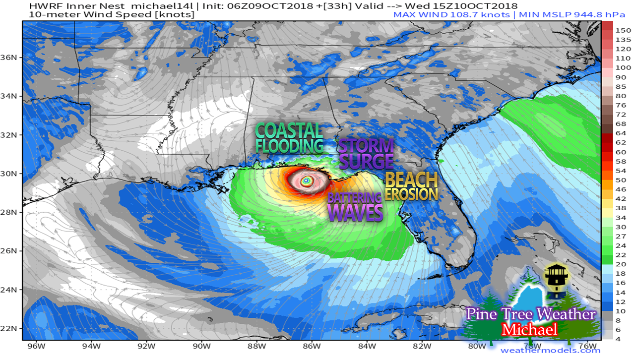 While Michael is likely to be a major hurricane at landfall, the one thing going for it is that it appears to be a fast mover. Projected landfall puts it around Panama City with winds 110-120 mph around midday Wednesday. The north and eastern quadrants of the storm are the main areas of concern, as always due to wind and rainfall. While it will be a quick mover, it will pack quite a punch. Areas of the Carolinas still dealing with flooding and damage from Florence will get more rain and wind, which are things that area could live without. Heavy rain, severe storms and tornadoes will all be a concern as the storm impacts land areas before it exits the Outer Banks on Friday. Stay in touch with the National Hurricane Center for the latest information from them. Stay Updated! For the latest official forecasts, bulletins and advisories, please check in with the National Weather Service in Gray for western and southern areas, or Caribou for northern and eastern parts of Maine.
For more information from me, please follow the Pine Tree Weather Facebook page and my Twitter feed. Thanks as always for your support! Please consider making a donation to keep Pine Tree Weather going. Check out the donate page on how to contribute. Always stay weather aware! - Mike |

Mike Haggett
|


