A raw, nasty day to end the weekI mentioned a few weeks ago that we entered silly season, and this is a silly storm. Some areas may see precipitation whiplash at times as the snow and rain flip-flop back and forth as the cold air from aloft tries to take over atmospheric dominance. With no surface deep cold to tap into, the snow that comes from this storm depends on the intensity of the low pressure aloft. Hence the difficulty to forecast snow amounts. As quickly as the storm intensifies, it weakens. Without the thermal support of the deep cold, it quickly loses steam. That said, it will be cold enough to cause accumulating snow for higher elevations, cause a mix of rain and snow for the interior, and for the shorelines, a mainly rain event during the day, with snow possible Friday night. 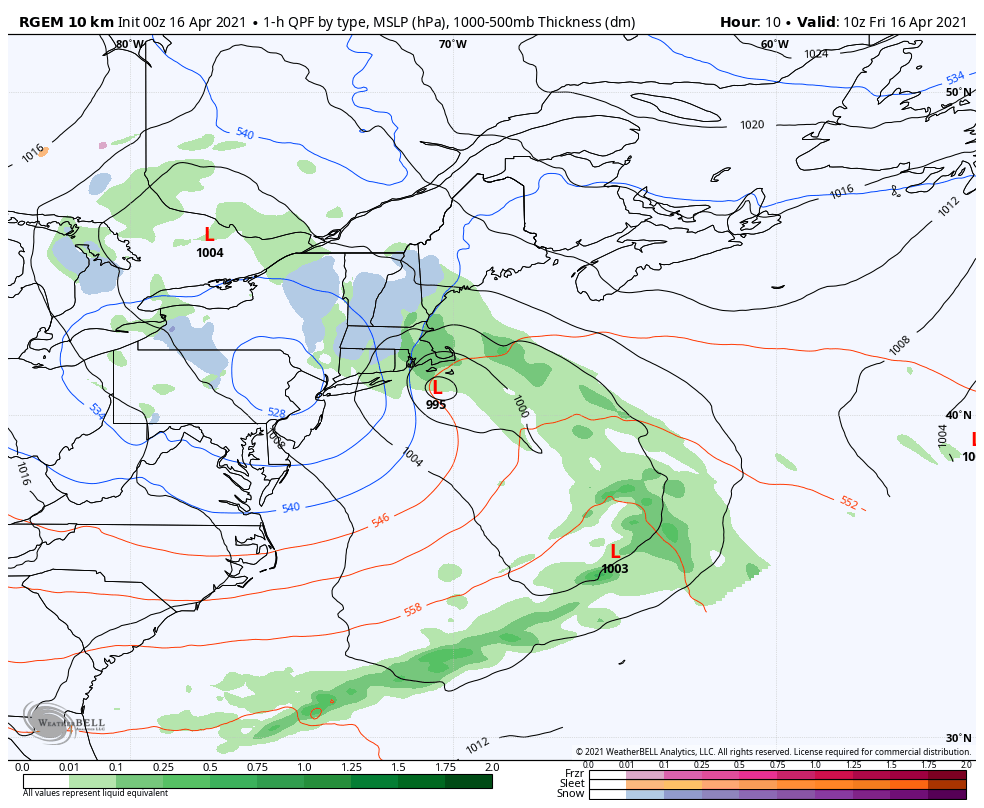 Timing of the storm remains on track. Western and southern areas get going Friday morning, precipitation moves eastward Friday afternoon. The storm weakens and moves east Friday night into early Saturday, and precipitation tapers off from the west around sunrise Saturday morning, and to the east by late morning. 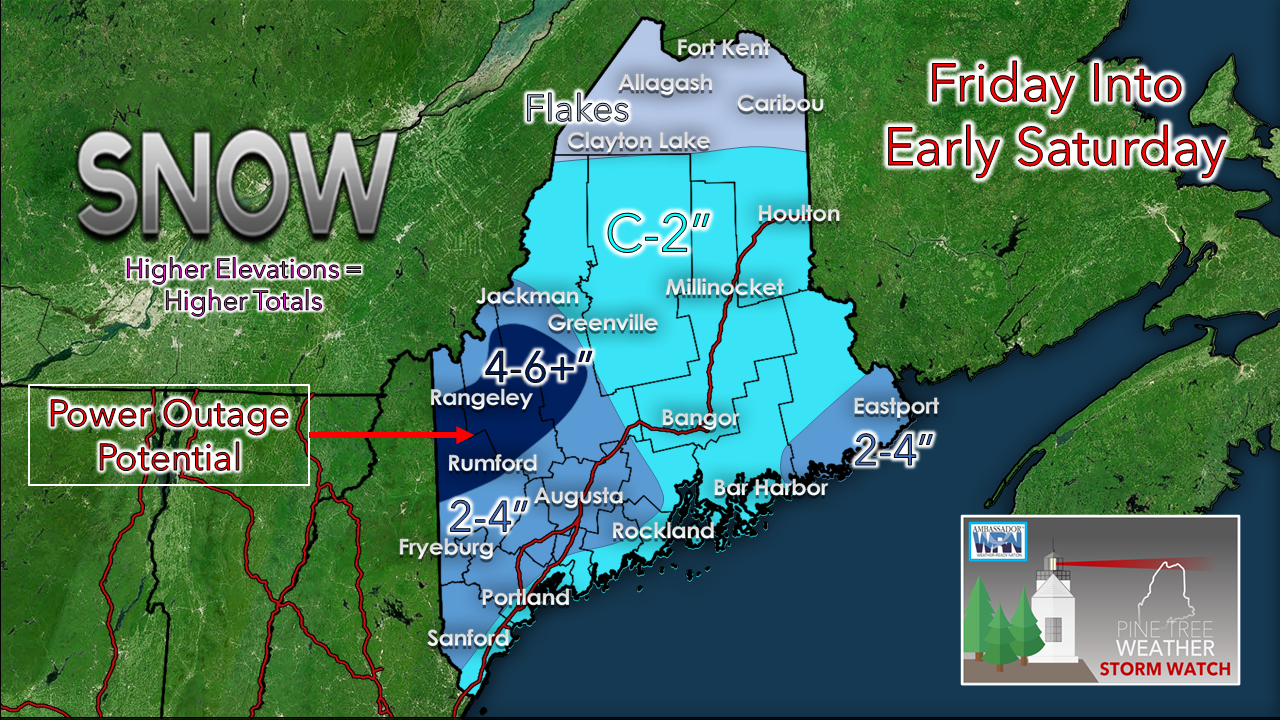 Respecting the dynamics of the storm as observations and guidance of the mid and low levels of the atmosphere come together caused a slight revision in the snowfall map. The snow that falls will stick to everything. We could see large flakes for a time. Given the low ratio nature of it, it will compact as it accumulates. As the storm intensifies, a dry slot is expected to develop in the key snow growth area this afternoon. With the sun angle being high, it will be tough for snow to pile up over the coastal plain during the midday hours. For areas 800' in elevation and higher, the higher end snow amounts are likely. Bust potential remains moderate given the sum of all these ingredients. 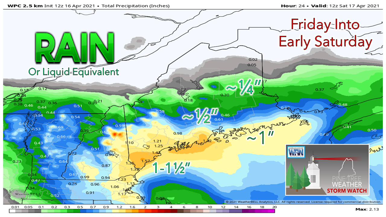 A much-needed rain event for southwestern and coastal areas, where deficits are between 3-4" from the dry winter. This will take the edge off for the short term. 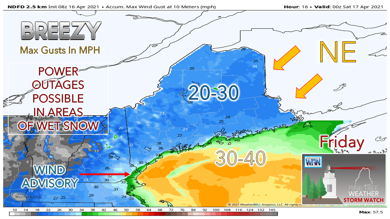 Peak gusts for Friday happen during the day. Expect breezy conditions to continue into Saturday, with the wind settling Saturday night. Extended outlookOur next chance for rain comes Wednesday into Thursday. A nice warm up is on the way to start the week. 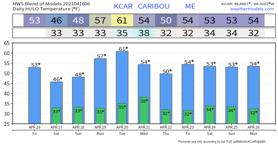 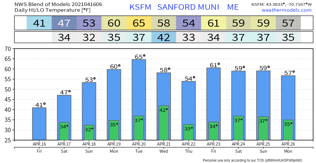 Ice and snow, take it slow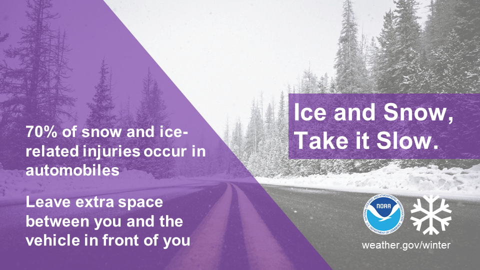 Winter driving can be hazardous. One simple way to keep yourself and everyone on the road safe is to slow down. Remember, “Ice and snow, take it slow”. Learn more at weather.gov/winter Be prepared to receive alerts and stay updated!
For more information in between posts, please follow Pine Tree Weather on Facebook and Twitter.
Thank you for supporting this community-based weather information source which operates by reader supported financial contributions. Stay updated, stay on alert, and stay safe! Thank you as always for your support! - Mike |

Mike Haggett
|