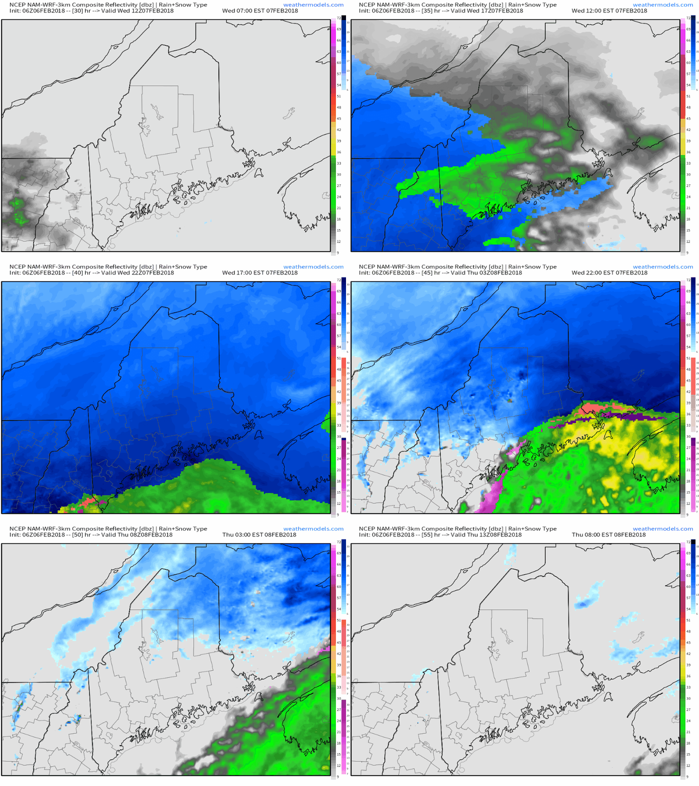
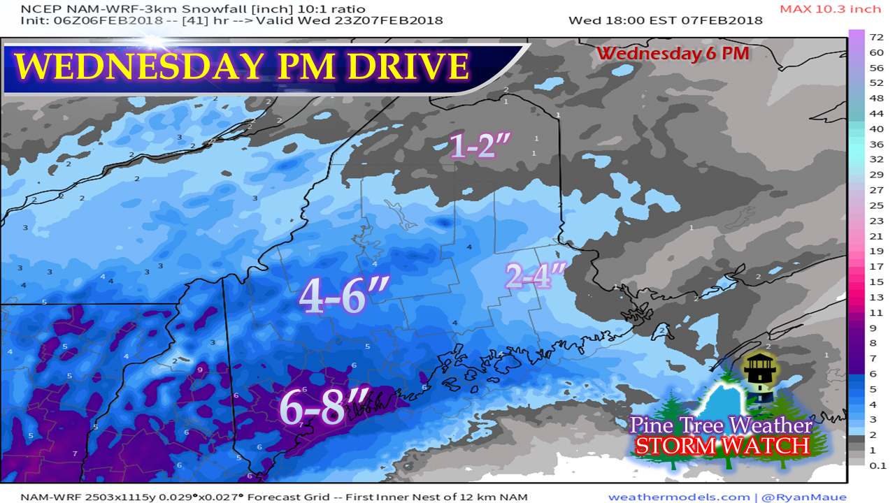
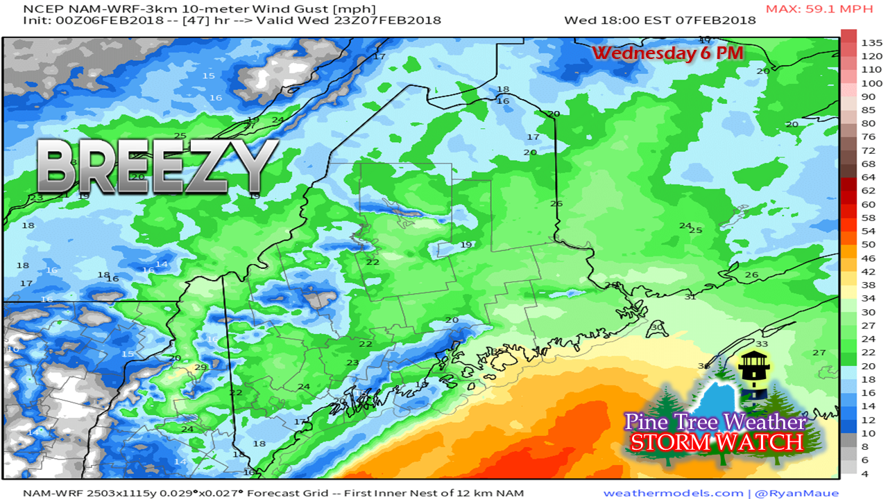
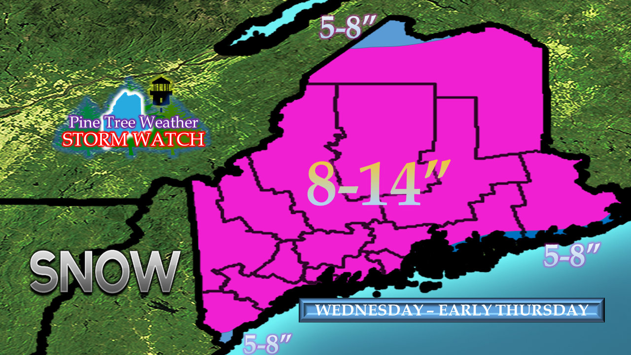
Quick hitter to dump snowWhile this storm will not last long, it will bring a snowy punch to the state. The combination of upper level energy to the northwest, a southern stream pumping in rich moisture out ahead of it puts Maine in the cross hairs. While the traditional morning drive time will be alright, it will goes down hill rather quick as we head into the afternoon. Don't let the suggested precipitation outlook from the NAM model here fool you, this is on track to be a full on snow event. What is green and yellow indicating rain is likely by-in-large to be blue with snow being the rule. As quickly as the storm comes, it will end. Southern areas see snow end by mid-evening Wednesday night, with far northern areas seeing the last of the snow showers exiting before daylight on Thursday. Wednesday evening drive to be impactedAgain, the morning drive looks good, but from around noon onward, snow intensifies and falls rapidly. Snowfall rates in the 1-2+" range are likely as the evening drive approaches. As much as 6-8" of fresh snow is likely to be on the ground over southern areas as we approach 6 PM. For the Bangor area, expect 3-5" down by evening. A bit of wind to reduce visibilityIn conjunction with the heavy snowfall comes a breeze to go with it. While certainly not a blizzard, it will be windy enough to cause whiteout conditions in areas as the snow rapidly falls. Wind will also play a role into Thursday on the backside of the system, which is likely to cause blowing and drifting of snow through the day. Gusts could range in the 30-35 mph range across much of the region. Total snowfallAll in all, as solid snow event for most of the region with 8-14" likely for much of the state. The northwest crown around the Allagash appears to be on the light end of this one. The extreme southwest coast in York County and the DownEast shorelines may see a bit of a mix or wetter snow from a coastal front which may knock totals down there a bit. The next system of concern appears Sunday and that could be a warm event for the coast. Stay in touch with the forecast for the latest on that. Relocation process continuesThis is a very busy time for my family as we are in the process of preparing to move from Poland Spring to Kennebunk. The sort, save, sell and purge phase is going strong. This is consuming much of my time, along with day job responsibilities. This is certainly a process, and not an event. I will update here when I can. You can always follow me on Twitter for any quick hits of information that I have time to pass along. For you Facebook followers, be sure to have page notifications turned on in order to get information there. I will update when time permits until the moving process is complete.
Thank you for your understanding and support. - Mike |
Mike Haggett
|


