
Thursday Night: Mild Temperatures Overnight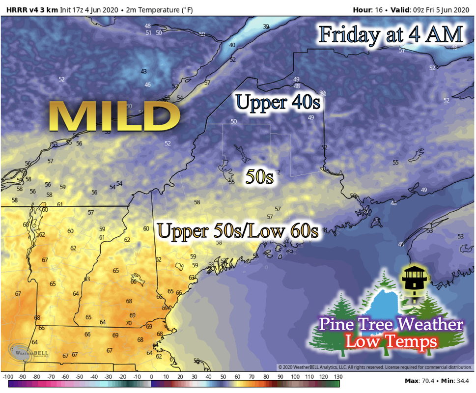 Another night of mild temperatures is expected statewide for Maine Thursday night. The state has been under an upper-level zonal wind pattern for the past few days. This pattern will be broken this weekend as a shortwave moves through, helping to create a deep, skinny upper-level trough, that will bring a surface low pressure system through Maine and the rain for this weekend. Friday: Morning Rain Showers and Warm Temperatures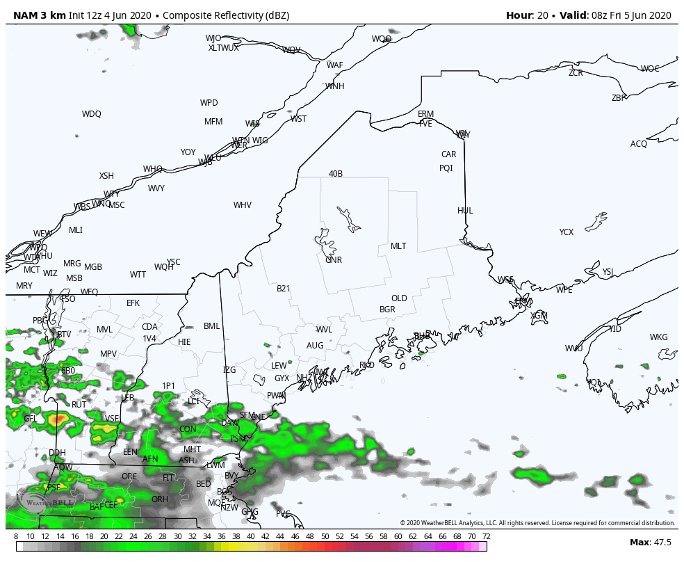 The GIF above runs from 3 AM Friday to 3 PM Friday. This rain looks to originate from the squall line that will develop in Pennsylvania later this evening. There may be isolated thunderstorms embedded in these widespread showers, so an occasional rumble of thunder could be heard. Rain showers should pass by early afternoon. 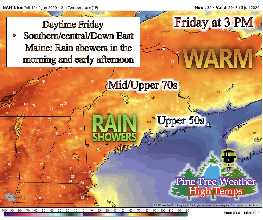 Besides the morning rain showers, Maine will be beautiful and warm statewide. Partly cloudy skies will blanket most of the state, with patches of clear skies to feel the Sun's warm rays. Most of the state will feel mid- to upper-70s with Down East Maine feeling temperatures in the upper-50s and lower-60s due to the onshore flow in the afternoon. Saturday: Thunderstorms and Temperature Outlook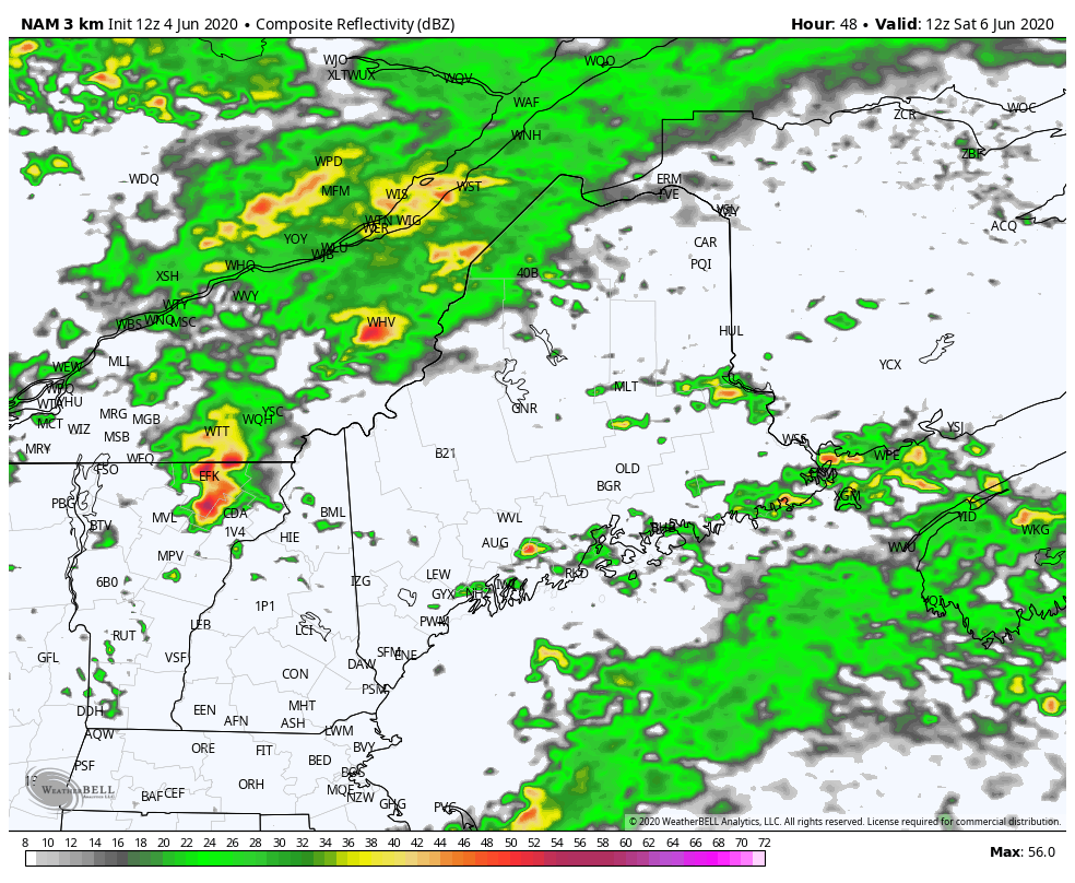 The GIF above runs from 7 AM Saturday to 7 PM Saturday. The first runs of the short-range models for this weekend output a line of thunderstorms pushing through Maine this Saturday afternoon. Early projections by long-range models showed this precipitation not to be as a structured line of thunderstorms, and more of a widespread rain with some embedded thunderstorms. A cold front associated with this system is a key player in the development of these lines of storms, as well as the deep, skinny upper-level trough helping to strengthen the low pressure system. We will continue to be monitoring this system as new model runs are available tomorrow and early Saturday morning. 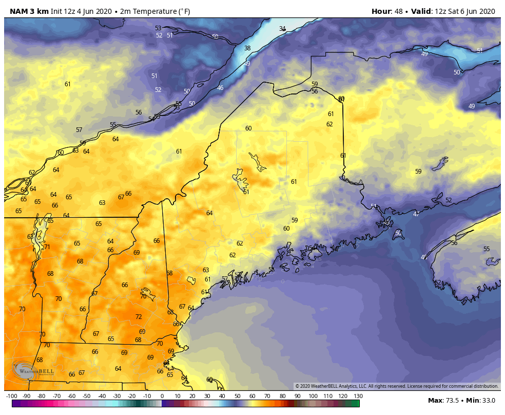 Frontal boundaries are associated with precipitation as they are with rapid temperatures changes. The GIF above runs from 7 AM Saturday to 7 PM Saturday. You can see the push of colder temperatures from the potential cold front for the system, pulling colder air from the north and into northern and central Maine. As newer model runs become available, low temperatures outlooks will be monitored tomorrow and Saturday morning. Cold Water Hazards and Safety!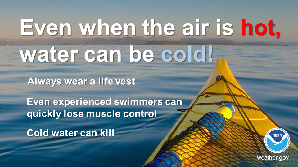 As temperatures begin to warm up and summer is coming quickly, it's important to remember that warm air doesn't necessarily mean warm waters. Water with a temperature below 70 degrees can drain body heat up to 25 times faster than being in cold air. When cold water makes contact with your skin, cold shock causes an immediate loss of breathing control, and greatly increases the risk of drowning. If you do consider going into cold waters, check water temperature online (https://tidesandcurrents.noaa.gov/map/index.shtml), wear water protection gear meant for cold water temperatures, and always wear a life jacket. Stay informed!
For more information, please follow Pine Tree Weather on Facebook and Twitter.
Thank you for supporting this community based weather information source that is funded by your financial contributions. Stay on alert, stay updated, and stay safe! Have a great rest of your Thursday! The weekend is almost here! - Kaitlyn |

Mike Haggett
|


