Wednesday: Mild and Partly Cloudy Skies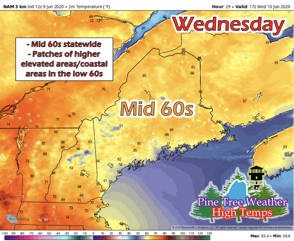 The Canadian high pressure system has progressed eastward north of Maine and resides on the northeast of Maine. As a result, Maine will experience light southeast winds. This gives coastal areas temperatures slightly warmer than the inland regions, ranging from mid 50s to low 60s. The rest of the state will be feeling temperatures in the mid 60s. Fair weather for the morning is in the forecast, with partly cloudy skies expected statewide until about mid-afternoon. Wednesday Afternoon into Thursday: Remnants of Tropical Depression Cristobal The GIF above runs from 12 PM Wednesday to 12 PM Thursday. As Tropical Depression Cristobal made its way north-northeast into the continental US, it has transformed into an extra-tropical cyclone (ET-cyclone). The occluded front attached to the newly formed ET-cyclone will push easterly north of Maine, and bring the remnants of precipitation through the state. This means scattered patches of light to moderate rain statewide. On the backside of this widespread and scattered precipitation, a cold front looks to push through Thursday night into Friday, and the chance for thunderstorms could be possible. Further information on this potential will be available as we get closer to Thursday. Thursday Temperatures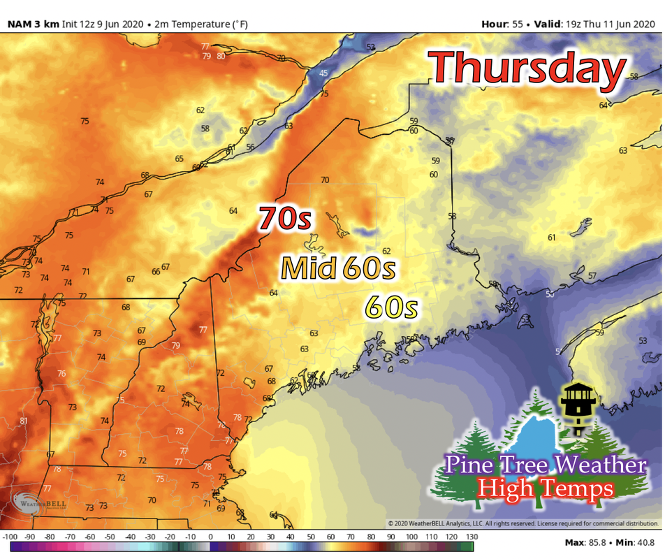 As the low pressure system of the ET-cyclone passes north of Maine, winds off of the ocean will keep Down East Maine cooler and in the upper 50s to low 60s. Central Maine will experience temperatures in the mid 60s, and northern and western Maine with temperatures in the low 70s. Thursday Night into Friday: Rain Outlook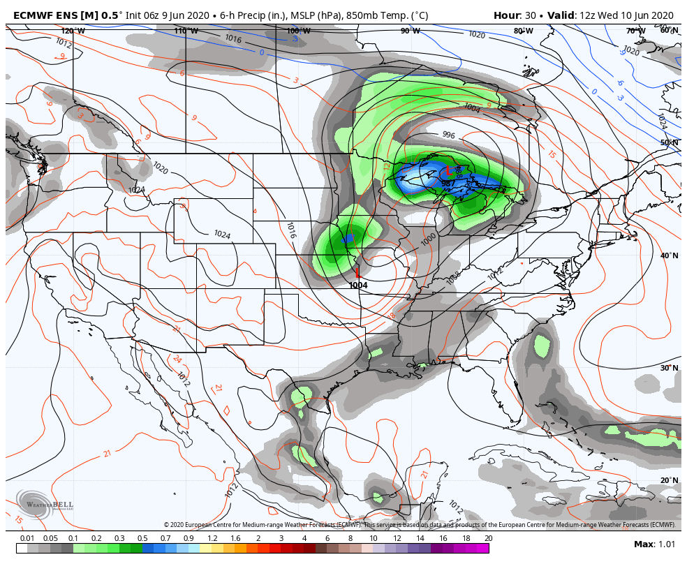 The GIF above runs from 7 AM Wednesday to 7 AM Friday. The ET-cyclone passes north of Maine, bringing Maine the widespread and scattered showers, but on the backside of that is a secondary low pressure system and frontal boundary associated with it, creating this long-range model to output rain potential for Maine Thursday Night and into Friday. Climatology of Maine's Average Temperatures: May 2019 vs. May 2020
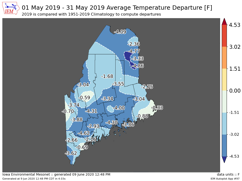
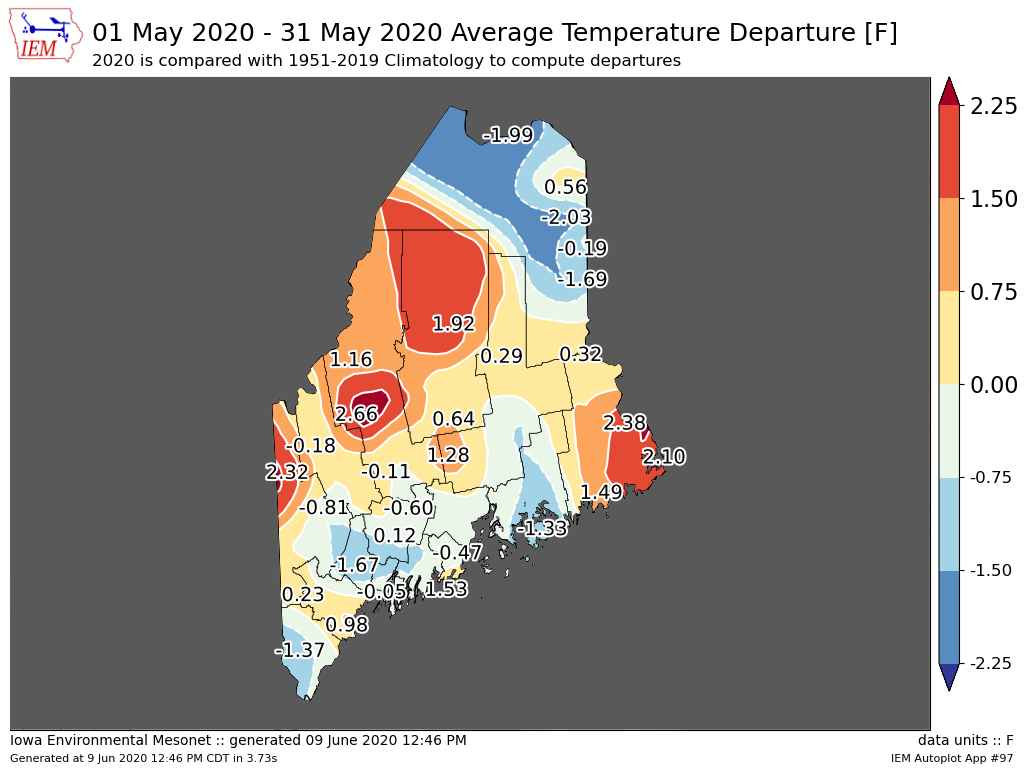
Now that May 2020 is officially over, we can take a look back to May 2019 and compare the average temperature departures of those years. Average temperature departure is how far off was the average temperatures were during May of that year from the 1951 to 2019 climatology. Overall, May 2020 was much warmer statewide than May 2019. There isn't a giant increase or decrease for any particular region; it seems that all of the regions increased together at roughly the same rate. To know why, you would have to look back at a number of factors, both within the state to regionally and globally. Overall, Maine had a warmer May 2020 than May 2019. Stay informed!
For more information, please follow Pine Tree Weather on Facebook and Twitter.
Thank you for supporting this community based weather information source that is funded by your financial contributions. Have a great rest of your day! Almost halfway through the week! - Kaitlyn |

Mike Haggett
|