|
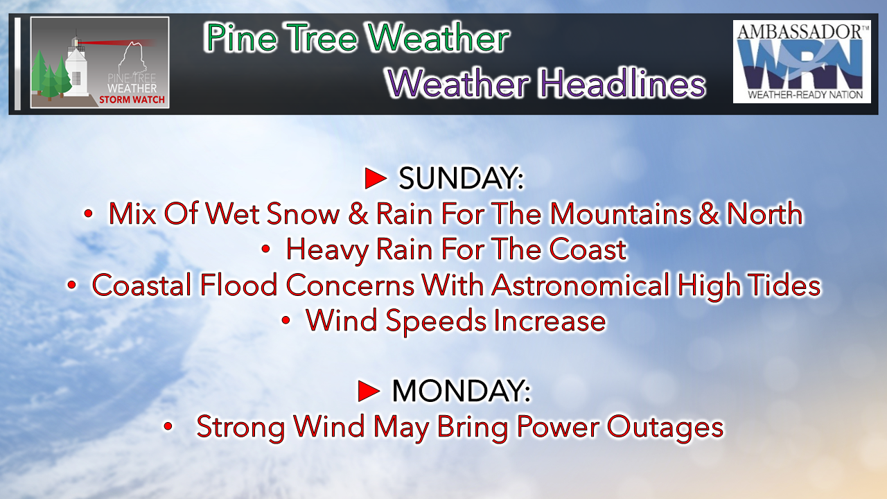
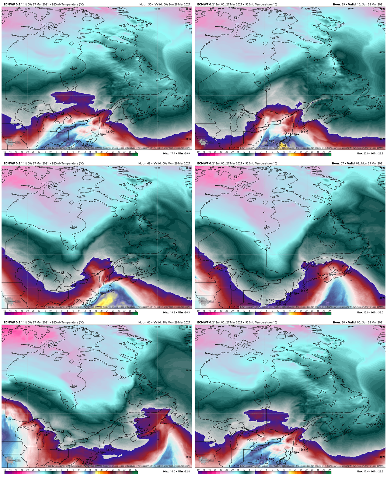
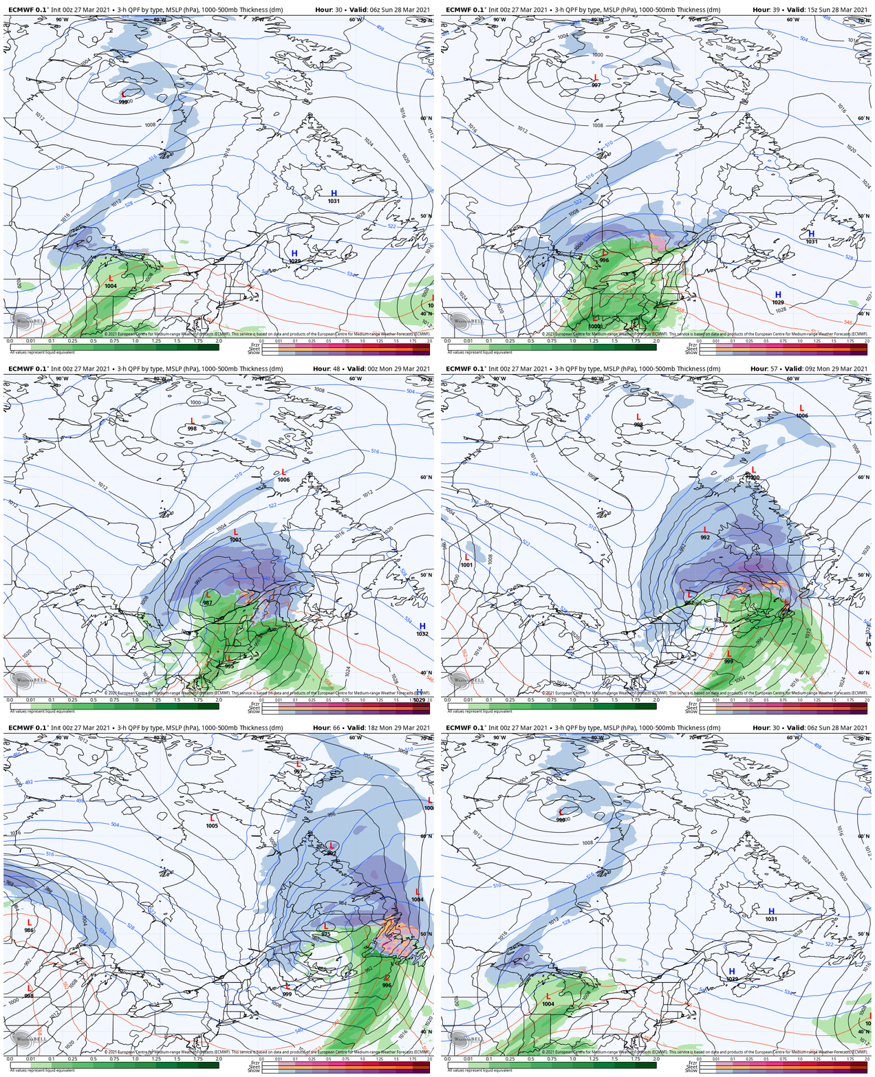
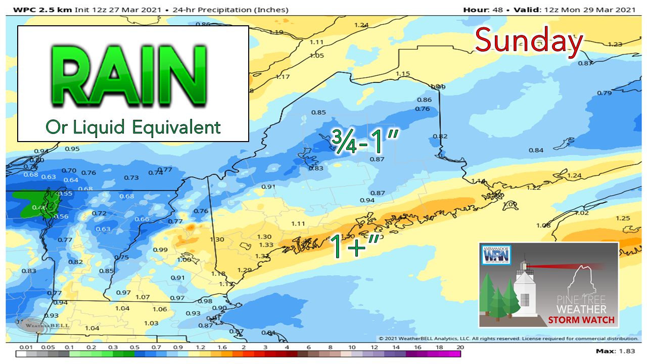
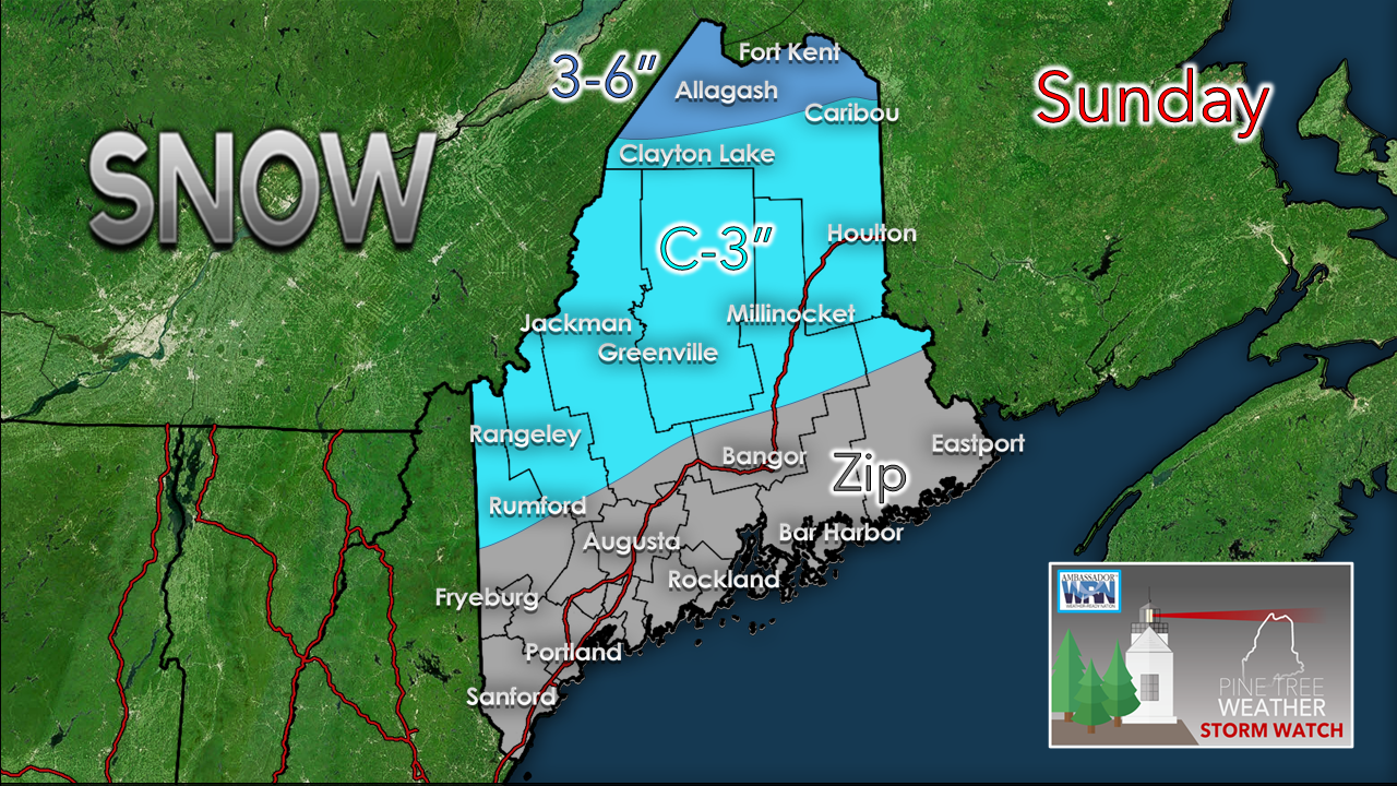
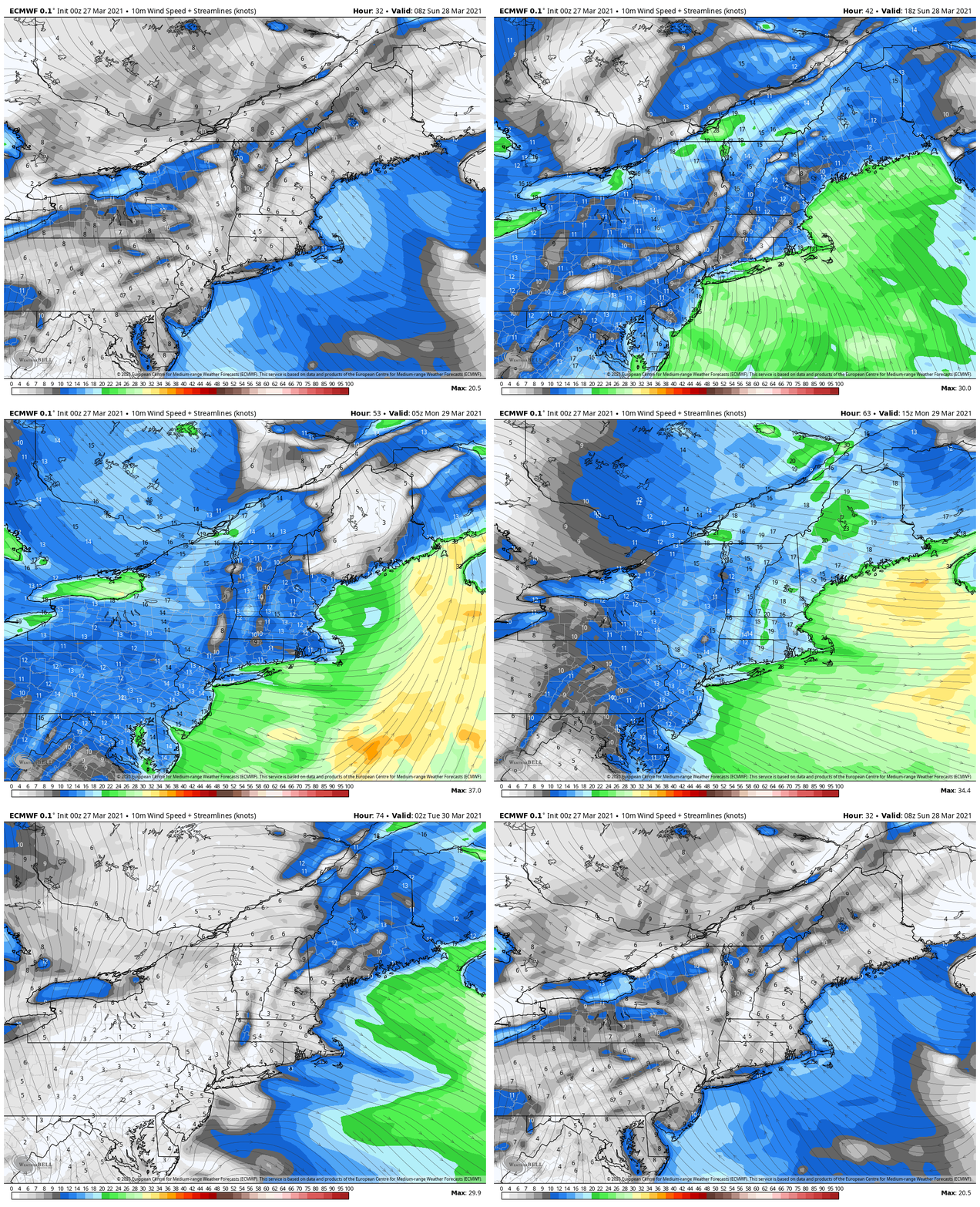
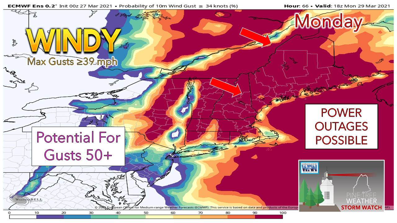
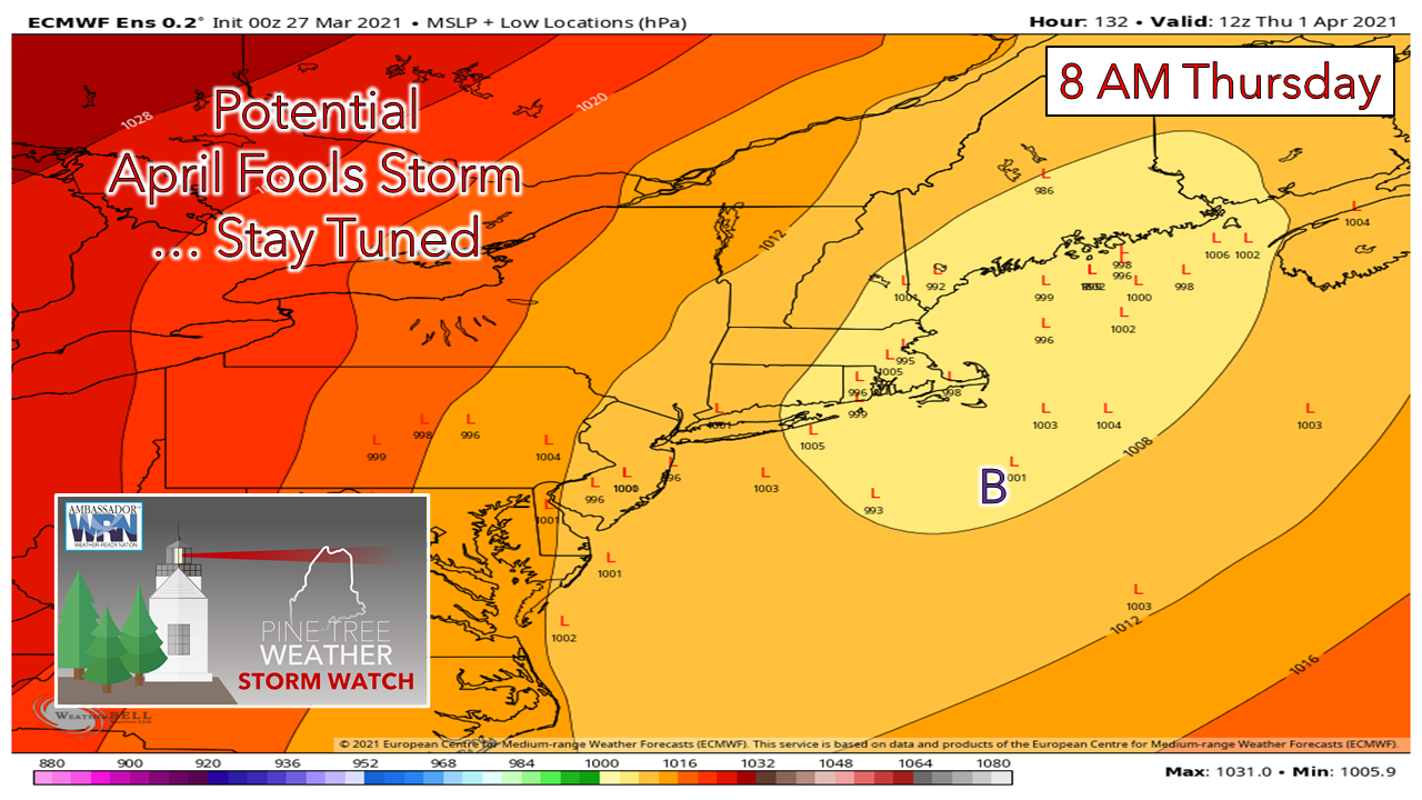
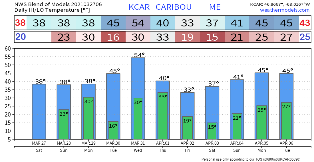
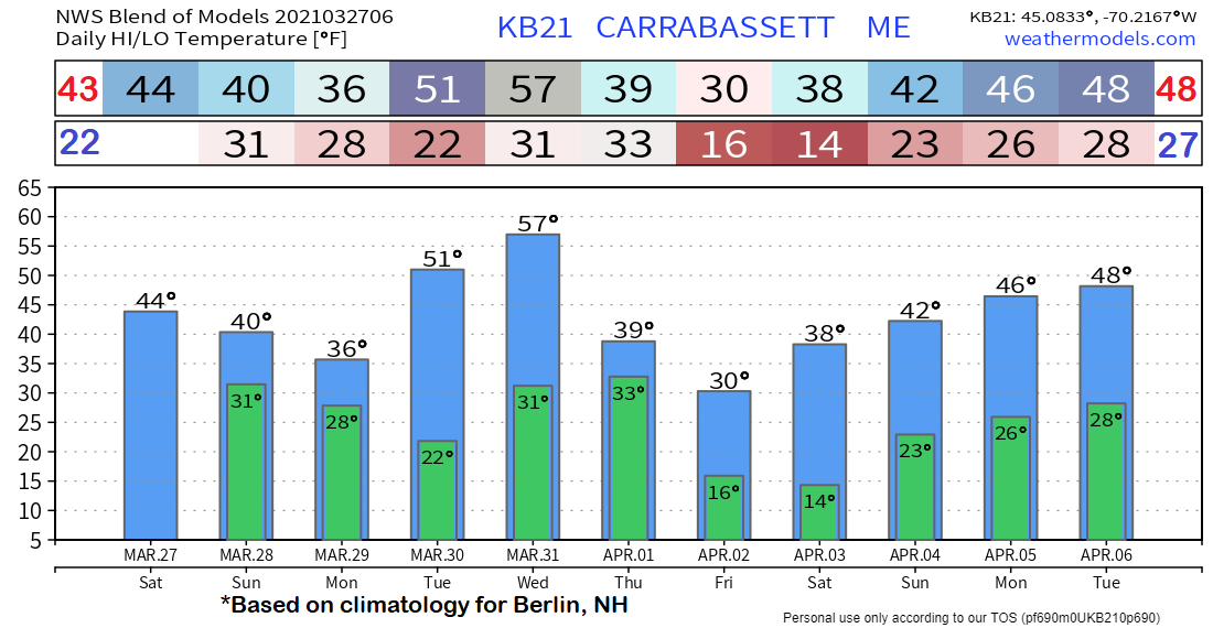
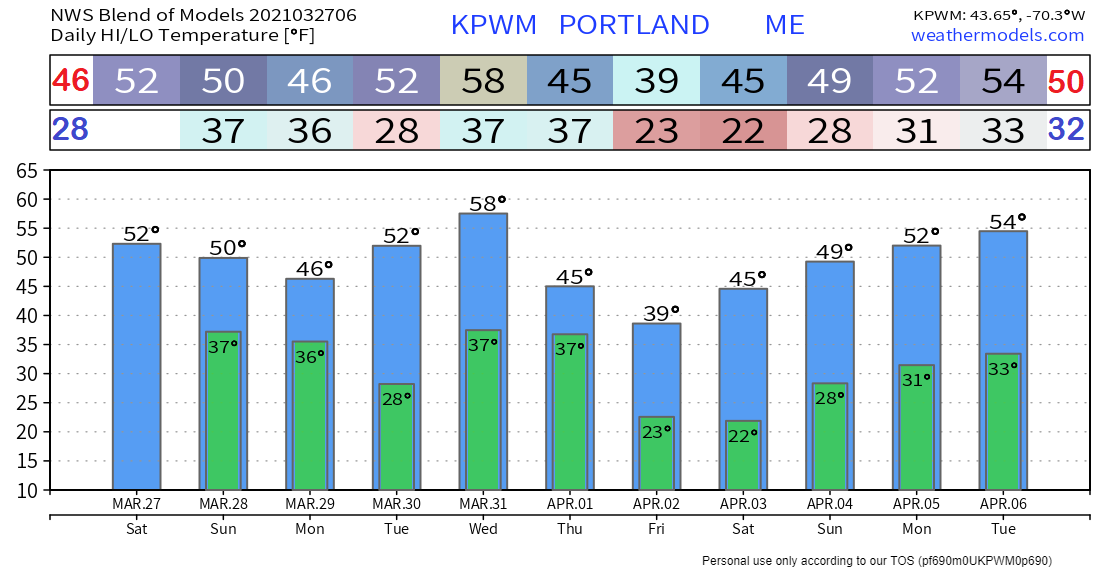
As I continue to wrap up my studies with Penn State, updates will continue to be sporadic at best. I do not plan an update for Sunday and may do a quick update on Facebook on Monday. I am eternally grateful that I have been blessed with the opportunity to advance my atmospheric studies to better serve my fellow Mainers. Graduation weekend is in early May. I will be done well before then but will need time to organize and prepare for several interns who will work with me over the summer. Thanks as always for your patience and support. A decent storm on the wayIt will be important to stay on alert and stay updated over the next couple of days. I suspect there will be bulletins issued by the National Weather Service for coastal flood concerns, along with wind advisories and/or high wind warnings. We usually get at least one corker of a storm in March, and this one fits the bill. Cold to determine snow for interior areas SundayA couple of things to point out with this loop of temperatures at the 925mb altitude level (2500 feet). First, the deep cold (pinks) at the low level remains fairly close to the region. As a result, the threat for interior / higher elevation snow continues to persist into April. Second, regarding this storm, it will dictate snowfall amounts for the higher elevations and northern areas. The concern all week has been the timing of the formation of the secondary low over in the Gulf of Maine. Where models were at one time thinking it would occur early, that idea faded away. The result is precipitation more in the way of rain as warm air noses in further. Sunday will be a stormy one. The mountains may start off with snow to start, and it may fall for a few hours before flipping to rain as the warm air surges in. The higher peaks stay snow the longest. Far northern areas appear to stay in the cold through most of the duration of precipitation, so mainly snow there for the Allagash and Fort Kent region. Coastal areas appear to get a solid rainfall out of this, which will help cut the deficit with the dry winter. It will help calm down wildfire concerns and help thaw the ground and green the foliage. On the flip side, ice jams and river flooding are a concern for The County due to melting of snow and runoff. An ice jam has already been noted in Washburn and a flood warning has been issued there. As far as frozen precipitation goes, it appears to be elevation dependent for western areas. The taller ski hills could see 3-6", but lesser amounts are likely below 2500 feet. Northern areas have the best chance for a general 3-6" snow event. The north country may also pick up an inch or two of snow on the backside of the system on Monday. The wind is going to blowGiven the rapid intensification of the storm as it passes through the area on Sunday into Monday, wind speeds will increase along with it. South / southeast winds on Sunday bring the main concern to coastal areas with storm surge. The high tide of concern is in the 11 AM hour, where flooding, splash over and beach erosion are possible. Tides are running astronomically high with the full moon approaching to make it more a concern. Monday is where the main concern is for power outages. The European ensemble idea is predicting a 100% chance for wind gusts to exceed 39 mph. This sets up the potential for power outages. The peak wind comes Monday afternoon. As the storm moves away, the wind settles by Tuesday morning. Check your storm supplies, keep the phones charged and be prepared in case power supply is disrupted. April Fools storm on the discussion tableWill March go out like a lion? The storm on Sunday appears to have more of a roar than this one potentially, but is should be monitored. This is a similar set up to Sunday with higher elevation / northern snow and coastal rain. Time will tell if it stays that way. With the cold air around to the north, timing of the storm will dictate the outcome. Stay tuned on that. Ten-day temperature outlookNormal highs and lows anointed into the graphics here to get an idea on where the forecast temperature aligns with seasonal averages. It's a bit of a roller coaster ride as we head through the week, with a warmup potentially as we get into the first full week of April. High Winds on a Clear DayClear isn’t always calm. Even on a clear day, strong winds can be dangerous. Objects that are not secured can be rolled or tossed. Use caution when driving, especially high-profile vehicles. weather.gov/safety/wind Be prepared to receive alerts and stay updated!
For more information in between posts, please follow Pine Tree Weather on Facebook and Twitter.
Thank you for supporting this community-based weather information source which operates by reader supported financial contributions. Stay updated, stay on alert, and stay safe! Thank you as always for your support! - Mike |
Mike Haggett
|

