
Tricky travel through Tuesday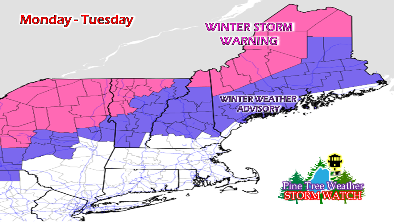 No real changes to what I posted here last night. The National Weather Service has converted the winter storm watch into a warning for the western mountains and the rooftop of the state. Model ideas have nudged a tad cooler. The game at this point is watching the thermometer and see what falls from the sky. Confidence remains good that snow will be the main feature in the warning areas. To the south and east, it becomes a bit more of a challenge. Precipitation type will be determined by how far inland the warm nose in the upper level of the atmosphere goes. It looks like sleet could be a concern for the western foothills on up into southeastern Aroostook. 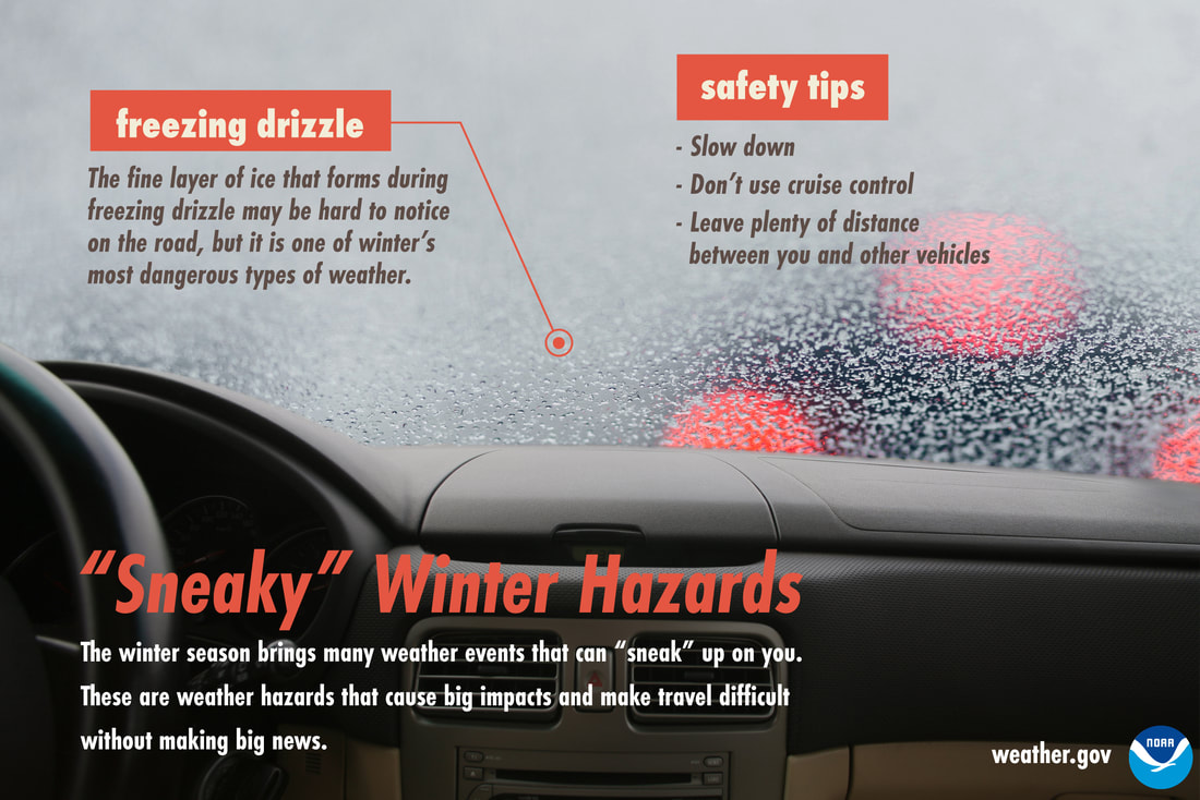 The National Weather Service issued winter weather advisories for the main concern of some light icing from freezing rain and/or freezing drizzle potential. Freezing drizzle is the worst of any winter precipitation type because it clings to most everything. While less than 0.10" is expected for most areas that see it, only a few hundredths of an inch is necessary to cause slick roads, sidewalks, and driveways. 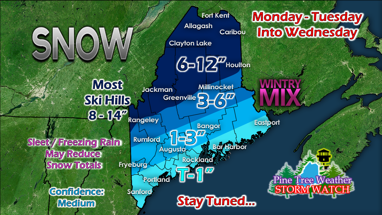 I am sticking with the snow map forecast posted here Sunday evening. I will be right up front and say my confidence below the mountains and north is low for snow amounts due to potential sleet and freezing rain knocking down totals. For ski country, remember that this is a three day event for you as upslope snow showers will continue into Wednesday. 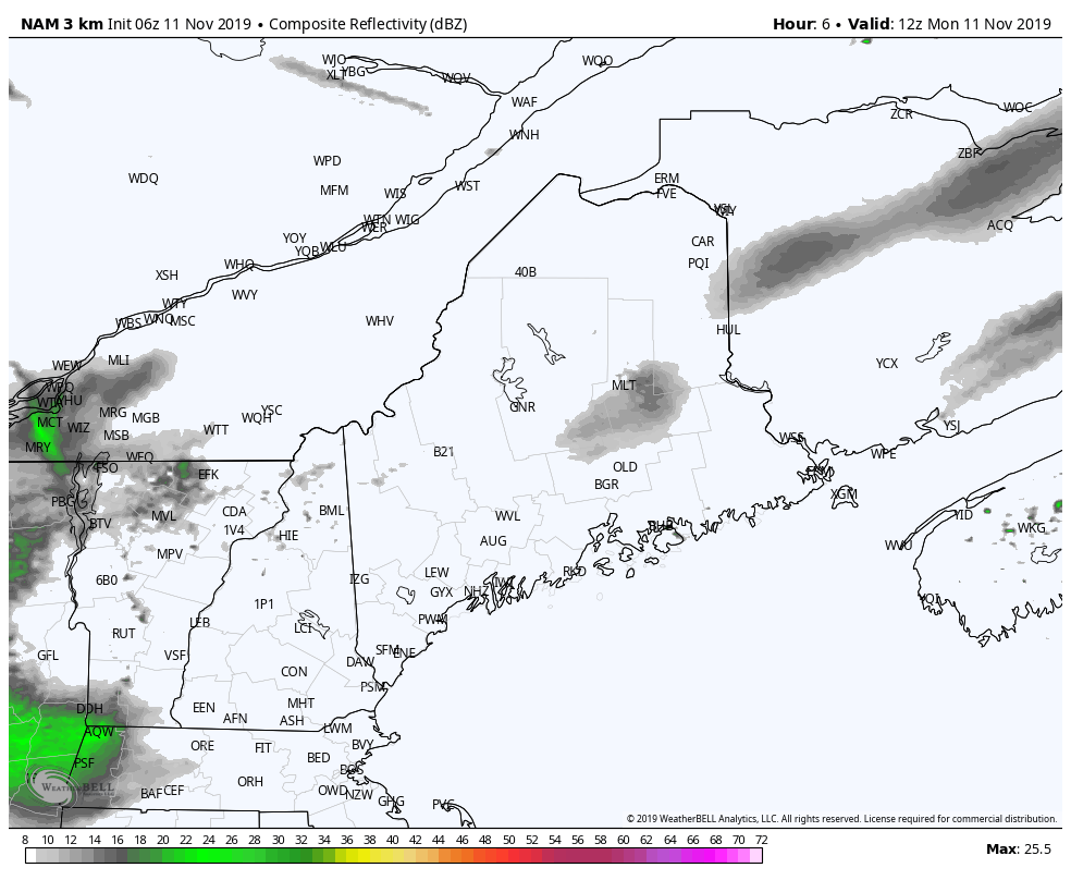 (This is the standard composite precipitation radar idea. This is not all rain. I don't like the looks of the precipitation type idea due to the way it handles mixed precipitation. ) Southern areas see some precipitation forming this morning into early this afternoon. The main event arrives over the area Monday night into early Tuesday morning. As low pressure moves to the northeast, the bulk of the precipitation ends early evening Tuesday over western and southern areas, Tuesday night into early Wednesday for northern and eastern areas. Expect changing driving conditions. DO NOT TRUST YOUR VEHICLE THERMOMETER. Expect a variance of 4° - 5° from what your vehicle thermometer states versus actual surface temperature. Thank you, Veterans! May those who are serving or have served, and their families be blessed and honored today and everyday. Thank you for your sacrifice to keep our country and world a safer place.
► ► For the latest official forecasts, bulletins and advisories, please check in with the National Weather Service in Gray for western and southern areas, or Caribou for northern and eastern parts of Maine. ► ► DONATION DRIVE UPDATE - $840 shortfall for the year ahead! You can help keep Pine Tree Weather going with a donation of any amount now through VENMO @PineTreeWeather, a monthly donation on Patreon or messaging me on Facebook or Twitter to send a check in the mail. Thank you for your support! For more information from me, please check the Pine Tree Weather Facebook page as well as my Twitter feed. Always stay weather aware! - Mike |

Mike Haggett
|


