Frontal boundary passes through Sunday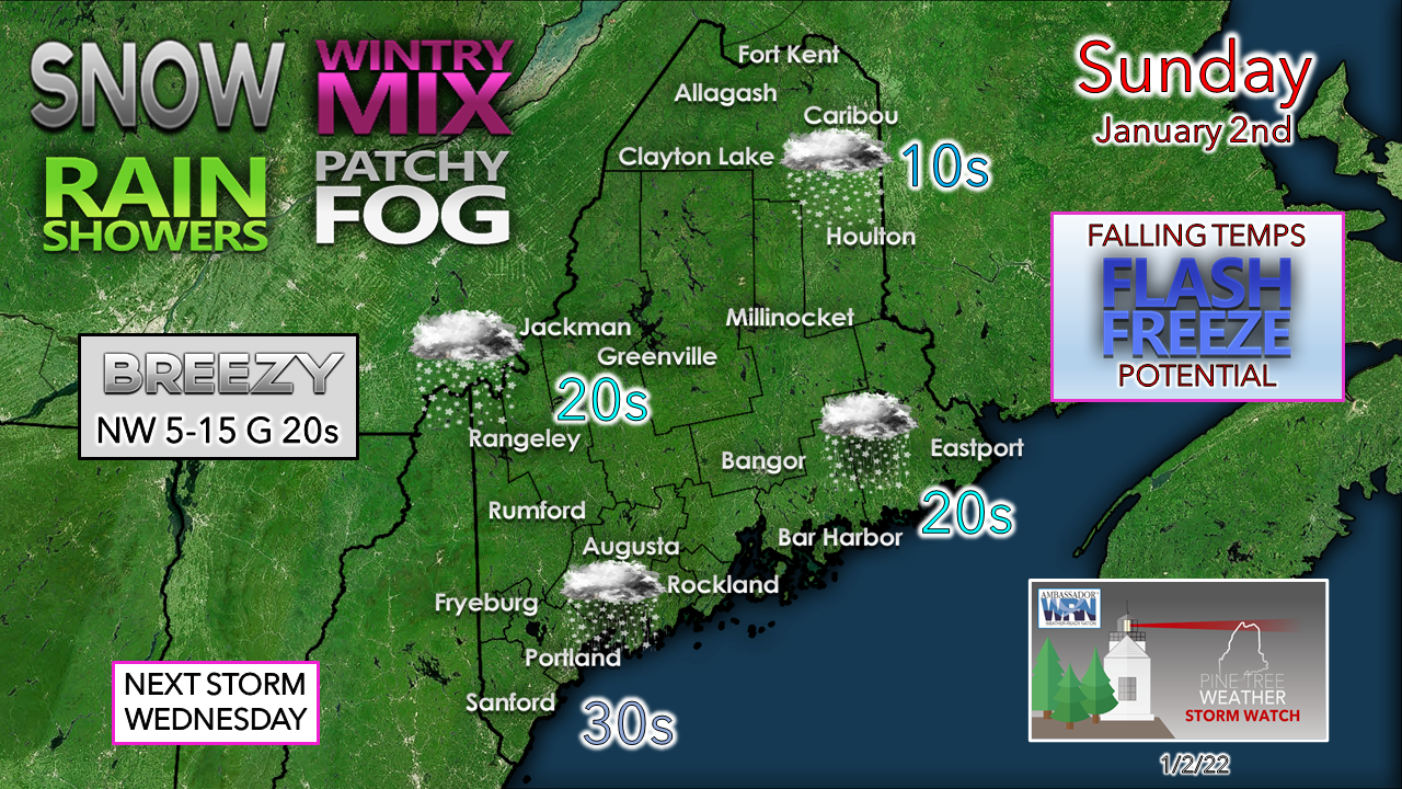 While snow is the main feature for the mountains and north, the western foothills on over to the eastern interior and the coast see a bit of everything with rain, light ice and/or sleet to snow. Any areas that see rain over the interior and coast should be on alert for a flash freeze as cold air works in Sunday afternoon into the evening. 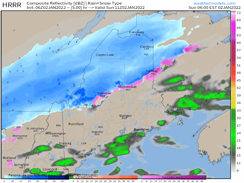 Sunday 6 AM to Monday 1 AM - The front continues its progression from northwest to southeast during the day. As cold air works in at the lower atmospheric levels, precipitation begins to change from rain to a wintry mix, then snow to end by late Sunday night over eastern areas. 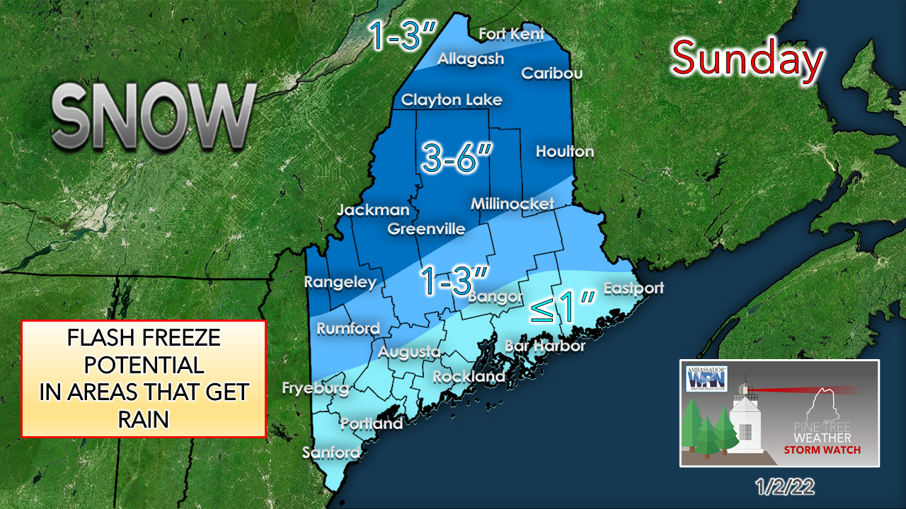 A slight modification to the forecast snowfall map for slightly less in the far north. Fluff factor remains high with this one with snow to water ratios at roughly 15:1 for the north and mountains. Closer to the coast the snow may bring a bit of paste to start off, but as cold air works into the dendritic growth zone it will fluff it up. I don't expect too many issues with snow removal for this one. The flash freeze potential for the foothills and coastal areas is more of a source for concern for anyone travelling this afternoon and evening. Blast of cold for Monday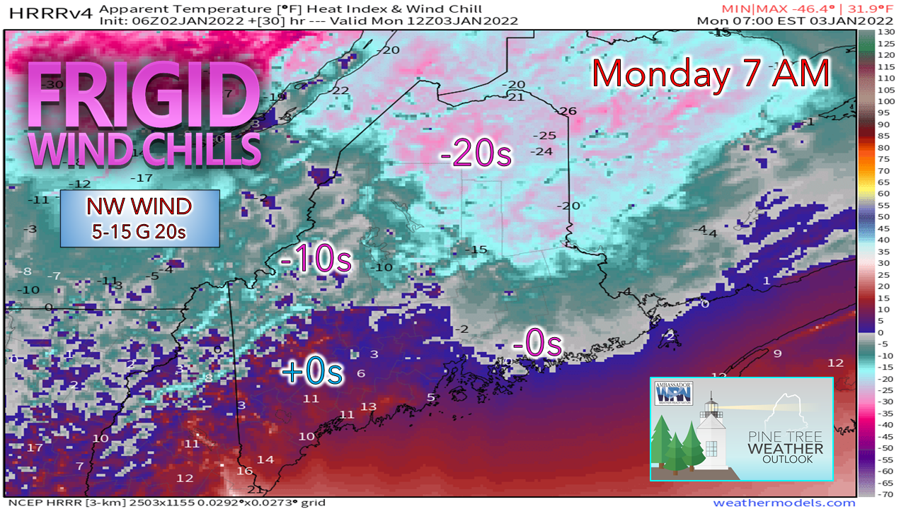 Folks in The County are on track to get a stiff slap to the face as they head out Monday morning, and everyone else feels it to a certain extent as well. The wind settles during the day as the cold Canadian high moves in overhead. Daily high temperatures are expected to stay below freezing everywhere, and below normal as well. Tuesday starts off with many interior areas below zero or a handful of degrees above. High pressure slides to the east and warmer air moves in, although it is expected that most of the region stays below the freezing mark beyond the shorelines and the far south. Two storms to watch in the week ahead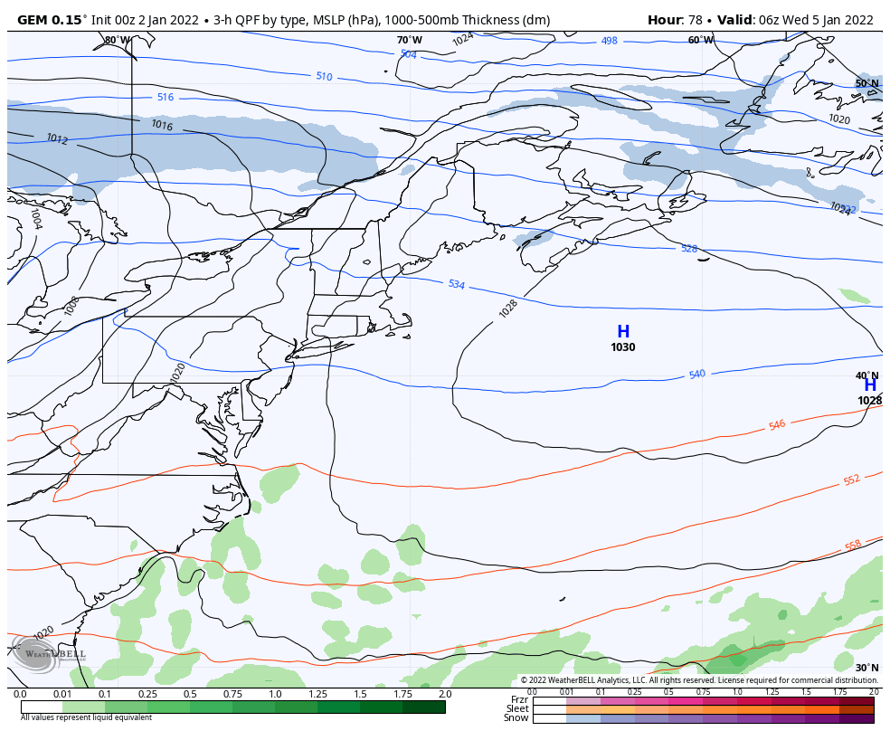 Wednesday 1 AM to Thursday 7 PM - As the cold Canadian high exits to the east, an upper-level ridge and associated warm front moves in from the southwest and could bring a mixed bag at the onset with a flip to rain for most Wednesday morning / early afternoon and then a cold front quickly sweeps it away Wednesday night into early Thursday. Black ice could be an issue once again for areas away from the shorelines during the overnight hours. 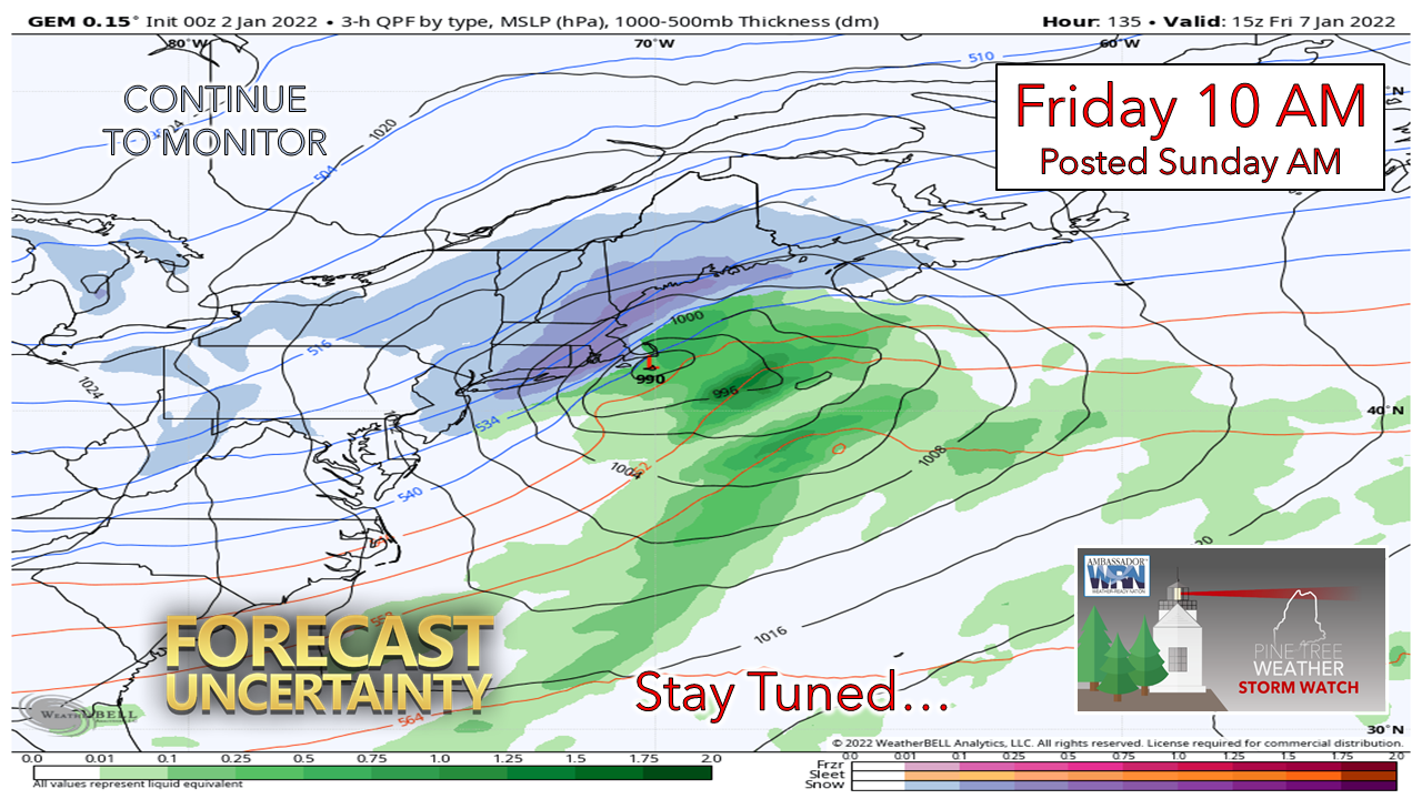 Storm Friday? As of Sunday morning, a fair portion of the ensembles of the ECMWF, GEFS and Canadian are on board with the idea of a nor'easter that could impact the region Friday. A sharp change of the ridging in the eastern Pacific helps support this potential IF it is as strong as it is being billed. This could be the first widespread impactful storm of the season. For now, it is something to monitor and see what happens.  Temperature outlook through Friday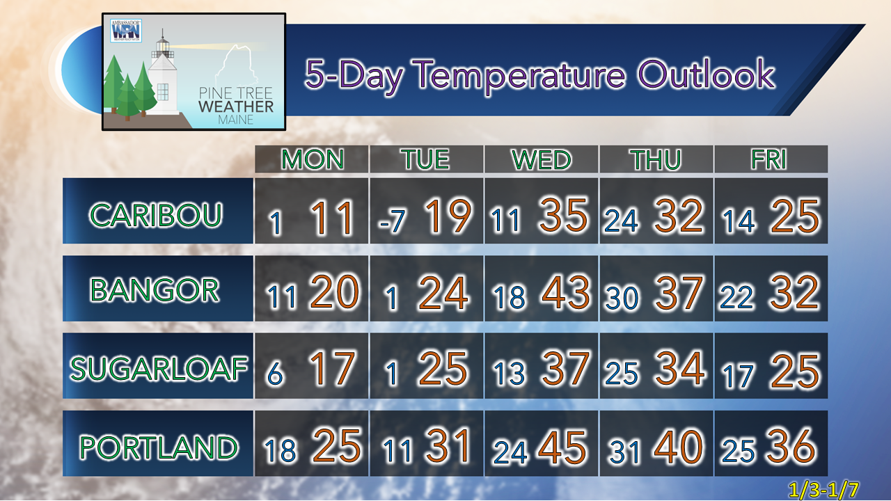 Science of Wind Chill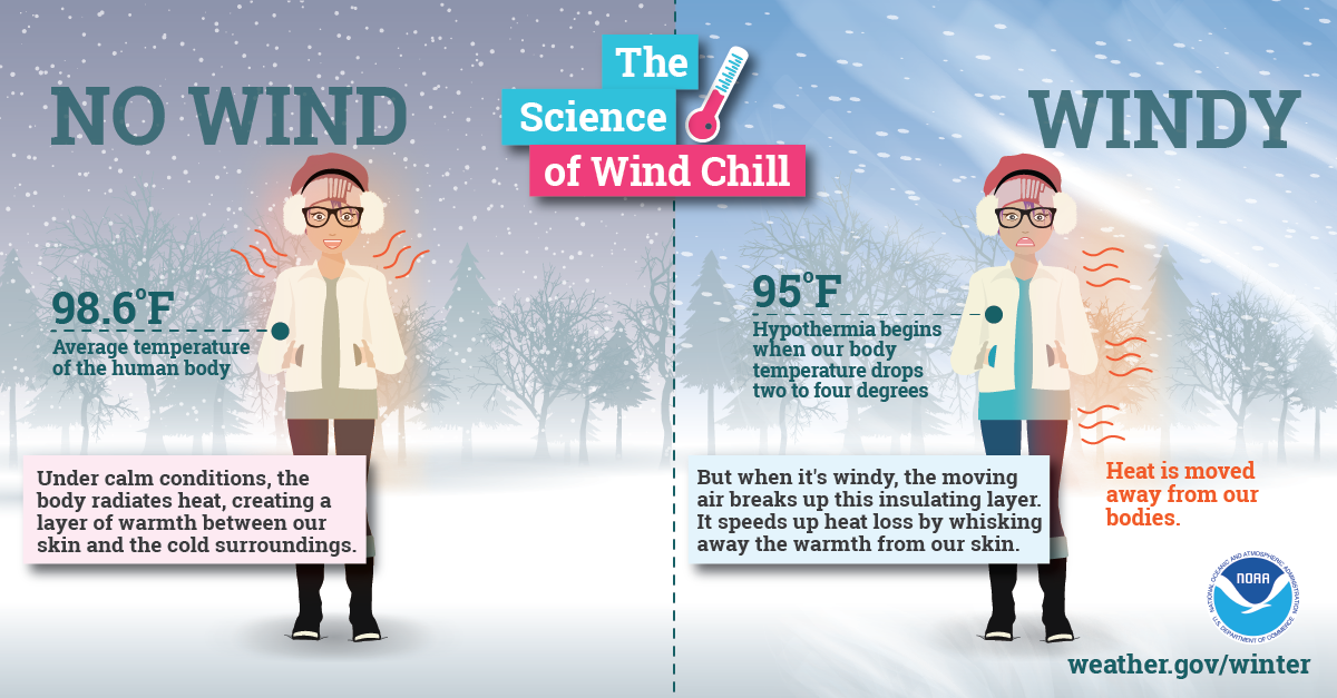 Extremely cold air affects millions of people across the United States every winter and even into parts of the spring. This Arctic air, together with brisk winds, can lead to dangerously cold wind chill values, which can cause your body to lose heat quickly. weather.gov/safety/cold-wind-chill-chart Be prepared to receive alerts and stay updated!
 For more information in between posts, please follow Pine Tree Weather on Facebook and Twitter.
Thank you for supporting this community-based weather information source which operates by reader supported financial contributions. Stay weather aware, stay on alert, and stay safe! - Mike |

Mike Haggett
|